Map of Grabill town
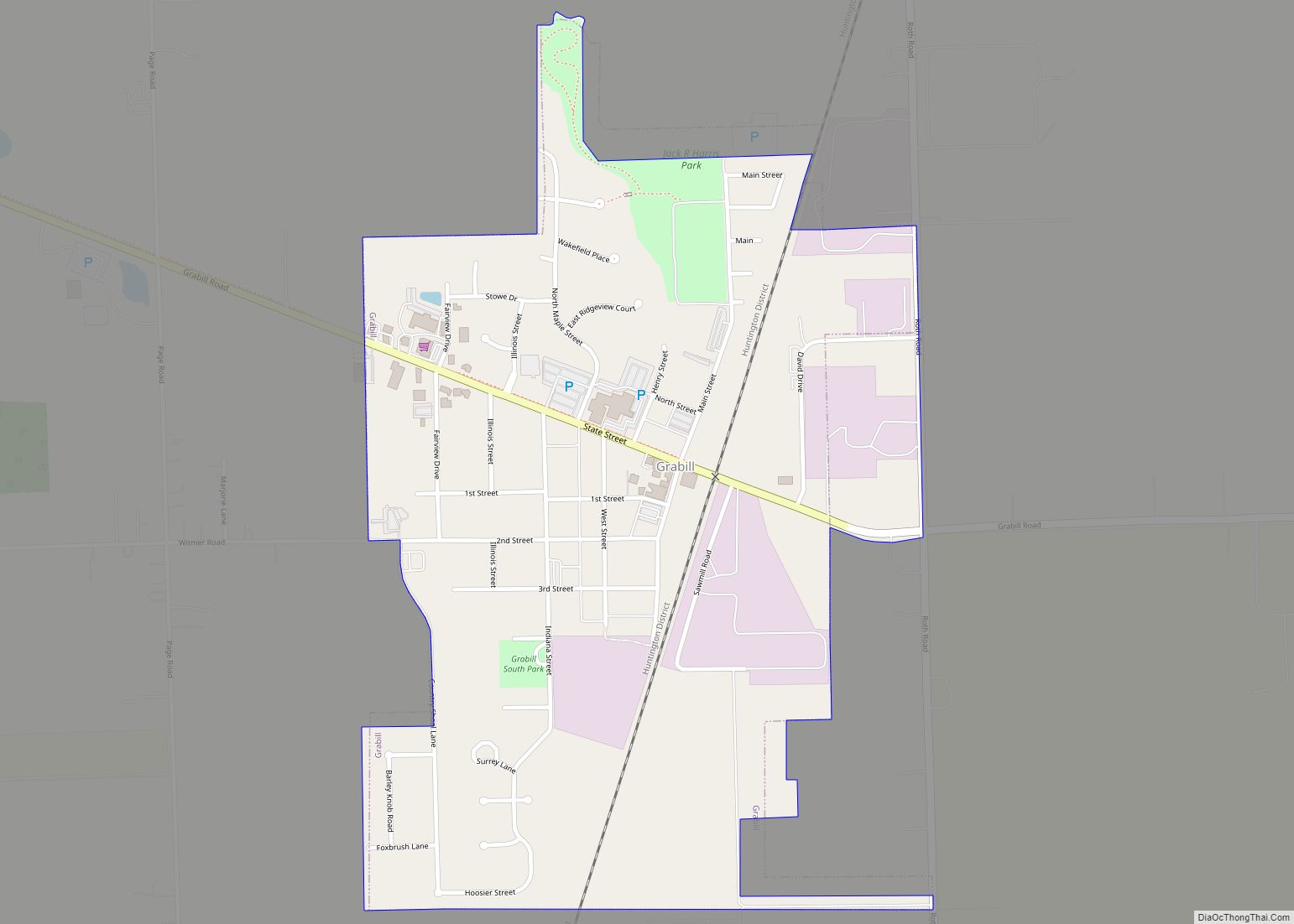
Grabill is a town in Cedar Creek Township, Allen County, Indiana, United States. The population was 1,053 at the 2010 census. Today it is known for the presence of antique stores and Amish farms. An incorporated town, Grabill has two community parks within the corporate limits. Grabill town overview: Name: Grabill town LSAD Code: 43 ... Read more
Map of Grabill town
Map of Gosport town
Gosport is a town in Wayne Township, Owen County, in the U.S. state of Indiana. The population was 826 at the 2010 census. It is part of the Bloomington, Indiana Metropolitan Statistical Area. Gosport town overview: Name: Gosport town LSAD Code: 43 LSAD Description: town (suffix) State: Indiana County: Owen County Elevation: 696 ft (212 m) Total ... Read more
Map of Gosport town
Map of Greendale city, Indiana
Greendale is a city in Dearborn County, Indiana, United States. The population was 4,520 at the 2010 census. Greendale city overview: Name: Greendale city LSAD Code: 25 LSAD Description: city (suffix) State: Indiana County: Dearborn County Elevation: 528 ft (161 m) Total Area: 5.73 sq mi (14.84 km²) Land Area: 5.66 sq mi (14.67 km²) Water Area: 0.07 sq mi (0.18 km²) Total Population: 4,602 Population ... Read more
Map of Greendale city, Indiana
Map of Greencastle city, Indiana
Greencastle is a city in Greencastle Township, Putnam County, Indiana, United States, and the county seat of Putnam County. It was founded in 1821 by Ephraim Dukes on a land grant. He named the settlement for his hometown of Greencastle, Pennsylvania. Greencastle was a village or town operating under authority of the Putnam County commissioners ... Read more
Map of Greencastle city, Indiana
Map of Granger CDP, Indiana
Granger is a census-designated place (CDP) in Clay and Harris townships, St. Joseph County, in the U.S. state of Indiana. The population was 30,465 at the 2010 census. Penn-Harris-Madison School Corporation and the South Bend Community School Corporation maintain the public schools in the area. Granger is part of the South Bend–Mishawaka metropolitan area as ... Read more
Map of Granger CDP, Indiana
Map of Greensboro town, Indiana
Greensboro is a town in Greensboro Township, Henry County, Indiana, United States. The population was 143 at the 2010 census. The town was a ‘station’ on the Underground Railroad and was recognized for its active abolitionists. Greensboro town overview: Name: Greensboro town LSAD Code: 43 LSAD Description: town (suffix) State: Indiana County: Henry County Elevation: ... Read more
Map of Greensboro town, Indiana
Map of Greens Fork town
Greens Fork is a town in Clay Township, Wayne County, in the U.S. state of Indiana. The population was 423 at the 2010 census. Greens Fork town overview: Name: Greens Fork town LSAD Code: 43 LSAD Description: town (suffix) State: Indiana County: Wayne County Elevation: 1,010 ft (308 m) Total Area: 0.14 sq mi (0.36 km²) Land Area: 0.14 sq mi (0.36 km²) ... Read more
Map of Greens Fork town
Map of Greenfield city, Indiana
Greenfield is a city in and the county seat of Hancock County, Indiana, United States It lies in Center Township and is part of the Indianapolis metropolitan area. The population was 23,488 at the 2020 census. Greenfield was a stop along the Pittsburgh, Cincinnati, Chicago and St. Louis Railroad that connected Pittsburgh to Chicago and ... Read more
Map of Greenfield city, Indiana
Map of Greenville town, Indiana
Greenville is an incorporated town in Floyd County, Indiana. The population was 595 at the 2010 census. Greenville is located in the greater Louisville metropolitan area. Greenville town overview: Name: Greenville town LSAD Code: 43 LSAD Description: town (suffix) State: Indiana County: Floyd County Elevation: 827 ft (252 m) Total Area: 0.90 sq mi (2.34 km²) Land Area: 0.90 sq mi (2.34 km²) ... Read more
Map of Greenville town, Indiana
Map of Greentown town, Indiana
Greentown is a town in Liberty Township, Howard County, Indiana, United States. Located approximately 9 miles east of Kokomo on State Road 22 / US 35; it is home to the Howard County Fair Grounds. The town was platted in 1848, and incorporated as a town in 1873. Known for its collectible glassware made for ... Read more
Map of Greentown town, Indiana
Map of Greensburg city, Indiana
Greensburg is a city in and the county seat of Decatur County, Indiana. The population was 12,312 at the time of the 2020 census. Greensburg city overview: Name: Greensburg city LSAD Code: 25 LSAD Description: city (suffix) State: Indiana County: Decatur County Elevation: 958 ft (292 m) Total Area: 9.41 sq mi (24.37 km²) Land Area: 9.36 sq mi (24.25 km²) Water Area: ... Read more
Map of Greensburg city, Indiana
Map of Griffin town, Indiana
Griffin is a town in Bethel Township, Posey County, in the U.S. state of Indiana. The population was 172 at the 2010 census. Griffin town overview: Name: Griffin town LSAD Code: 43 LSAD Description: town (suffix) State: Indiana County: Posey County Elevation: 384 ft (117 m) Total Area: 0.07 sq mi (0.18 km²) Land Area: 0.07 sq mi (0.18 km²) Water Area: 0.00 sq mi ... Read more
Map of Griffin town, Indiana