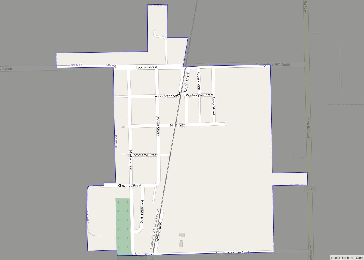
Jonesville is a town in Wayne Township, Bartholomew County, in the U.S. state of Indiana. The population was 177 at the 2010 census. It is part of the Columbus, Indiana metropolitan statistical area. Jonesville town overview: Name: Jonesville town LSAD Code: 43 LSAD Description: town (suffix) State: Indiana County: Bartholomew County Elevation: 594 ft (181 m) Total ... Read more
Map of US Cities and Places
Jonesboro is a city in Grant County, Indiana, United States, located along the Mississinewa River opposite Gas City. The population was 1,756 at the 2010 census. According to the 2010 census, Jonesboro had the third smallest population of a city in Indiana. Jonesboro city overview: Name: Jonesboro city LSAD Code: 25 LSAD Description: city (suffix) ... Read more
Kent is an unincorporated community and census-designated place (CDP) in Republican Township, Jefferson County, Indiana, United States. As of the 2010 census it had a population of 70. Kent CDP overview: Name: Kent CDP LSAD Code: 57 LSAD Description: CDP (suffix) State: Indiana County: Jefferson County Elevation: 712 ft (217 m) Total Area: 0.07 sq mi (0.18 km²) Land Area: ... Read more
Kennard is a town in Greensboro Township, Henry County, Indiana, United States. The population was 471 at the 2010 census. Kennard town overview: Name: Kennard town LSAD Code: 43 LSAD Description: town (suffix) State: Indiana County: Henry County Elevation: 1,040 ft (317 m) Total Area: 0.42 sq mi (1.10 km²) Land Area: 0.42 sq mi (1.10 km²) Water Area: 0.00 sq mi (0.00 km²) Total Population: ... Read more
Kendallville is a city in Wayne Township, Noble County, in the U.S. state of Indiana. The population was 10,205 at the 2021 census. Kendallville city overview: Name: Kendallville city LSAD Code: 25 LSAD Description: city (suffix) State: Indiana County: Noble County Elevation: 988 ft (301 m) Total Area: 6.34 sq mi (16.42 km²) Land Area: 6.12 sq mi (15.84 km²) Water Area: 0.22 sq mi ... Read more
Kentland is a town in Jefferson Township, Newton County, in the U.S. state of Indiana. The population was 1,641 at the 2020 census. Kentland town overview: Name: Kentland town LSAD Code: 43 LSAD Description: town (suffix) State: Indiana County: Newton County Elevation: 682 ft (208 m) Total Area: 1.35 sq mi (3.50 km²) Land Area: 1.35 sq mi (3.50 km²) Water Area: 0.00 sq mi ... Read more
Kimmell is an unincorporated census-designated place in Sparta Township, Noble County, in the U.S. state of Indiana. Kimmell CDP overview: Name: Kimmell CDP LSAD Code: 57 LSAD Description: CDP (suffix) State: Indiana County: Noble County Elevation: 915 ft (279 m) ZIP code: 46760 Area code: 260 FIPS code: 1839744 GNISfeature ID: 437309 Online Interactive Map Kimmell online ... Read more
Kewanna is a town in Union Township, Fulton County, Indiana, United States. The population was 613 at the 2010 census. Kewanna town overview: Name: Kewanna town LSAD Code: 43 LSAD Description: town (suffix) State: Indiana County: Fulton County Elevation: 794 ft (242 m) Total Area: 0.55 sq mi (1.42 km²) Land Area: 0.55 sq mi (1.42 km²) Water Area: 0.00 sq mi (0.00 km²) Total Population: ... Read more
Kingsford Heights is a town in Union Township, LaPorte County, Indiana, United States. The population was 1,335 at the 2020 census. It is included in the Michigan City, Indiana–La Porte, Indiana Metropolitan Statistical Area. Also known as “Victory City,” the town was built by the United States government for workers that worked in the Kingsbury ... Read more
Kingsbury is a town in Washington Township, LaPorte County, Indiana, just northwest of the intersection of U.S. Route 35 and U.S. Route 6. The town was founded in 1835 and incorporated on March 3, 1941. During 1940 – 1941, the Kingsbury Ordnance Plant (KOP) was built for use during World War II. The plant closed ... Read more
Kingman is a town in Millcreek Township, Fountain County, Indiana, United States. The population was 511 at the 2010 census. Kingman town overview: Name: Kingman town LSAD Code: 43 LSAD Description: town (suffix) State: Indiana County: Fountain County Elevation: 702 ft (214 m) Total Area: 0.66 sq mi (1.71 km²) Land Area: 0.66 sq mi (1.71 km²) Water Area: 0.00 sq mi (0.00 km²) Total Population: ... Read more
Knightsville is a town in Van Buren Township, Clay County, Indiana, United States. The population was 872 at the 2010 census. It is part of the Terre Haute Metropolitan Statistical Area. Knightsville town overview: Name: Knightsville town LSAD Code: 43 LSAD Description: town (suffix) State: Indiana County: Clay County Elevation: 653 ft (199 m) Total Area: 1.04 sq mi ... Read more