Map of Gibsland town
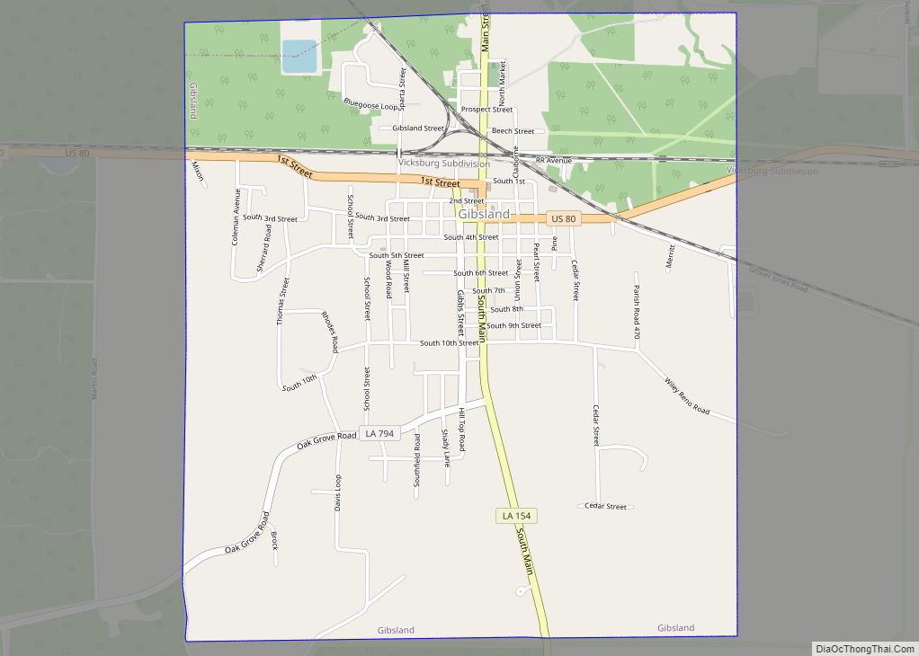
Gibsland is a town in Bienville Parish in northern Louisiana, United States. As of the 2020 census, its population was 773. The town is best known for its connecting railroads, as the birthplace of the defunct historically black Coleman College, and for the nearby shootings in 1934 of the bandits Bonnie and Clyde. Gibsland native ... Read more
Map of Gibsland town
Map of Georgetown village, Louisiana
Georgetown is a village in Grant Parish, Louisiana, United States. It is part of the Alexandria, Louisiana Metropolitan Statistical Area. The population was 327 at the 2010 census. Georgetown village overview: Name: Georgetown village LSAD Code: 47 LSAD Description: village (suffix) State: Louisiana County: Grant Parish Elevation: 95 ft (29 m) Total Area: 1.30 sq mi (3.37 km²) Land Area: ... Read more
Map of Georgetown village, Louisiana
Map of Garyville CDP
Garyville is a census-designated place (CDP) in St. John the Baptist Parish, Louisiana, United States. The population was 2,775 at the 2000 census and 2,123 in 2020. It is part of the New Orleans–Metairie–Kenner Metropolitan Statistical Area. Garyville has the distinction of being the location of the most recently built oil refinery in the United ... Read more
Map of Garyville CDP
Map of Gillis CDP
Gillis is an unincorporated community and census-designated place (CDP) in northern Calcasieu Parish, Louisiana, United States. As of the 2010 census it had a population of 657. Gillis CDP overview: Name: Gillis CDP LSAD Code: 57 LSAD Description: CDP (suffix) State: Louisiana County: Calcasieu Parish Elevation: 26 ft (8 m) Total Area: 1.67 sq mi (4.32 km²) Land Area: 1.67 sq mi ... Read more
Map of Gillis CDP
Map of Gilliam village, Louisiana
Gilliam is a village in Caddo Parish, Louisiana, United States. The population was 164 at the 2010 census. It is part of the Shreveport–Bossier City Metropolitan Statistical Area. Gilliam village overview: Name: Gilliam village LSAD Code: 47 LSAD Description: village (suffix) State: Louisiana County: Caddo Parish Elevation: 190 ft (60 m) Total Area: 2.37 sq mi (6.13 km²) Land Area: ... Read more
Map of Gilliam village, Louisiana
Map of Gilbert village, Louisiana
Gilbert is a village in Franklin Parish, Louisiana, United States. The population was 521 at the 2010 census. The Gilbert welcome sign describes the village as the home of U.S. Lieutenant General Claire Chennault. Gilbert village overview: Name: Gilbert village LSAD Code: 47 LSAD Description: village (suffix) State: Louisiana County: Franklin Parish Elevation: 75 ft (23 m) ... Read more
Map of Gilbert village, Louisiana
Map of Gloster CDP, Louisiana
Gloster is an unincorporated community and census-designated place (CDP) in DeSoto Parish, Louisiana, United States. As of the 2010 census it had a population of 94. Gloster is located 1.5 miles (2.4 km) east of U.S. Route 171, 17 miles (27 km) north of Mansfield, the DeSoto Parish seat, and 30 miles (48 km) south of Shreveport. It ... Read more
Map of Gloster CDP, Louisiana
Map of Glenmora town
Glenmora is a town in Rapides Parish, Louisiana, United States. It is part of the Alexandria, Louisiana Metropolitan Statistical Area. The population was 1,342 at the 2010 census. Claude Kirkpatrick, a member of the Louisiana House of Representatives from Jefferson Davis Parish from 1952–1960, a candidate for governor in 1963, and the instigator of Toledo ... Read more
Map of Glenmora town
Map of Glencoe CDP, Louisiana
Glencoe is a census-designated place (CDP) in St. Mary Parish, Louisiana, United States. The population was 126 at the 2010 census. It is part of the Morgan City Micropolitan Statistical Area. Glencoe CDP overview: Name: Glencoe CDP LSAD Code: 57 LSAD Description: CDP (suffix) State: Louisiana County: St. Mary Parish Elevation: 9 ft (3 m) Total Area: ... Read more
Map of Glencoe CDP, Louisiana
Map of Gonzales city, Louisiana
Gonzales is a city in Ascension Parish, Louisiana, United States. As of the 2020 census, it has a population of 12,231. Known as the “Jambalaya Capital of the World”, it is famous for its annual Jambalaya Festival, which was first held in 1968. Stephen “Steve” F. Juneau came up with the idea for the Jambalaya ... Read more
Map of Gonzales city, Louisiana
Map of Goldonna village
Goldonna is a village in Natchitoches Parish, Louisiana, United States. The population was 430 at the 2010 census. It is part of the Natchitoches Micropolitan Statistical Area. South of Goldonna along Louisiana Highway 156, one may access Saline Bayou, popular for blackwater canoeing. Goldonna village overview: Name: Goldonna village LSAD Code: 47 LSAD Description: village ... Read more
Map of Goldonna village
Map of Golden Meadow town
Golden Meadow French: Canal Yankee is a town along Bayou Lafourche in Lafourche Parish, Louisiana, United States. The population was 1,761 in 2020. It is part of the Houma–Bayou Cane–Thibodaux metropolitan statistical area. Its main source of revenue is the oil and gas industry. The fishing and seafood industries also have strong economic impacts, with ... Read more
Map of Golden Meadow town