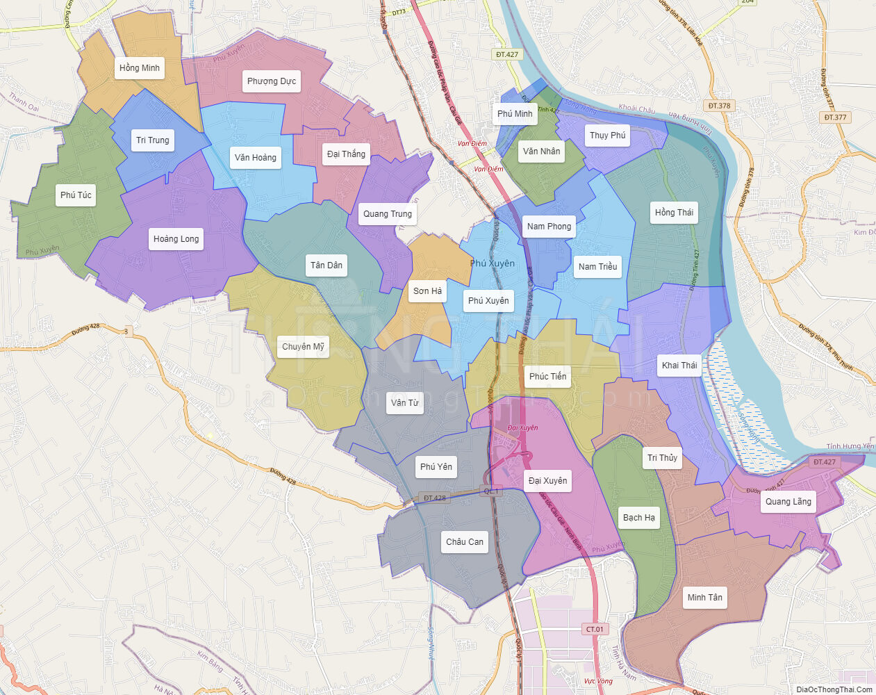
Political Map of Phu Xuyen district – Ha Noi
Interactive online map of Phu Xuyen
Click on ![]() to view map in “full screen” mode.
to view map in “full screen” mode.
Base Map Layer: Open Street Map (OSM), Arcgisonline, Google Map, Wmflabs.
Large scale maps of Phu Xuyen
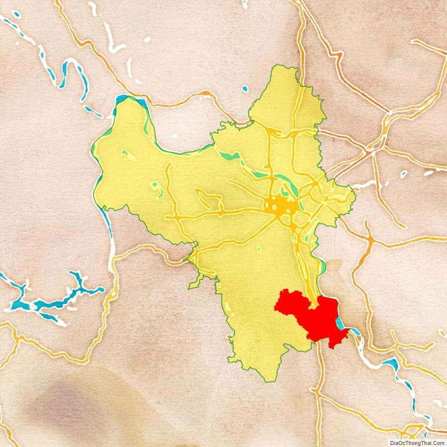
Phu Xuyen location map
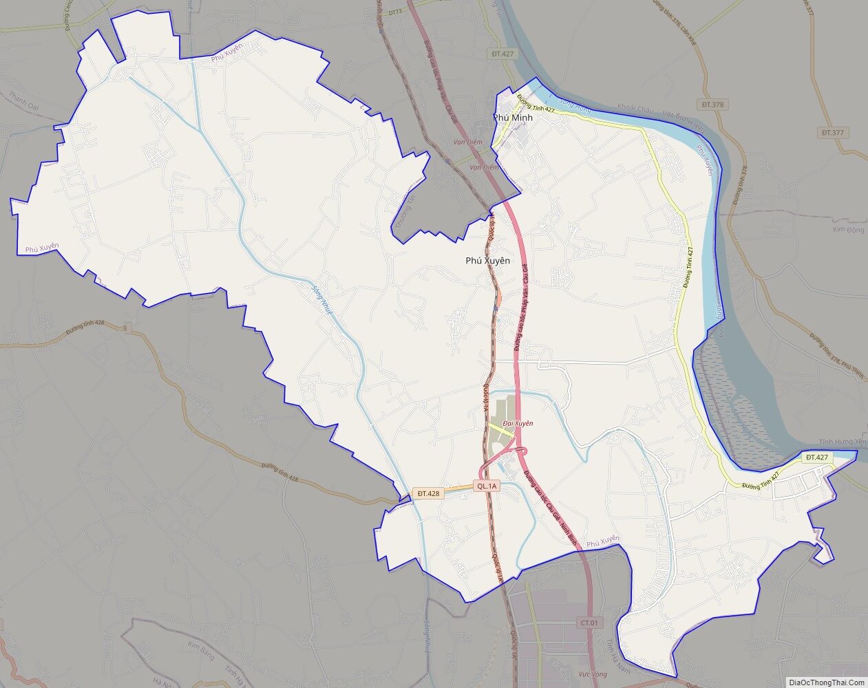
Phu Xuyen street map
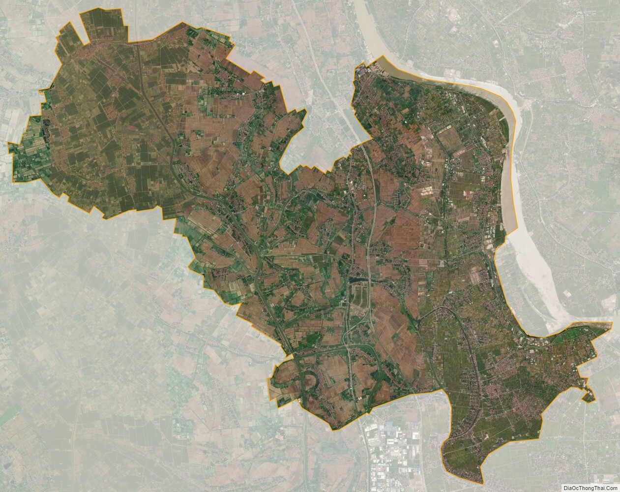
Phu Xuyen satellite map
See also
See also map of Ha Noi city and district-level sub-divisions: Map of Vietnam provinces:- Ha Noi
- Ho Chi Minh
- Da Nang
- Can Tho
- Hai Phong
- An Giang
- Ba Ria-Vung Tau
- Bac Giang
- Bac Kan
- Bac Lieu
- Bac Ninh
- Ben Tre
- Binh Dinh
- Binh Duong
- Binh Phuoc
- Binh Thuan
- Ca Mau
- Cao Bang
- Dak Lak
- Dak Nong
- Dien Bien
- Dong Nai
- Dong Thap
- Gia Lai
- Ha Giang
- Ha Nam
- Ha Tinh
- Hai Duong
- Hau Giang
- Hoa Binh
- Hung Yen
- Khanh Hoa
- Kien Giang
- Kon Tum
- Lai Chau
- Lam Dong
- Lang Son
- Lao Cai
- Long An
- Nam Dinh
- Nghe An
- Ninh Binh
- Ninh Thuan
- Phu Tho
- Phu Yen
- Quang Binh
- Quang Nam
- Quang Ngai
- Quang Ninh
- Quang Tri
- Soc Trang
- Son La
- Tay Ninh
- Thai Binh
- Thai Nguyen
- Thanh Hoa
- Thua Thien-Hue
- Tien Giang
- Tra Vinh
- Tuyen Quang
- Vinh Long
- Vinh Phuc
- Yen Bai