Abbeville County is a county located in the U.S. state of South Carolina. As of the 2020 census, its population was 24,295. Its county seat is Abbeville. It is the first county (or county equivalent) in the United States alphabetically. Abbeville County is traditionally included in the Upstate region of South Carolina. For a time, the county was included in the Greenwood, SC Micropolitan Statistical Area, but as of 2018 it was no longer included.
| Name: | Abbeville County |
|---|---|
| FIPS code: | 45-001 |
| State: | South Carolina |
| Founded: | 1785 |
| Named for: | Abbeville, France |
| Seat: | Abbeville |
| Largest city: | Abbeville |
| Total Area: | 511 sq mi (1,320 km²) |
| Land Area: | 490 sq mi (1,300 km²) |
| Total Population: | 24,299 |
| Population Density: | 49.6/sq mi (19.2/km²) |
| Time zone: | UTC−5 (Eastern) |
| Summer Time Zone (DST): | UTC−4 (EDT) |
| Website: | www.abbevillecountysc.com |
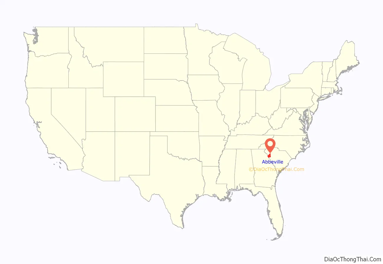
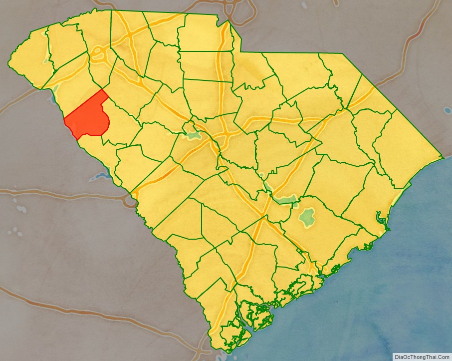
Abbeville County location map. Where is Abbeville County?
History
Both Abbeville County and the county seat, Abbeville, get their name from the town of Abbeville, France, the native home of an early settler. The county was originally part of Ninety-Six District, South Carolina, but was designated Abbeville County in 1785, with parts of the county later going to the creation of the counties of Greenwood and McCormick. Abbeville County was settled by mostly Scotch Irish and French-Huguenot farmers in the mid-18th century.
The Treaty of Dewitt’s Corner, a historic peace negotiation with the Cherokee Indians, was signed in Dewitt’s Corner (which is now known as Due West) in the county. A a result of the treaty, the Cherokee tribe broke into two factions, one of which, the Chickamauga Cherokee, continued fighting area settlers for another 30 years.
Abbeville County was a hotbed of secession before the Civil War and was also where the last Confederate council of war was held.
In 1950 Abbeville County had a population of 22,456.
Lynchings
There were nine documented lynchings in Abbeville, SC.
- Dave Roberts known as “David Roberts”,”Robert Dane”, 1882.
- Tut Danford, 1889.
- Jake “Jacob” Davis, August 21, 1893.
- Will Lawton, December 6, 1893.
- James A. Nelson known as “James Macon”,”James Mason”, 1894.
- Allen Pendleton, 1905.
- Will Lozier, 1915.
- Anthony Crawford, a prominent landowner, farmer, businessman lynched for not selling his cotton at the price demanded. 1916.
- Mark “Max” Smith, 1919.
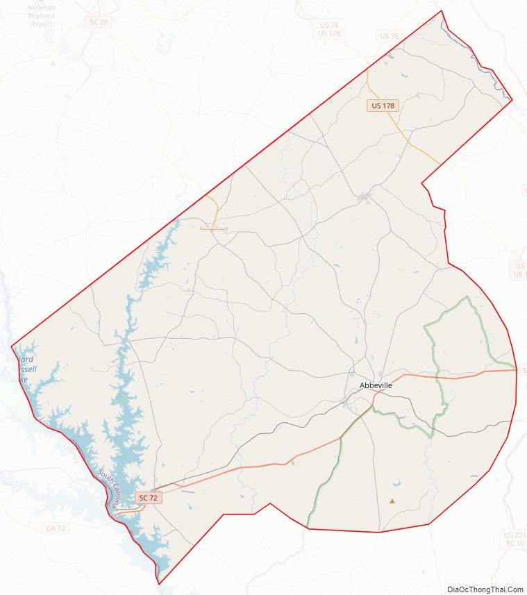
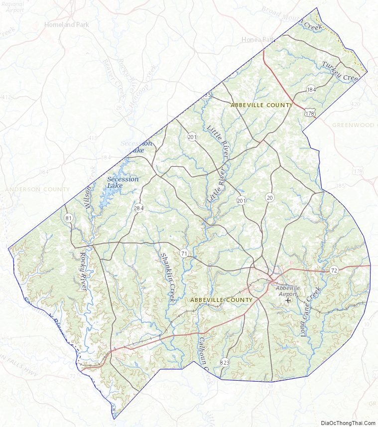
Abbeville County Road Map
Geography
According to the U.S. Census Bureau, the county has a total area of 511 square miles (1,320 km), of which 490 square miles (1,300 km) is land and 21 square miles (54 km) (4.0%) is water. Abbeville County is in the Savannah River basin and the Saluda River basin.
National protected area
- Sumter National Forest (part)
State and local protected areas
- Calhoun Falls State Park
- Long Cane Scenic Area
Major water bodies
- Lake Russell
- Saluda River
- Savannah River
- Lake Secession
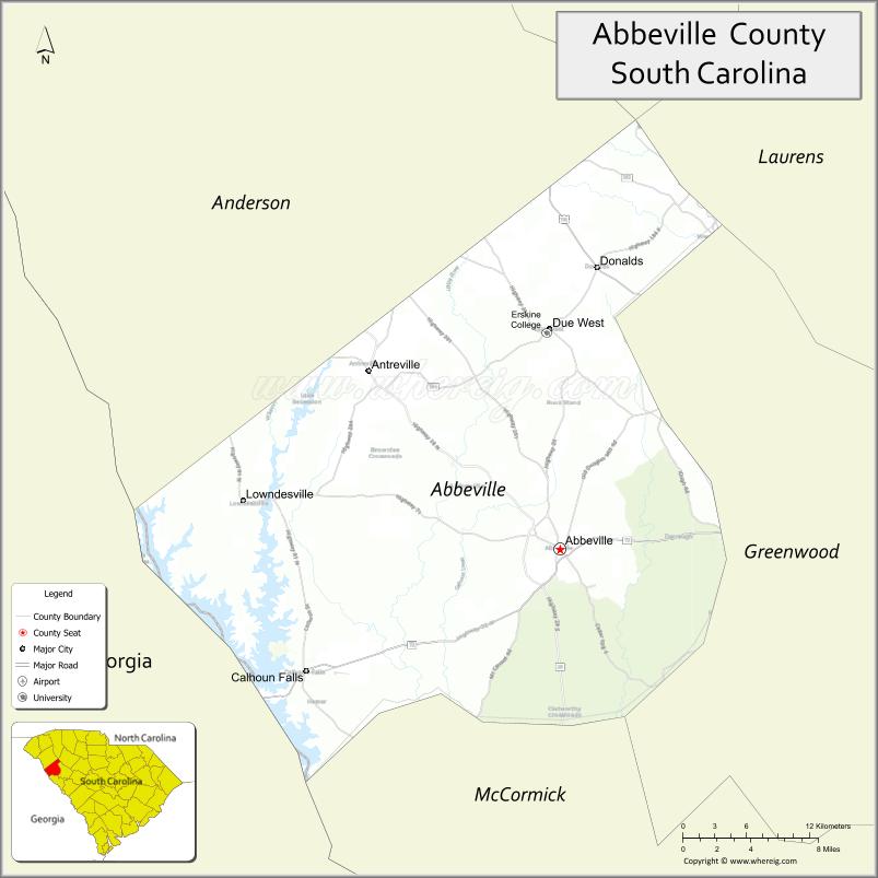
Adjacent counties
- Greenville County – north
- Anderson County – north
- Laurens County – northeast
- Greenwood County – east
- McCormick County – southeast
- Elbert County, Georgia – west
Major highways
- US 25 Bus.
- US 178
- SC 20
- SC 20 Conn.
- SC 28
- SC 28 Conn.
- SC 71
- SC 71 Truck
- SC 72
- SC 81
- SC 184
- SC 185
- SC 203
- SC 203 Truck
- SC 284
Abbeville County Topographic Map
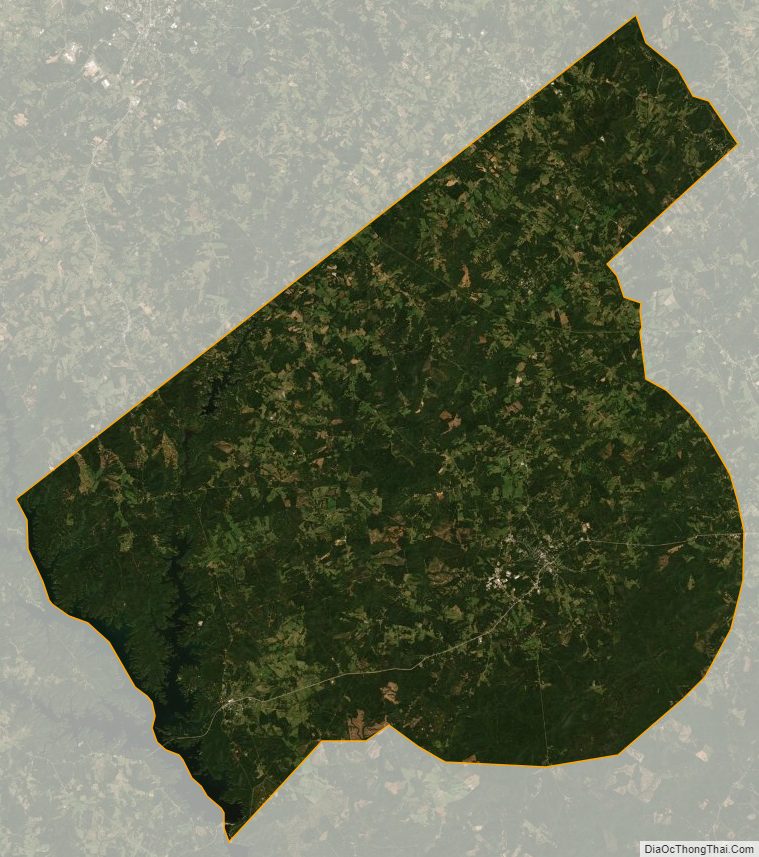
Abbeville County Satellite Map
Abbeville County Outline Map

See also
Map of South Carolina State and its subdivision:- Abbeville
- Aiken
- Allendale
- Anderson
- Bamberg
- Barnwell
- Beaufort
- Berkeley
- Calhoun
- Charleston
- Cherokee
- Chester
- Chesterfield
- Clarendon
- Colleton
- Darlington
- Dillon
- Dorchester
- Edgefield
- Fairfield
- Florence
- Georgetown
- Greenville
- Greenwood
- Hampton
- Horry
- Jasper
- Kershaw
- Lancaster
- Laurens
- Lee
- Lexington
- Marion
- Marlboro
- McCormick
- Newberry
- Oconee
- Orangeburg
- Pickens
- Richland
- Saluda
- Spartanburg
- Sumter
- Union
- Williamsburg
- York
- Alabama
- Alaska
- Arizona
- Arkansas
- California
- Colorado
- Connecticut
- Delaware
- District of Columbia
- Florida
- Georgia
- Hawaii
- Idaho
- Illinois
- Indiana
- Iowa
- Kansas
- Kentucky
- Louisiana
- Maine
- Maryland
- Massachusetts
- Michigan
- Minnesota
- Mississippi
- Missouri
- Montana
- Nebraska
- Nevada
- New Hampshire
- New Jersey
- New Mexico
- New York
- North Carolina
- North Dakota
- Ohio
- Oklahoma
- Oregon
- Pennsylvania
- Rhode Island
- South Carolina
- South Dakota
- Tennessee
- Texas
- Utah
- Vermont
- Virginia
- Washington
- West Virginia
- Wisconsin
- Wyoming