Aitkin County (/ˈeɪkɪn/ AY-kin) is a county in the U.S. state of Minnesota. As of the 2020 census, the population was 15,697. Its county seat is Aitkin. Part of the Mille Lacs Indian Reservation is in the county. The county was created in 1857 and organized in 1871.
| Name: | Aitkin County |
|---|---|
| FIPS code: | 27-001 |
| State: | Minnesota |
| Founded: | 1857 |
| Named for: | William Alexander Aitken |
| Seat: | Aitkin |
| Largest city: | Aitkin |
| Total Area: | 1,995 sq mi (5,170 km²) |
| Land Area: | 1,822 sq mi (4,720 km²) |
| Total Population: | 15,697 |
| Population Density: | 8.69/sq mi (3.36/km²) |
| Time zone: | UTC−6 (Central) |
| Summer Time Zone (DST): | UTC−5 (CDT) |
| Website: | www.co.aitkin.mn.us |
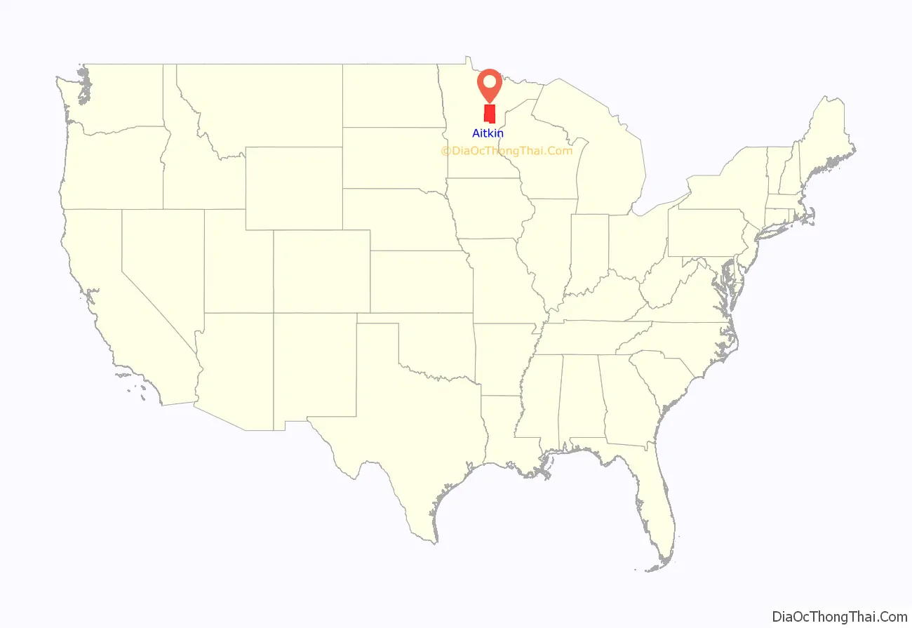
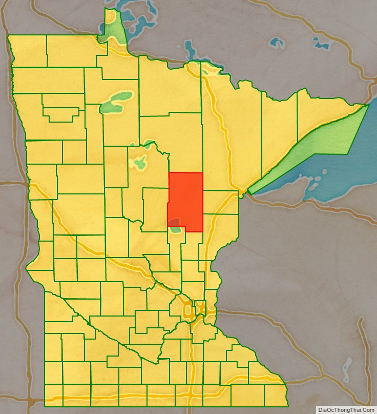
Aitkin County location map. Where is Aitkin County?
History
Aitkin County was established in 1857 as Aiken County. The current spelling was adopted in 1872. It was named for William Alexander Aitken, a fur trader for the American Fur Company, under John Jacob Astor. Formed from Ramsey and Pine counties, Aiken County originally consisted of the 17 townships closest to Mille Lacs Lake. It acquired outlands of Ramsey, Itasca and Pine Counties to its north and east. It was organized in 1871, taking up lands from Cass and Itasca Counties and losing a point in the southwestern corner to Crow Wing County to form its current boundaries.
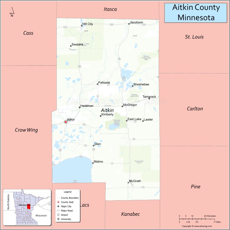
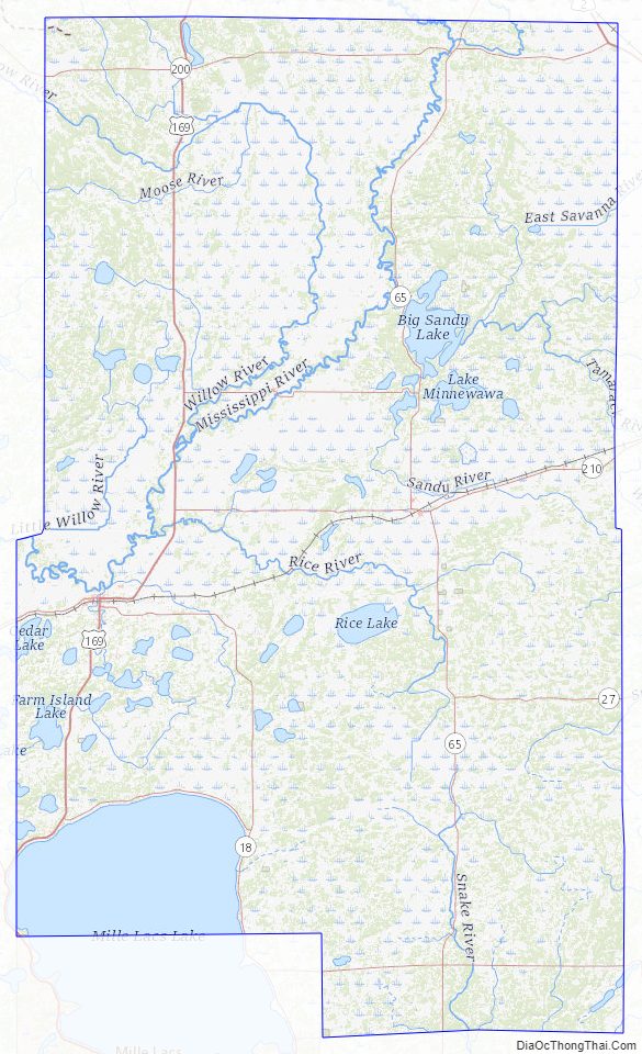
Aitkin County Road Map
Geography
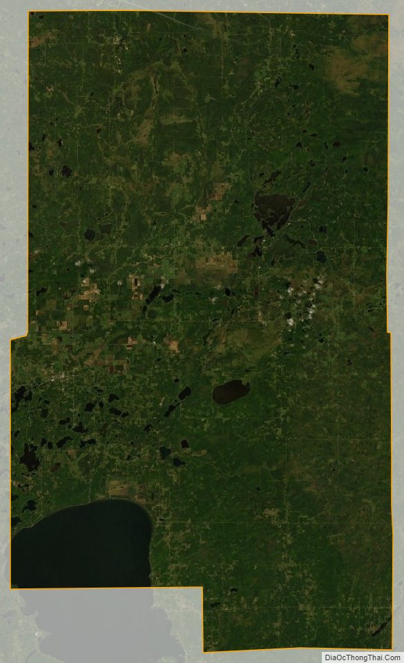
The Mississippi River flows southward through the west central part of the county. The county terrain consists of wooded rolling hills, dotted with lakes and ponds. The terrain slopes to the south; its highest point is Quadna Mountain, 2.5 miles (4.0 km) south-southeast of Hill City, at 1,591′ (485m) ASL. Otherwise the highest terrain is near its northwestern corner, at 1,388′ (423m) ASL. The county has a total area of 1,995 square miles (5,170 km), of which 1,822 square miles (4,720 km) is land and 174 square miles (450 km) (8.7%) is water.
Major highways
- U.S. Highway 2
- U.S. Highway 169
- Minnesota State Highway 18
- Minnesota State Highway 27
- Minnesota State Highway 47
- Minnesota State Highway 65
- Minnesota State Highway 200
- Minnesota State Highway 210
- List of County Roads
Adjacent counties
- Itasca County – north
- Saint Louis County – northeast
- Carlton County – east
- Pine County – southeast
- Kanabec County – south
- Mille Lacs County – southwest
- Crow Wing County – west
- Cass County – northwest
Protected areas
- Grayling State Wildlife Management Area
- Hill River State Forest
- Kimberly State Wildlife Management Area
- McGregor Marsh Scientific and Natural Area
- Rice Lake National Wildlife Refuge
- Ripple River State Wildlife Management Area
- Salo Marsh State Wildlife Management Area
- Savanna Portage State Park
- Snake River County Park
- Solana State Forest
Aitkin County Topographic Map
Aitkin County Satellite Map
Aitkin County Outline Map

See also
Map of Minnesota State and its subdivision:- Aitkin
- Anoka
- Becker
- Beltrami
- Benton
- Big Stone
- Blue Earth
- Brown
- Carlton
- Carver
- Cass
- Chippewa
- Chisago
- Clay
- Clearwater
- Cook
- Cottonwood
- Crow Wing
- Dakota
- Dodge
- Douglas
- Faribault
- Fillmore
- Freeborn
- Goodhue
- Grant
- Hennepin
- Houston
- Hubbard
- Isanti
- Itasca
- Jackson
- Kanabec
- Kandiyohi
- Kittson
- Koochiching
- Lac qui Parle
- Lake
- Lake of the Woods
- Lake Superior
- Le Sueur
- Lincoln
- Lyon
- Mahnomen
- Marshall
- Martin
- McLeod
- Meeker
- Mille Lacs
- Morrison
- Mower
- Murray
- Nicollet
- Nobles
- Norman
- Olmsted
- Otter Tail
- Pennington
- Pine
- Pipestone
- Polk
- Pope
- Ramsey
- Red Lake
- Redwood
- Renville
- Rice
- Rock
- Roseau
- Saint Louis
- Scott
- Sherburne
- Sibley
- Stearns
- Steele
- Stevens
- Swift
- Todd
- Traverse
- Wabasha
- Wadena
- Waseca
- Washington
- Watonwan
- Wilkin
- Winona
- Wright
- Yellow Medicine
- Alabama
- Alaska
- Arizona
- Arkansas
- California
- Colorado
- Connecticut
- Delaware
- District of Columbia
- Florida
- Georgia
- Hawaii
- Idaho
- Illinois
- Indiana
- Iowa
- Kansas
- Kentucky
- Louisiana
- Maine
- Maryland
- Massachusetts
- Michigan
- Minnesota
- Mississippi
- Missouri
- Montana
- Nebraska
- Nevada
- New Hampshire
- New Jersey
- New Mexico
- New York
- North Carolina
- North Dakota
- Ohio
- Oklahoma
- Oregon
- Pennsylvania
- Rhode Island
- South Carolina
- South Dakota
- Tennessee
- Texas
- Utah
- Vermont
- Virginia
- Washington
- West Virginia
- Wisconsin
- Wyoming