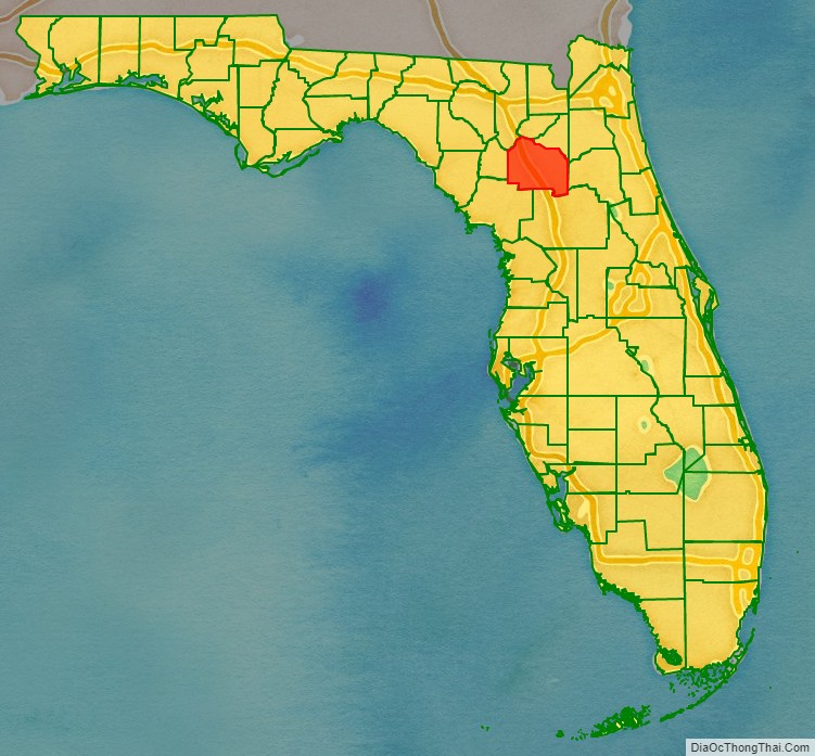
Alachua County (/əˈlætʃuə/ (listen) ə-LATCH-oo-ə) is a county in the north central portion of the U.S. state of Florida. As of the 2020 census, the population was 278,468. The county seat is Gainesville, the home of the University of Florida since 1906, when the campus opened with 106 students.
Alachua County is part of the Gainesville Metropolitan Statistical Area. The county is known for its diverse culture, local music, and artisans. Much of its economy revolves around the university, which had nearly 55,000 students in the fall of 2016.
| Name: | Alachua County |
|---|---|
| FIPS code: | 12-001 |
| State: | Florida |
| Founded: | December 29, 1824 |
| Named for: | Alachua (Timucuan word for “sinkhole”) |
| Seat: | Gainesville |
| Largest city: | Gainesville |
| Total Area: | 969 sq mi (2,510 km²) |
| Land Area: | 875 sq mi (2,270 km²) |
| Total Population: | 278,468 |
| Population Density: | 290/sq mi (110/km²) |
| Time zone: | UTC−5 (Eastern) |
| Summer Time Zone (DST): | UTC−4 (EDT) |
| Website: | www.alachuacounty.us |
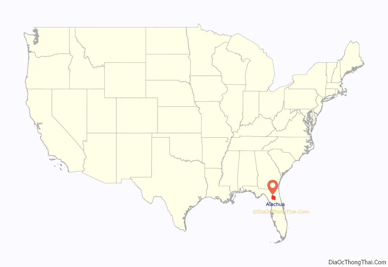
Alachua County location map. Where is Alachua County?
History
Prehistory and early european settlements
The first people known to have entered the area of Alachua County were Paleo-Indians, who left artifacts in the Santa Fe River basin before 8000 BC. Artifacts from the Archaic period (8000 – 2000 BC) have been found at several sites in Alachua County. Permanent settlements appeared in what is now Alachua County around 100 AD, as people of the wide-ranging Deptford culture developed the local Cades Pond culture. The Cades Pond culture gave way to the Alachua culture around 600 AD.
The Timucua-speaking Potano tribe lived in the Alachua culture area in the 16th century, when the Spanish entered Florida. The Potano were incorporated by the colonists in the Spanish mission system, but new infectious diseases, rebellion, and raids by tribes backed by the English led to severe population declines. What is now Alachua County had lost much of its indigenous population by the early 18th century.
In the 17th century, Francisco Menéndez Márquez, Royal Treasurer for Spanish Florida, established the La Chua ranch on the northern side of what is now known as Payne’s Prairie, on a bluff overlooking the Alachua Sink. Chua may have been the Timucua language word for sinkhole. Lieutenant Diego Peña reported in 1716 that he passed by springs named Aquilachua, Usichua, Usiparachua, and Afanochua while traveling through what is now Suwannee County. In the twentieth-century, anthropologist J. Clarence Simpson assumed the named springs were in fact sinkholes. The Spanish later called the interior of Florida west of the St. Johns River Tierras de la Chua, which became “Alachua Country” in English.
Around 1740, a band of Oconee people led by Ahaya, who was called “Cowkeeper” by the English, settled on what is now Payne’s Prairie. Ahaya’s band became known as the Alachua Seminole. In 1774, botanist William Bartram visited Ahaya’s town, Cuscowilla, near what Bartram called the Alachua Savanna. King Payne, who succeeded Ahaya as chief of the Alachua Seminole, established a new town known as Payne’s Town.
In 1812, during the Patriot War of East Florida, an attempt by American adventurers to seize Spanish Florida, a force of more than 100 volunteers from Georgia led by Colonel Daniel Newnan encountered a band of Alachua Seminole led by King Payne near Newnans Lake. After several days of intermittent fighting, Colonel Newnan’s force withdrew. King Payne was wounded in the fight and died two months later. The Alachua Seminole then left Payne’s Town and moved farther west and south, but other bands of Seminole moved in. A second American expedition in 1813 of U. S. Army troops and militia from Tennessee, led by Lt. Colonel Thomas Adams Smith, found some Seminoles, killing about 20, and burned every Seminole village they could find in the area.
In 1814, a group of more than 100 American settlers moved to a point believed to be near the abandoned Payne’s Town (near present-day Micanopy) and declared the establishment of the District of Elotchaway of the Republic of East Florida. The settlement collapsed a few months later after its leader, Colonel Buckner Harris, was killed by Seminole. The remaining settlers returned to Georgia.
Early American settlements
In 1817, F. M. Arredondo received the 20-mile square Arredondo Grant in the southern part of what is Alachua County. By the time Florida was formally transferred from Spain to the United States, people from the United States and from Europe were settling in the area. Wanton’s Store, near the site of the abandoned King Payne’s Town, attracted settlers, primarily from Europe, who founded Micanopy. The 1823 Treaty of Moultrie Creek required the Seminole to move a reservation south of what is now Ocala, and the flow of settlers into the area increased. Many settlers occupied former Seminole towns, such as Hogtown.
Alachua County was created by the Florida territorial legislature in 1824. The new county stretched from the border with Georgia, south to Charlotte Harbor. The original county seat was Wanton’s (per the store, as the name Micanopy had not been adopted). In 1828, the county seat was moved to Newnansville, near the current site of the city of Alachua.
As the area’s population increased, Alachua County’s size was reduced to organize new counties. In 1832, the county’s northern part, including Newnansville, was separated to create Columbia County, forcing the county seat to move to various temporary locations, then to Spring Grove, from 1836 to 1839.
In 1834, Hillsborough County was created, which included the area around Tampa Bay down to Charlotte Harbor. In 1839, that part of Columbia County south of the Santa Fe River was returned to Alachua County, and Newnansville was restored as the county seat. Hernando County was created in 1843 from that part of Alachua County south of the Withlacoochee River; Marion County was created in 1844; and Levy County was created in 1846 from that part of Alachua County west of the Suwannee River. It would be another 80 years before Alachua County was again reduced in size.
In 1853, the residents of Alachua County realized that the route of the planned Florida Railroad connecting Fernandina to Cedar Key would bypass Newnansville. A general meeting at Boulware Springs was called to consider moving the county seat to a new town on the expected route of the railroad. The motion to move the county seat was hotly contested by the residents of Newnansville, but Tillman Ingram, a plantation owner in Hogtown who owned a sawmill there, offered to build a courthouse in the new town. The offer was for such as favorable price that the move was approved. At tha time, the name “Gainesville” was chosen for the new town. The county seat was moved to Gainesville in late 1856, upon completion of the new courthouse.
Lynchings and disenfranchisement
During the post-Reconstruction period, White Democrats regained control of the state legislature and worked to restore White supremacy. Violence against Blacks, including lynchings, rose in the late 19th and early 20th centuries as Whites imposed Jim Crow and discriminatory laws, disenfranchising most blacks, which forced them out of the political system. Alachua County was the site of 21 documented lynchings between 1891 and 1926. The first three documented lynchings, in Gainesville in 1891, involved two Black men and a White man, who were associated with the notorious Harmon Murray. Ten lynchings took place in Newberry, six of them in a mass lynching there in 1916. These lynchings were conducted outside the justice system, by mobs or small groups working alone. Nineteen of the victims were Black; two were White. (A 2015 report by the Equal Justice Initiative, based in Montgomery, Alabama, had identified 18 lynchings. The Historical Commission documented three more, including two white men.)
In September 2017, the county commission approved plans to place markers with the names of the victims in the county. (See linked article for names of these individuals.) They are working with the Historical Commission and cities to discuss how best to achieve this. A state historical marker on the Newberry Lynchings was dedicated in 2019.
Contemporary history
On February 15, 2023, the board of county commissioners for Alachua County voted to support the proposed amendment to the Florida state constitution that is entitled, Florida Right To Clean And Healthy Waters, making Alachua the first county in the state to lend its support for adoption of the proposed amendment. The proposed amendment is the subject of a statewide, nonpartisan campaign to place adoption of it before all Florida voters on the 2024 ballot. The adoption was signed into effect by its chair, Anna Prizzia, after a unaminous vote by the board.
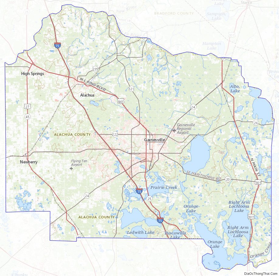
Alachua County Road Map
Geography
According to the U.S. Census Bureau, the county has a total area of 969 square miles (2,510 km), of which 875 square miles (2,270 km) is land and 94 square miles (240 km) (9.7%) is water.
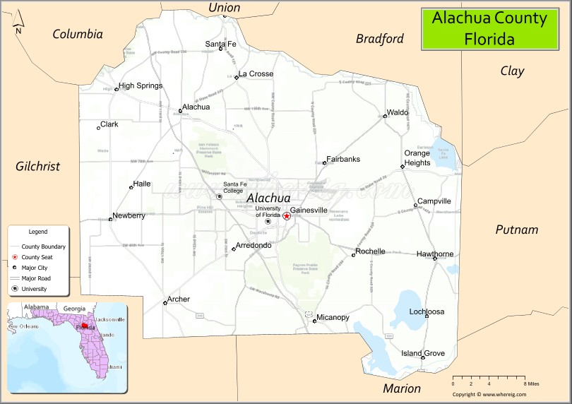
Adjacent counties
- Bradford County – north
- Union County – north
- Clay County, Florida – northeast
- Putnam County – east
- Marion County – southeast
- Levy County – southwest
- Gilchrist County – west
- Columbia County – northwest
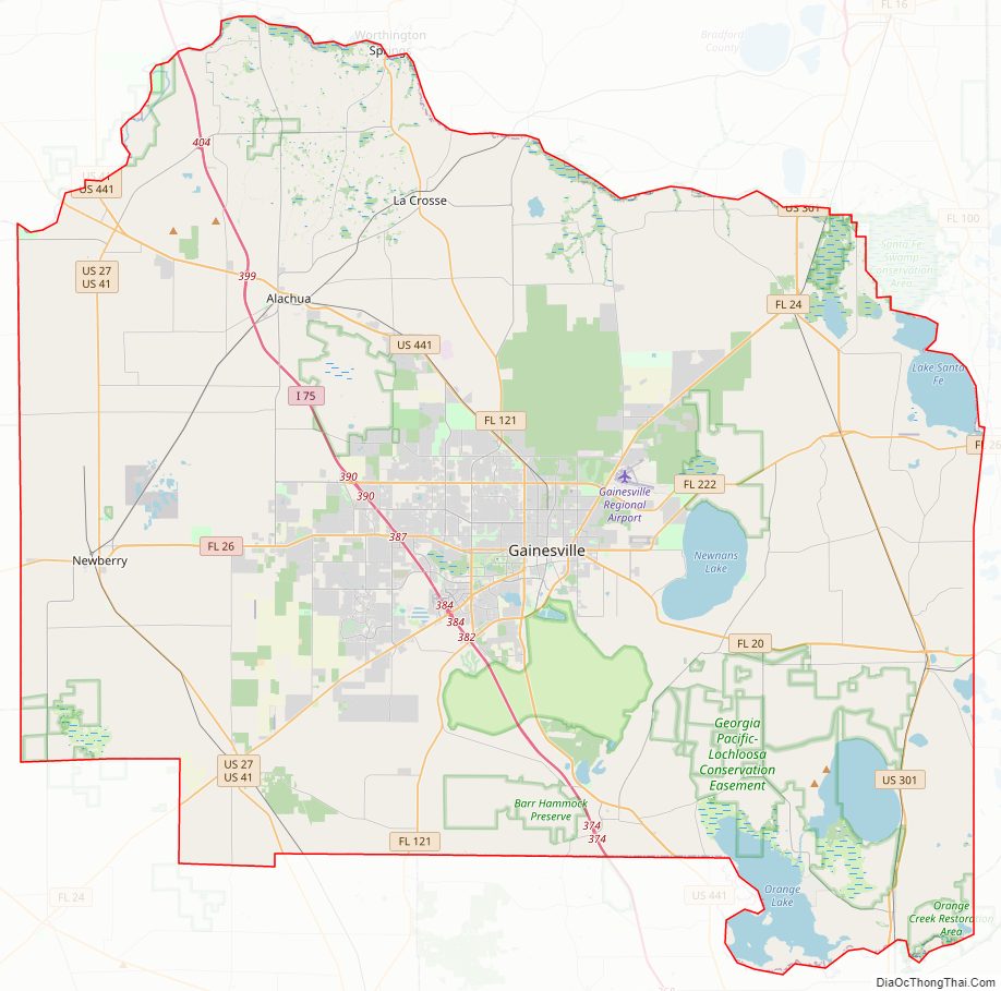
Alachua County Topographic Map
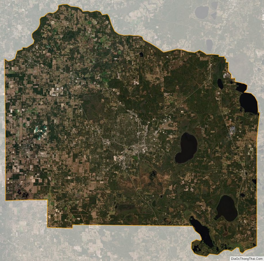
Alachua County Satellite Map
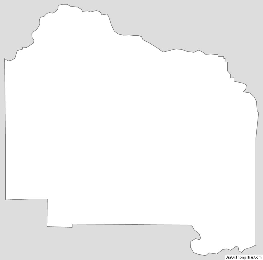
Alachua County Outline Map
See also
Map of Florida State and its subdivision:- Alachua
- Baker
- Bay
- Bradford
- Brevard
- Broward
- Calhoun
- Charlotte
- Citrus
- Clay
- Collier
- Columbia
- Desoto
- Dixie
- Duval
- Escambia
- Flagler
- Franklin
- Gadsden
- Gilchrist
- Glades
- Gulf
- Hamilton
- Hardee
- Hendry
- Hernando
- Highlands
- Hillsborough
- Holmes
- Indian River
- Jackson
- Jefferson
- Lafayette
- Lake
- Lee
- Leon
- Levy
- Liberty
- Madison
- Manatee
- Marion
- Martin
- Miami-Dade
- Monroe
- Nassau
- Okaloosa
- Okeechobee
- Orange
- Osceola
- Palm Beach
- Pasco
- Pinellas
- Polk
- Putnam
- Saint Johns
- Saint Lucie
- Santa Rosa
- Sarasota
- Seminole
- Sumter
- Suwannee
- Taylor
- Union
- Volusia
- Wakulla
- Walton
- Washington
- Alabama
- Alaska
- Arizona
- Arkansas
- California
- Colorado
- Connecticut
- Delaware
- District of Columbia
- Florida
- Georgia
- Hawaii
- Idaho
- Illinois
- Indiana
- Iowa
- Kansas
- Kentucky
- Louisiana
- Maine
- Maryland
- Massachusetts
- Michigan
- Minnesota
- Mississippi
- Missouri
- Montana
- Nebraska
- Nevada
- New Hampshire
- New Jersey
- New Mexico
- New York
- North Carolina
- North Dakota
- Ohio
- Oklahoma
- Oregon
- Pennsylvania
- Rhode Island
- South Carolina
- South Dakota
- Tennessee
- Texas
- Utah
- Vermont
- Virginia
- Washington
- West Virginia
- Wisconsin
- Wyoming