Alameda County (/ˌæləˈmiːdə/ (listen) AL-ə-MEE-də) is a county located in the U.S. state of California. As of the 2020 census, the population was 1,682,353, making it the 7th-most populous county in the state and 21st most populous nationally. The county seat is Oakland. Alameda County is in the San Francisco Bay Area, occupying much of the East Bay region.
The Spanish word alameda means either “a grove of poplars…or a tree lined street.” The name was originally used to describe the Arroyo de la Alameda. The willow and sycamore trees along the banks of the river reminded the early Spanish explorers of a road lined with trees. Although a strict translation to English might be “Poplar Grove Creek,” the name of the principal stream that flows through the county is now simply “Alameda Creek.”
Alameda County is part of the San Francisco–Oakland–Berkeley, CA Metropolitan Statistical Area, and the San Jose–San Francisco–Oakland, CA Combined Statistical Area.
| Name: | Alameda County |
|---|---|
| FIPS code: | 06-001 |
| State: | California |
| Founded: | 1853 |
| Named for: | Rancho Arroyo de la Alameda (also see Alameda Creek) |
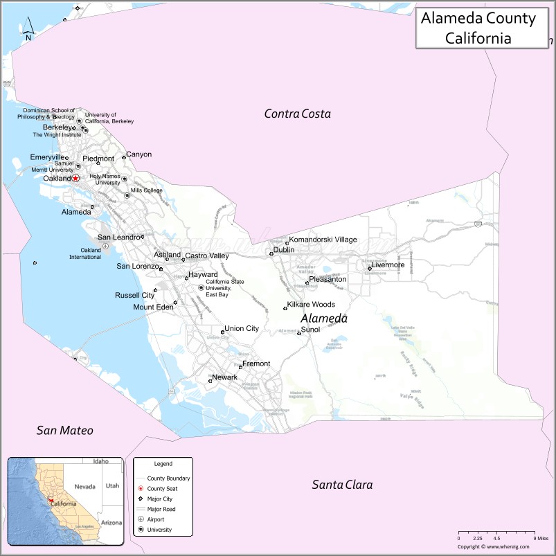
| Seat: | Oakland |
| Largest city: | Oakland (population) Fremont (area) |
| Total Area: | 821 sq mi (2,130 km²) |
| Land Area: | 739 sq mi (1,910 km²) |
| Total Population: | 1,682,353 |
| Population Density: | 2,000/sq mi (800/km²) |
| Time zone: | UTC-8 (Pacific Time Zone) |
| Summer Time Zone (DST): | UTC-7 (Pacific Daylight Time) |
| Website: | acgov.org |
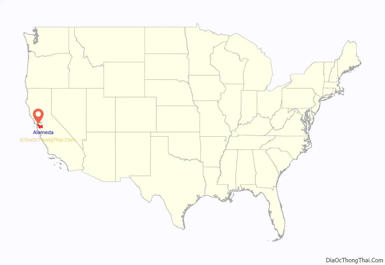
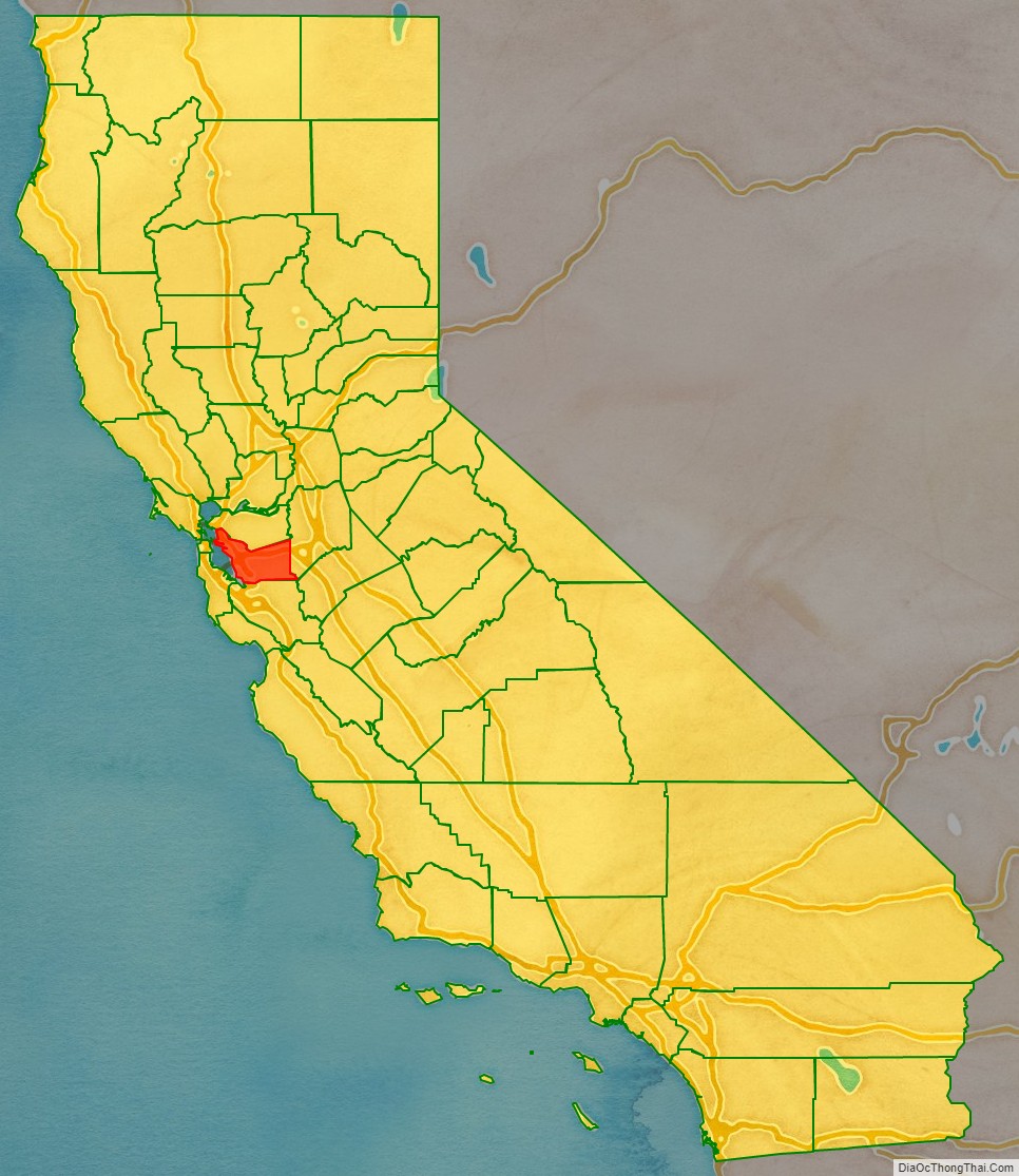
Alameda County location map. Where is Alameda County?
History
The county was formed on March 25, 1853, from a large portion of Contra Costa County and a smaller portion of Santa Clara County.
The county seat at the time of the county’s formation was located at Alvarado, now part of Union City. In 1856, it was moved to San Leandro, where the county courthouse was destroyed by the devastating 1868 quake on the Hayward Fault. The county seat was then re-established in the town of Brooklyn from 1872 to 1875. Brooklyn is now part of Oakland, which has been the county seat since 1873.
Much of what is now an intensively urban region was initially developed as a trolley car suburb of San Francisco in the late 19th and early 20th centuries. The historical progression from Native American tribal lands to Spanish then Mexican ranches, then to farms, ranches, and orchards, then to multiple city centers and suburbs, is shared with the adjacent and closely associated Contra Costa County.
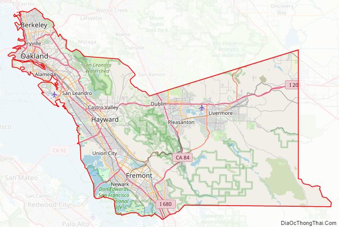
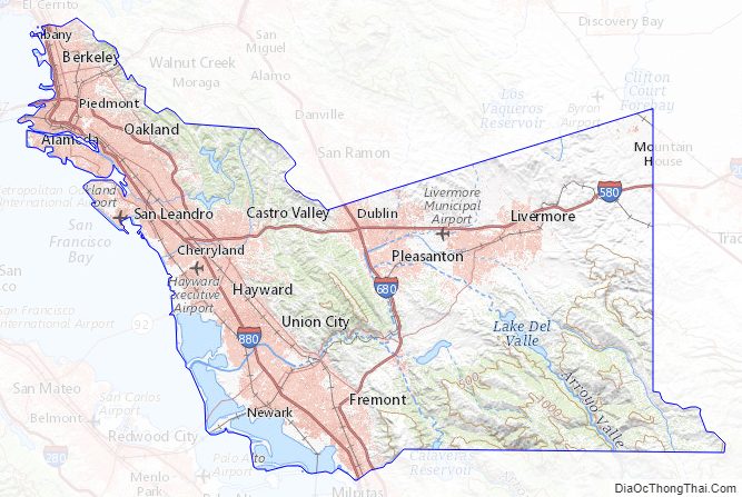
Alameda County Road Map
Geography
According to the U.S. Census Bureau, the county has a total area of 821 square miles (2,130 km), of which 739 square miles (1,910 km) is land and 82 square miles (210 km) (10%) is water. The San Francisco Bay borders the county on the west.
The crest of the Berkeley Hills form part of the northeastern boundary and reach into the center of the county. A coastal plain several miles wide lines the bay; and is Oakland’s most populous region. Livermore Valley lies in the eastern part of the county. Amador Valley abuts the western edge of Livermore Valley and continues west to the Pleasanton Ridge. The ridges and valleys of the Diablo Range, containing the county’s highest peaks, cover the very sparsely populated southeast portion of the county.
The Hayward Fault, a major branch of the San Andreas Fault to the west, runs through the most populated parts of Alameda County, while the Calaveras Fault runs through the southeastern part of the county.
The areas near the Bay itself have a maritime warm-summer Mediterranean climate, whereas behind the mountains, summers are significantly warmer. The climate charts below are for Oakland and inland Livermore.
Neighboring counties
The City and County of San Francisco, California, borders the county on the west, and has a small land border with the city of Alameda, California due to land filling.
Santa Clara County borders the county on the south.
San Joaquin County borders the county on the east.
Contra Costa County borders the county on the north.
Stanislaus County borders the county on the easternmost end of its southern boundary for 250 feet (76 m).
National protected area
- Don Edwards San Francisco Bay National Wildlife Refuge (part)
Alameda County Topographic Map
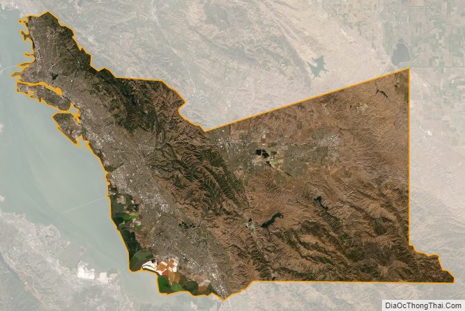
Alameda County Satellite Map
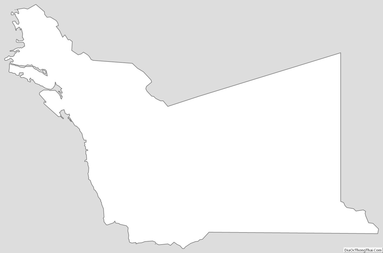
Alameda County Outline Map
See also
Map of California State and its subdivision:- Alameda
- Alpine
- Amador
- Butte
- Calaveras
- Colusa
- Contra Costa
- Del Norte
- El Dorado
- Fresno
- Glenn
- Humboldt
- Imperial
- Inyo
- Kern
- Kings
- Lake
- Lassen
- Los Angeles
- Madera
- Marin
- Mariposa
- Mendocino
- Merced
- Modoc
- Mono
- Monterey
- Napa
- Nevada
- Orange
- Placer
- Plumas
- Riverside
- Sacramento
- San Benito
- San Bernardino
- San Diego
- San Francisco
- San Joaquin
- San Luis Obispo
- San Mateo
- Santa Barbara
- Santa Clara
- Santa Cruz
- Shasta
- Sierra
- Siskiyou
- Solano
- Sonoma
- Stanislaus
- Sutter
- Tehama
- Trinity
- Tulare
- Tuolumne
- Ventura
- Yolo
- Yuba
- Alabama
- Alaska
- Arizona
- Arkansas
- California
- Colorado
- Connecticut
- Delaware
- District of Columbia
- Florida
- Georgia
- Hawaii
- Idaho
- Illinois
- Indiana
- Iowa
- Kansas
- Kentucky
- Louisiana
- Maine
- Maryland
- Massachusetts
- Michigan
- Minnesota
- Mississippi
- Missouri
- Montana
- Nebraska
- Nevada
- New Hampshire
- New Jersey
- New Mexico
- New York
- North Carolina
- North Dakota
- Ohio
- Oklahoma
- Oregon
- Pennsylvania
- Rhode Island
- South Carolina
- South Dakota
- Tennessee
- Texas
- Utah
- Vermont
- Virginia
- Washington
- West Virginia
- Wisconsin
- Wyoming