Albany County (/ˈɔːlbəni/ (listen) AWL-bə-nee) is a county in the state of New York, United States. Its northern border is formed by the Mohawk River, at its confluence with the Hudson River, which is to the east. As of the 2020 United States Census, the population was 314,848. The county seat and largest city is Albany, which is also the state capital of New York. As originally established by the English government in the colonial era, Albany County had an indefinite amount of land, but has had an area of 530 square miles (1,400 km) since March 3, 1888. The county is named for the Duke of York and of Albany, who became James II of England (James VII of Scotland).
Albany County constitutes the central core of the Capital District of the State of New York, which comprises the Albany-Schenectady–Troy, NY Metropolitan Statistical Area.
| Name: | Albany County |
|---|---|
| FIPS code: | 36-001 |
| State: | New York |
| Founded: | 1683 |
| Named for: | Prince James, Duke of York and of Albany |
| Seat: | Albany |
| Largest city: | Albany |
| Total Area: | 533 sq mi (1,380 km²) |
| Land Area: | 523 sq mi (1,350 km²) |
| Total Population: | 313,743 |
| Population Density: | 602.13/sq mi (232.48/km²) |
| Time zone: | UTC−5 (Eastern) |
| Summer Time Zone (DST): | UTC−4 (EDT) |
| Website: | www.albanycounty.com |
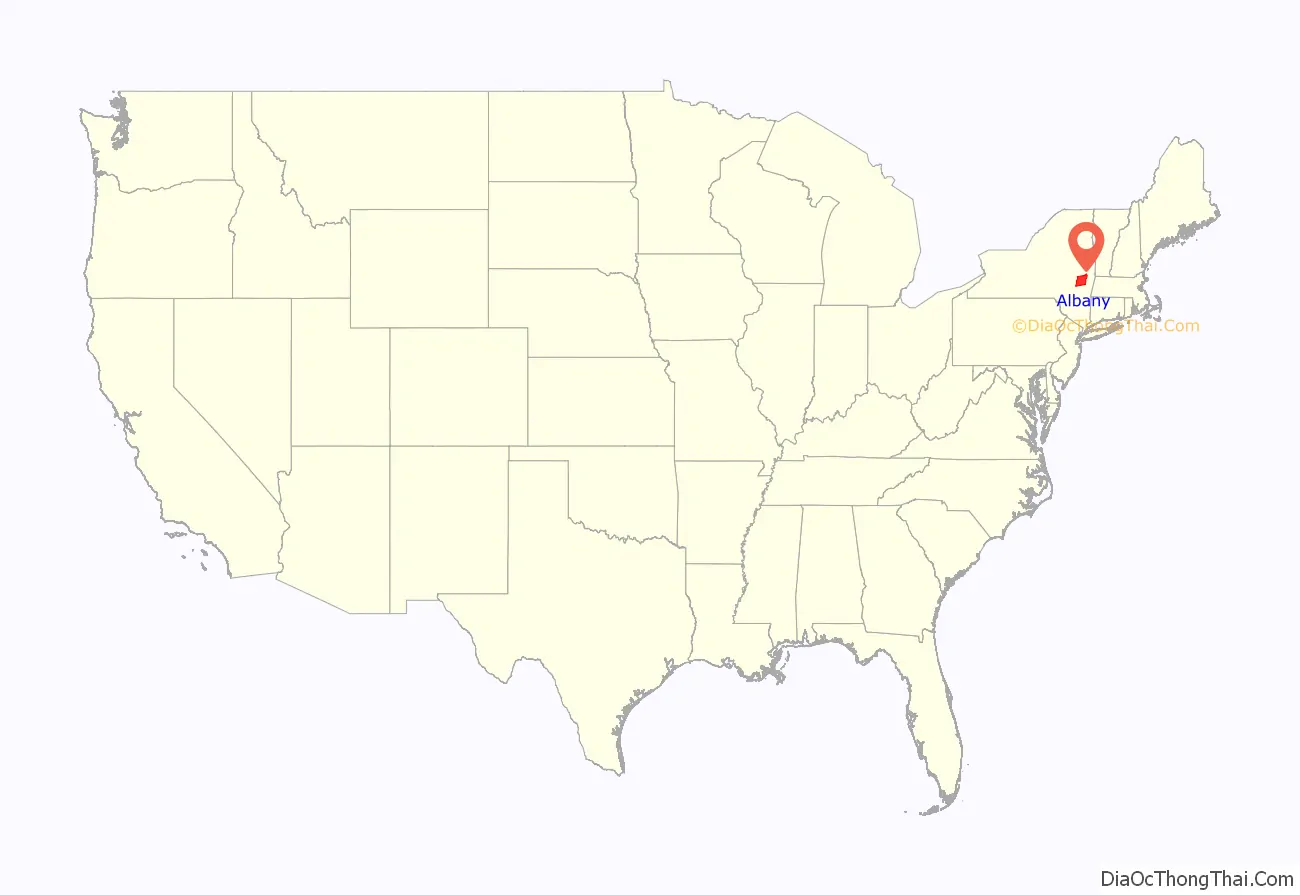
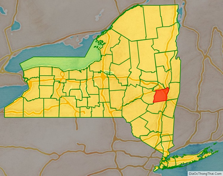
Albany County location map. Where is Albany County?
History
Colonial
After England took control of the colony of New Netherland from the Dutch, Albany County was created on November 1, 1683, by New York Governor Thomas Dongan, and confirmed on October 1, 1691. The act creating the county vaguely defined its territory “to containe the Towns of Albany, the Collony Rensselaerwyck, Schonecteda, and all the villages, neighborhoods, and Christian Plantaçons on the east side of Hudson River from Roelef’s Creek, and on the west side from Sawyer’s Creek (Saugerties) to the Sarraghtoga.” The confirmation declared in 1691 was similar but omitted the Town of Albany, substituted “Mannor of Ranselaerswyck” for “Collony Rensselaerwyck”, and stated “to the uttermost end of Sarraghtoga” instead of just “to Sarraghtoga”. Livingston Manor was annexed to Albany County from Dutchess County in 1717.
Albany’s boundaries were defined more closely as state statutes would add land to the county, or more commonly subtract land for the formation of new counties. In 1772 with the creation of Tryon and Charlotte counties, Albany gained definitive boundaries and included what are now Albany, Columbia, Rensselaer, Saratoga, and Schenectady counties; large parts of Greene and Washington counties; and the disputed southwest corner of Vermont.
The city of Albany was the first municipality within this large county, founded as the village (dorp in Dutch) of Beverwyck by the Director-General of New Amsterdam, Pieter Stuyvesant, who also established the first court in Albany. Albany was established as a city in 1686 by Governor Dongan through the Dongan Charter after the English took over the colony. Schenectady to the west was given a patent with some municipal rights in 1684 and became a borough in 1765.
The Manor of Rensselaerswyck was created as a district within the county in 1772, and later divided into two districts, one on each side of the Hudson River in 1779. The west district included all of what is now Albany County other than lands were in the city of Albany at the time. Though the Manor of Rensselaerswyck was the only district (along with the city of Albany) in what is today Albany County, it was not the only district in what was Albany County at the time. Pittstown in 1761, and Duanesburgh in 1764, were created as townships. But when districts were created in 1772, those townships were incorporated into new districts, Pittstown in Schaghticoke and Duanesburgh into the United Districts of Duanesburgh and Schoharie. Schenectady was also made from a borough to a district in 1772. Other districts established in 1772 were Hoosick, Coxsackie, Cambridge, Saratoga, Halfmoon, Kinderhook, Kings, Claverack, Great Imboght, and the Manor of Livingston.
In a census of 1697, there were 1,452 individuals living in Albany County; two years later it would be counted as 2,016 at the beginning of King William’s War. By the end of the war in 1698, the population had dropped to 1,482, but rebounded quickly and was at 2,273 by 1703. By 1723, it had increased to 6,501 and in 1731 to 8,573, which was slightly less than the population of the city of New York in the same year. In 1737, the inhabitants of Albany County would outnumber those of New York County by 17 people. In 1774, Albany County, with 42,706 people, was the largest county in colonial New York. According to the first Federal Census in 1790, Albany County reached 75,921 inhabitants and was still the state’s largest county.
Formation of towns
On March 7, 1788, the state of New York divided the entire state into towns eliminating districts as administrative units by passing New York Laws of 1788, Chapters 63 and 64.
Timeline of boundary changes
Albany County was one of the original twelve counties created by the Province of New York on November 1, 1683. At the time, it included all of New York state north of Dutchess and Ulster counties, all of what is now Bennington County in Vermont, and theoretically west to the Pacific Ocean.
On May 27, 1717, Albany County was adjusted to gain an indefinite amount of land from Dutchess County and other non-county lands.
On October 7, 1763, King George III, as part of his Proclamation of 1763, created the new province of Quebec, implicitly setting the northern limit of New York at the parallel of 45 degrees north latitude from the Atlantic-St. Lawrence watershed westward to the St. Lawrence River, implicitly setting the northern limit of Albany County, but it was never mapped.
On July 20, 1764, King George III established the boundary between New Hampshire and New York along the west bank of the Connecticut River, north of Massachusetts and south of the parallel of 45 degrees north latitude. Albany County implicitly gained present-day Vermont. Although disputes occasionally broke out later, this line became the boundary between New Hampshire and Vermont, and has remained unchanged to the present. When New York refused to recognize land titles through the New Hampshire Grants (towns created earlier by New Hampshire in present Vermont), dissatisfied colonists organized in opposition, which led to the creation of independent Vermont in 1777.
On July 3, 1766, Cumberland County was partitioned from Albany County to cover all territory to the northern and eastern limits of the colony, including Windsor County, most of Windham County, and parts of Bennington and Rutland counties in present-day Vermont.
On June 26, 1767, Albany County regained all of Cumberland County.
On March 19, 1768, Albany County was re-partitioned, and Cumberland County restored.
On March 16, 1770, Albany County was again partitioned. Gloucester County was created to include all of Orange, Caledonia and Essex counties, most of Washington County, and parts of Orleans, Lamoille, Addison and Chittenden counties in present-day Vermont.
On March 12, 1772, Albany County was partitioned again, this time into the counties of Albany, Tryon (now Montgomery), and Charlotte (now Washington). This established a definite area for Albany County of 5,470 sq mi (14,200 km).
On March 24, 1772, Albany County was partitioned again, with an additional 50 square miles (130 km) handed over to Cumberland County.
On March 9, 1774, Albany County was partitioned again, this time passing 1,090 square miles (2,800 km) to Ulster County.
On April 1, 1775, Albany was again partitioned, this time giving up 60 square miles (160 km) to Charlotte County, who then exchanged this land with a like parcel in Cumberland County.
On January 15, 1777, Albany County was again partitioned, this time on account of the independence of Vermont from New York, reducing Albany County by an additional 300 square miles (780 km).
On June 26, 1781, Bennington County, Vermont, attempted to annex a portion of Albany County that today includes portions of Washington and Rensselaer counties to form what they called “The West Union”. The fledgling United States – under the Articles of Confederation – arbitrated this annexation, and condemned it, resulting in Vermont ceasing the annexation on 1782-02-23.
On April 4, 1786, Columbia County was created from 650 square miles (1,700 km) of Albany County land.
On March 7, 1788, New York, refusing to recognize the independence of Vermont, and the attendant elimination of Cumberland County, attempted to adjust the line that separated Cumberland from Albany County in present-day Vermont, but to no effect.
On February 7, 1791, Albany County was partitioned again, this time to form Rensselaer and Saratoga counties. Rensselaer received 660 square miles (1,700 km), while Saratoga received 850 square miles (2,200 km). Also the town of Cambridge was transferred to Washington County. A total of 1,680 square miles (4,400 km) changed hands.
On June 1, 1795, Albany County was once again partitioned, this time losing 460 sq mi (1,200 km) to Schoharie County.
On April 5, 1798, another partition took place, with 90 square miles (230 km) passing to Ulster County.
On March 25, 1800, once again Albany County was partitioned, with 360 square miles (930 km) being used to create Greene County.
On April 3, 1801, all New York counties were redefined, with Albany County gaining 10 sq mi (26 km).
On March 7, 1809, Schenectady County was created from 230 square miles (600 km) of Albany County land, reducing Albany County to its current size.
On March 3, 1888, Albany County ceded Havre Island to Saratoga County.
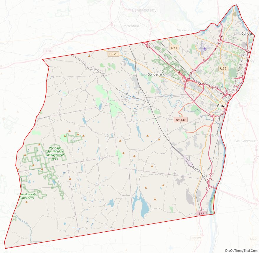
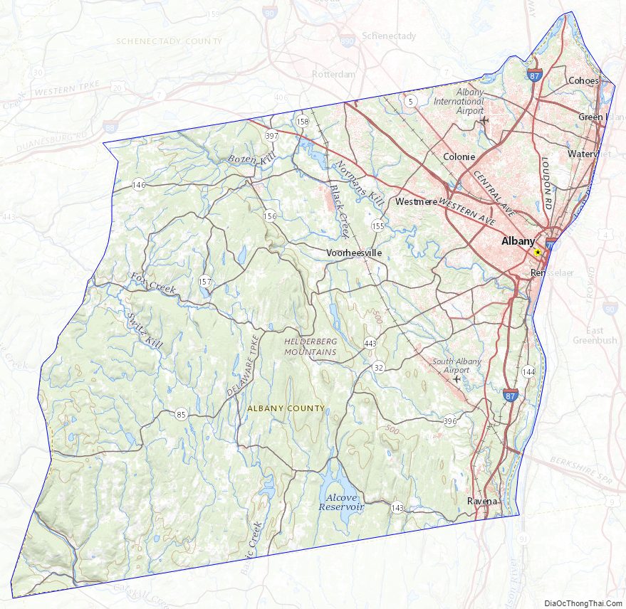
Albany County Road Map
Geography
According to the U.S. Census Bureau, the county has a total area of 533 square miles (1,380 km), of which 523 square miles (1,350 km) is land and 10 square miles (26 km) (2.0%) is water.
Albany County is in the east central part of New York, extending southward and westward from the point where the Mohawk River joins the Hudson River. Its eastern boundary is the Hudson; a portion of its northern boundary is the Mohawk.
The terrain of the county ranges from flat near the Hudson and Mohawk Rivers to high and hilly to the southwest, of the Helderberg Escarpment and the Helderberg Mountains. The highest point is one of several summits near Henry Hill at approximately 2,160 feet (658 m) above sea level; The lowest point is 62 feet (19 m) above sea level at the Hudson River’s southernmost extent in the county.
Climate
The Capital District has a humid continental climate, with cold, snowy winters, and hot, wet summers. Albany receives around 36.2 inches (920 mm) of rain per year, with 135 days of at least 0.01 inches (0.25 mm) of precipitation. Snowfall is significant, totaling about 63 inches (1,600 mm) annually, but with less accumulation than the lake-effect areas to the north and west, being far enough from Lake Ontario. Albany County is however, close enough to the coast to receive heavy snow from Nor’easters, and the region gets the bulk of its yearly snowfall from these types of storms. The county also occasionally receives Alberta clippers. Winters are often very cold with fluctuating conditions, temperatures often drop to below 0 °F (−18 °C) at night. Summers in the Albany can contain stretches of excessive heat and humidity, with temperatures above 90 °F (32 °C) and dew points near 70. Severe thunderstorms are common but tornadoes are rare. Albany receives on average per year 69 sunny days, 111 partly cloudy days, and 185 cloudy days; and an average, over the course of a year, of less than four hours of sunshine per day, with just over an average of 2.5 hours per day over the course of the winter. The chance during daylight hours of sunshine is 53%, with the highest percentage of sunny daylight hours being in July with 64%, and the lowest month is November with 37%.
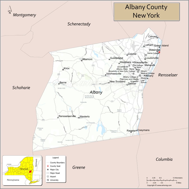
Adjacent counties
Albany County is bordered by six counties. Listed clockwise, they are:
- Schenectady County – northwest
- Saratoga County – north
- Rensselaer County – east
- Columbia County – southeast
- Greene County – south
- Schoharie County – west
Albany County Topographic Map
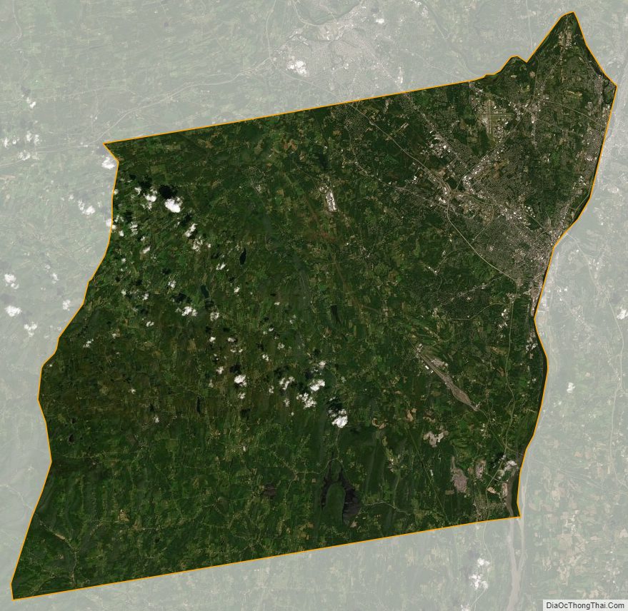
Albany County Satellite Map
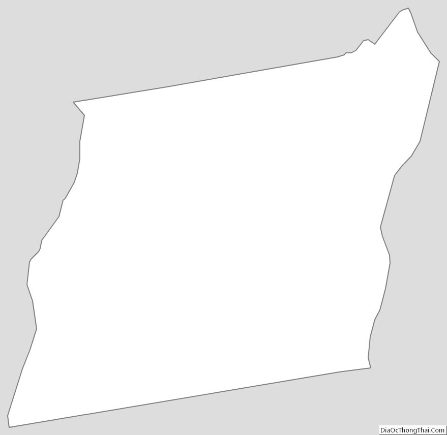
Albany County Outline Map
See also
Map of New York State and its subdivision:- Albany
- Allegany
- Bronx
- Broome
- Cattaraugus
- Cayuga
- Chautauqua
- Chemung
- Chenango
- Clinton
- Columbia
- Cortland
- Delaware
- Dutchess
- Erie
- Essex
- Franklin
- Fulton
- Genesee
- Greene
- Hamilton
- Herkimer
- Jefferson
- Kings
- Lake Ontario
- Lewis
- Livingston
- Madison
- Monroe
- Montgomery
- Nassau
- New York
- Niagara
- Oneida
- Onondaga
- Ontario
- Orange
- Orleans
- Oswego
- Otsego
- Putnam
- Queens
- Rensselaer
- Richmond
- Rockland
- Saint Lawrence
- Saratoga
- Schenectady
- Schoharie
- Schuyler
- Seneca
- Steuben
- Suffolk
- Sullivan
- Tioga
- Tompkins
- Ulster
- Warren
- Washington
- Wayne
- Westchester
- Wyoming
- Yates
- Alabama
- Alaska
- Arizona
- Arkansas
- California
- Colorado
- Connecticut
- Delaware
- District of Columbia
- Florida
- Georgia
- Hawaii
- Idaho
- Illinois
- Indiana
- Iowa
- Kansas
- Kentucky
- Louisiana
- Maine
- Maryland
- Massachusetts
- Michigan
- Minnesota
- Mississippi
- Missouri
- Montana
- Nebraska
- Nevada
- New Hampshire
- New Jersey
- New Mexico
- New York
- North Carolina
- North Dakota
- Ohio
- Oklahoma
- Oregon
- Pennsylvania
- Rhode Island
- South Carolina
- South Dakota
- Tennessee
- Texas
- Utah
- Vermont
- Virginia
- Washington
- West Virginia
- Wisconsin
- Wyoming