Albany County (/ˈɔːlbəni/ (listen) AWL-bə-nee) is a county in the U.S. state of Wyoming. As of the 2020 United States Census, the population was 37,066. Its county seat is Laramie, the site of the University of Wyoming. Its south border lies on the northern Colorado state line.
Albany County comprises the Laramie, WY Micropolitan Statistical Area. It is the fifth-most populous county in Wyoming.
| Name: | Albany County |
|---|---|
| FIPS code: | 56-001 |
| State: | Wyoming |
| Founded: | December 16, 1868 |
| Named for: | Albany, New York |
| Seat: | Laramie |
| Largest city: | Laramie |
| Total Area: | 4,309 sq mi (11,160 km²) |
| Land Area: | 4,274 sq mi (11,070 km²) |
| Total Population: | 37,066 |
| Population Density: | 8.6/sq mi (3.3/km²) |
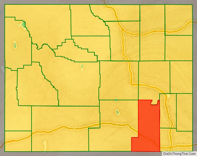
Albany County location map. Where is Albany County?

History
Albany County was organized in 1868 of territory annexed from Laramie County in Dakota Territory, which at the time had jurisdiction over part of modern-day Wyoming. It became a county in Wyoming Territory when its government was formally organized on May 19, 1869.
Charles D. Bradley, a member of the legislature of the Dakota Territory named the county for Albany, New York, the capital of his native state. In 1875, the Wyoming Territorial legislature authorized portions of Albany County to be annexed to create Crook and Johnson counties, and in 1888 land was taken from Albany County for the creation of Converse County. Further adjustments were made to the county’s boundary in 1911 and 1955.
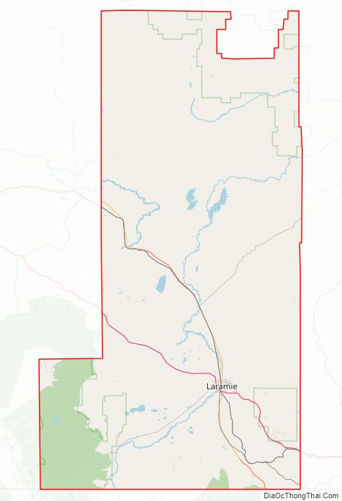
Albany County Road Map
Geography
According to the U.S. Census Bureau, the county has a total area of 4,309 square miles (11,160 km), of which 4,274 square miles (11,070 km) is land and 35 square miles (91 km) (0.8%) is water.
Adjacent counties
- Converse County – north
- Platte County – northeast
- Laramie County – east
- Larimer County, Colorado – south
- Jackson County, Colorado – southwest
- Carbon County – west
- Natrona County – northwest
Major highways
- Interstate 80
- I-80 BL
- U.S. Highway 30
- U.S. Highway 287
- Wyoming Highway 10
- Wyoming Highway 11
- Wyoming Highway 12
- Wyoming Highway 13
- Wyoming Highway 34
- Wyoming Highway 130
- Wyoming Highway 210
- Wyoming Highway 230
National protected areas
- Bamforth National Wildlife Refuge
- Hutton Lake National Wildlife Refuge
- Medicine Bow National Forest (part)
- Mortenson Lake National Wildlife Refuge
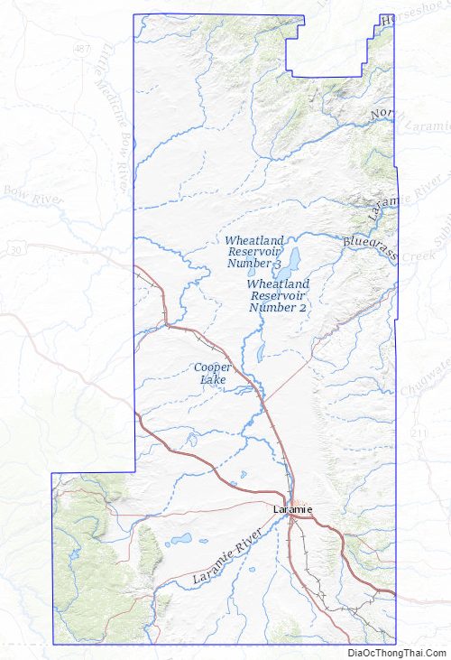
Albany County Topographic Map
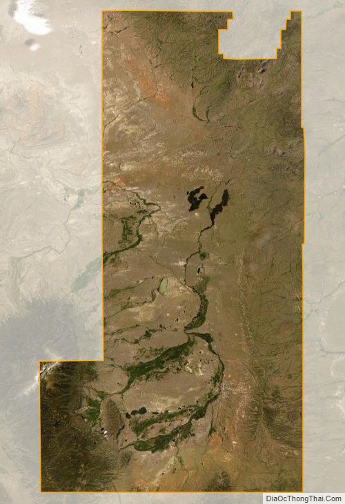
Albany County Satellite Map
Albany County Outline Map

See also
Map of Wyoming State and its subdivision: Map of other states:- Alabama
- Alaska
- Arizona
- Arkansas
- California
- Colorado
- Connecticut
- Delaware
- District of Columbia
- Florida
- Georgia
- Hawaii
- Idaho
- Illinois
- Indiana
- Iowa
- Kansas
- Kentucky
- Louisiana
- Maine
- Maryland
- Massachusetts
- Michigan
- Minnesota
- Mississippi
- Missouri
- Montana
- Nebraska
- Nevada
- New Hampshire
- New Jersey
- New Mexico
- New York
- North Carolina
- North Dakota
- Ohio
- Oklahoma
- Oregon
- Pennsylvania
- Rhode Island
- South Carolina
- South Dakota
- Tennessee
- Texas
- Utah
- Vermont
- Virginia
- Washington
- West Virginia
- Wisconsin
- Wyoming