Amador County (/ˈæmədɔːr/ (listen)) is a county located in the U.S. state of California, in the Sierra Nevada. As of the 2020 census, the population was 40,474. The county seat is Jackson. Amador County, located within California’s Gold Country, is known as “The Heart of the Mother Lode”. There is a substantial viticultural industry in the county.
| Name: | Amador County |
|---|---|
| FIPS code: | 06-005 |
| State: | California |
| Founded: | 1854 |
| Named for: | José María Amador |
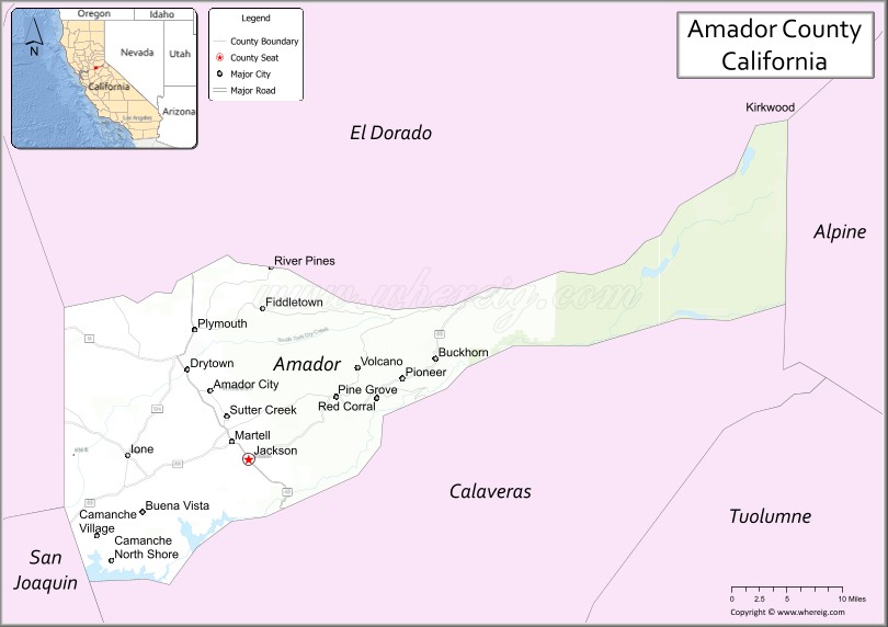
| Seat: | Jackson |
| Largest city: | Ione (population and area) |
| Total Area: | 606 sq mi (1,570 km²) |
| Land Area: | 595 sq mi (1,540 km²) |
| Total Population: | 40,474 |
| Population Density: | 67/sq mi (26/km²) |
| Time zone: | UTC-8 (Pacific Time Zone) |
| Summer Time Zone (DST): | UTC-7 (Pacific Daylight Time) |
| Website: | www.co.amador.ca.us |
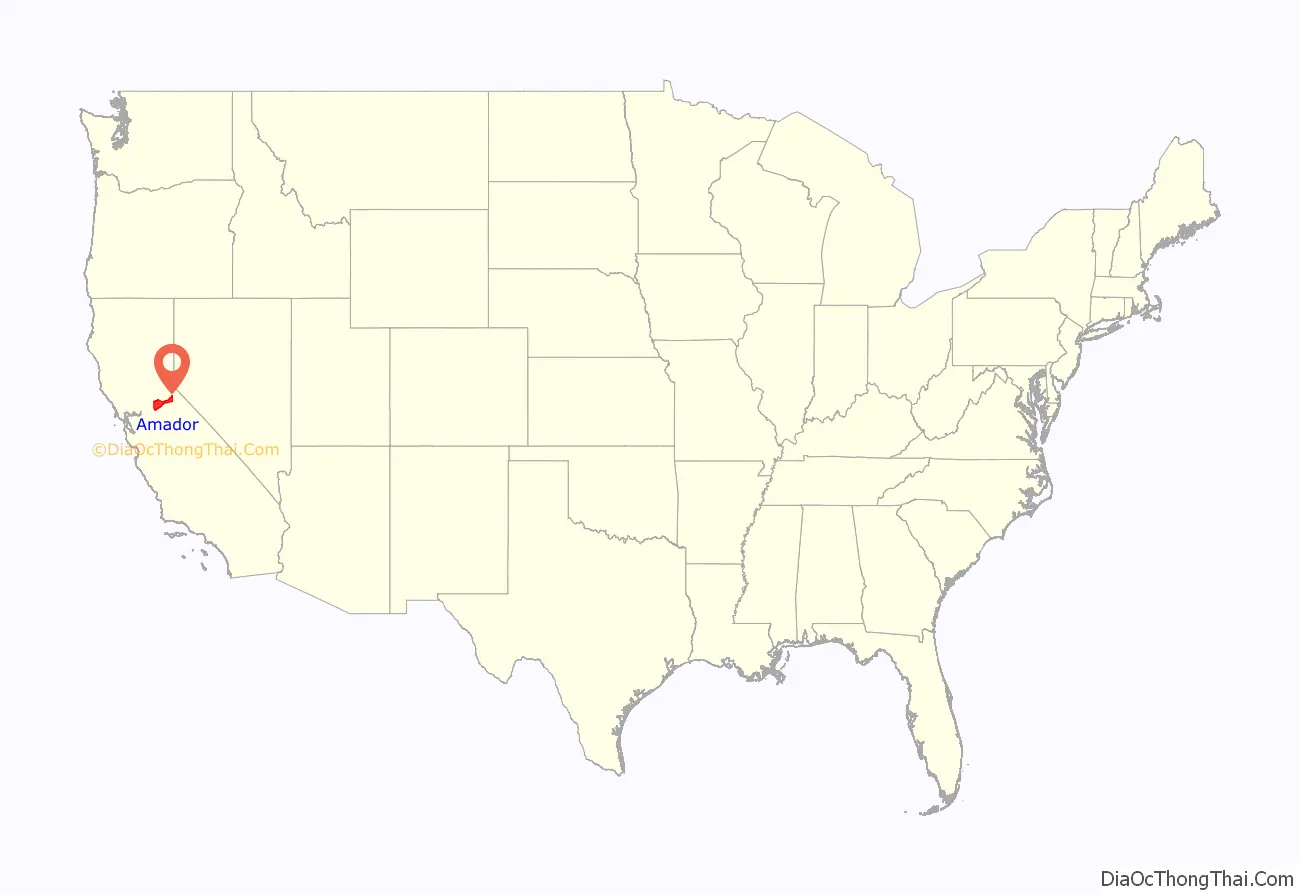
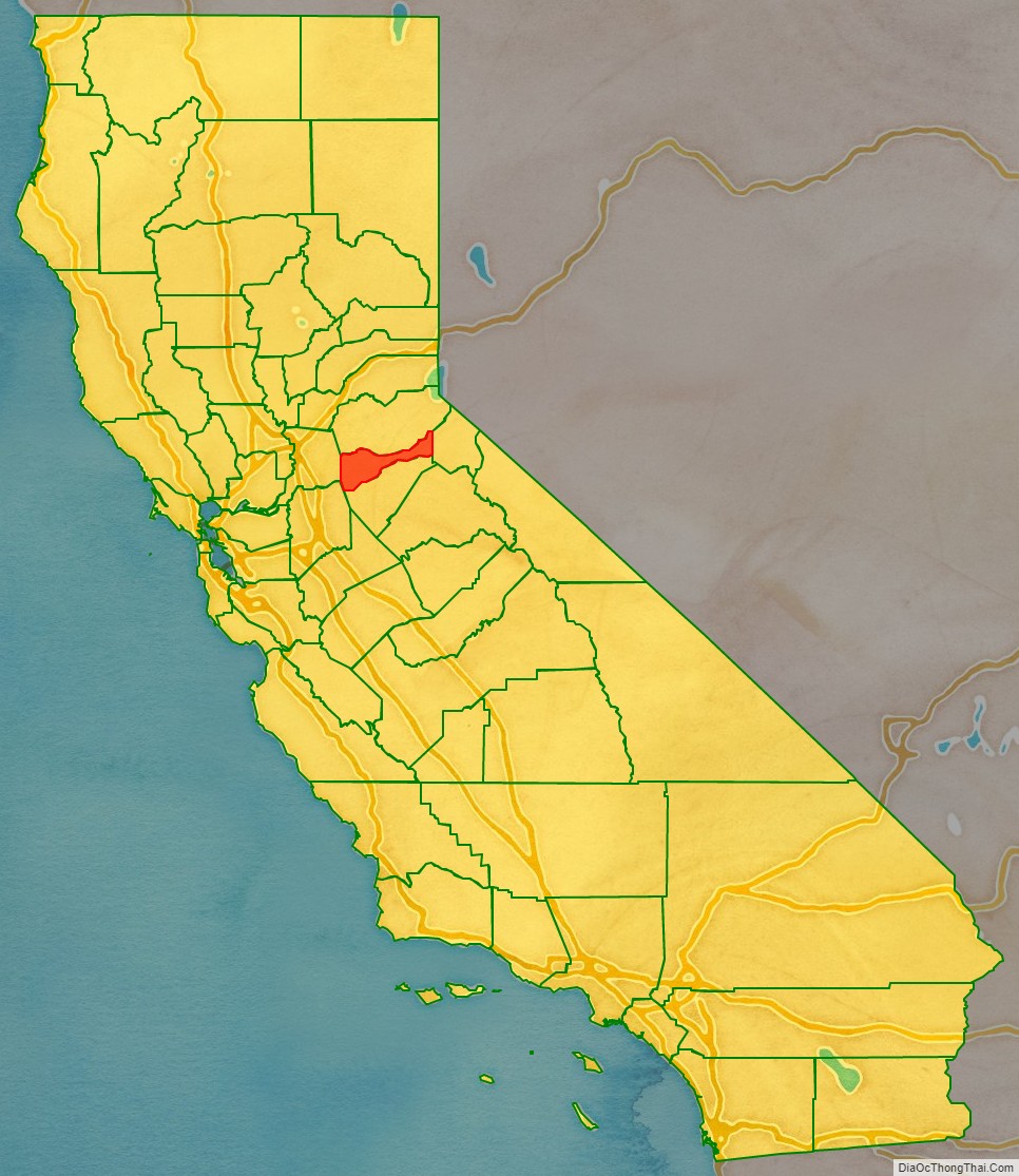
Amador County location map. Where is Amador County?
History
Amador County was created by the California Legislature on May 11, 1854, from parts of Calaveras and El Dorado counties. It was organized on July 3, 1854. In 1864, part of the county’s territory was given to Alpine County.
The county is named for José María Amador, a soldier, rancher, and miner, born in San Francisco in 1794, the son of Sergeant Pedro Amador (a Spanish soldier who settled in California in 1771) and younger brother to Sinforosa Amador.
In 1848, Jose Maria Amador, with several Native Americans, established a successful gold mining camp near the present town of Amador City. In Spanish, the word amador means “one who loves”. Some of the Mother Lode’s most successful gold mines were located in Amador County, including the Kennedy, Argonaut, and Keystone.
There are numerous gold mines in Amador County including the Argonaut Mine, the Kennedy Mine, the Central Eureka, and the Lincoln. The Kennedy Mine in Jackson was the deepest gold mine of its time. The federal government closed all of the Mother Lode’s mines in 1942 because they were considered non-essential to the war effort.
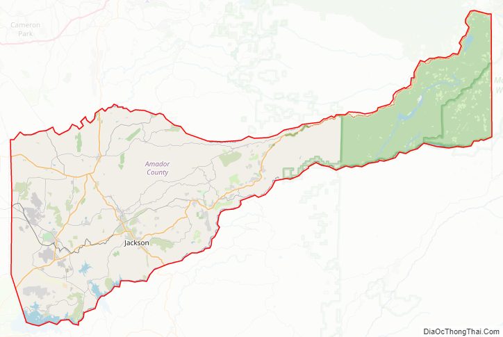
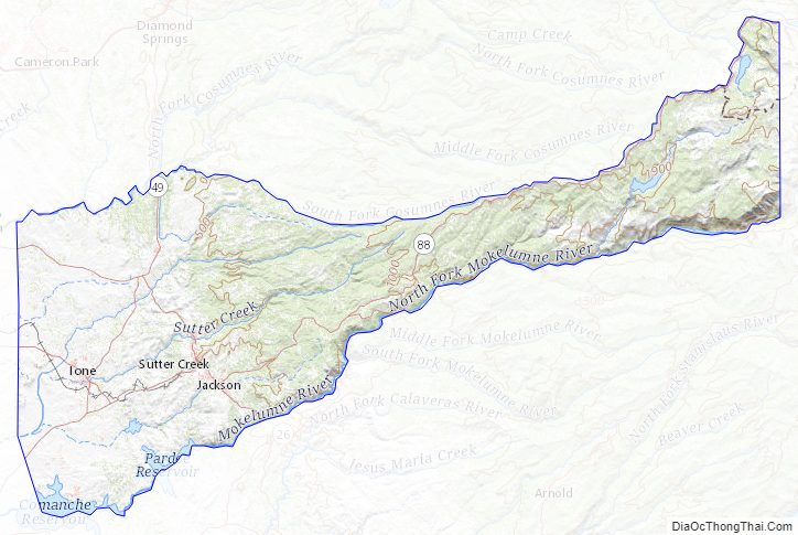
Amador County Road Map
Geography
According to the U.S. Census Bureau, the county has a total area of 606 square miles (1,570 km), of which 595 square miles (1,540 km) is land and 11.4 square miles (30 km) (1.9%) is water. It is the fifth-smallest county in California by land area and second-smallest by total area. Water bodies in the county include Lake Amador, Lake Camanche, Pardee Reservoir, Bear River Reservoir, Silver Lake, Sutter Creek, Cosumnes River, Mokelumne River, and Lake Tabeaud. Thirty-seven miles of the North Fork and main Mokelumne River were added to the California Wild and Scenic Rivers System on June 27, 2018, when Governor Edmund G. “Jerry” Brown signed Senate Bill 854.
Amador County is located approximately 45 miles (72 km) southeast of Sacramento in the part of California known as the Mother Lode, or Gold Country in the Sierra Nevada.
Amador County ranges in elevation from approximately 250 feet (76 m) in the western portion of the county to over 9,000 feet (2,700 m) in the eastern portion of the county, the tallest point being Thunder Mountain. The county is bordered on the north by the Cosumnes River and El Dorado County and on the south by the Mokelumne River and Calaveras County, on the west by Sacramento and San Joaquin Counties, and the east by Alpine County.
Adjacent counties
- El Dorado County – north
- Alpine County – east
- Calaveras County – south
- San Joaquin County – southwest
- Sacramento County – west
National protected area
- Eldorado National Forest (part)
- Mokelumne Wilderness (part)
Amador County Topographic Map
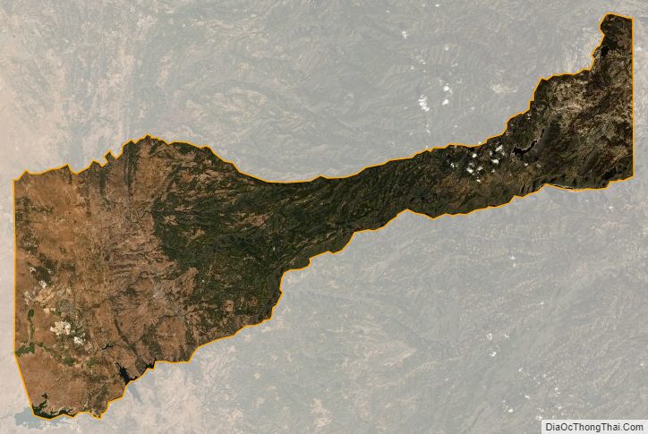
Amador County Satellite Map
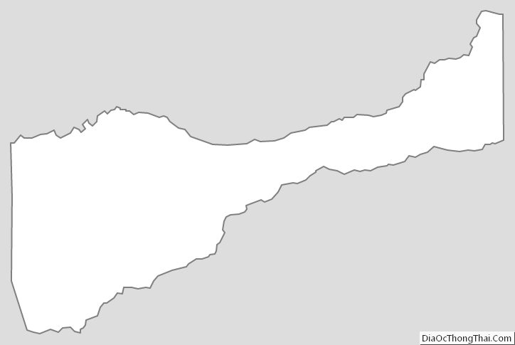
Amador County Outline Map
See also
Map of California State and its subdivision:- Alameda
- Alpine
- Amador
- Butte
- Calaveras
- Colusa
- Contra Costa
- Del Norte
- El Dorado
- Fresno
- Glenn
- Humboldt
- Imperial
- Inyo
- Kern
- Kings
- Lake
- Lassen
- Los Angeles
- Madera
- Marin
- Mariposa
- Mendocino
- Merced
- Modoc
- Mono
- Monterey
- Napa
- Nevada
- Orange
- Placer
- Plumas
- Riverside
- Sacramento
- San Benito
- San Bernardino
- San Diego
- San Francisco
- San Joaquin
- San Luis Obispo
- San Mateo
- Santa Barbara
- Santa Clara
- Santa Cruz
- Shasta
- Sierra
- Siskiyou
- Solano
- Sonoma
- Stanislaus
- Sutter
- Tehama
- Trinity
- Tulare
- Tuolumne
- Ventura
- Yolo
- Yuba
- Alabama
- Alaska
- Arizona
- Arkansas
- California
- Colorado
- Connecticut
- Delaware
- District of Columbia
- Florida
- Georgia
- Hawaii
- Idaho
- Illinois
- Indiana
- Iowa
- Kansas
- Kentucky
- Louisiana
- Maine
- Maryland
- Massachusetts
- Michigan
- Minnesota
- Mississippi
- Missouri
- Montana
- Nebraska
- Nevada
- New Hampshire
- New Jersey
- New Mexico
- New York
- North Carolina
- North Dakota
- Ohio
- Oklahoma
- Oregon
- Pennsylvania
- Rhode Island
- South Carolina
- South Dakota
- Tennessee
- Texas
- Utah
- Vermont
- Virginia
- Washington
- West Virginia
- Wisconsin
- Wyoming