Andrews County is a county in the U.S. state of Texas. It is in West Texas and its county seat is Andrews.
As of the 2020 census, the population was 18,610. The Andrews Micropolitan Statistical Area includes all of Andrews County.
Andrews county was created August 21, 1876, from Tom Green County and organized in 1910. It is named for Richard Andrews, a soldier of the Texas Revolution.
| Name: | Andrews County |
|---|---|
| FIPS code: | 48-003 |
| State: | Texas |
| Founded: | 1910 |
| Named for: | Richard Andrews |
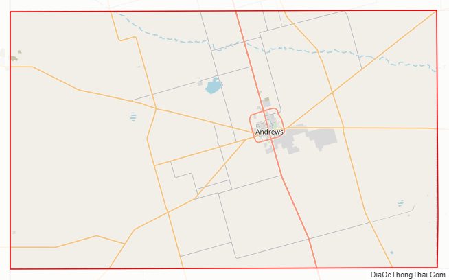
| Seat: | Andrews |
| Largest city: | Andrews |
| Total Area: | 1,501 sq mi (3,890 km²) |
| Land Area: | 1,501 sq mi (3,890 km²) |
| Total Population: | 18,610 |
| Population Density: | 12/sq mi (4.8/km²) |
| Time zone: | UTC−6 (Central) |
| Summer Time Zone (DST): | UTC−5 (CDT) |
| Website: | www.co.andrews.tx.us |
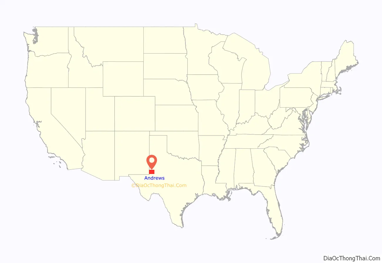
Andrews County location map. Where is Andrews County?
History
Along with the rest of Texas, Andrews County was:
- Part of the Viceroyalty of New Spain from August 18, 1521
- Part of an independent Mexico from September 27, 1821
- Part of the Republic of Texas from March 2, 1836
- Part of a state of the United States of America from December 29, 1845
- Part of the Confederate States of America from March 4, 1861
- Part of a state mandated to rejoin the Union of The United States of America on June 19, 1865, following the surrender of General Robert E. Lee and the Army of Northern Virginia of the Confederate States of America at Appomattox Courthouse, Virginia, that effectively ended the Civil War.
- Part of a state governed by provisional governors during nine years of reconstruction because of the state’s insurrection during the Civil War.
- Part of a state whose people were allowed to vote on a new constitution and fully rejoin the Union of the United States of America, with elected representation in the U.S. Congress, by an act of President U.S.Grant, March 30, 1870.
In 1876, the Texas Legislature repealed the constitution of 1869 replacing it with the current constitution and established Andrews County.
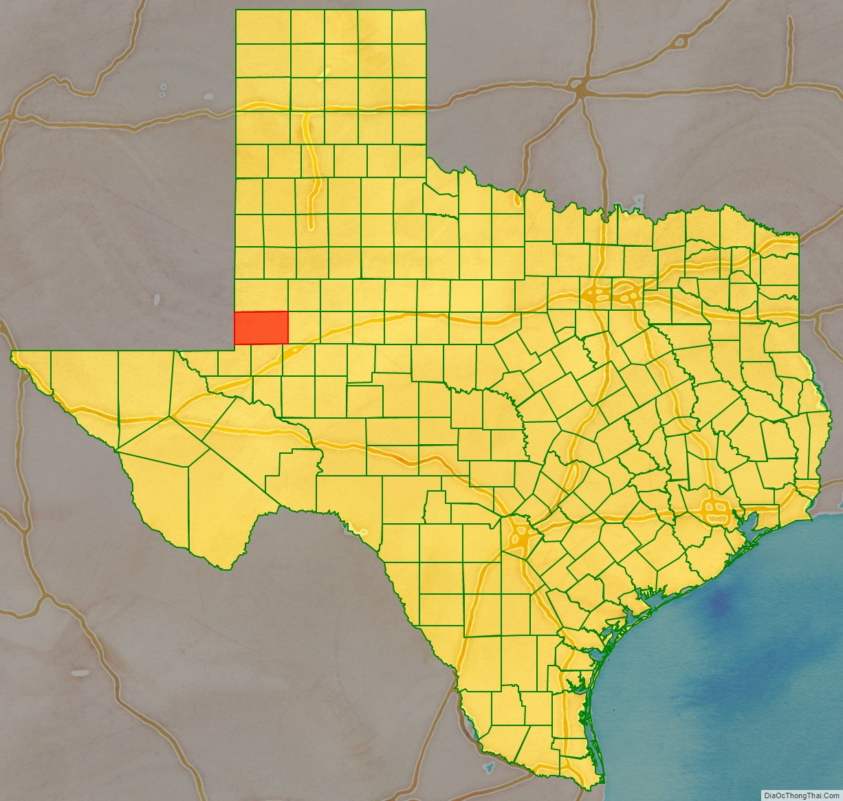
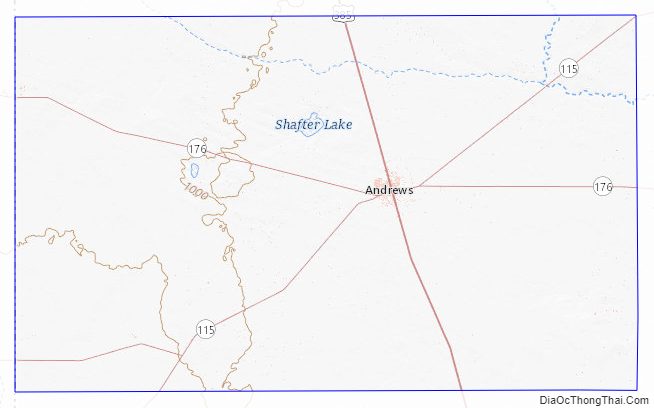
Andrews County Road Map
Geography
According to the U.S. Census Bureau, the county has an area of 1,501 square miles (3,890 km), of which essentially all is land although 0.4 square miles (1.0 km) (0.02%) are water. The county contains many playa lakes, the two largest being Baird lake and Shafter Lake.
In the west part of Andrews County on the border with New Mexico (see the state border issue below), a private company, Waste Control Specialists (WCS), formerly owned by the late Harold Simmons and headquartered in Dallas, Texas, operates a 14,000 acres (57 km) site. The company was awarded a license to dispose of radioactive waste by the TCEQ in 2009. The permit allows for disposal of radioactive materials such as uranium, plutonium and thorium from commercial power plants, academic institutions and medical schools. The company finished construction on the project in 2011 and began disposing of waste in 2012. There are two radioactive waste landfills at the site. The 30-acre compact site is owned and regulated by the State of Texas for use by Texas, Vermont, and up to 36 other states. The 90-acre federal site is owned by the United States federal government and is used for Department of Energy and other federal waste. The company employs 130 people or about 1% of the total labor force in Andrews and Andrews County.
For years, there has been a simmering dispute over which state these waste sites are lawfully a part of: Texas or New Mexico? The straight north–south border between the two states was originally defined as the 103rd meridian, but the 1859 survey that was supposed to mark that boundary mistakenly set the border between 2.29 and 3.77 miles too far west of that line, making the Waste Control Specialists waste sites, which are west of the 103rd meridian, along with the current towns of Farwell, Texline, and part of Glenrio, appear to be within the State of Texas. New Mexico’s short border with Oklahoma, in contrast, was surveyed on the correct meridian. New Mexico’s draft constitution in 1910 stated that the border is on the 103rd meridian as intended. The disputed strip, hundreds of miles long, includes parts of valuable oilfields of the Permian Basin. A bill was passed in the New Mexico Senate to fund and file a lawsuit in the U.S. Supreme Court to recover the strip from Texas, but the bill did not become law. Today, land in the strip is included in Texas land surveys and the waste sites for all purposes are taxed and governed by Andrews County and The State of Texas.
Major highways
- US 385
- SH 115
- SH 176
- Loop 1910
- FM 181
- FM 1218
- FM 1967
- FM 1788
- FM 2371
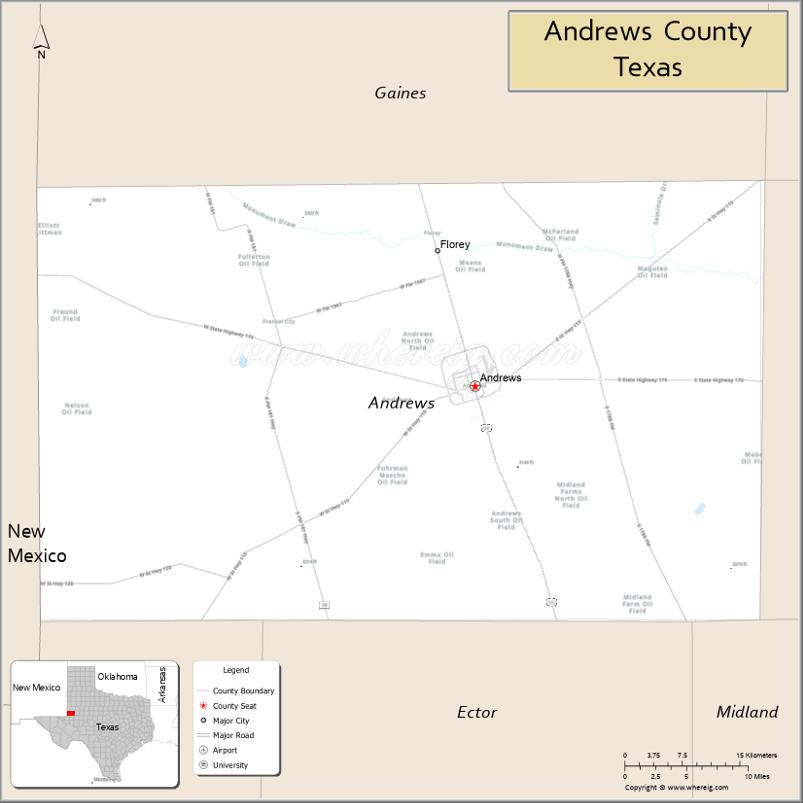
Adjacent counties
- Gaines County (north)
- Martin County (east)
- Midland County (southeast)
- Ector County (south)
- Winkler County (southwest)
- Lea County, New Mexico (west/Mountain Time Zone)
Andrews County Topographic Map
Andrews County Satellite Map

Andrews County Outline Map

See also
Map of Texas State and its subdivision:- Anderson
- Andrews
- Angelina
- Aransas
- Archer
- Armstrong
- Atascosa
- Austin
- Bailey
- Bandera
- Bastrop
- Baylor
- Bee
- Bell
- Bexar
- Blanco
- Borden
- Bosque
- Bowie
- Brazoria
- Brazos
- Brewster
- Briscoe
- Brooks
- Brown
- Burleson
- Burnet
- Caldwell
- Calhoun
- Callahan
- Cameron
- Camp
- Carson
- Cass
- Castro
- Chambers
- Cherokee
- Childress
- Clay
- Cochran
- Coke
- Coleman
- Collin
- Collingsworth
- Colorado
- Comal
- Comanche
- Concho
- Cooke
- Coryell
- Cottle
- Crane
- Crockett
- Crosby
- Culberson
- Dallam
- Dallas
- Dawson
- Deaf Smith
- Delta
- Denton
- Dewitt
- Dickens
- Dimmit
- Donley
- Duval
- Eastland
- Ector
- Edwards
- El Paso
- Ellis
- Erath
- Falls
- Fannin
- Fayette
- Fisher
- Floyd
- Foard
- Fort Bend
- Franklin
- Freestone
- Frio
- Gaines
- Galveston
- Garza
- Gillespie
- Glasscock
- Goliad
- Gonzales
- Gray
- Grayson
- Gregg
- Grimes
- Guadalupe
- Hale
- Hall
- Hamilton
- Hansford
- Hardeman
- Hardin
- Harris
- Harrison
- Hartley
- Haskell
- Hays
- Hemphill
- Henderson
- Hidalgo
- Hill
- Hockley
- Hood
- Hopkins
- Houston
- Howard
- Hudspeth
- Hunt
- Hutchinson
- Irion
- Jack
- Jackson
- Jasper
- Jeff Davis
- Jefferson
- Jim Hogg
- Jim Wells
- Johnson
- Jones
- Karnes
- Kaufman
- Kendall
- Kenedy
- Kent
- Kerr
- Kimble
- King
- Kinney
- Kleberg
- Knox
- La Salle
- Lamar
- Lamb
- Lampasas
- Lavaca
- Lee
- Leon
- Liberty
- Limestone
- Lipscomb
- Live Oak
- Llano
- Loving
- Lubbock
- Lynn
- Madison
- Marion
- Martin
- Mason
- Matagorda
- Maverick
- McCulloch
- McLennan
- McMullen
- Medina
- Menard
- Midland
- Milam
- Mills
- Mitchell
- Montague
- Montgomery
- Moore
- Morris
- Motley
- Nacogdoches
- Navarro
- Newton
- Nolan
- Nueces
- Ochiltree
- Oldham
- Orange
- Palo Pinto
- Panola
- Parker
- Parmer
- Pecos
- Polk
- Potter
- Presidio
- Rains
- Randall
- Reagan
- Real
- Red River
- Reeves
- Refugio
- Roberts
- Robertson
- Rockwall
- Runnels
- Rusk
- Sabine
- San Augustine
- San Jacinto
- San Patricio
- San Saba
- Schleicher
- Scurry
- Shackelford
- Shelby
- Sherman
- Smith
- Somervell
- Starr
- Stephens
- Sterling
- Stonewall
- Sutton
- Swisher
- Tarrant
- Taylor
- Terrell
- Terry
- Throckmorton
- Titus
- Tom Green
- Travis
- Trinity
- Tyler
- Upshur
- Upton
- Uvalde
- Val Verde
- Van Zandt
- Victoria
- Walker
- Waller
- Ward
- Washington
- Webb
- Wharton
- Wheeler
- Wichita
- Wilbarger
- Willacy
- Williamson
- Wilson
- Winkler
- Wise
- Wood
- Yoakum
- Young
- Zapata
- Zavala
- Alabama
- Alaska
- Arizona
- Arkansas
- California
- Colorado
- Connecticut
- Delaware
- District of Columbia
- Florida
- Georgia
- Hawaii
- Idaho
- Illinois
- Indiana
- Iowa
- Kansas
- Kentucky
- Louisiana
- Maine
- Maryland
- Massachusetts
- Michigan
- Minnesota
- Mississippi
- Missouri
- Montana
- Nebraska
- Nevada
- New Hampshire
- New Jersey
- New Mexico
- New York
- North Carolina
- North Dakota
- Ohio
- Oklahoma
- Oregon
- Pennsylvania
- Rhode Island
- South Carolina
- South Dakota
- Tennessee
- Texas
- Utah
- Vermont
- Virginia
- Washington
- West Virginia
- Wisconsin
- Wyoming