| Name: | Apache County |
|---|---|
| FIPS code: | 04-001 |
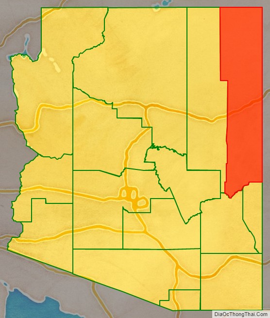
| State: | Arizona |
| Founded: | February 24, 1879 |
| Named for: | Apache people |
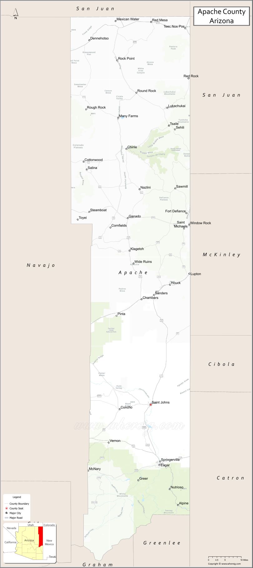
| Seat: | St. Johns |
| Largest town: | Eagar |
| Total Area: | 11,218 sq mi (29,050 km²) |
| Land Area: | 11,198 sq mi (29,000 km²) |
| Total Population: | 66,021 |
| Population Density: | 5.9/sq mi (2.3/km²) |
| Time zone: | UTC−7 (Mountain) |
| Website: | www.apachecountyaz.gov |
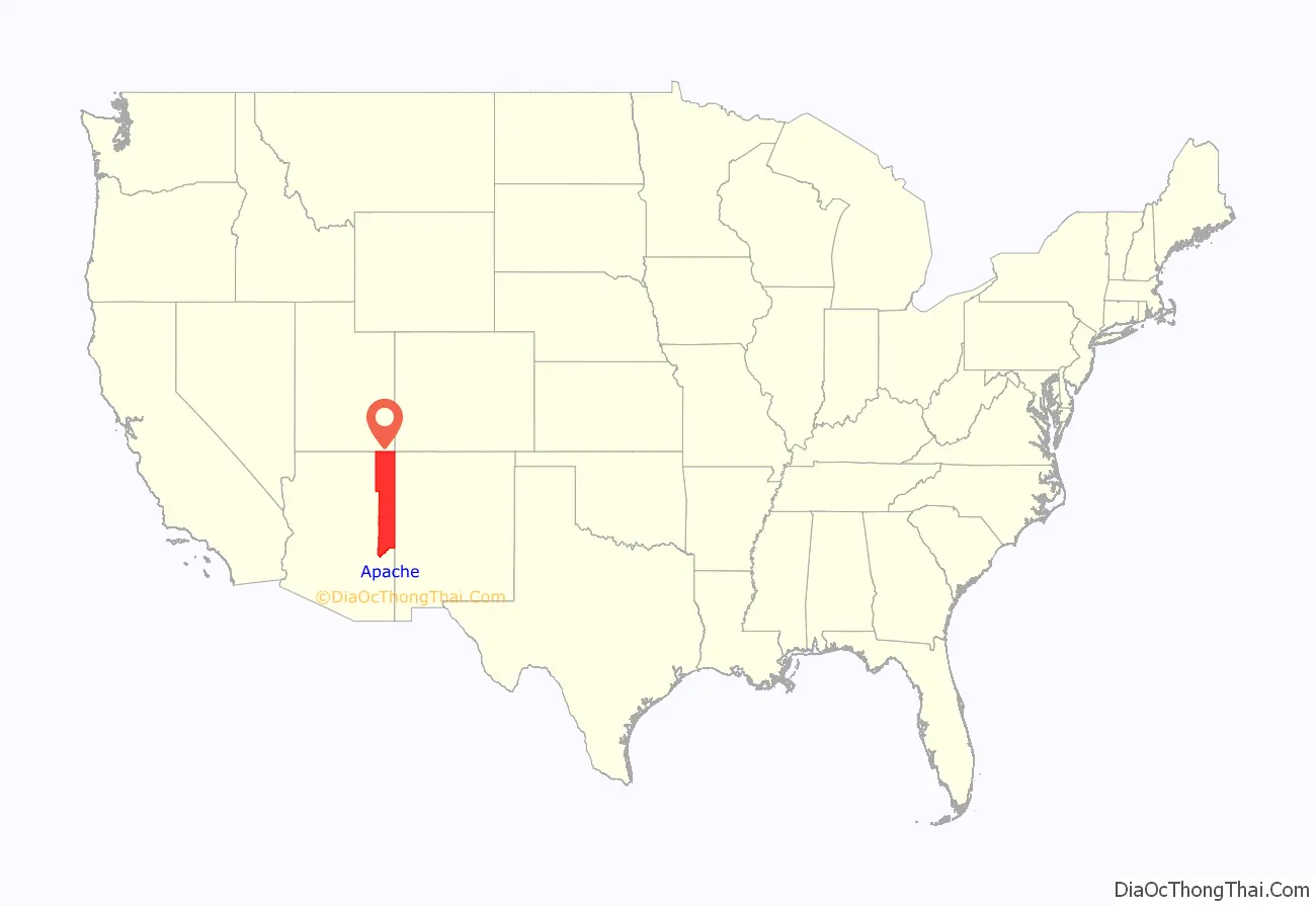
Apache County location map. Where is Apache County?
History
The United States acquired this territory following its victory in the Mexican–American War in 1848. It was originally part of the New Mexico Territory established at the time. In 1863, during the American Civil War, Congress established the Arizona Territory to improve regional administration. It operated until 1912 when it was admitted as a state.
In 1879 the Tenth Territorial Legislature organized Apache County from the eastern section of Yavapai County; officially all land east of 109°45′ W was included in the new county. As population increased in the area, by 1895, the legislature divided this county to create Navajo County and assigned some of the lands to the newly organized Graham, Greenlee and Gila counties. The county seat was first designated as the town of Snowflake, but a year later it was moved to St. Johns. From 1880 to 1882, the county seat was temporarily in Springerville, before being returned to St. Johns.
An 1896 history of the area described the county by the following:
In the late 1880s, the county sheriff was Commodore Perry Owens, a legendary Old West gunfighter. At that time, the county covered more than 21,177 square miles (54,850 km) in territory. In September 1887, near Holbrook in what is now Navajo County, Owens was involved in a famous gunfight: he killed three men and wounded a fourth while serving a warrant on outlaw Andy Blevins/Andy Cooper, a participant in a raging range war, later dubbed the Pleasant Valley War.
In 2015, Apache County had the highest rate of deaths due to motor vehicles in the United States, with 82.5 deaths per 100,000 people.
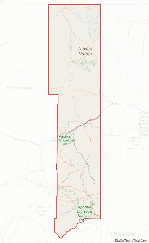
The Fort Apache Indian Reservation occupies part of the county, as does the Navajo Nation, whose territory extends well beyond it. The Apache and Navajo Nation are federally recognized tribes that long occupied territory here.
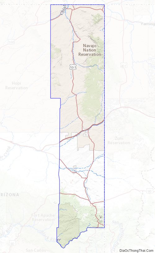
Apache County Road Map
Geography
According to the United States Census Bureau, the county has a total area of 11,218 square miles (29,050 km), of which 11,198 square miles (29,000 km) is land and 21 square miles (54 km) (0.2%) is water. The county is the third-largest county by area in Arizona and the sixth-largest in the United States (excluding boroughs and census areas in Alaska).
Apache County contains parts of each of the Navajo Indian Reservation and the Fort Apache Indian Reservation, and landholdings of the Zuni Indian Reservation that are not contiguous to their main territory. It also contains part of Petrified Forest National Park. Canyon de Chelly National Monument is entirely within the county and within the boundaries of the Navajo Nation.
Adjacent counties
- Greenlee County – south
- Graham County – south
- Navajo County – west
- Montezuma County, Colorado – northeast
- San Juan County, Utah – north
- San Juan County, New Mexico – east
- McKinley County, New Mexico – east
- Cibola County, New Mexico – east
- Catron County, New Mexico – east
Apache County is one of three U.S. counties (the others being Wayne County, West Virginia and Cook County, Illinois) to border two counties of the same name, neither of which is in the same state as the county itself (San Juan County, Utah and San Juan County, New Mexico).
Indian reservations
Apache County has the most land designated as Indian reservation of any county in the United States. (Coconino County and Navajo County are a close second and third.) The county has 19,857.34 km (7,666.96 sq mi) of reservation territory, or 68.34 percent of its total area. The reservations are, in descending order of area within the county, the Navajo Nation, the Fort Apache Indian Reservation, and the Zuni Indian Reservation, all of which are partly located within the county.
National protected areas
- Apache-Sitgreaves National Forest (part)
- Canyon de Chelly National Monument
- Hubbell Trading Post National Historic Site
- Petrified Forest National Park (part)
Apache County Topographic Map
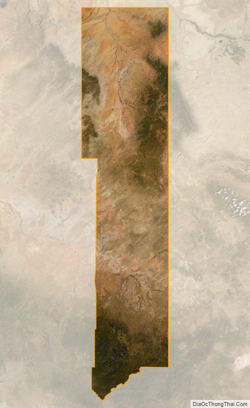
Apache County Satellite Map
Apache County Outline Map

See also
Map of Arizona State and its subdivision: Map of other states:- Alabama
- Alaska
- Arizona
- Arkansas
- California
- Colorado
- Connecticut
- Delaware
- District of Columbia
- Florida
- Georgia
- Hawaii
- Idaho
- Illinois
- Indiana
- Iowa
- Kansas
- Kentucky
- Louisiana
- Maine
- Maryland
- Massachusetts
- Michigan
- Minnesota
- Mississippi
- Missouri
- Montana
- Nebraska
- Nevada
- New Hampshire
- New Jersey
- New Mexico
- New York
- North Carolina
- North Dakota
- Ohio
- Oklahoma
- Oregon
- Pennsylvania
- Rhode Island
- South Carolina
- South Dakota
- Tennessee
- Texas
- Utah
- Vermont
- Virginia
- Washington
- West Virginia
- Wisconsin
- Wyoming