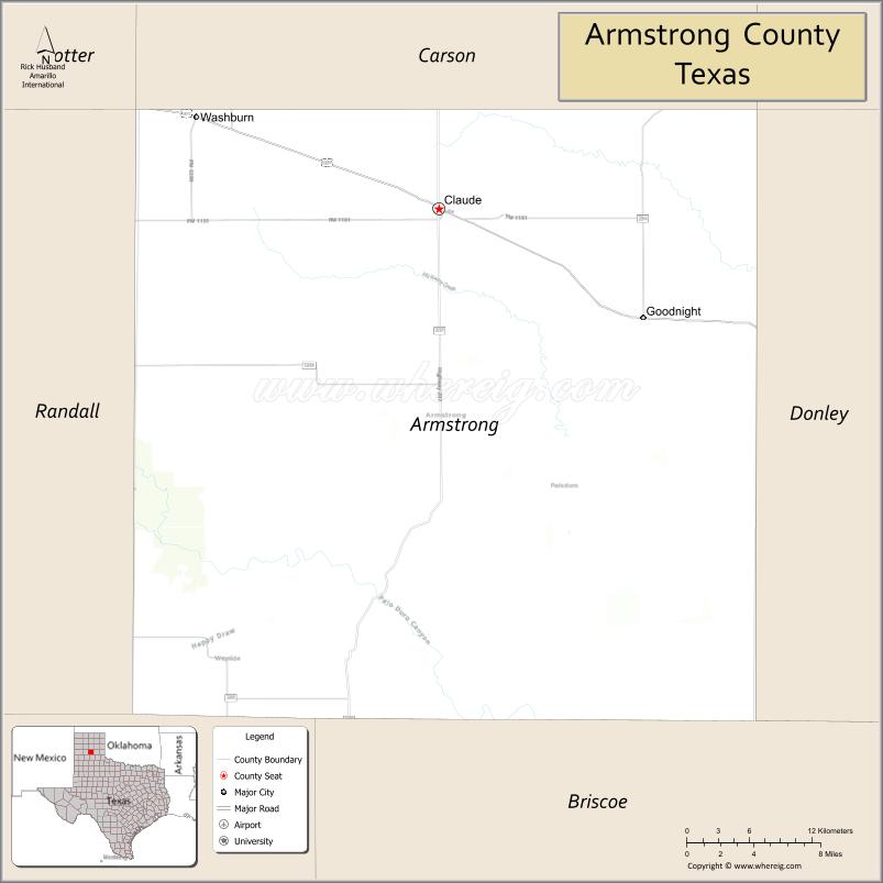
Armstrong County is a county located in the U.S. state of Texas. It is in the Texas Panhandle and its county seat is Claude.
As of the 2020 census, its population was 1,848. Armstrong County is included in the Amarillo metropolitan area.
The county was formed in 1876 and later organized in 1890. It was named for one of several Texas pioneer families named Armstrong.
| Name: | Armstrong County |
|---|---|
| FIPS code: | 48-011 |
| State: | Texas |
| Founded: | 1890 |
| Seat: | Claude |
| Largest city: | Claude |
| Total Area: | 914 sq mi (2,370 km²) |
| Land Area: | 909 sq mi (2,350 km²) |
| Total Population: | 1,848 |
| Population Density: | 2.0/sq mi (0.78/km²) |
| Time zone: | UTC−6 (Central) |
| Summer Time Zone (DST): | UTC−5 (CDT) |
| Website: | www.co.armstrong.tx.us |
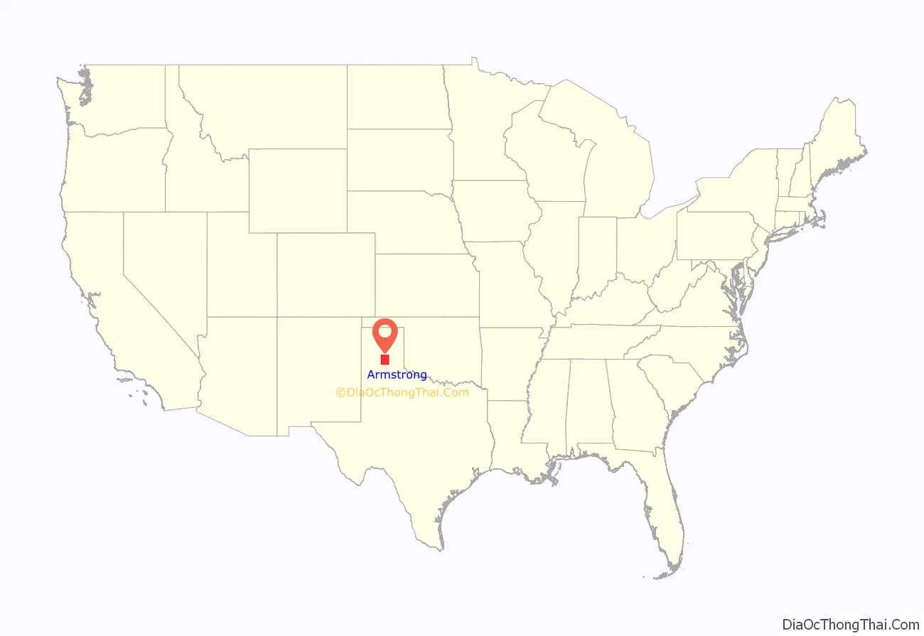
Armstrong County location map. Where is Armstrong County?
History
Native Americans
Paleo-Indians first inhabitants as far back as 10,000 BC. Apachean cultures roamed the county until Comanche dominated around 1700. The Comanches were defeated by the United States Army in the Red River War of 1874. Later tribes include Kiowa and Cheyenne.
County established and growth
In 1876, the Texas Legislature established Armstrong County from portions of Bexar County, and it organized in 1890 with Claude as the county seat.
In 1876, Charles Goodnight brought a herd of 1,600 cattle into the Palo Duro Canyon, and he and John George Adair established ranching in the county. The JA Ranch encompassed over a million acres (4,000 km), spread over Armstrong County and five adjoining counties. The county land use was primarily ranch-related, even after the trickling in of homesteaders, for the remainder of the 19th century.
In 1887, the JA Ranch split up, giving way to a terminus for the Fort Worth and Denver City Railway. The first town from the ranch was Goodnight. Landowner Robert E. Montgomery platted the town of Washburn, named after railroad executive D.W. Washburn.
The next year, railroad lines turned Washburn into a boom town. In the same year, Armstrong City was renamed Claude in honor of railroad engineer Claude Ayers. In 1890, the two towns competed for the county seat, with Claude winning.
At the beginning of the 20th century, ranching began to share the land with cotton and wheat crops, although ranching remained the leading industry. The Great Depression had a severe effect on the county’s economy, and recovery took years. Ranches still occupied about 68% of the land in the county in 2005.
Many scenes of the 1963 Paul Newman film Hud were filmed at Goodnight and Claude.
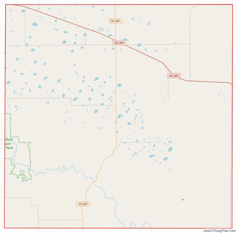
Armstrong County Road Map
Geography
According to the U.S. Census Bureau, the county has a total area of 914 square miles (2,370 km), of which 4.7 sq mi (12 km) (0.5%) are covered by water.
Major highways
- U.S. Highway 287
- State Highway 207
Adjacent counties
- Carson County (north)
- Gray County (northeast)
- Donley County (east)
- Briscoe County (south)
- Swisher County (southwest)
- Randall County (west)
- Potter County (northwest)
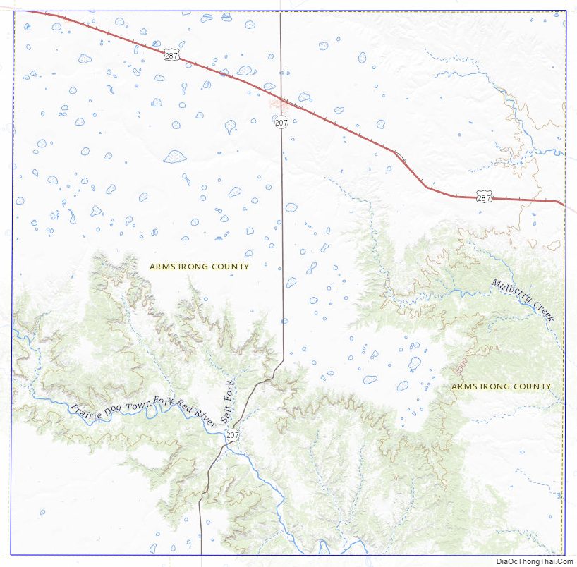
Armstrong County Topographic Map
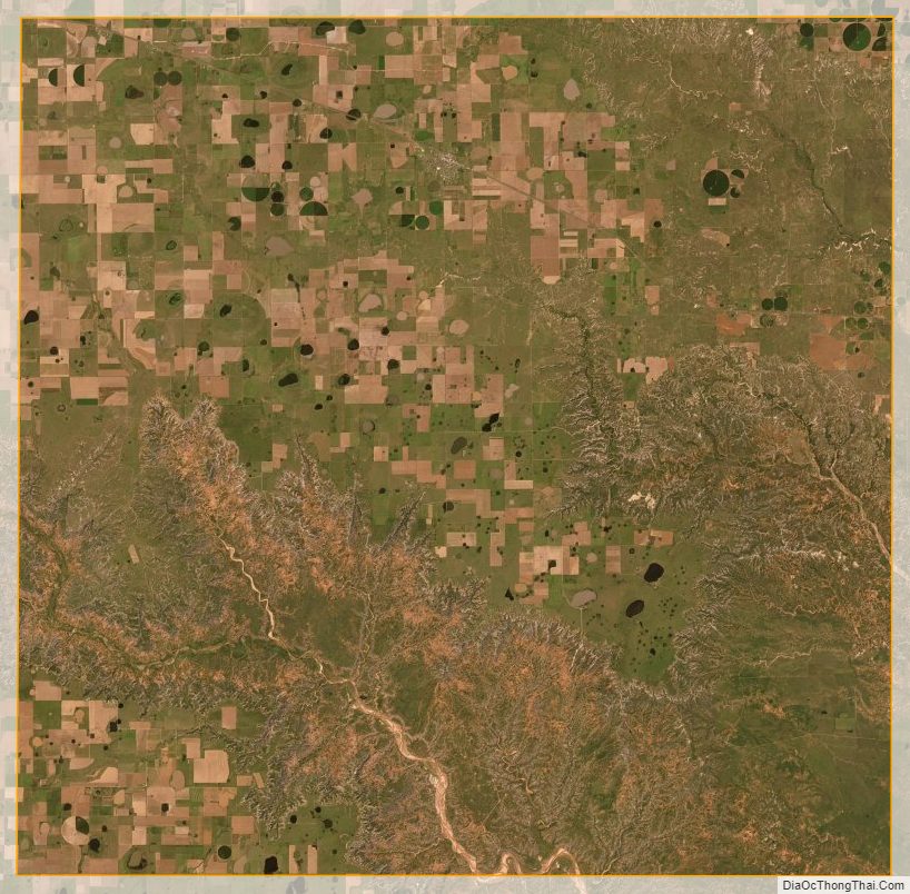
Armstrong County Satellite Map
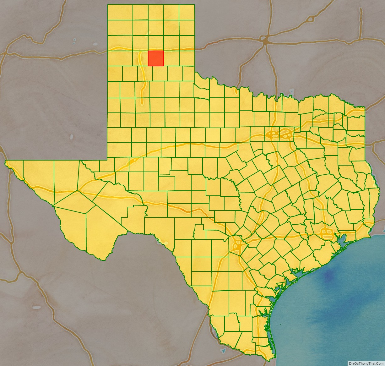
Armstrong County Outline Map

See also
Map of Texas State and its subdivision:- Anderson
- Andrews
- Angelina
- Aransas
- Archer
- Armstrong
- Atascosa
- Austin
- Bailey
- Bandera
- Bastrop
- Baylor
- Bee
- Bell
- Bexar
- Blanco
- Borden
- Bosque
- Bowie
- Brazoria
- Brazos
- Brewster
- Briscoe
- Brooks
- Brown
- Burleson
- Burnet
- Caldwell
- Calhoun
- Callahan
- Cameron
- Camp
- Carson
- Cass
- Castro
- Chambers
- Cherokee
- Childress
- Clay
- Cochran
- Coke
- Coleman
- Collin
- Collingsworth
- Colorado
- Comal
- Comanche
- Concho
- Cooke
- Coryell
- Cottle
- Crane
- Crockett
- Crosby
- Culberson
- Dallam
- Dallas
- Dawson
- Deaf Smith
- Delta
- Denton
- Dewitt
- Dickens
- Dimmit
- Donley
- Duval
- Eastland
- Ector
- Edwards
- El Paso
- Ellis
- Erath
- Falls
- Fannin
- Fayette
- Fisher
- Floyd
- Foard
- Fort Bend
- Franklin
- Freestone
- Frio
- Gaines
- Galveston
- Garza
- Gillespie
- Glasscock
- Goliad
- Gonzales
- Gray
- Grayson
- Gregg
- Grimes
- Guadalupe
- Hale
- Hall
- Hamilton
- Hansford
- Hardeman
- Hardin
- Harris
- Harrison
- Hartley
- Haskell
- Hays
- Hemphill
- Henderson
- Hidalgo
- Hill
- Hockley
- Hood
- Hopkins
- Houston
- Howard
- Hudspeth
- Hunt
- Hutchinson
- Irion
- Jack
- Jackson
- Jasper
- Jeff Davis
- Jefferson
- Jim Hogg
- Jim Wells
- Johnson
- Jones
- Karnes
- Kaufman
- Kendall
- Kenedy
- Kent
- Kerr
- Kimble
- King
- Kinney
- Kleberg
- Knox
- La Salle
- Lamar
- Lamb
- Lampasas
- Lavaca
- Lee
- Leon
- Liberty
- Limestone
- Lipscomb
- Live Oak
- Llano
- Loving
- Lubbock
- Lynn
- Madison
- Marion
- Martin
- Mason
- Matagorda
- Maverick
- McCulloch
- McLennan
- McMullen
- Medina
- Menard
- Midland
- Milam
- Mills
- Mitchell
- Montague
- Montgomery
- Moore
- Morris
- Motley
- Nacogdoches
- Navarro
- Newton
- Nolan
- Nueces
- Ochiltree
- Oldham
- Orange
- Palo Pinto
- Panola
- Parker
- Parmer
- Pecos
- Polk
- Potter
- Presidio
- Rains
- Randall
- Reagan
- Real
- Red River
- Reeves
- Refugio
- Roberts
- Robertson
- Rockwall
- Runnels
- Rusk
- Sabine
- San Augustine
- San Jacinto
- San Patricio
- San Saba
- Schleicher
- Scurry
- Shackelford
- Shelby
- Sherman
- Smith
- Somervell
- Starr
- Stephens
- Sterling
- Stonewall
- Sutton
- Swisher
- Tarrant
- Taylor
- Terrell
- Terry
- Throckmorton
- Titus
- Tom Green
- Travis
- Trinity
- Tyler
- Upshur
- Upton
- Uvalde
- Val Verde
- Van Zandt
- Victoria
- Walker
- Waller
- Ward
- Washington
- Webb
- Wharton
- Wheeler
- Wichita
- Wilbarger
- Willacy
- Williamson
- Wilson
- Winkler
- Wise
- Wood
- Yoakum
- Young
- Zapata
- Zavala
- Alabama
- Alaska
- Arizona
- Arkansas
- California
- Colorado
- Connecticut
- Delaware
- District of Columbia
- Florida
- Georgia
- Hawaii
- Idaho
- Illinois
- Indiana
- Iowa
- Kansas
- Kentucky
- Louisiana
- Maine
- Maryland
- Massachusetts
- Michigan
- Minnesota
- Mississippi
- Missouri
- Montana
- Nebraska
- Nevada
- New Hampshire
- New Jersey
- New Mexico
- New York
- North Carolina
- North Dakota
- Ohio
- Oklahoma
- Oregon
- Pennsylvania
- Rhode Island
- South Carolina
- South Dakota
- Tennessee
- Texas
- Utah
- Vermont
- Virginia
- Washington
- West Virginia
- Wisconsin
- Wyoming