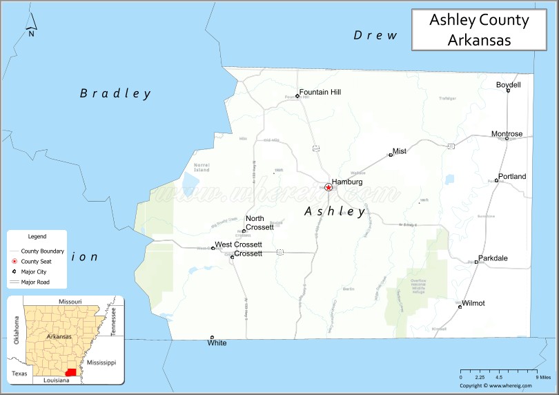
Ashley County is a rural South Arkansas county with a culture, economy, and history based on timber and agriculture. Created as Arkansas’s 52nd county on November 30, 1848, Ashley County has seven incorporated municipalities, including Hamburg, the county seat and Crossett, the most populous city. The county is also the site of numerous unincorporated communities and ghost towns. The county is named for Chester Ashley, a prominent lawyer in the Arkansas Territory and U.S. senator from the state from 1844 to 1848.
The county is roughly divided into two halves by Bayou Bartholomew, with the rich, fertile, alluvial soils of the Arkansas Delta in the east, and the shortleaf pine forests of the Arkansas Timberlands in the west. The county contains six protected areas: Overflow National Wildlife Refuge, Felsenthal National Wildlife Refuge, three Wildlife Management Areas and the Crossett Experimental Forest. Other historical features such as log cabins, one-room school houses, community centers, and museums describe the history and culture of Ashley County.
Ashley County occupies 939.08 square miles (243,220 ha) and contained a population of 19,062 as of the 2020 Census. The economy is largely based on agriculture and small manufacturing. Poverty and unemployment rates are above national averages, but steady. Household incomes are below state and national averages. Politically, Ashley County has transitioned from reliably Democratic to steadily Republican since the mid-20th century.
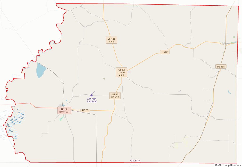
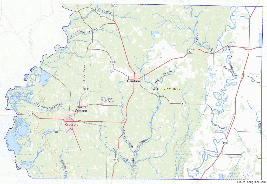
Ashley County is mostly served by two school districts, Hamburg School District and Crossett School District. Higher education is provided at University of Arkansas at Monticello College of Technology—Crossett, a public two-year community college in Crossett. Ashley County Medical Center in Crossett is a community hospital providing primary care in the county. Although no Interstate highways serve Ashley County, the county has access to three United States highways (U.S. Route 82 [US 82], US 165, and US 425) and eleven Arkansas state highways. Ashley County is also served by one public owned/public use general aviation airport, Z. M. Jack Stell Field, one electric cooperative (Ashley-Chicot Electric Cooperative), and ten community water systems provide potable water to customers in the county. It is an alcohol prohibition or dry county.
| Name: | Ashley County |
|---|---|
| FIPS code: | 05-003 |
| State: | Arkansas |
| Founded: | November 30, 1848 |
| Named for: | Chester Ashley |
| Seat: | Hamburg |
| Largest city: | Crossett |
| Total Area: | 939.08 sq mi (1,511.31 km²) |
| Land Area: | 921.15 sq mi (1,482.45 km²) |
| Total Population: | 19,062 |
| Population Density: | 33/sq mi (13/km²) |
| Time zone: | UTC−6 (Central) |
| Summer Time Zone (DST): | UTC−5 (CDT) |
| Website: | www.ashleycountyar.com |
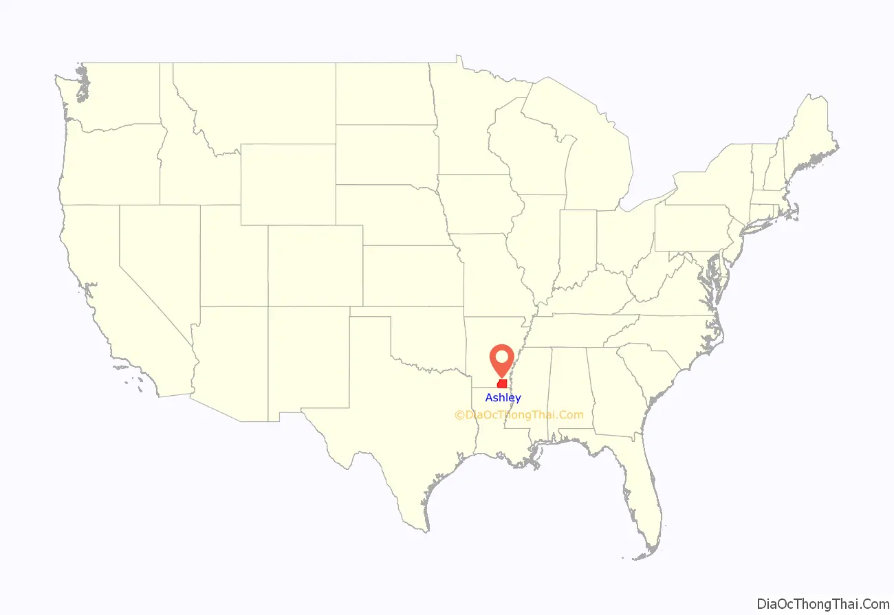
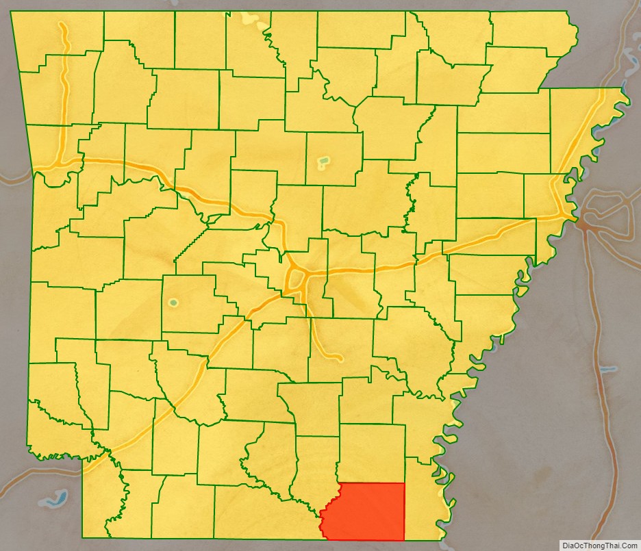
Ashley County location map. Where is Ashley County?
History
Ashley County, the fifth-largest county in Arkansas in terms of land area, was formed by the 7th Arkansas General Assembly on November 30, 1848, from portions of Drew, Chicot and Union Counties. It was named after Chester Ashley, a US Senator and land speculator. The final borders were laid in 1861.
The first settlement in Ashley County appears to have been made by the French at Longview. Now there is no trace of Longview that was a river town connecting the Arkansas Post and Monroe, Louisiana. The Fogle and Gulett families claimed to have located at Longview in 1768 or 1770. In 1846 Captain Phillip Derden came from Virginia and moved to Longview. He bought furs and skins from hunters and trappers and ran a general store for pioneer settlers. He built a log warehouse and a lived in a 2-story log cabin. The home of Isaac Denson in Fountain Hill served as the temporary county seat until a new centrally located town could be established in 1849. It was named “Hamburg” in honor of “fine deer hams” enjoyed by the county commissioners making the selection in the vicinity. The 1850 courthouse was replaced in 1905 but was lost in a fire in 1921. The current courthouse was built in the 1960s. The courtroom in the courthouse has a one-of-a-kind architecture: it is round, and the seats are arranged so that members of the audience can always see each other.
John R. Steelman, who wrote his 1928 PhD dissertation on “mob action in the South”, wrote:
Ashley County Road Map
Geography
Ashley County is split between two geographic regions, divided by the Bayou Bartholomew. The rich, fertile, alluvial soils of the Mississippi Alluvial Plain extend into the eastern part of the county. In Arkansas, this region is called the Arkansas Delta (in Arkansas, usually referred to as “the Delta”), having a distinct history and culture from adjacent regions. West of the Ouachita, Ashley County is characterized by forests of shortleaf pine and hardwoods typical of the Gulf Coastal Plain. In Arkansas, this region is referred to as the Arkansas Timberlands, a subdivision of the Piney Woods.
According to the U.S. Census Bureau, the county has a total area of 941 square miles (2,440 km), of which 925 square miles (2,400 km) is land and 15 square miles (39 km) (1.6%) is water. The lowest point in the state of Arkansas is located on the Ouachita River in Ashley County and Union County, where it flows out of Arkansas and into Louisiana.
The county is located approximately 58 miles (93 km) north of Monroe, Louisiana, 118 miles (190 km) south of Little Rock, and 158 miles (254 km) northwest of Jackson, Mississippi. Ashley County is surrounded by Drew County to the north, Chicot County to the east, Morehouse Parish, Louisiana, to the south, Union Parish, Louisiana, to the southwest, and two Timberlands counties; Union County to the west and Bradley County to the northwest.
Hydrology
Water is an extremely important part of Ashley County’s geography, history, economy, and culture. The many rivers, streams, and ditches crossing the county have featured prominently since prehistoric times, and many archaeological sites, including the Lake Enterprise Mound from the Archaic period, are along waterways. Many early white settlements, including Berea, Arkansas, were founded along waterways, but many faded as railroads eclipsed waterways as the favored mode of transportation.
Ashley County is split among four watersheds: the lower Saline River in the northwest, lower Ouachita River in the southwest, Bayou Bartholomew across the majority of the county, and the Boeuf River along the eastern edge. The Saline River serves as the northwestern boundary of the county before emptying into the Ouachita River, which serves as the southwestern boundary. The Port of Crossett is positioned just south of the Saline River’s mouth. Within the county, Bearhouse Creek, Chemin-a-haut Bayou, Fountain Creek, Flat Creek, Mill Creek, and Overflow Creek are important watercourses.
Protected areas
Ashley County contains Overflow National Wildlife Refuge, part of the Felsenthal National Wildlife Refuge, and four Wildlife Management Areas (WMAs) under Arkansas Game and Fish Commission jurisdiction.
Beryl Anthony Lower Ouachita WMA preserves seasonally flooded bottomland hardwood forest habitat along the Ouachita River between the Felsenthal NWR and the Louisiana state line for preservation, recreation, and hunting opportunities. Duck hunting, especially when the Ouachita River floods, is the primary hunting opportunity due to the site’s position along the Mississippi Flyway, with deer and squirrel hunting also available during the year. Most of the 7,020 acres (2,840 ha) is on the Union County side of the Ouachita River, leaving the only public access to the Ashley County area via boat. A small segment in Ashley County contains the Coffee Prairie Natural Area, owned by the Arkansas Natural Heritage Commission.
The Casey Jones Leased Lands WMA is a common name for five fragmented parcels in Ashley and Drew counties established in 1988. The two largest segments in Ashley County are south of Crossett and in the northwest corner of the county, with a small area northwest of the Overflow WMA also included in Casey Jones WMA. This lease includes segments of working forest actively managed for forest products, primarily by single tree selection. Habitats range from upland pine to bottomland hardwood depending upon location. Deer and turkey hunting are most common in the WMA.
Little Bayou WMA is located in northeastern Ashley County along the western banks of Bayou Bartholomew at the mouth of Little Bayou. The area contains a boat ramp on Bayou Bartholomew, as well as birding, camping, fishing, and hunting. The former agricultural area was replanted with bottomland and upland hardwoods, short-leaf pines, and native warm season grasses in the 1990s.
The Crossett Experimental Forest is a 1,765 acres (714 ha) property donated by Georgia-Pacific Corporation in 1934 to research forest management in second-growth loblolly pine and shortleaf pine forests. Within the Forest is the Reynolds Natural Area, a stand that has been largely untouched since the area’s creation in 1934. The property is managed by the Southern Research Station of the United States Forest Service.
Ashley County Topographic Map
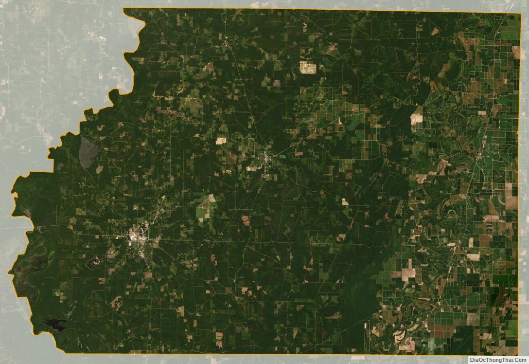
Ashley County Satellite Map
Ashley County Outline Map

See also
Map of Arkansas State and its subdivision:- Arkansas
- Ashley
- Baxter
- Benton
- Boone
- Bradley
- Calhoun
- Carroll
- Chicot
- Clark
- Clay
- Cleburne
- Cleveland
- Columbia
- Conway
- Craighead
- Crawford
- Crittenden
- Cross
- Dallas
- Desha
- Drew
- Faulkner
- Franklin
- Fulton
- Garland
- Grant
- Greene
- Hempstead
- Hot Spring
- Howard
- Independence
- Izard
- Jackson
- Jefferson
- Johnson
- Lafayette
- Lawrence
- Lee
- Lincoln
- Little River
- Logan
- Lonoke
- Madison
- Marion
- Miller
- Mississippi
- Monroe
- Montgomery
- Nevada
- Newton
- Ouachita
- Perry
- Phillips
- Pike
- Poinsett
- Polk
- Pope
- Prairie
- Pulaski
- Randolph
- Saint Francis
- Saline
- Scott
- Searcy
- Sebastian
- Sevier
- Sharp
- Stone
- Union
- Van Buren
- Washington
- White
- Woodruff
- Yell
- Alabama
- Alaska
- Arizona
- Arkansas
- California
- Colorado
- Connecticut
- Delaware
- District of Columbia
- Florida
- Georgia
- Hawaii
- Idaho
- Illinois
- Indiana
- Iowa
- Kansas
- Kentucky
- Louisiana
- Maine
- Maryland
- Massachusetts
- Michigan
- Minnesota
- Mississippi
- Missouri
- Montana
- Nebraska
- Nevada
- New Hampshire
- New Jersey
- New Mexico
- New York
- North Carolina
- North Dakota
- Ohio
- Oklahoma
- Oregon
- Pennsylvania
- Rhode Island
- South Carolina
- South Dakota
- Tennessee
- Texas
- Utah
- Vermont
- Virginia
- Washington
- West Virginia
- Wisconsin
- Wyoming