Assumption Parish (French: Paroisse de l’Assomption, Spanish: Parroquia de la Asunción) is a parish located in the U.S. state of Louisiana. As of the 2020 census, the population was 21,039. Its parish seat is Napoleonville. Assumption Parish was established in 1807, as one of the original parishes of the Territory of Orleans.
Assumption Parish is one of the twenty-two Acadiana parishes. Its major product is sugar cane. In proportion to its area, Assumption Parish produces the most sugar of any parish of Louisiana.
| Name: | Assumption Parish |
|---|---|
| FIPS code: | 22-007 |
| State: | Louisiana |
| Founded: | 1807 |
| Named for: | Assumption Roman Catholic Church |
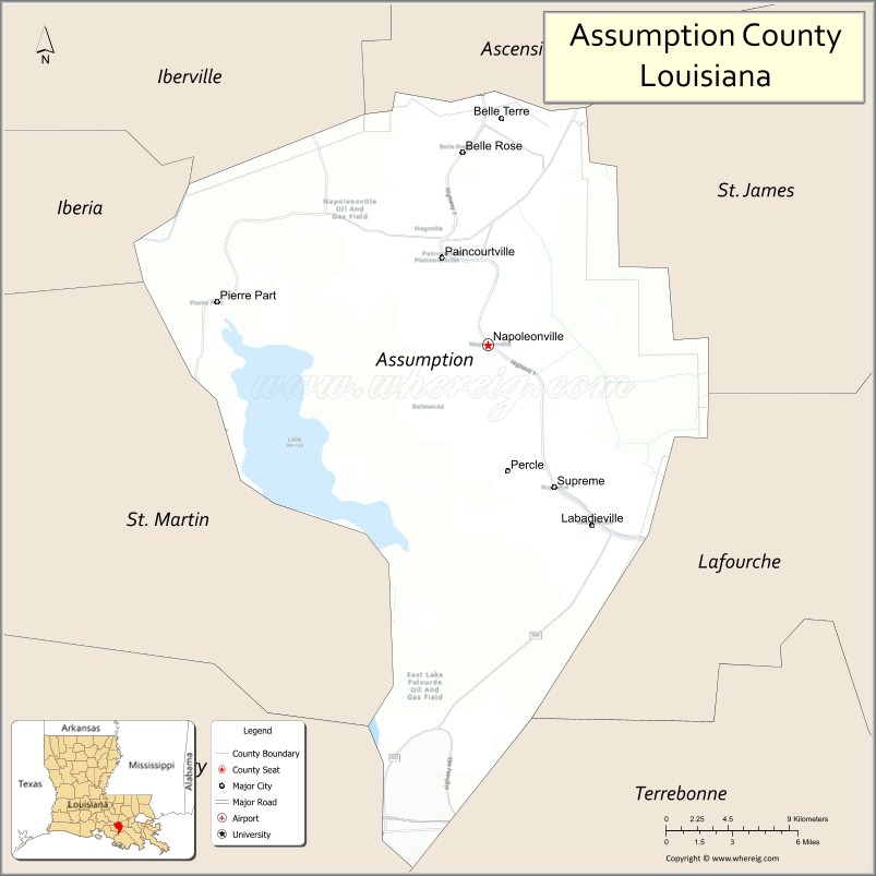
| Seat: | Napoleonville |
| Total Area: | 365 sq mi (950 km²) |
| Land Area: | 339 sq mi (880 km²) |
| Total Population: | 21,039 |
| Population Density: | 58/sq mi (22/km²) |
| Time zone: | UTC−6 (Central) |
| Summer Time Zone (DST): | UTC−5 (CDT) |
| Website: | www.assumptionla.com |
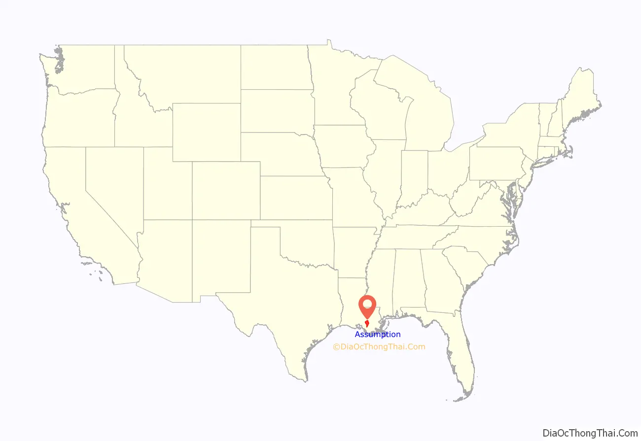
Assumption Parish location map. Where is Assumption Parish?
History
In 1807, Assumption became the eighth parish of the Orleans Territory. Its history is rooted in its waterways and its large expanse of fertile soils ideal for farming. Settled in the middle 18th century by French and Spanish settlers, the area retains strong cultural ties to its past with conversational French still common among residents. Assumption was also a final destination for many of the French Acadians exiled from Nova Scotia between 1755 and 1764.
After the Confederacy forced the surrender of Fort Sumter, South Carolina, in 1861, the Assumption Parish Police Jury appropriated $1,000 to provide uniforms for military volunteers against the Union. By contrast, Lafayette Parish contributed $6,000. Plaquemines Parish approved a gift of $10 to $15 per month for needy volunteer families.
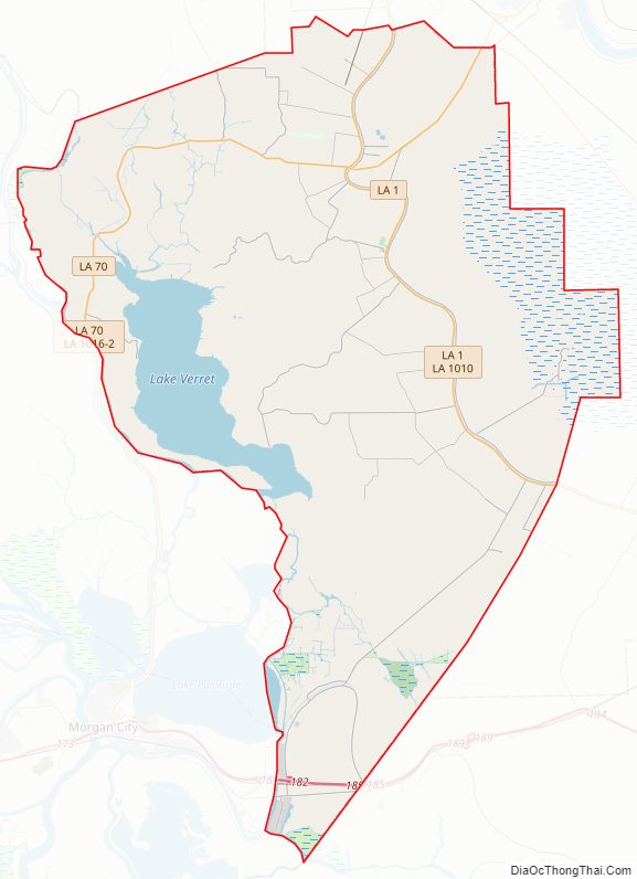
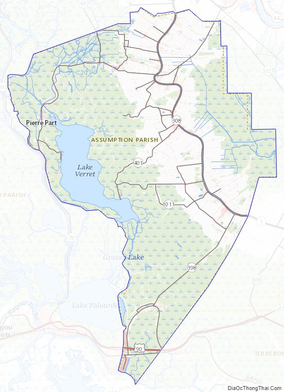
Assumption Parish Road Map
Geography
According to the U.S. Census Bureau, the parish has a total area of 365 square miles (950 km), of which 339 square miles (880 km) is land and 26 square miles (67 km) (7.1%) is water.
Major highways
- Future Interstate 49
- U.S. Highway 90
- Louisiana Highway 1
- Louisiana Highway 70
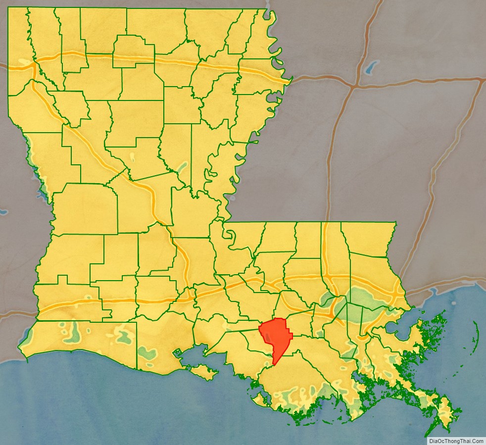
Adjacent parishes
- Iberville Parish (north)
- Ascension Parish (north)
- St. James Parish (northeast)
- Lafourche Parish (east)
- Terrebonne Parish (southeast)
- St. Mary Parish (southwest)
- Iberia Parish (northwest)
- St. Martin Parish (west)
Assumption Parish Topographic Map
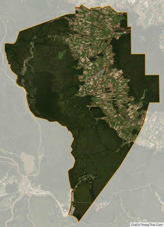
Assumption Parish Satellite Map
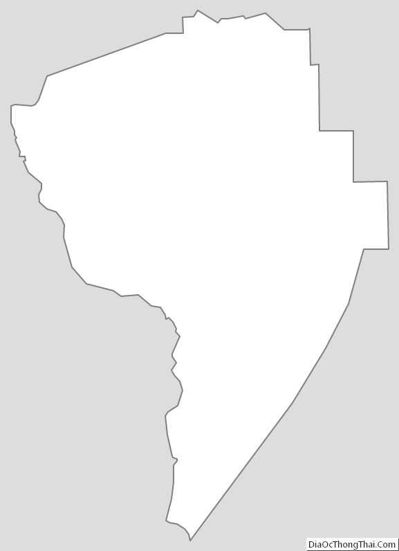
Assumption Parish Outline Map
See also
Map of Louisiana State and its subdivision:- Acadia
- Allen
- Ascension
- Assumption
- Avoyelles
- Beauregard
- Bienville
- Bossier
- Caddo
- Calcasieu
- Caldwell
- Cameron
- Catahoula
- Claiborne
- Concordia
- De Soto
- East Baton Rouge
- East Carroll
- East Feliciana
- Evangeline
- Franklin
- Grant
- Iberia
- Iberville
- Jackson
- Jefferson
- Jefferson Davis
- La Salle
- Lafayette
- Lafourche
- Lincoln
- Livingston
- Madison
- Morehouse
- Natchitoches
- Orleans
- Ouachita
- Plaquemines
- Pointe Coupee
- Rapides
- Red River
- Richland
- Sabine
- Saint Bernard
- Saint Charles
- Saint Helena
- Saint James
- Saint John the Baptist
- Saint Landry
- Saint Martin
- Saint Mary
- Saint Tammany
- Tangipahoa
- Tensas
- Terrebonne
- Union
- Vermilion
- Vernon
- Washington
- Webster
- West Baton Rouge
- West Carroll
- West Feliciana
- Winn
- Alabama
- Alaska
- Arizona
- Arkansas
- California
- Colorado
- Connecticut
- Delaware
- District of Columbia
- Florida
- Georgia
- Hawaii
- Idaho
- Illinois
- Indiana
- Iowa
- Kansas
- Kentucky
- Louisiana
- Maine
- Maryland
- Massachusetts
- Michigan
- Minnesota
- Mississippi
- Missouri
- Montana
- Nebraska
- Nevada
- New Hampshire
- New Jersey
- New Mexico
- New York
- North Carolina
- North Dakota
- Ohio
- Oklahoma
- Oregon
- Pennsylvania
- Rhode Island
- South Carolina
- South Dakota
- Tennessee
- Texas
- Utah
- Vermont
- Virginia
- Washington
- West Virginia
- Wisconsin
- Wyoming