| Name: | Baca County |
|---|---|
| FIPS code: | 08-009 |
| State: | Colorado |
| Founded: | April 16, 1889 |
| Named for: | Felipe Baca |
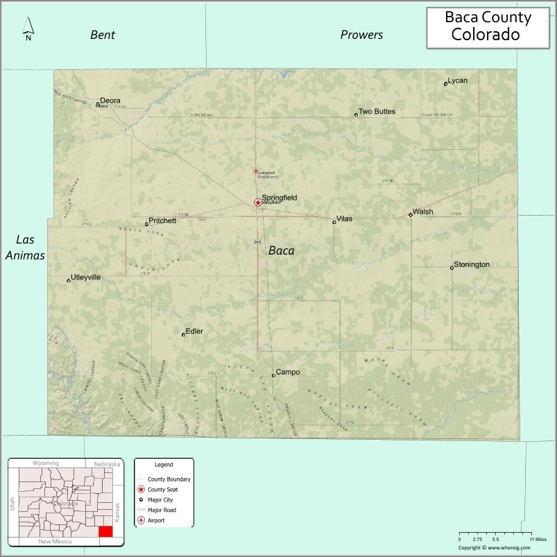
| Seat: | Springfield |
| Largest town: | Springfield |
| Total Area: | 2,557 sq mi (6,620 km²) |
| Land Area: | 2,555 sq mi (6,620 km²) |
| Total Population: | 3,506 |
| Population Density: | 1.4/sq mi (0.5/km²) |
| Time zone: | UTC−7 (Mountain) |
| Summer Time Zone (DST): | UTC−6 (MDT) |
| Website: | bacacountyco.gov |
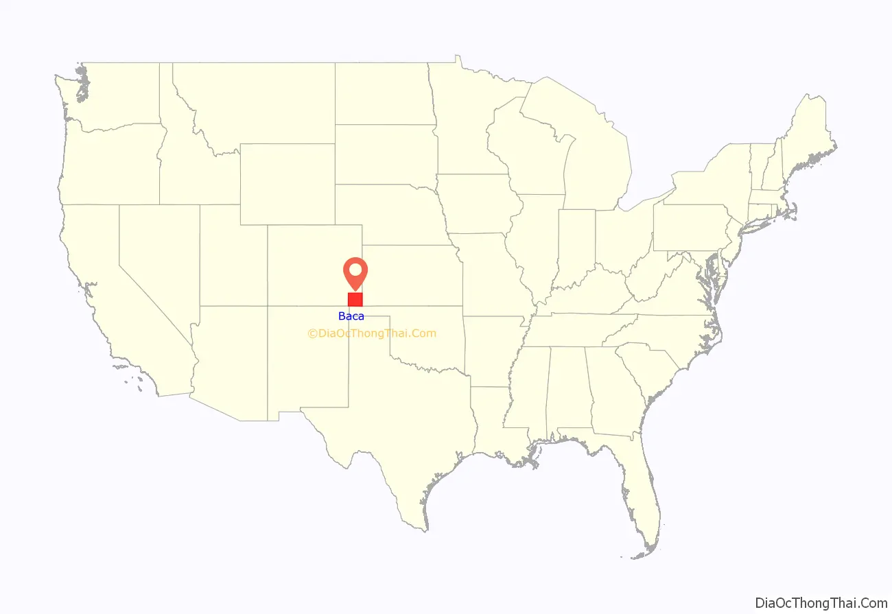
Baca County location map. Where is Baca County?
History
Baca County was created by the Colorado legislature on April 16, 1889, out of eastern portions of Las Animas County. Baca County was named in honor of pioneer and Colorado territorial legislator Felipe Baca.
Prior to the 1880s there was little activity in the county, other than along the Cutoff Branch of the Santa Fe Trail that crosses its extreme southeastern corner. The 1910s saw wet years and expansion due to the increase in acreage that could be homesteaded. World War I also brought increased demand for agricultural products. The arrival of the Santa Fe Railroad in 1926 created new towns and a population increase.
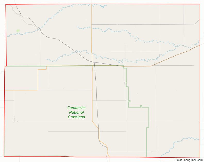
The Dust Bowl arrived in the 1930s, with Baca County being one of the hardest hit areas. This prompted soil conservation efforts by the federal government. Part of this effort was the purchase of cultivated land by the government in order to return it to grassland. Today the U.S. Forest Service supervises 220,000 acres of Comanche National Grassland which was purchased in the 1930s. These areas include Carrizo Creek and Picture Canyon. The Colorado Division of Wildlife maintains the recreational areas at Two Buttes Lake and Turk’s Pond.
On May 18, 1977, an F4 tornado struck the southeastern portion of Baca County, causing an estimated $2.5 million in damage. It tracked from Keyes, Oklahoma, where damage was estimated at $25,000. As of 2020, this is the only F4/EF4 tornado ever recorded in Colorado since 1950.
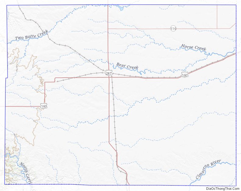
Baca County Road Map
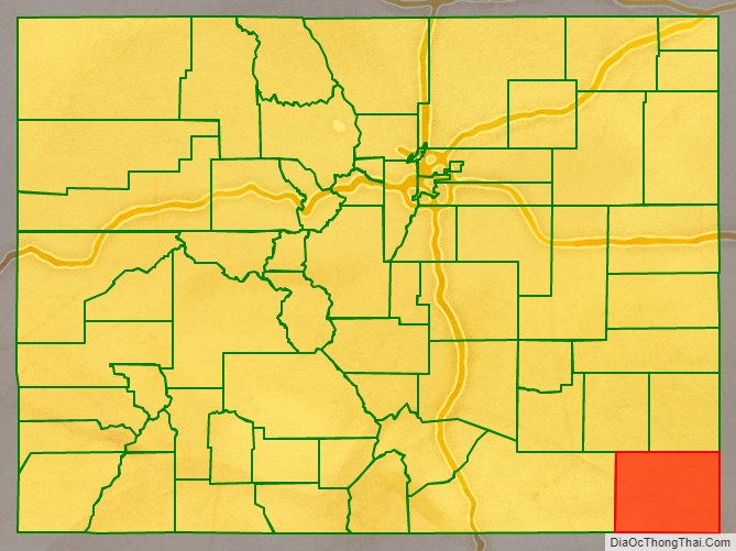
Geography
According to the U.S. Census Bureau, the county has a total area of 2,557 square miles (6,620 km), of which 2,555 square miles (6,620 km) is land and 2.4 square miles (6.2 km) (0.09%) is water.
Adjacent counties
- Prowers County, Colorado (north)
- Stanton County, Kansas (east/Central Time border)
- Morton County, Kansas (east/Central Time border)
- Cimarron County, Oklahoma (south/Central Time border)
- Union County, New Mexico (southwest)
- Las Animas County, Colorado (west)
- Bent County, Colorado (northwest)
Major Highways
- U.S. Highway 160
- U.S. Highway 385
- State Highway 116
National historic trail
- Santa Fe National Historic Trail
Baca County Topographic Map
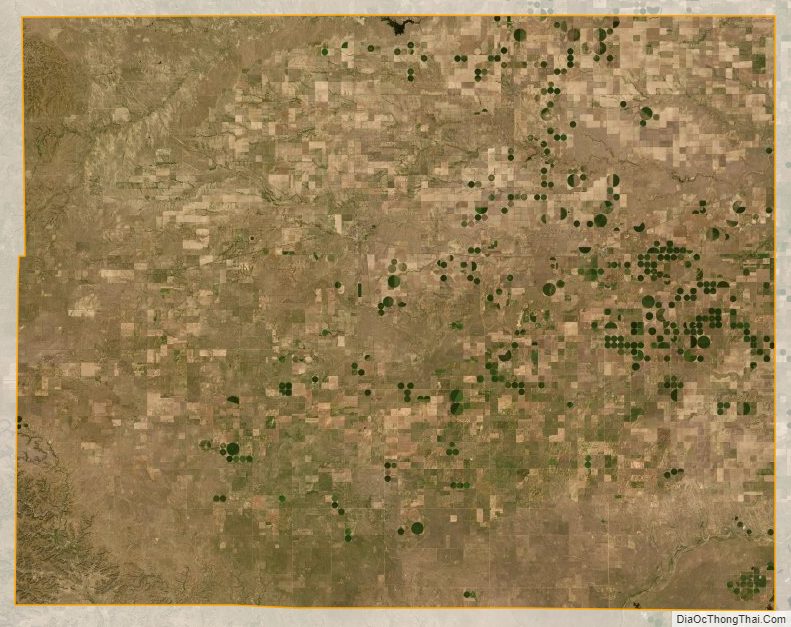
Baca County Satellite Map
Baca County Outline Map

See also
Map of Colorado State and its subdivision:- Adams
- Alamosa
- Arapahoe
- Archuleta
- Baca
- Bent
- Boulder
- Broomfield
- Chaffee
- Cheyenne
- Clear Creek
- Conejos
- Costilla
- Crowley
- Custer
- Delta
- Denver
- Dolores
- Douglas
- Eagle
- El Paso
- Elbert
- Fremont
- Garfield
- Gilpin
- Grand
- Gunnison
- Hinsdale
- Huerfano
- Jackson
- Jefferson
- Kiowa
- Kit Carson
- La Plata
- Lake
- Larimer
- Las Animas
- Lincoln
- Logan
- Mesa
- Mineral
- Moffat
- Montezuma
- Montrose
- Morgan
- Otero
- Ouray
- Park
- Phillips
- Pitkin
- Prowers
- Pueblo
- Rio Blanco
- Rio Grande
- Routt
- Saguache
- San Juan
- San Miguel
- Sedgwick
- Summit
- Teller
- Washington
- Weld
- Yuma
- Alabama
- Alaska
- Arizona
- Arkansas
- California
- Colorado
- Connecticut
- Delaware
- District of Columbia
- Florida
- Georgia
- Hawaii
- Idaho
- Illinois
- Indiana
- Iowa
- Kansas
- Kentucky
- Louisiana
- Maine
- Maryland
- Massachusetts
- Michigan
- Minnesota
- Mississippi
- Missouri
- Montana
- Nebraska
- Nevada
- New Hampshire
- New Jersey
- New Mexico
- New York
- North Carolina
- North Dakota
- Ohio
- Oklahoma
- Oregon
- Pennsylvania
- Rhode Island
- South Carolina
- South Dakota
- Tennessee
- Texas
- Utah
- Vermont
- Virginia
- Washington
- West Virginia
- Wisconsin
- Wyoming