Banks County is a county located in the northeastern part of the U.S. state of Georgia. As of the 2020 census, the population was 18,035, down from 18,395 in 2010. The county seat is Homer. The Old Banks County Courthouse is located in Homer and listed on the National Register of Historic Places. A new county courthouse was constructed adjacent to the old one in 1983.
| Name: | Banks County |
|---|---|
| FIPS code: | 13-011 |
| State: | Georgia |
| Founded: | 1859 |
| Named for: | Richard Banks |
| Seat: | Homer |
| Largest city: | Baldwin |
| Total Area: | 234 sq mi (610 km²) |
| Land Area: | 232 sq mi (600 km²) |
| Total Population: | 18,035 |
| Population Density: | 79/sq mi (31/km²) |
| Time zone: | UTC−5 (Eastern) |
| Summer Time Zone (DST): | UTC−4 (EDT) |
| Website: | www.bankscountyga.org |
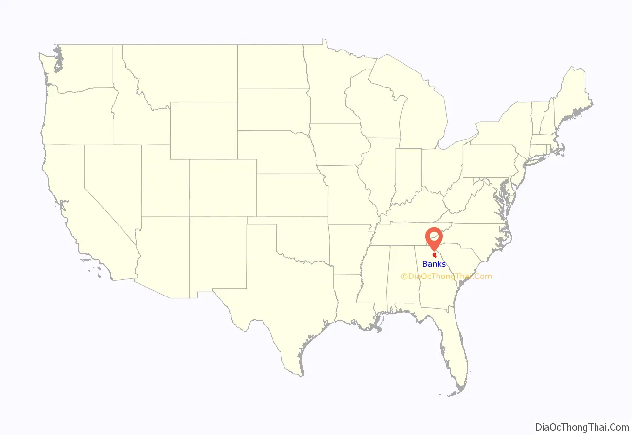
Banks County location map. Where is Banks County?
History
The law to establish Banks County was passed by the Georgia General Assembly on December 11, 1858. It was named for Dr. Richard E. Banks. The legislation called for the creation of Banks County on February 1, 1859, from Franklin and Habersham counties.
Ty Cobb, a Baseball Hall of Famer, was born in Banks County in 1886 in an area of the county known as The Narrows – a small farming community consisting of fewer than 100 people. The area and birthplace are on State Highway 105 in the northern part of the county near the Broad River. The legal organ for the county is The Banks County News, a member of Mainstreet News, Inc. One of the county’s oldest church sites is the Hebron Presbyterian Church, established in 1796. Banks County is the home of the Atlanta Dragway, located near Banks Crossing. Banks County is also known for being the home of the former world’s largest Easter egg hunt. (The 50th annual egg hunt in 2009 was the last in the series.)
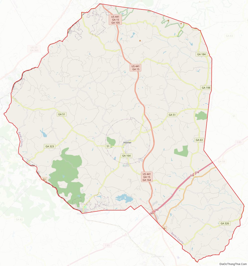
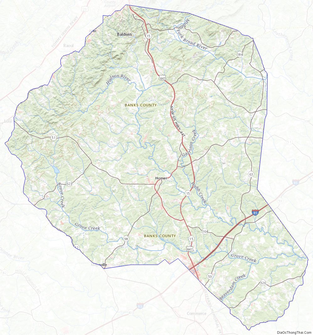
Banks County Road Map
Geography
According to the U.S. Census Bureau, the county has a total area of 234 square miles (610 km), of which 232 square miles (600 km) is land and 1.8 square miles (4.7 km) (0.8%) is water. Banks County is entirely located in the Broad River sub-basin of the Savannah River basin.
Major highways
- Interstate 85
- U.S. Route 441
- State Route 15
- State Route 51
- State Route 52
- State Route 59
- State Route 63
- State Route 98
- State Route 105
- State Route 164
- State Route 184
- State Route 198
- State Route 323
- State Route 326
- State Route 403 (hidden designation for I-85)
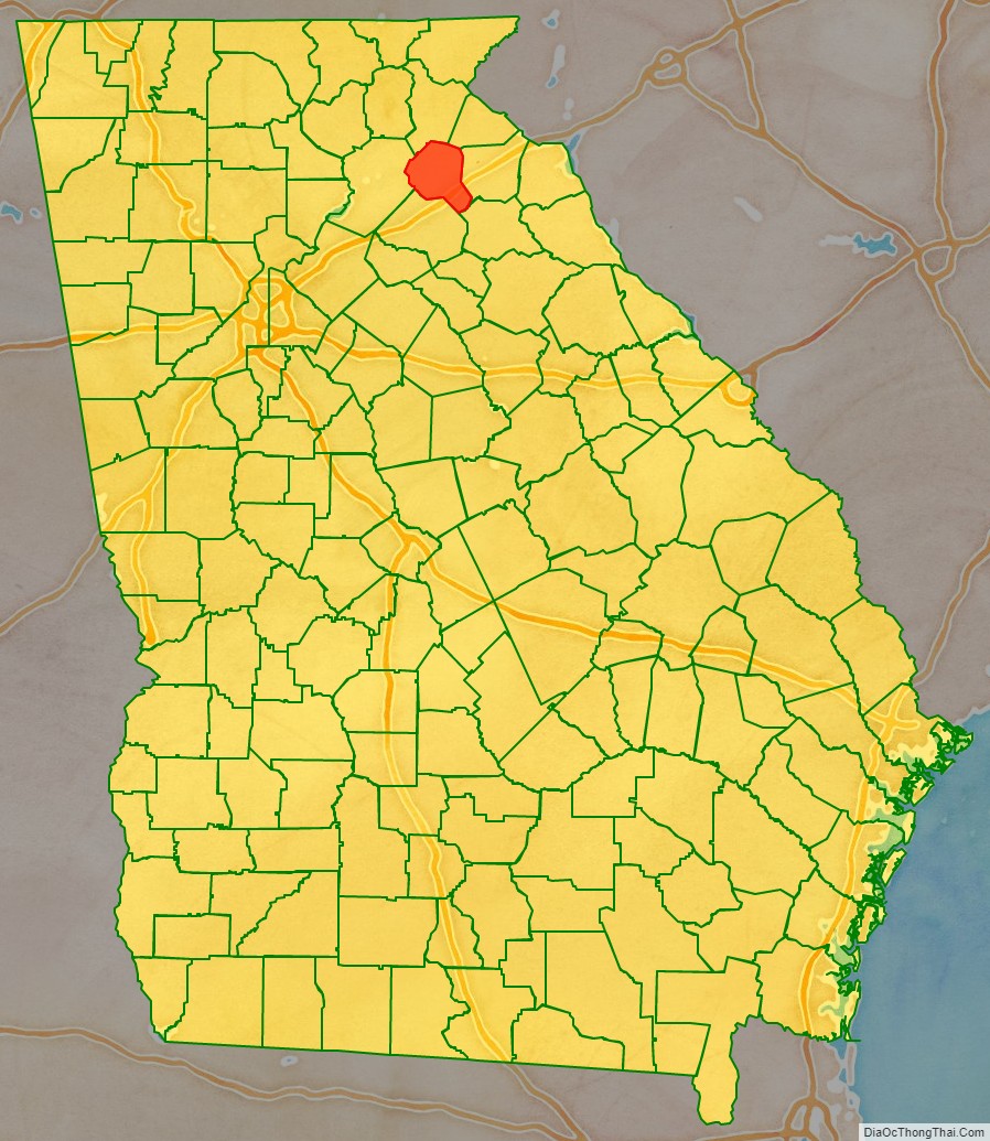
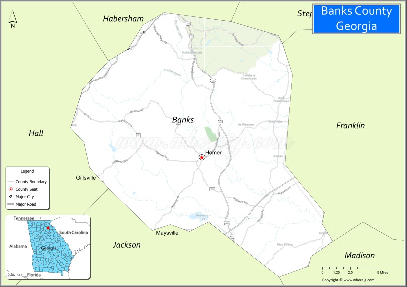
Adjacent counties
- Habersham County – north
- Stephens County – northeast
- Madison County – southeast
- Jackson County – south
- Hall County – west
- Franklin County – east
National protected area
- Chattahoochee National Forest (part)
Banks County Topographic Map
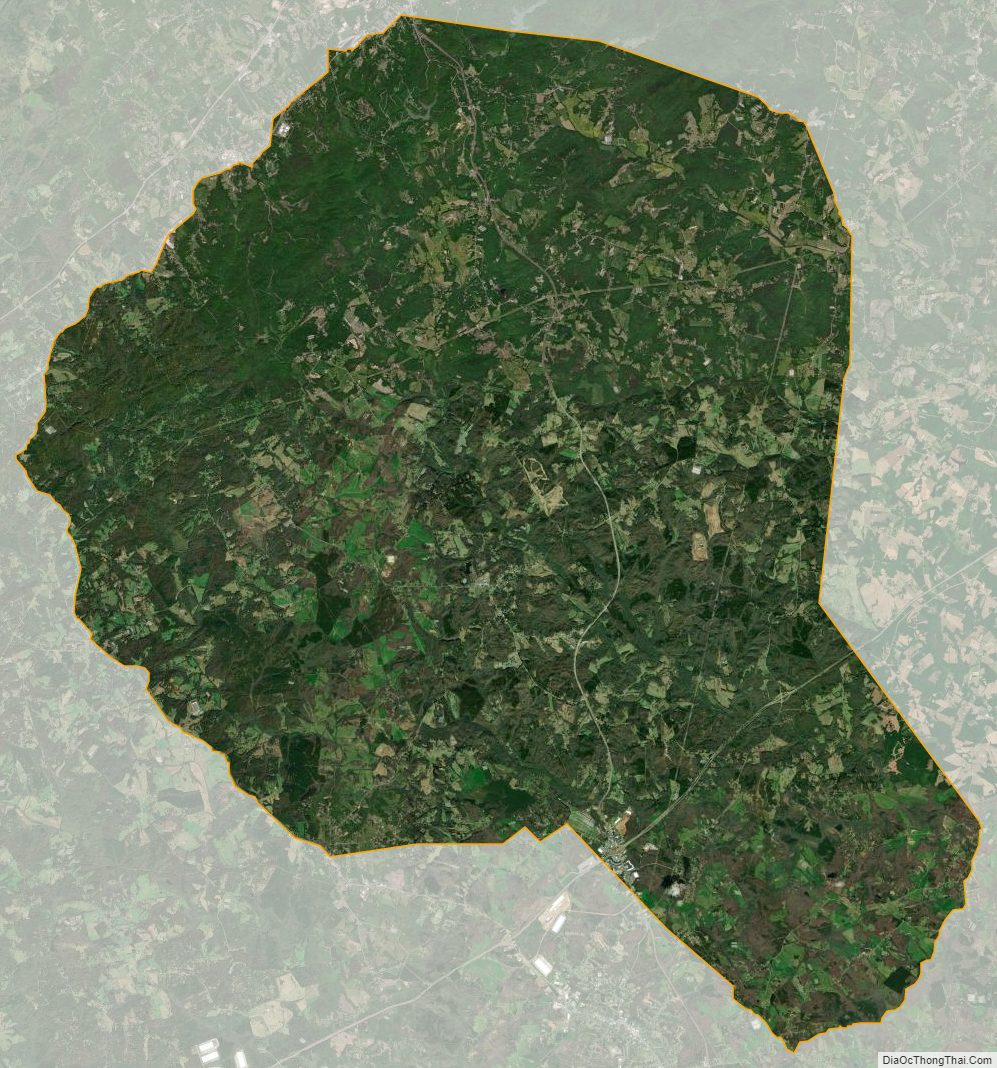
Banks County Satellite Map
Banks County Outline Map

See also
Map of Georgia State and its subdivision:- Appling
- Atkinson
- Bacon
- Baker
- Baldwin
- Banks
- Barrow
- Bartow
- Ben Hill
- Berrien
- Bibb
- Bleckley
- Brantley
- Brooks
- Bryan
- Bulloch
- Burke
- Butts
- Calhoun
- Camden
- Candler
- Carroll
- Catoosa
- Charlton
- Chatham
- Chattahoochee
- Chattooga
- Cherokee
- Clarke
- Clay
- Clayton
- Clinch
- Cobb
- Coffee
- Colquitt
- Columbia
- Cook
- Coweta
- Crawford
- Crisp
- Dade
- Dawson
- Decatur
- DeKalb
- Dodge
- Dooly
- Dougherty
- Douglas
- Early
- Echols
- Effingham
- Elbert
- Emanuel
- Evans
- Fannin
- Fayette
- Floyd
- Forsyth
- Franklin
- Fulton
- Gilmer
- Glascock
- Glynn
- Gordon
- Grady
- Greene
- Gwinnett
- Habersham
- Hall
- Hancock
- Haralson
- Harris
- Hart
- Heard
- Henry
- Houston
- Irwin
- Jackson
- Jasper
- Jeff Davis
- Jefferson
- Jenkins
- Johnson
- Jones
- Lamar
- Lanier
- Laurens
- Lee
- Liberty
- Lincoln
- Long
- Lowndes
- Lumpkin
- Macon
- Madison
- Marion
- McDuffie
- McIntosh
- Meriwether
- Miller
- Mitchell
- Monroe
- Montgomery
- Morgan
- Murray
- Muscogee
- Newton
- Oconee
- Oglethorpe
- Paulding
- Peach
- Pickens
- Pierce
- Pike
- Polk
- Pulaski
- Putnam
- Quitman
- Rabun
- Randolph
- Richmond
- Rockdale
- Schley
- Screven
- Seminole
- Spalding
- Stephens
- Stewart
- Sumter
- Talbot
- Taliaferro
- Tattnall
- Taylor
- Telfair
- Terrell
- Thomas
- Tift
- Toombs
- Towns
- Treutlen
- Troup
- Turner
- Twiggs
- Union
- Upson
- Walker
- Walton
- Ware
- Warren
- Washington
- Wayne
- Webster
- Wheeler
- White
- Whitfield
- Wilcox
- Wilkes
- Wilkinson
- Worth
- Alabama
- Alaska
- Arizona
- Arkansas
- California
- Colorado
- Connecticut
- Delaware
- District of Columbia
- Florida
- Georgia
- Hawaii
- Idaho
- Illinois
- Indiana
- Iowa
- Kansas
- Kentucky
- Louisiana
- Maine
- Maryland
- Massachusetts
- Michigan
- Minnesota
- Mississippi
- Missouri
- Montana
- Nebraska
- Nevada
- New Hampshire
- New Jersey
- New Mexico
- New York
- North Carolina
- North Dakota
- Ohio
- Oklahoma
- Oregon
- Pennsylvania
- Rhode Island
- South Carolina
- South Dakota
- Tennessee
- Texas
- Utah
- Vermont
- Virginia
- Washington
- West Virginia
- Wisconsin
- Wyoming