Barnwell County is a county in the U.S. state of South Carolina. As of the 2020 census, its population was 20,589. Barnwell County is part of the Augusta-Richmond County, GA-SC Metropolitan Statistical Area. It is located in the Central Savannah River Area. Its county seat is Barnwell.
| Name: | Barnwell County |
|---|---|
| FIPS code: | 45-011 |
| State: | South Carolina |
| Founded: | 1800 |
| Named for: | John Barnwell |
| Seat: | Barnwell |
| Largest city: | Barnwell |
| Total Area: | 557 sq mi (1,440 km²) |
| Land Area: | 548 sq mi (1,420 km²) |
| Total Population: | 20,580 |
| Population Density: | 37.6/sq mi (14.5/km²) |
| Time zone: | UTC−5 (Eastern) |
| Summer Time Zone (DST): | UTC−4 (EDT) |
| Website: | sc-barnwell.civicplus.com |
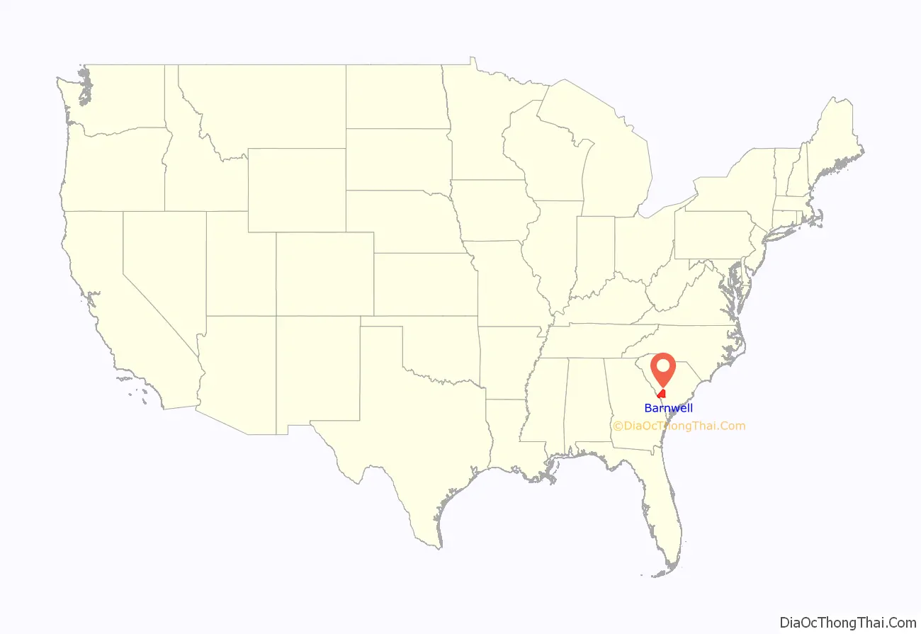
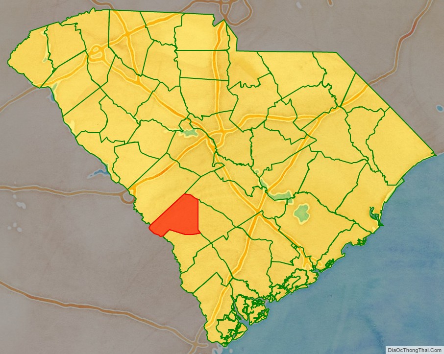
Barnwell County location map. Where is Barnwell County?
History
The Barnwell District was created in 1797 (effective in 1800) from the southwestern portion of the Orangeburg District, along the Savannah River. It was named after John Barnwell, a local figure in the Revolutionary War.
In 1868, under the South Carolina Constitution revised during Reconstruction, South Carolina districts became counties. The government was made more democratic, with county officials to be elected by male citizens at least 21 years old, rather than by the state legislature as done previously.
In 1871 the legislature took the northwestern portion of the county to form part of the new Aiken County, the only county organized during the Reconstruction era. In 1874 the border with Aiken County was adjusted slightly. This county and Barnwell, with populations of blacks and whites that were nearly equal, had extensive violence in the months before the 1874 and 1876 elections, as groups of paramilitary Red Shirts rode to disrupt black Republican meetings and intimidate voters to suppress black voting. More than 100 black men were killed in Aiken County during the violence, especially at Ellenton, South Carolina.
In 1895 white Democrats in the state legislature passed a new constitution, disfranchising most blacks for more than 60 years by raising barriers to voter registration.
In 1897 the eastern third of the county was taken to form the new Bamberg County. In 1919 most of the southern half of the county was taken to form most of the new Allendale County, thus reducing Barnwell county to its present size.
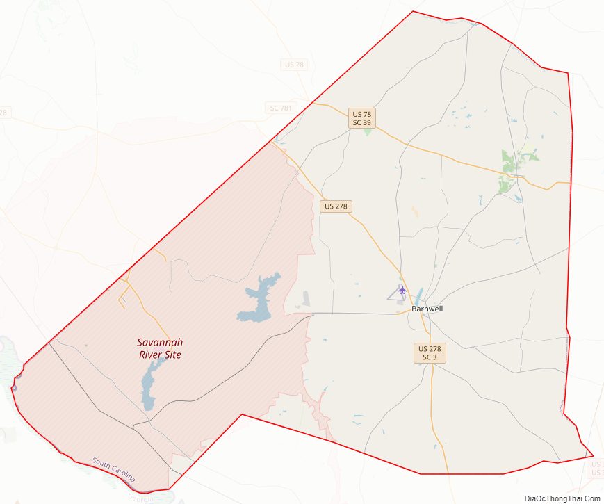
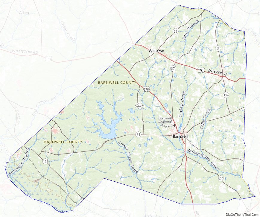
Barnwell County Road Map
Geography
According to the U.S. Census Bureau, the county has a total area of 557 square miles (1,440 km), of which 548 square miles (1,420 km) is land and 8.9 square miles (23 km) (1.6%) is water.
State and local protected areas/sites
- Banksia Hall
- Barnwell State Park
Major water bodies
- Georges Creek
- Parr Pond
- Pond B
- Salkehatchie River
- Savannah River
- South Fork Edisto River
Adjacent counties
- Aiken County – north
- Bamberg County – east
- Orangeburg County – east
- Allendale County – southeast
- Burke County, Georgia – southwest
Major highways
- US 78
- US 78 Bus.
- US 278
- SC 3
- SC 37
- SC 39
- SC 64
- SC 70
- SC 125
- SC 300
- SC 304
Major infrastructure
- Barnwell Regional Airport
- Savannah River Site (part)
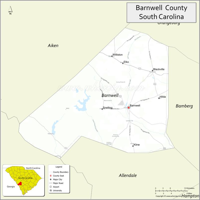
Barnwell County Topographic Map
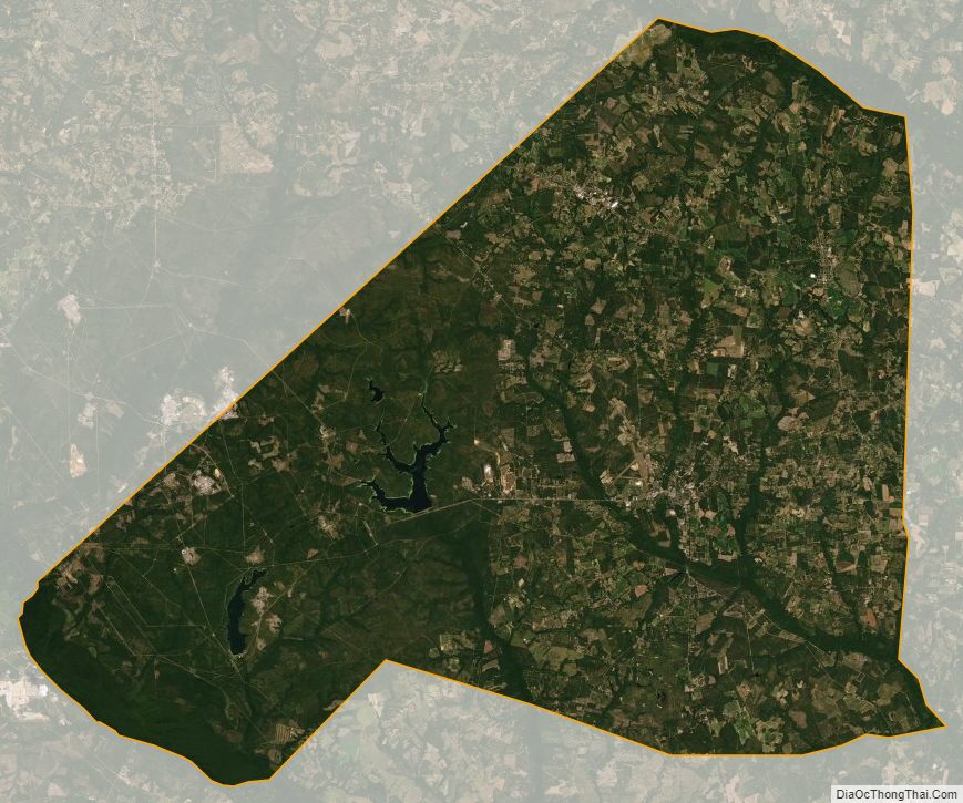
Barnwell County Satellite Map
Barnwell County Outline Map

See also
Map of South Carolina State and its subdivision:- Abbeville
- Aiken
- Allendale
- Anderson
- Bamberg
- Barnwell
- Beaufort
- Berkeley
- Calhoun
- Charleston
- Cherokee
- Chester
- Chesterfield
- Clarendon
- Colleton
- Darlington
- Dillon
- Dorchester
- Edgefield
- Fairfield
- Florence
- Georgetown
- Greenville
- Greenwood
- Hampton
- Horry
- Jasper
- Kershaw
- Lancaster
- Laurens
- Lee
- Lexington
- Marion
- Marlboro
- McCormick
- Newberry
- Oconee
- Orangeburg
- Pickens
- Richland
- Saluda
- Spartanburg
- Sumter
- Union
- Williamsburg
- York
- Alabama
- Alaska
- Arizona
- Arkansas
- California
- Colorado
- Connecticut
- Delaware
- District of Columbia
- Florida
- Georgia
- Hawaii
- Idaho
- Illinois
- Indiana
- Iowa
- Kansas
- Kentucky
- Louisiana
- Maine
- Maryland
- Massachusetts
- Michigan
- Minnesota
- Mississippi
- Missouri
- Montana
- Nebraska
- Nevada
- New Hampshire
- New Jersey
- New Mexico
- New York
- North Carolina
- North Dakota
- Ohio
- Oklahoma
- Oregon
- Pennsylvania
- Rhode Island
- South Carolina
- South Dakota
- Tennessee
- Texas
- Utah
- Vermont
- Virginia
- Washington
- West Virginia
- Wisconsin
- Wyoming