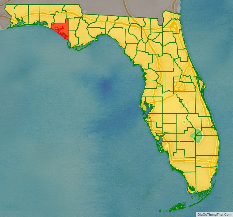
Bay County is a county on the Emerald Coast in Northwest Florida. As of the 2020 census, the population was 175,216. Its county seat is Panama City.
Bay County is included in the Panama City, Florida Metropolitan Statistical Area.
| Name: | Bay County |
|---|---|
| FIPS code: | 12-005 |
| State: | Florida |
| Founded: | April 24, 1913 |
| Named for: | St. Andrews Bay |
| Seat: | Panama City |
| Largest city: | Panama City |
| Total Area: | 1,033 sq mi (2,680 km²) |
| Land Area: | 758 sq mi (1,960 km²) |
| Total Population: | 175,216 |
| Population Density: | 231/sq mi (89/km²) |
| Time zone: | UTC−6 (Central) |
| Summer Time Zone (DST): | UTC−5 (CDT) |
| Website: | www.co.bay.fl.us |
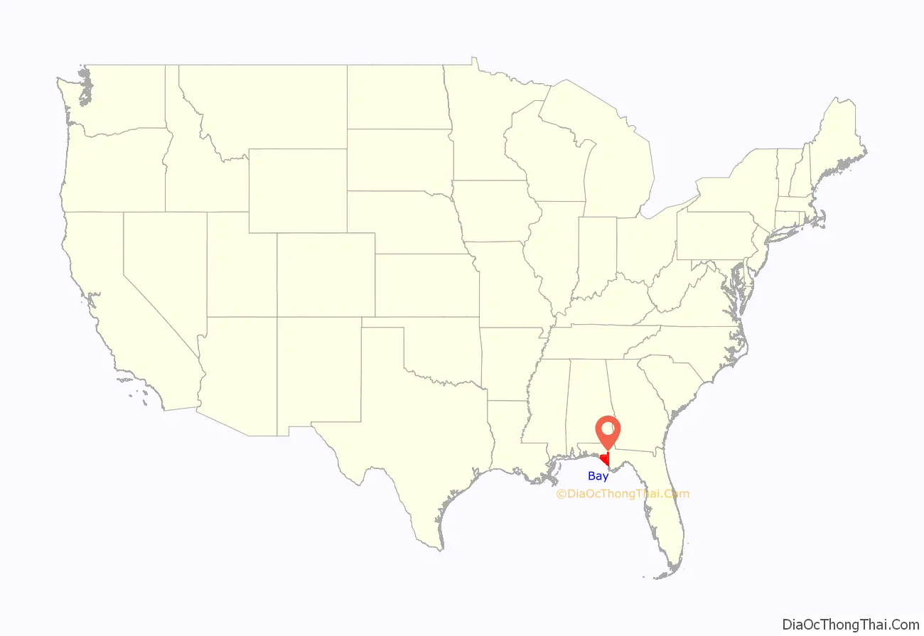
Bay County location map. Where is Bay County?
History
On February 12, 1913, representatives from five towns on St. Andrews Bay met in Panama City to select a name for a proposed new county. The name Bay was selected because it was satisfactory to the majority of the citizens and descriptive of the territory that would be included. On July 1, 1913, the Legislature created Bay County from portions of Washington, Calhoun and Walton counties.
Panama City was where Gideon v. Wainwright, a 1963 US Supreme Court decision that gave all persons accused of a crime the right to an attorney paid for by the government, originated.
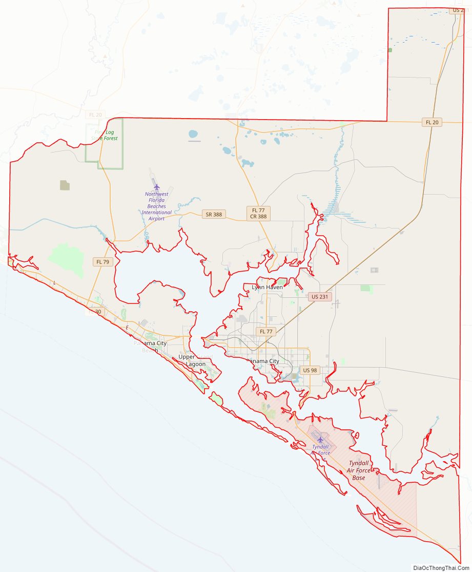
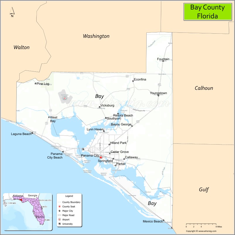
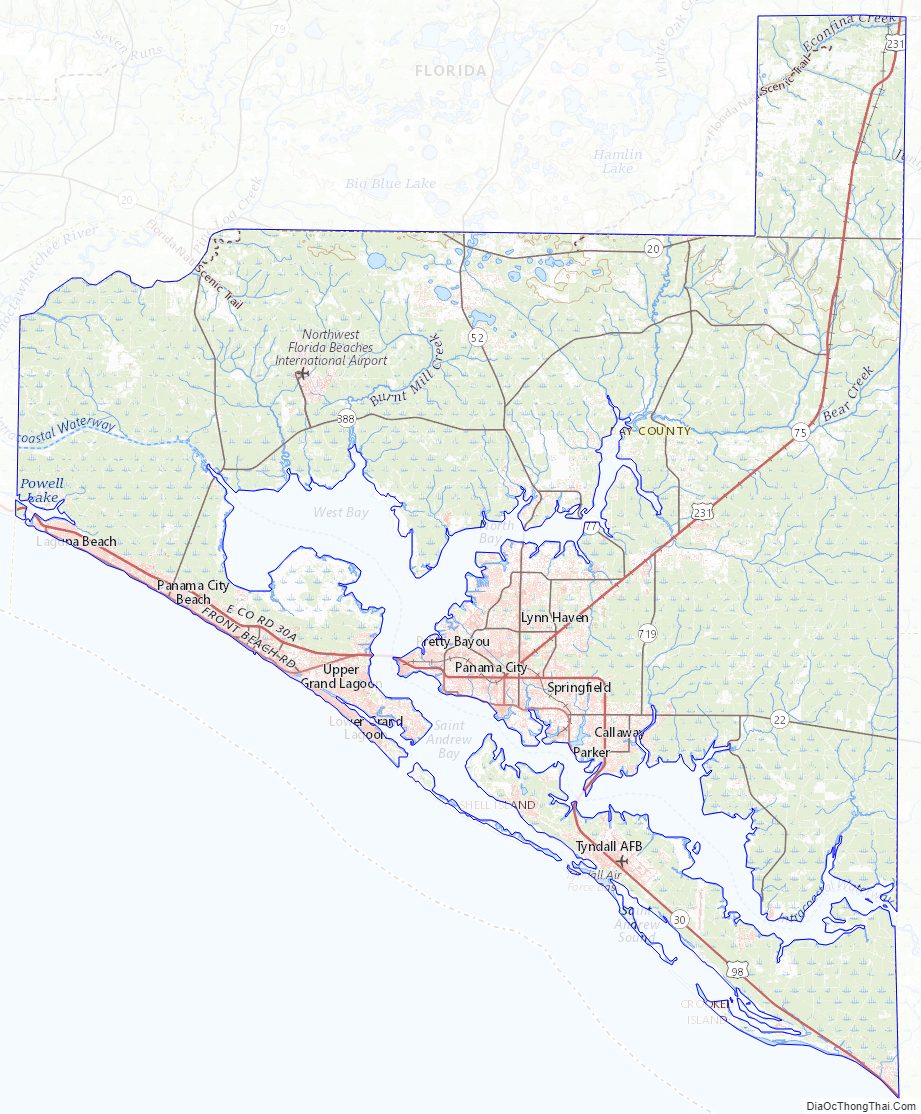
Bay County Road Map
Geography
According to the U.S. Census Bureau, the county has a total area of 1,467 square miles (3,800 km), of which 759 square miles (1,970 km) is land and 708 square miles (1,830 km) is water.
Adjacent counties
- Washington County – north
- Jackson County – northeast
- Calhoun County – east
- Gulf County – southeast
- Walton County – west
National protected area
- Apalachicola National Forest (part)
Bay County Topographic Map
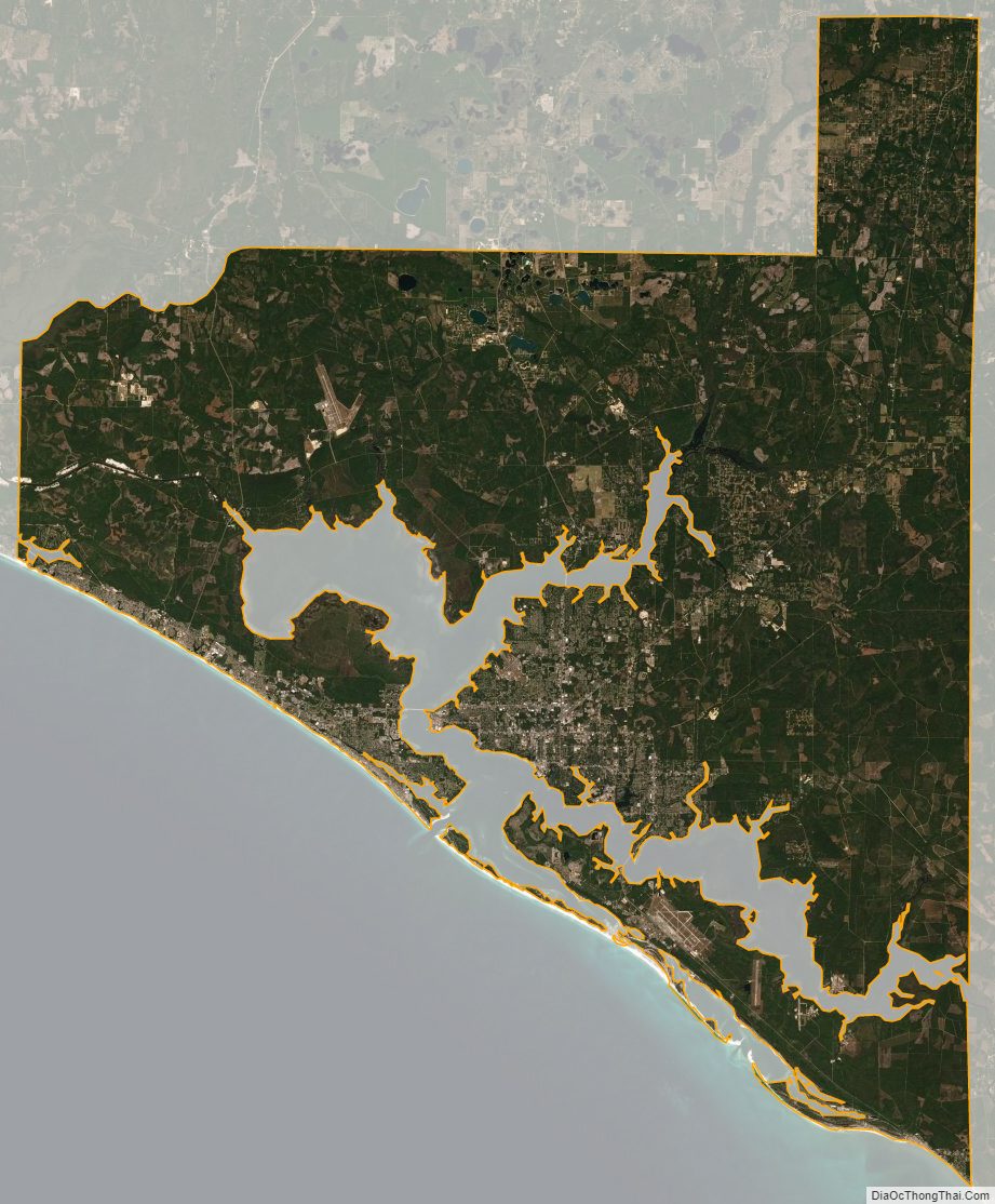
Bay County Satellite Map
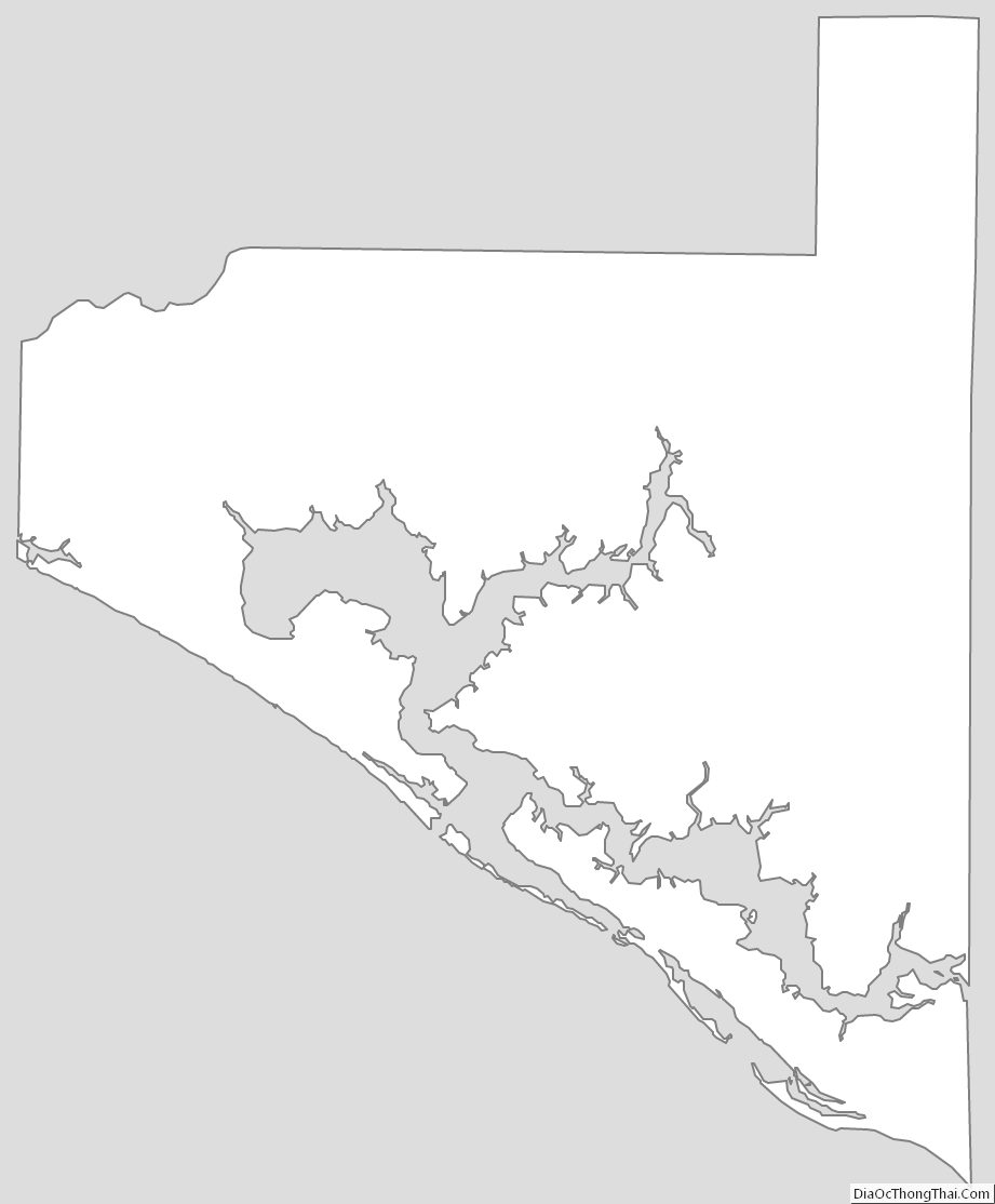
Bay County Outline Map
See also
Map of Florida State and its subdivision:- Alachua
- Baker
- Bay
- Bradford
- Brevard
- Broward
- Calhoun
- Charlotte
- Citrus
- Clay
- Collier
- Columbia
- Desoto
- Dixie
- Duval
- Escambia
- Flagler
- Franklin
- Gadsden
- Gilchrist
- Glades
- Gulf
- Hamilton
- Hardee
- Hendry
- Hernando
- Highlands
- Hillsborough
- Holmes
- Indian River
- Jackson
- Jefferson
- Lafayette
- Lake
- Lee
- Leon
- Levy
- Liberty
- Madison
- Manatee
- Marion
- Martin
- Miami-Dade
- Monroe
- Nassau
- Okaloosa
- Okeechobee
- Orange
- Osceola
- Palm Beach
- Pasco
- Pinellas
- Polk
- Putnam
- Saint Johns
- Saint Lucie
- Santa Rosa
- Sarasota
- Seminole
- Sumter
- Suwannee
- Taylor
- Union
- Volusia
- Wakulla
- Walton
- Washington
- Alabama
- Alaska
- Arizona
- Arkansas
- California
- Colorado
- Connecticut
- Delaware
- District of Columbia
- Florida
- Georgia
- Hawaii
- Idaho
- Illinois
- Indiana
- Iowa
- Kansas
- Kentucky
- Louisiana
- Maine
- Maryland
- Massachusetts
- Michigan
- Minnesota
- Mississippi
- Missouri
- Montana
- Nebraska
- Nevada
- New Hampshire
- New Jersey
- New Mexico
- New York
- North Carolina
- North Dakota
- Ohio
- Oklahoma
- Oregon
- Pennsylvania
- Rhode Island
- South Carolina
- South Dakota
- Tennessee
- Texas
- Utah
- Vermont
- Virginia
- Washington
- West Virginia
- Wisconsin
- Wyoming