Beaver County is a county located in the U.S. state of Oklahoma. As of the 2010 census, the population was 5,636. The county seat is Beaver. The name was given because of the presence of many beaver dams on the Beaver River, which runs through the area. It is located in the Oklahoma Panhandle.
| Name: | Beaver County |
|---|---|
| FIPS code: | 40-007 |
| State: | Oklahoma |
| Founded: | 1890 |
| Seat: | Beaver |
| Largest town: | Beaver |
| Total Area: | 1,818 sq mi (4,710 km²) |
| Land Area: | 1,815 sq mi (4,700 km²) |
| Total Population: | 5,049 |
| Population Density: | 3.1/sq mi (1.2/km²) |
| Time zone: | UTC−6 (Central) |
| Summer Time Zone (DST): | UTC−5 (CDT) |
| Website: | beaver.okcounties.org |
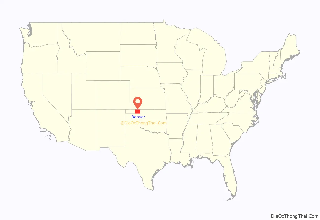
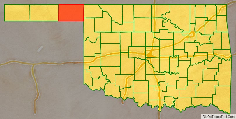
Beaver County location map. Where is Beaver County?
History
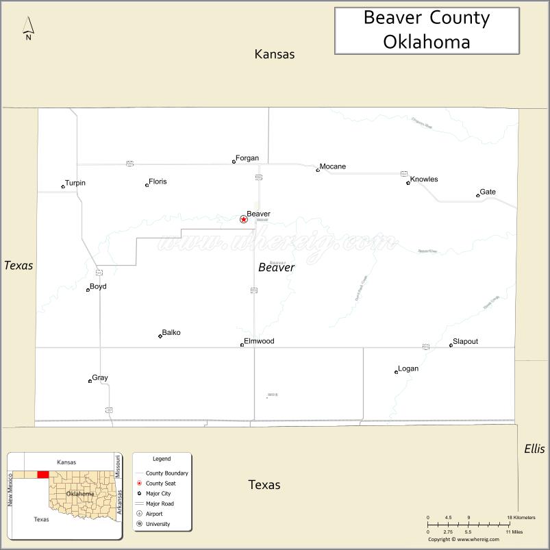
The land where Beaver County is located has been under several jurisdictions. At one time, it was part of Mexico and then Texas before Texas became a state of the United States. Then in the Compromise of 1850, Texas ceded the land that would eventually become the Oklahoma panhandle to the United States government. The area was known as “No Man’s Land” because it belonged to no state or territorial government. From 1886 to 1890, it was a separate organized territory known as Cimarron Territory. After becoming part of the Oklahoma Territory in 1890, Beaver County (first called Seventh County) covered the entire Oklahoma Panhandle. At statehood in 1907, Cimarron County was taken from the western one-third, while Texas County was taken from the middle, leaving Beaver County only in the east. Its borders are now at 100°W (east), 37°N (north), 36.5°N (south), and approximately 100.8°W (west).
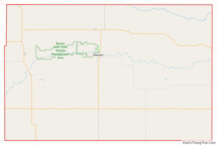
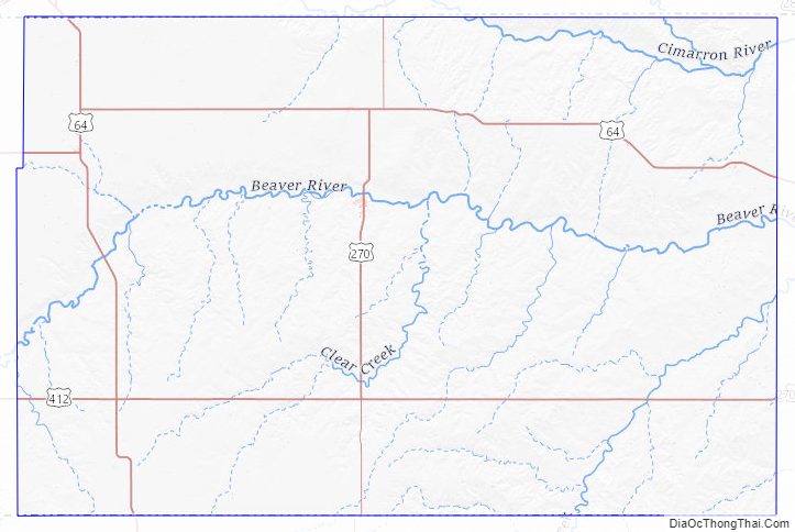
Beaver County Road Map
Geography
According to the U.S. Census Bureau, the county has a total area of 1,818 square miles (4,710 km), of which 1,815 square miles (4,700 km) is land and 2.8 square miles (7.3 km) (0.2%) is water. It is the fifth-largest county in Oklahoma by area.
Just north of the town of Beaver is the Beaver Dunes State Park.
Major highways
- U.S. Highway 64
- U.S. Highway 83
- U.S. Highway 270
- U.S. Highway 412
- State Highway 3
- State Highway 23
Adjacent counties
- Meade County, Kansas (north)
- Clark County, Kansas (northeast)
- Harper County (east)
- Ellis County (southeast)
- Lipscomb County, Texas (south)
- Ochiltree County, Texas (southwest)
- Texas County (west)
- Seward County, Kansas (northwest)
Beaver County Topographic Map
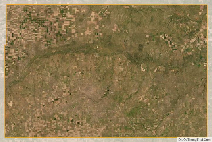
Beaver County Satellite Map
Beaver County Outline Map

See also
Map of Oklahoma State and its subdivision:- Adair
- Alfalfa
- Atoka
- Beaver
- Beckham
- Blaine
- Bryan
- Caddo
- Canadian
- Carter
- Cherokee
- Choctaw
- Cimarron
- Cleveland
- Coal
- Comanche
- Cotton
- Craig
- Creek
- Custer
- Delaware
- Dewey
- Ellis
- Garfield
- Garvin
- Grady
- Grant
- Greer
- Harmon
- Harper
- Haskell
- Hughes
- Jackson
- Jefferson
- Johnston
- Kay
- Kingfisher
- Kiowa
- Latimer
- Le Flore
- Lincoln
- Logan
- Love
- Major
- Marshall
- Mayes
- McClain
- McCurtain
- McIntosh
- Murray
- Muskogee
- Noble
- Nowata
- Okfuskee
- Oklahoma
- Okmulgee
- Osage
- Ottawa
- Pawnee
- Payne
- Pittsburg
- Pontotoc
- Pottawatomie
- Pushmataha
- Roger Mills
- Rogers
- Seminole
- Sequoyah
- Stephens
- Texas
- Tillman
- Tulsa
- Wagoner
- Washington
- Washita
- Woods
- Woodward
- Alabama
- Alaska
- Arizona
- Arkansas
- California
- Colorado
- Connecticut
- Delaware
- District of Columbia
- Florida
- Georgia
- Hawaii
- Idaho
- Illinois
- Indiana
- Iowa
- Kansas
- Kentucky
- Louisiana
- Maine
- Maryland
- Massachusetts
- Michigan
- Minnesota
- Mississippi
- Missouri
- Montana
- Nebraska
- Nevada
- New Hampshire
- New Jersey
- New Mexico
- New York
- North Carolina
- North Dakota
- Ohio
- Oklahoma
- Oregon
- Pennsylvania
- Rhode Island
- South Carolina
- South Dakota
- Tennessee
- Texas
- Utah
- Vermont
- Virginia
- Washington
- West Virginia
- Wisconsin
- Wyoming