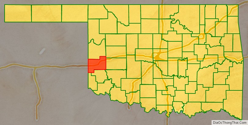
Beckham County is a county located on the western border of the U.S. state of Oklahoma. As of the 2010 census, the population was 22,119. Its county seat is Sayre. Founded upon statehood in 1907, Beckham County was named for J. C. W. Beckham, who was Governor of Kentucky and the first popularly elected member of the United States Senate from Kentucky. Beckham County comprises the Elk City, OK Micropolitan Statistical Area.
| Name: | Beckham County |
|---|---|
| FIPS code: | 40-009 |
| State: | Oklahoma |
| Founded: | November 16, 1907 |
| Named for: | J. C. W. Beckham |
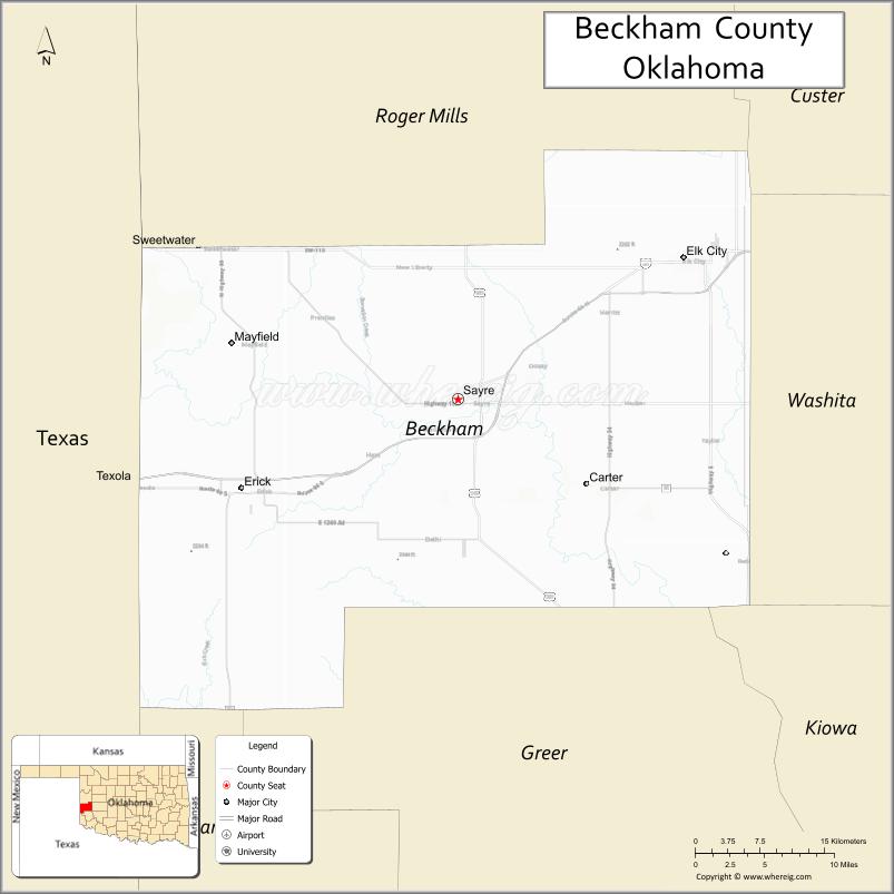
| Seat: | Sayre |
| Largest city: | Elk City |
| Total Area: | 904 sq mi (2,340 km²) |
| Land Area: | 902 sq mi (2,340 km²) |
| Total Population: | 22,119 |
| Population Density: | 25/sq mi (10/km²) |
| Time zone: | UTC−6 (Central) |
| Summer Time Zone (DST): | UTC−5 (CDT) |
| Website: | beckham.okcounties.org |
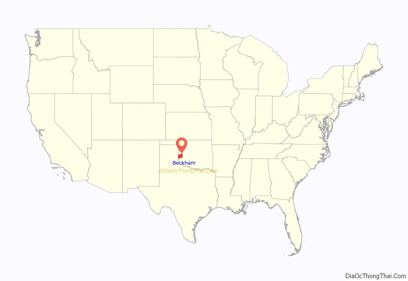
Beckham County location map. Where is Beckham County?
History
In 1855, the U.S. government leased the western part of the formerly reserved Choctaw and Chickasaw Nation lands, which became known as the Leased District. After the Civil War, the two nations were forced to cede the land to the US government under terms of new treaties required because they had been allies of the Confederacy. Under the treaties they were also required to emancipate their slaves and provide them with citizenship in their nations.
In 1869, the former Leased District was designated by the President as the Cheyenne and Arapaho Indian Reservation, following their removal from further west. During the 1880s, Texas cattlemen leased grazing land from the Cheyenne and Arapaho.
Under the Dawes Act of 1891, the government split up such communal lands, allocating plots to individual households of various tribes. After distribution was made, the government declared any additional lands on the reservation to be “surplus”. In 1892, the government opened such surplus land to settlement by non-Indians, attracting numerous European-American settlers and immigrants.
The area was designated as County F in the newly created Oklahoma Territory, until it was renamed Roger Mills County. At statehood, portions of land from both Roger Mills and Greer counties were joined to form Beckham County. Sayre was named as the temporary county seat. A 1908 election after statehood made Sayre, Oklahoma the permanent seat.
In 1910, a piece of southern Beckham County was returned to Greer County. The Gannett survey of 1927-1929 found that the true 100th Meridian, the boundary between Texas and western Oklahoma, was 3,800 feet (1,200 m) farther east than previously thought. The US Supreme Court ruled that the strip of land must be returned to Texas, thereby reducing Beckham County’s area slightly.
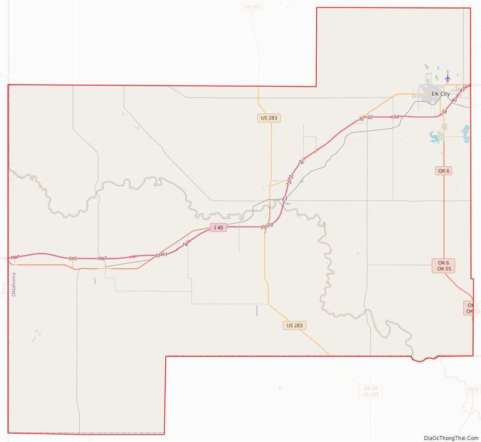
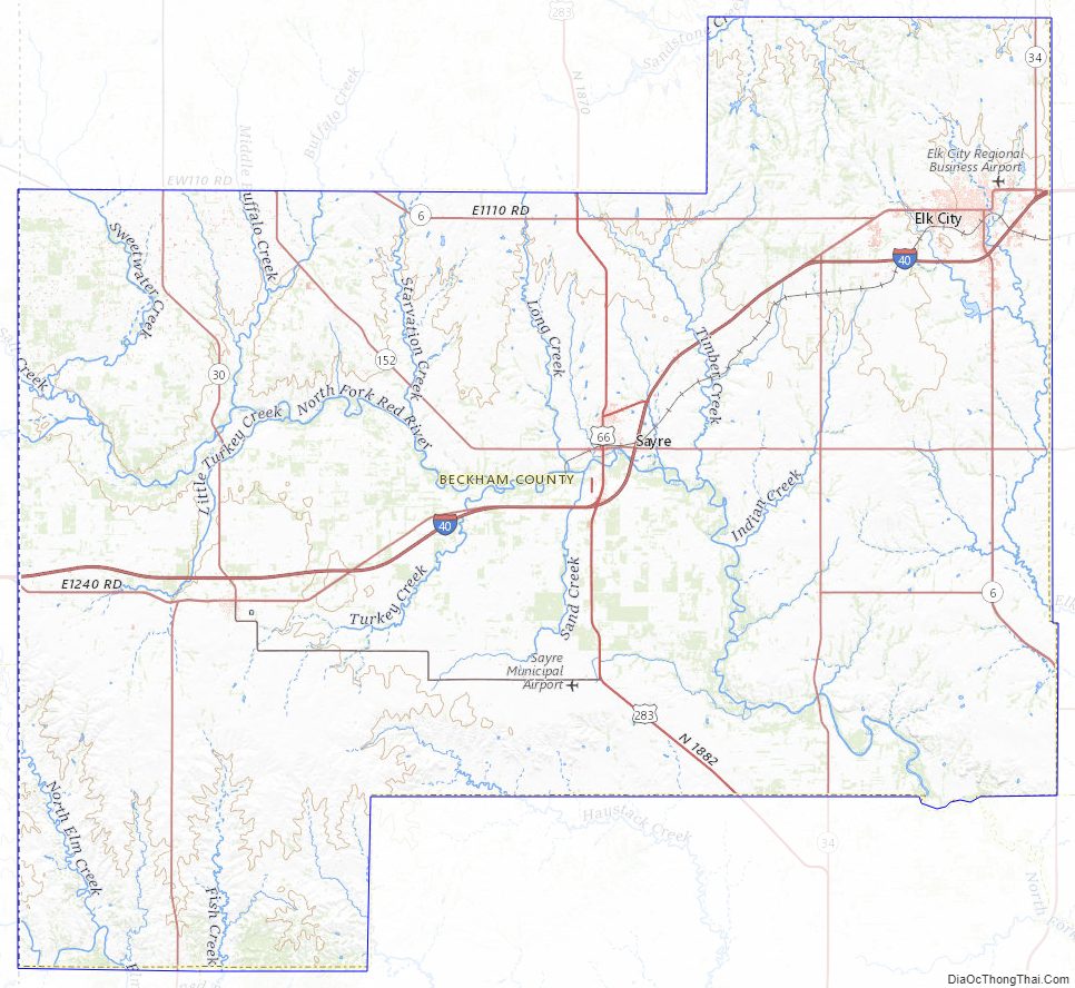
Beckham County Road Map
Geography
According to the U.S. Census Bureau, the county has a total area of 904 square miles (2,340 km), of which 902 square miles (2,340 km) is land and 2.1 square miles (5.4 km) (0.2%) is water. The county is drained by the North Fork of the Red River and its tributaries: the Timber, Sweetwater, and Buffalo creeks. The northwestern part of the county is part of the High Plains. The rest of the county is part of the Gypsum Hills physiographic region.
Major highways
- Interstate 40
- I-40 BL / US 66
- U.S. Highway 283
- State Highway 6
- State Highway 30
- State Highway 34
- State Highway 55
- State Highway 66
- State Highway 152
Adjacent counties
- Roger Mills County (north)
- Custer County (northeast)
- Washita County (east)
- Kiowa County (southeast)
- Greer County (south)
- Harmon County (southwest)
- Collingsworth County, Texas (west)
- Wheeler County, Texas (northwest)
Beckham County Topographic Map
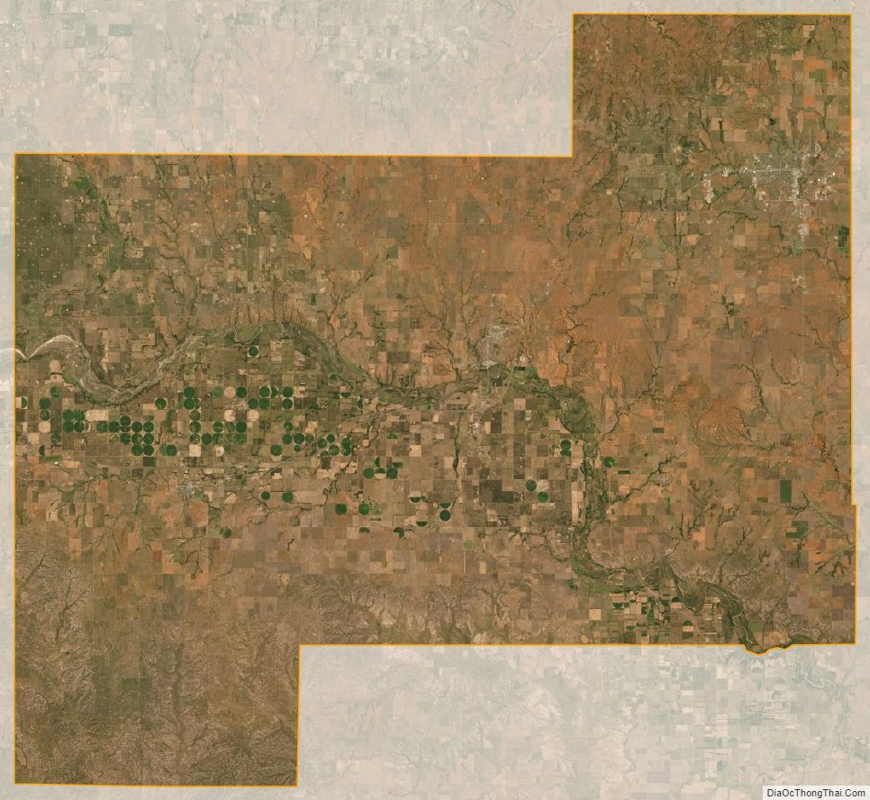
Beckham County Satellite Map
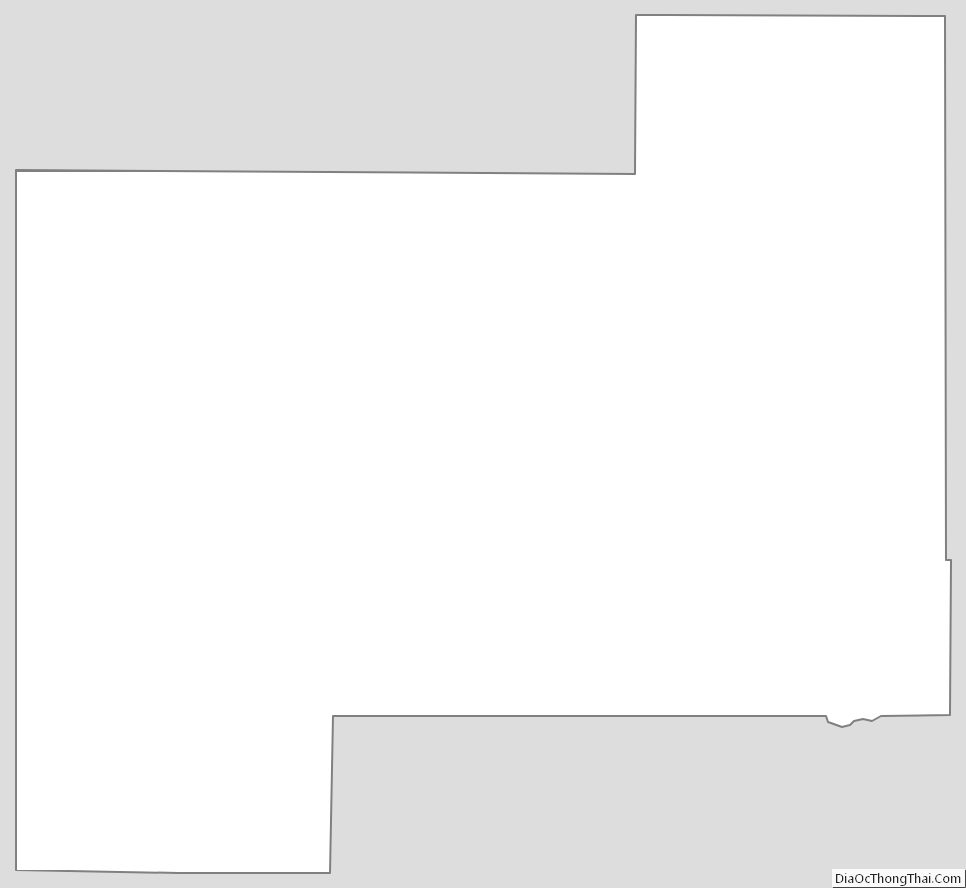
Beckham County Outline Map
See also
Map of Oklahoma State and its subdivision:- Adair
- Alfalfa
- Atoka
- Beaver
- Beckham
- Blaine
- Bryan
- Caddo
- Canadian
- Carter
- Cherokee
- Choctaw
- Cimarron
- Cleveland
- Coal
- Comanche
- Cotton
- Craig
- Creek
- Custer
- Delaware
- Dewey
- Ellis
- Garfield
- Garvin
- Grady
- Grant
- Greer
- Harmon
- Harper
- Haskell
- Hughes
- Jackson
- Jefferson
- Johnston
- Kay
- Kingfisher
- Kiowa
- Latimer
- Le Flore
- Lincoln
- Logan
- Love
- Major
- Marshall
- Mayes
- McClain
- McCurtain
- McIntosh
- Murray
- Muskogee
- Noble
- Nowata
- Okfuskee
- Oklahoma
- Okmulgee
- Osage
- Ottawa
- Pawnee
- Payne
- Pittsburg
- Pontotoc
- Pottawatomie
- Pushmataha
- Roger Mills
- Rogers
- Seminole
- Sequoyah
- Stephens
- Texas
- Tillman
- Tulsa
- Wagoner
- Washington
- Washita
- Woods
- Woodward
- Alabama
- Alaska
- Arizona
- Arkansas
- California
- Colorado
- Connecticut
- Delaware
- District of Columbia
- Florida
- Georgia
- Hawaii
- Idaho
- Illinois
- Indiana
- Iowa
- Kansas
- Kentucky
- Louisiana
- Maine
- Maryland
- Massachusetts
- Michigan
- Minnesota
- Mississippi
- Missouri
- Montana
- Nebraska
- Nevada
- New Hampshire
- New Jersey
- New Mexico
- New York
- North Carolina
- North Dakota
- Ohio
- Oklahoma
- Oregon
- Pennsylvania
- Rhode Island
- South Carolina
- South Dakota
- Tennessee
- Texas
- Utah
- Vermont
- Virginia
- Washington
- West Virginia
- Wisconsin
- Wyoming