Berks County (Pennsylvania German: Barricks Kaundi) is a county in the Commonwealth of Pennsylvania. As of the 2020 census, the population was 428,849. The county seat is Reading.
The Schuylkill River, a 135-mile-long (217 km) tributary of the Delaware River, flows through Berks County. The county is part of the Reading, PA metropolitan statistical area (MSA), which is included in the Delaware Valley or Greater Philadelphia metropolitan area or the Philadelphia-Reading-Camden, PA-NJ–DE–MD combined statistical area (CSA).
| Name: | Berks County |
|---|---|
| FIPS code: | 42-011 |
| State: | Pennsylvania |
| Founded: | March 11, 1752 |
| Named for: | Berkshire |
| Seat: | Reading |
| Largest city: | Reading |
| Total Area: | 866 sq mi (2,240 km²) |
| Land Area: | 857 sq mi (2,220 km²) |
| Total Population: | 428,849 |
| Population Density: | 495/sq mi (191/km²) |
| Time zone: | UTC−5 (Eastern) |
| Summer Time Zone (DST): | UTC−4 (EDT) |
| Website: | www.co.berks.pa.us |
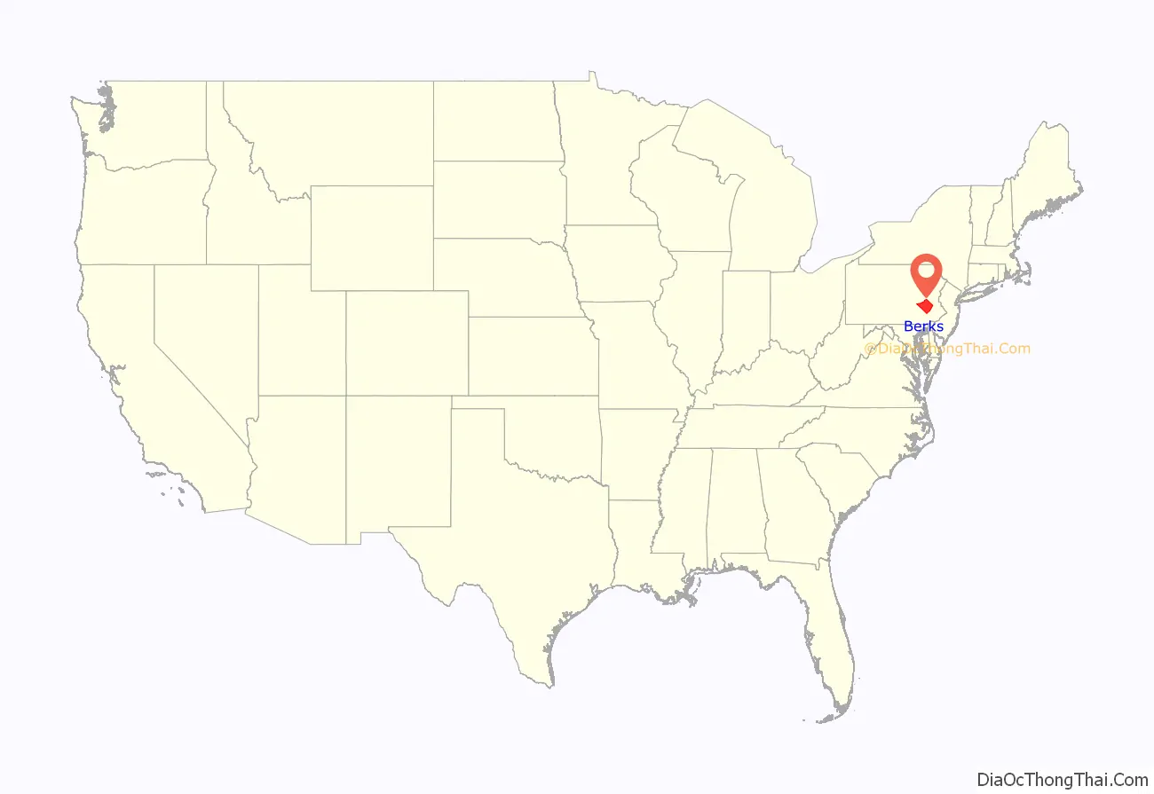
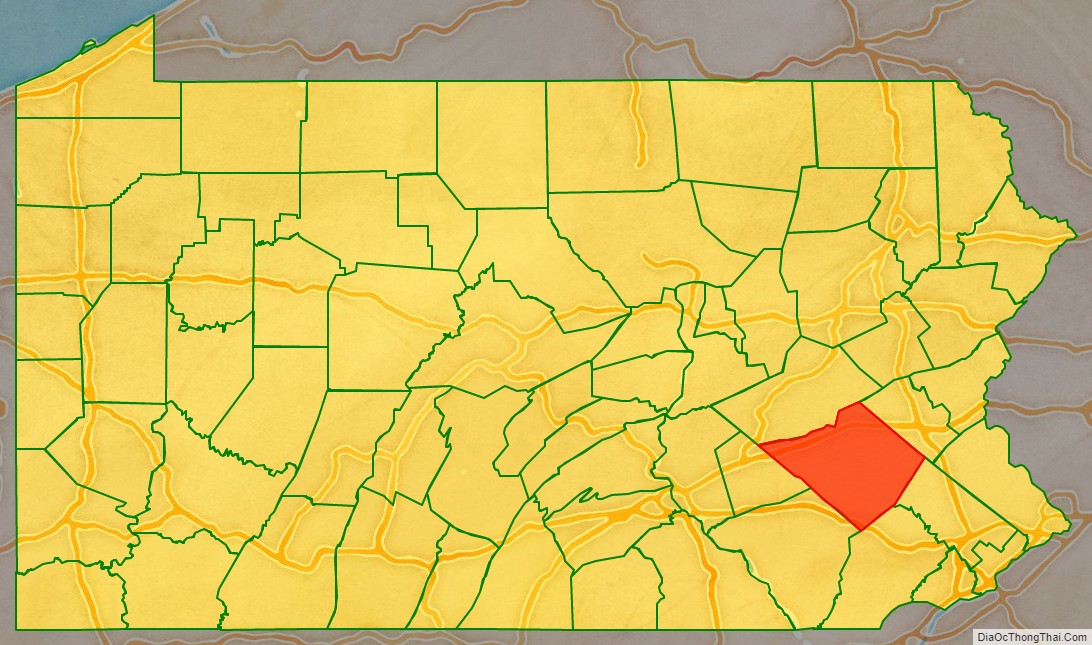
Berks County location map. Where is Berks County?
History
Reading developed during the 1740s when inhabitants of northern Lancaster County sent several petitions requesting that a separate county be established. With the help of German immigrant Conrad Weiser, the county was formed on March 11, 1752, from parts of Chester County, Lancaster County, and Philadelphia County.
It was named after the English county in which William Penn’s family home lay, Berkshire, which is often abbreviated to Berks. Berks County began much larger than it is today. The northwestern parts of the county went to the founding of Northumberland County in 1772 and Schuylkill County in 1811, when it reached its current size. In 2005, Berks County was added to the Delaware Valley Planning Area due to a fast-growing population and close proximity to the other communities.
In 2016, the borough of Strausstown merged with Upper Tulpehocken Township. Strausstown is now a village within Upper Tulpehocken Township.
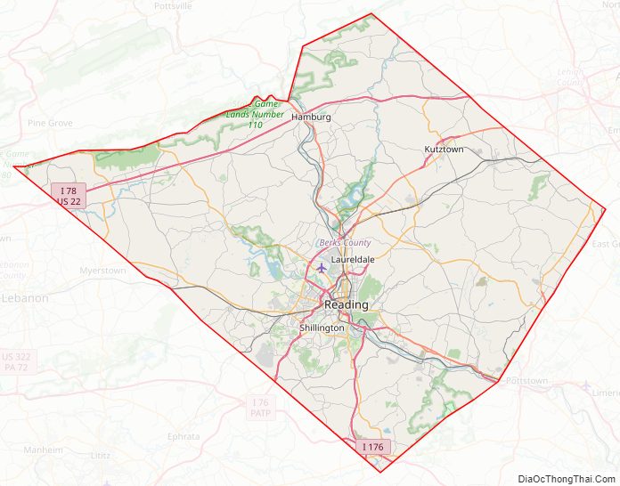
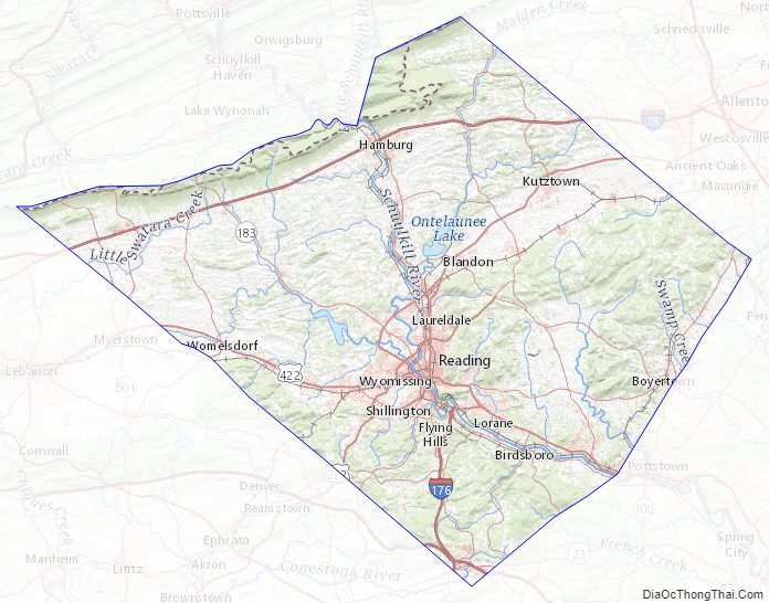
Berks County Road Map
Geography
According to the U.S. Census Bureau, the county has a total area of 866 square miles (2,240 km), of which 857 square miles (2,220 km) is land and 9.2 square miles (24 km) (1.1%) is water. Most of the county is drained by the Schuylkill River, but an area in the northeast is drained by the Lehigh River via the Little Lehigh Creek and areas are drained by the Susquehanna River via the Swatara Creek in the northwest and the Conestoga River, which starts in Berks County between Morgantown and Elverson in the county’s extreme south. It has a humid continental climate (Dfa except for some Dfb on Blue Mountain at the northern boundary and on Mount Penn) and the hardiness zone is mostly 6b, with 6a in some higher areas, and 7a along the Schuylkill in the southeastern part of the county.
Major roads and highways
- I-76 / Penna Turnpike
- I-176
- I-78 / US 22
- US 222
- US 222 Bus.
- US 422
- US 422 Bus.
- PA 10
- PA 12
- PA 23
- PA 29
- PA 61
- PA 73
- PA 100
- PA 143
- PA 183
- PA 272
- PA 345
- PA 401
- PA 419
- PA 501
- PA 562
- PA 568
- PA 625
- PA 645
- PA 662
- PA 724
- PA 737
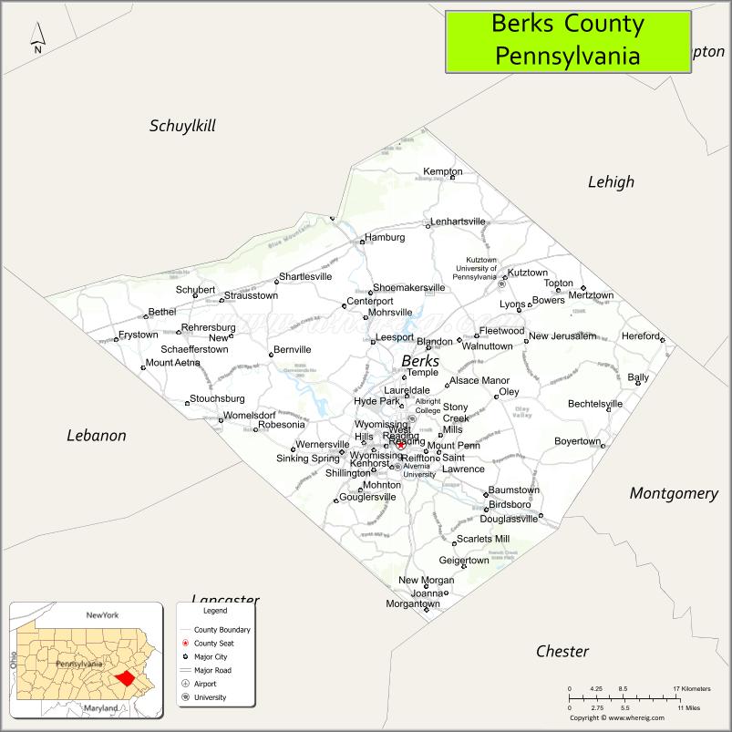
Adjacent counties
- Schuylkill County (north)
- Lehigh County (northeast)
- Montgomery County (east)
- Chester County (southeast)
- Lancaster County (southwest)
- Lebanon County (west)
National protected area
- Hopewell Furnace National Historic Site
State protected area
- French Creek State Park
Berks County Topographic Map
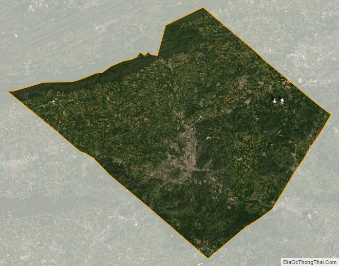
Berks County Satellite Map
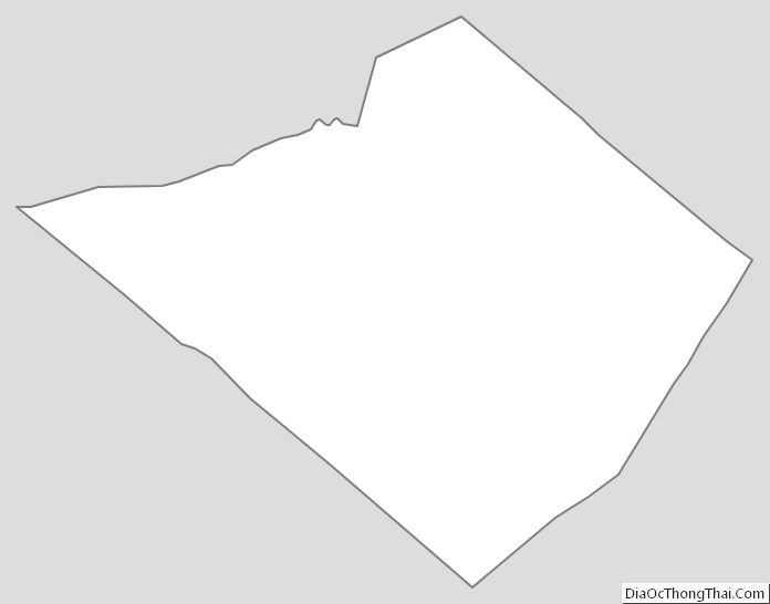
Berks County Outline Map
See also
Map of Pennsylvania State and its subdivision:- Adams
- Allegheny
- Armstrong
- Beaver
- Bedford
- Berks
- Blair
- Bradford
- Bucks
- Butler
- Cambria
- Cameron
- Carbon
- Centre
- Chester
- Clarion
- Clearfield
- Clinton
- Columbia
- Crawford
- Cumberland
- Dauphin
- Delaware
- Elk
- Erie
- Fayette
- Forest
- Franklin
- Fulton
- Greene
- Huntingdon
- Indiana
- Jefferson
- Juniata
- Lackawanna
- Lancaster
- Lawrence
- Lebanon
- Lehigh
- Luzerne
- Lycoming
- Mc Kean
- Mercer
- Mifflin
- Monroe
- Montgomery
- Montour
- Northampton
- Northumberland
- Perry
- Philadelphia
- Pike
- Potter
- Schuylkill
- Snyder
- Somerset
- Sullivan
- Susquehanna
- Tioga
- Union
- Venango
- Warren
- Washington
- Wayne
- Westmoreland
- Wyoming
- York
- Alabama
- Alaska
- Arizona
- Arkansas
- California
- Colorado
- Connecticut
- Delaware
- District of Columbia
- Florida
- Georgia
- Hawaii
- Idaho
- Illinois
- Indiana
- Iowa
- Kansas
- Kentucky
- Louisiana
- Maine
- Maryland
- Massachusetts
- Michigan
- Minnesota
- Mississippi
- Missouri
- Montana
- Nebraska
- Nevada
- New Hampshire
- New Jersey
- New Mexico
- New York
- North Carolina
- North Dakota
- Ohio
- Oklahoma
- Oregon
- Pennsylvania
- Rhode Island
- South Carolina
- South Dakota
- Tennessee
- Texas
- Utah
- Vermont
- Virginia
- Washington
- West Virginia
- Wisconsin
- Wyoming