Big Stone County is a county in the U.S. state of Minnesota. As of the 2020 census, the population was 5,166. Its county seat is Ortonville.
| Name: | Big Stone County |
|---|---|
| FIPS code: | 27-011 |
| State: | Minnesota |
| Founded: | 1862 |
| Named for: | Big Stone Lake |
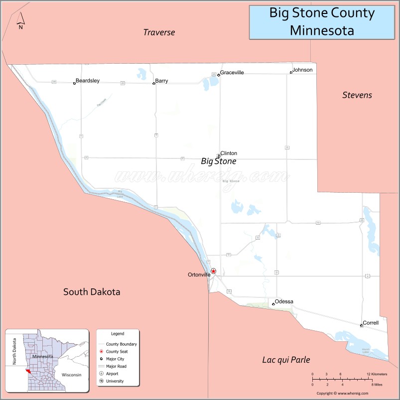
| Seat: | Ortonville |
| Largest city: | Ortonville |
| Total Area: | 528 sq mi (1,370 km²) |
| Land Area: | 499 sq mi (1,290 km²) |
| Total Population: | 5,166 |
| Population Density: | 10.1/sq mi (3.9/km²) |
| Time zone: | UTC−6 (Central) |
| Summer Time Zone (DST): | UTC−5 (CDT) |
| Website: | www.bigstonecounty.org |
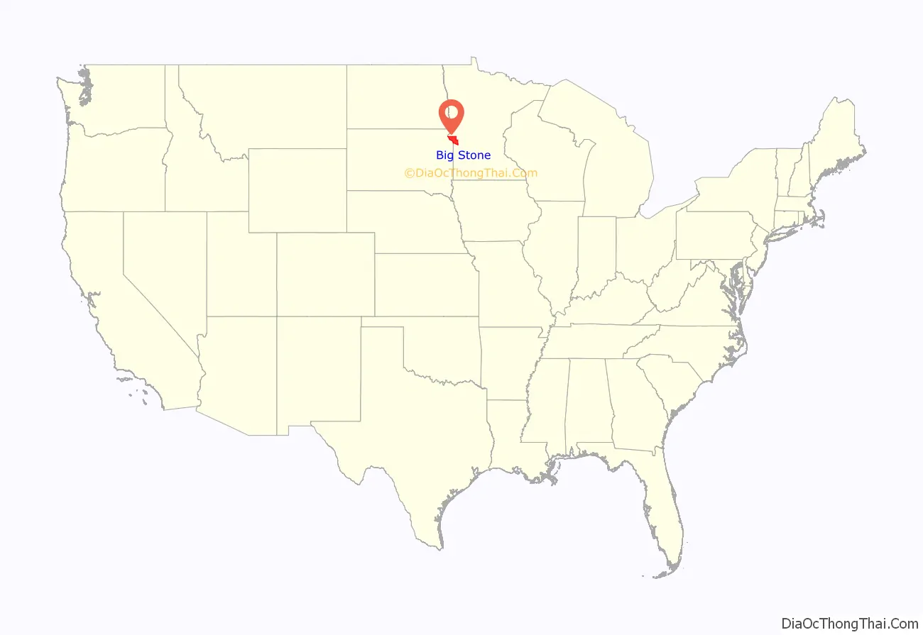
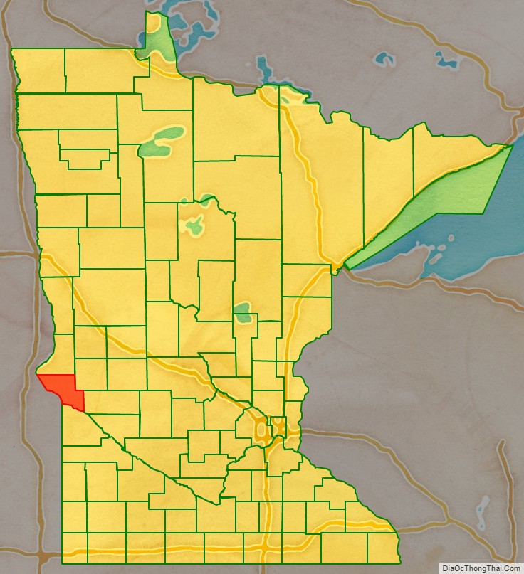
Big Stone County location map. Where is Big Stone County?
History
The county was formed in 1862, and was organized in 1874.
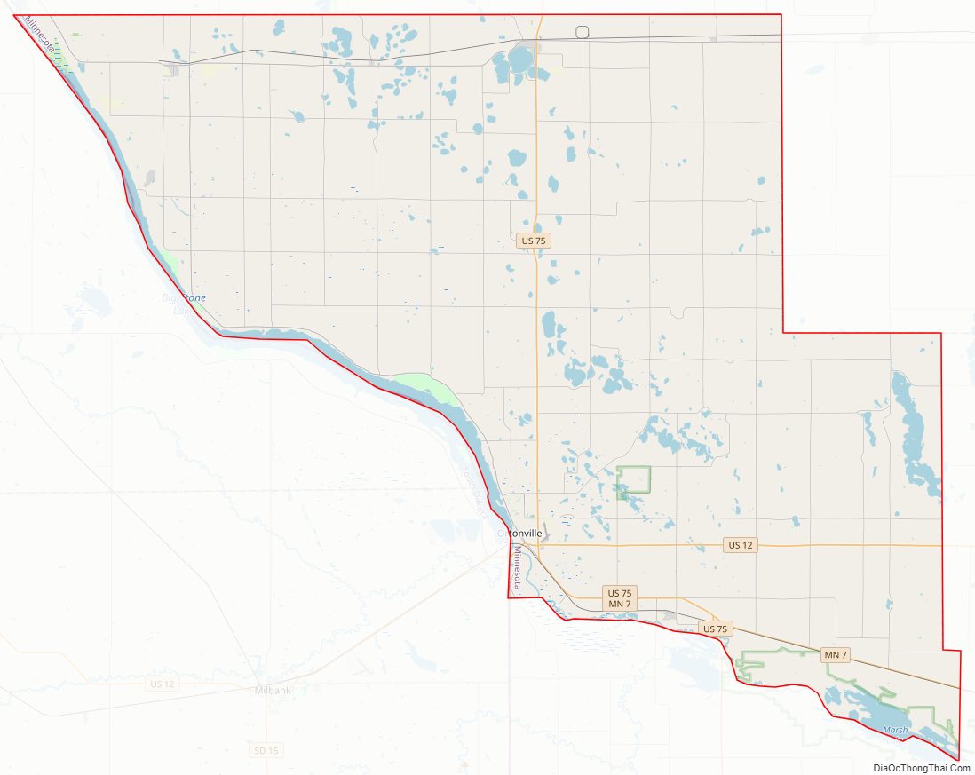
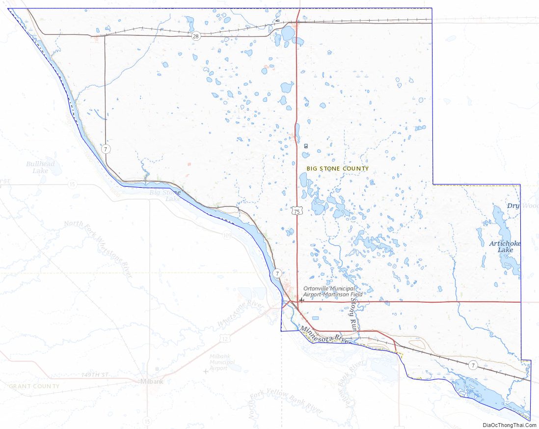
Big Stone County Road Map
Geography
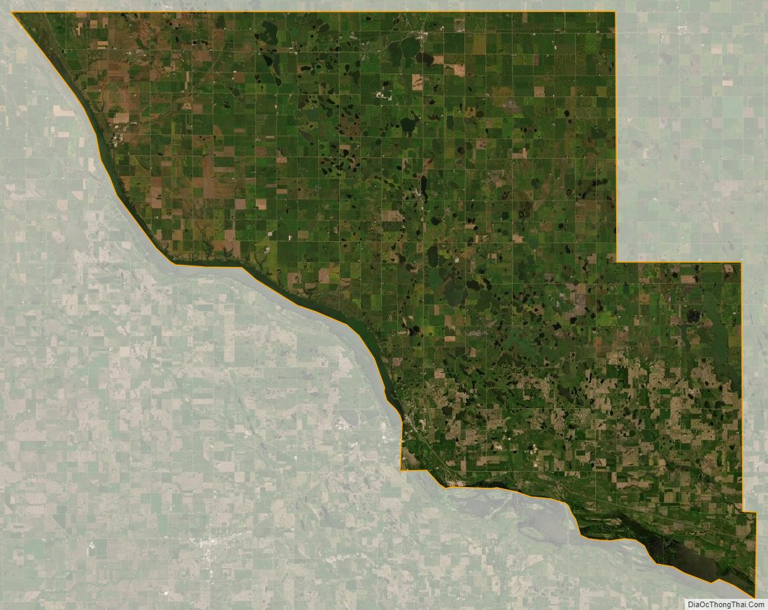
Big Stone County lies on the western side of Minnesota. Its southwest boundary line abuts the east boundary line of the state of South Dakota. The Little Minnesota River flows along the county’s southwestern boundary. Since 1937, a dam (Big Stone Lake Dam) has impounded the river’s waters, creating Big Stone Lake. Water flowing out from this lake flows along the south boundary line of the county, and is known as the Minnesota River from that point. Fish Creek flows southwesterly through the northwestern part of the county, discharging into Big Stone Lake at the county’s southwestern boundary.
The terrain of Big Stone County is low rolling hills, wooded or devoted to agriculture. The terrain generally slopes to the south and east, although its southwestern portion slopes to the river valley. Its highest point is on its north line near the northwestern corner, 2.9 miles (4.6 km) east of Lagoona Beach, at 1,201′ (366m) ASL. The county has a total area of 528 square miles (1,370 km), of which 499 square miles (1,290 km) is land and 29 square miles (75 km) (5.5%) is water.
Lakes
- Artichoke Lake – south edge in Akron Township, vast majority in Artichoke Township
- Barry Lake – Toqua Township
- Bentsen Lake – east half in Otrey Township, west half in Big Stone Township
- Big Stone Lake – Ortonville Township, Browns Valley Township, Foster Township, Prior Township, Big Stone Township
- Clear Lake – Toqua Township
- Cup Lake – Almond Township
- Deep Lake – Big Stone Township
- East Toqua Lake – Graceville Township
- Eli Lake – south three-quarters in Almond Township, west quarter in Clinton
- Fogarty Lake – Toqua Township
- Horseshoe Lake – Odessa Township
- Lannon Lake – Graceville Township
- Lindgren Lake – Ortonville Township
- Lake Leo – Graceville Township
- Lone Tree Lake – east three-quarters in Malta Township, west quarter in Almond Township
- Long Lake – Artichoke Township
- Long Tom Lake – northeast edge in Otrey Township, vast majority in Odessa Township
- Lysing Lake – vast majority in Almond Township, south edge in Big Stone Township
- Marsh Lake – Akron Township
- Moonshine Lake – Moonshine Township
- Moulton Lake – Big Stone Township
- Mundweiler Lake – Big Stone Township
- Munnwyler Lake – Ortonville Township
- Olson Lake – Big Stone Township
- Olson Lake – Otrey Township
- Otrey Lake – Otrey Township
- Peterson Lake – Odessa Township
- South Rothwell Lake – north edge in Graceville Township, vast majority in Almond Township
- Smithwicks Lake – Graceville Township
- Swenson Lake – Big Stone Township
- Twin Lakes – Big Stone Township
- West Toqua Lake – Graceville Township
- Walter Lake – Ortonville Township
Source: United States Census Bureau 2007 TIGER/Line Shapefiles
Major highways
- U.S. Highway 12
- U.S. Highway 75
- Minnesota State Highway 7
- Minnesota State Highway 28
Adjacent counties
- Traverse County – north
- Stevens County – northeast
- Swift County – southeast
- Lac qui Parle County – south
- Grant County, South Dakota – southwest
- Roberts County, South Dakota – northwest
Protected areas
- Big Stone Lake State Park
- Big Stone National Wildlife Refuge (part)
- Big Stone Wildlife Management Preserve (part)
- Clinton Prairie Scientific and Nature Area
- Dismal Swamp State Wildlife Management Area
- Freed State Wildlife Management Area
- Lac qui Parle State Wildlife Management Area
- Otrey State Wildlife Management Area
- Reisdorph State Wildlife Management Area
- Victor State Wildlife Management Area
Big Stone County Topographic Map
Big Stone County Satellite Map
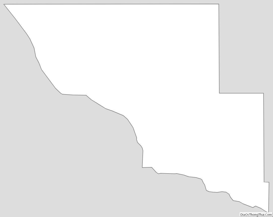
Big Stone County Outline Map
See also
Map of Minnesota State and its subdivision:- Aitkin
- Anoka
- Becker
- Beltrami
- Benton
- Big Stone
- Blue Earth
- Brown
- Carlton
- Carver
- Cass
- Chippewa
- Chisago
- Clay
- Clearwater
- Cook
- Cottonwood
- Crow Wing
- Dakota
- Dodge
- Douglas
- Faribault
- Fillmore
- Freeborn
- Goodhue
- Grant
- Hennepin
- Houston
- Hubbard
- Isanti
- Itasca
- Jackson
- Kanabec
- Kandiyohi
- Kittson
- Koochiching
- Lac qui Parle
- Lake
- Lake of the Woods
- Lake Superior
- Le Sueur
- Lincoln
- Lyon
- Mahnomen
- Marshall
- Martin
- McLeod
- Meeker
- Mille Lacs
- Morrison
- Mower
- Murray
- Nicollet
- Nobles
- Norman
- Olmsted
- Otter Tail
- Pennington
- Pine
- Pipestone
- Polk
- Pope
- Ramsey
- Red Lake
- Redwood
- Renville
- Rice
- Rock
- Roseau
- Saint Louis
- Scott
- Sherburne
- Sibley
- Stearns
- Steele
- Stevens
- Swift
- Todd
- Traverse
- Wabasha
- Wadena
- Waseca
- Washington
- Watonwan
- Wilkin
- Winona
- Wright
- Yellow Medicine
- Alabama
- Alaska
- Arizona
- Arkansas
- California
- Colorado
- Connecticut
- Delaware
- District of Columbia
- Florida
- Georgia
- Hawaii
- Idaho
- Illinois
- Indiana
- Iowa
- Kansas
- Kentucky
- Louisiana
- Maine
- Maryland
- Massachusetts
- Michigan
- Minnesota
- Mississippi
- Missouri
- Montana
- Nebraska
- Nevada
- New Hampshire
- New Jersey
- New Mexico
- New York
- North Carolina
- North Dakota
- Ohio
- Oklahoma
- Oregon
- Pennsylvania
- Rhode Island
- South Carolina
- South Dakota
- Tennessee
- Texas
- Utah
- Vermont
- Virginia
- Washington
- West Virginia
- Wisconsin
- Wyoming