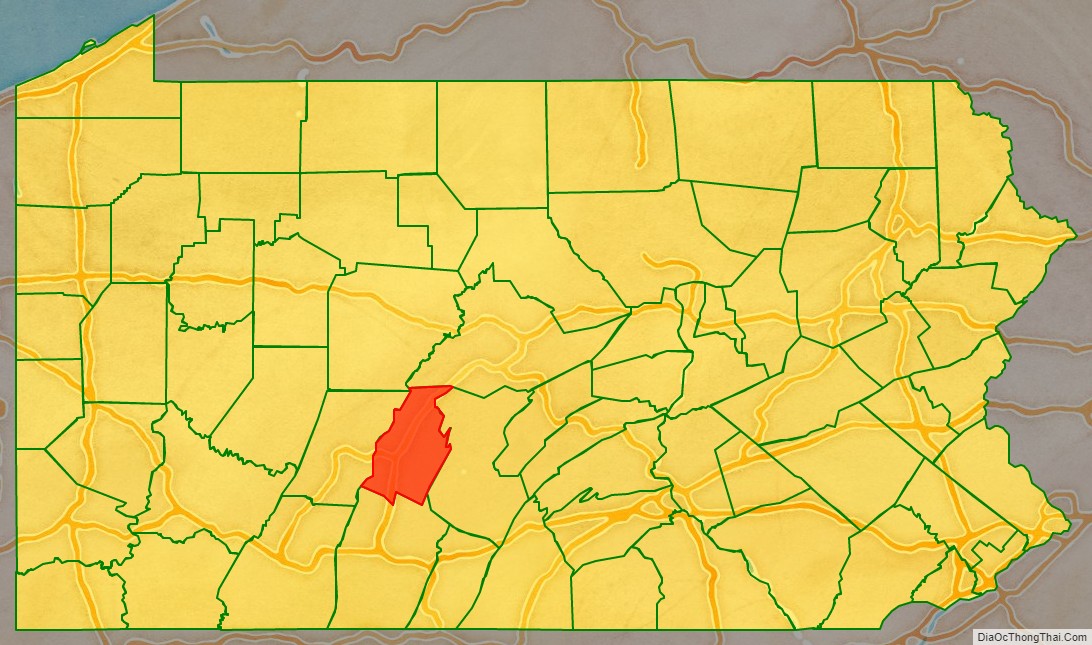
Blair County is a county in the Commonwealth of Pennsylvania. As of the 2020 census, the population was 122,822. Its county seat is Hollidaysburg. The county was created on February 26, 1846, from parts of Huntingdon and Bedford counties.
Blair County comprises the Altoona, PA metropolitan statistical area. It is also part of the Altoona-Huntingdon, PA Combined Statistical Area, which includes Blair and Huntingdon counties.
| Name: | Blair County |
|---|---|
| FIPS code: | 42-013 |
| State: | Pennsylvania |
| Founded: | February 26, 1846 |
| Seat: | Hollidaysburg |
| Largest city: | Altoona |
| Total Area: | 527 sq mi (1,360 km²) |
| Land Area: | 526 sq mi (1,360 km²) |
| Total Population: | 122,822 |
| Population Density: | 234/sq mi (90/km²) |
| Time zone: | UTC−5 (Eastern) |
| Summer Time Zone (DST): | UTC−4 (EDT) |
| Website: | www.blairco.org |
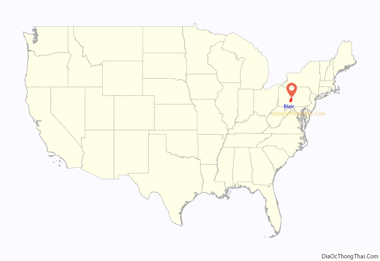
Blair County location map. Where is Blair County?
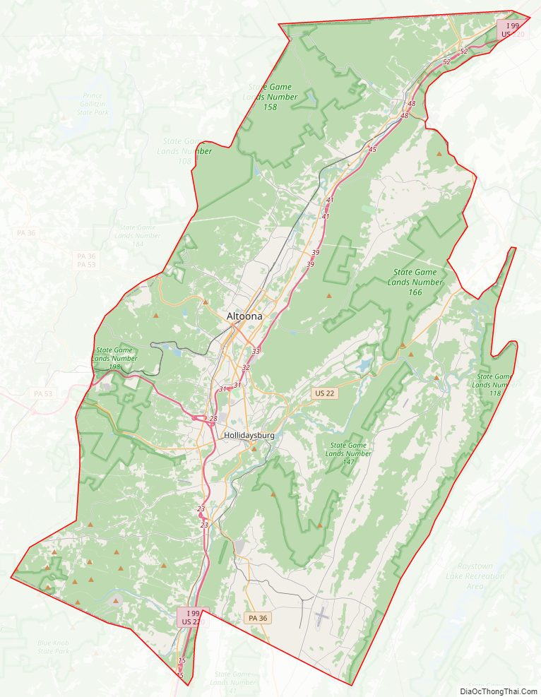
Blair County Road Map
Geography
According to the U.S. Census Bureau, the county has a total area of 527 square miles (1,360 km), of which 526 square miles (1,360 km) is land and 1.3 square miles (3.4 km) (0.2%) is water.
Features
- Brush Mountain
- Logan Valley
- Morrison Cove
- Tussey Mountain
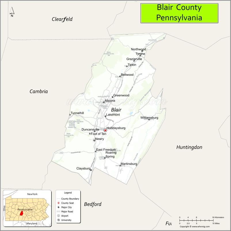
Adjacent counties
- Centre County (north)
- Huntingdon County (east)
- Bedford County (south)
- Cambria County (west)
- Clearfield County (northwest)
National protected area
- Allegheny Portage Railroad National Historic Site (part)
Major highways
- I-99 / US 220
- US 22
- US 220 Bus.
- PA 36
- PA 164
- PA 350
- PA 453
- PA 550
- PA 764
- PA 865
- PA 866
- PA 867
- PA 867 Truck
Climate
Blair has a warm-summer humid continental climate (Dfb).
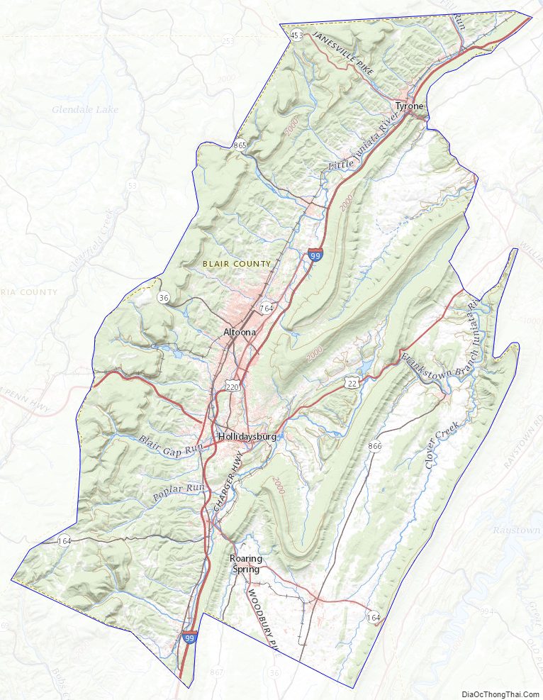
Blair County Topographic Map
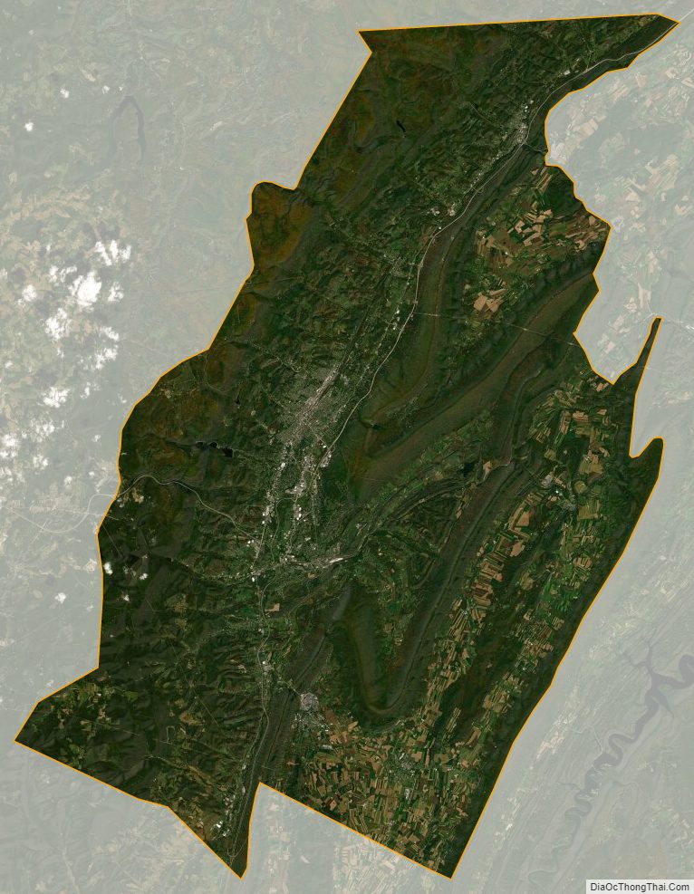
Blair County Satellite Map
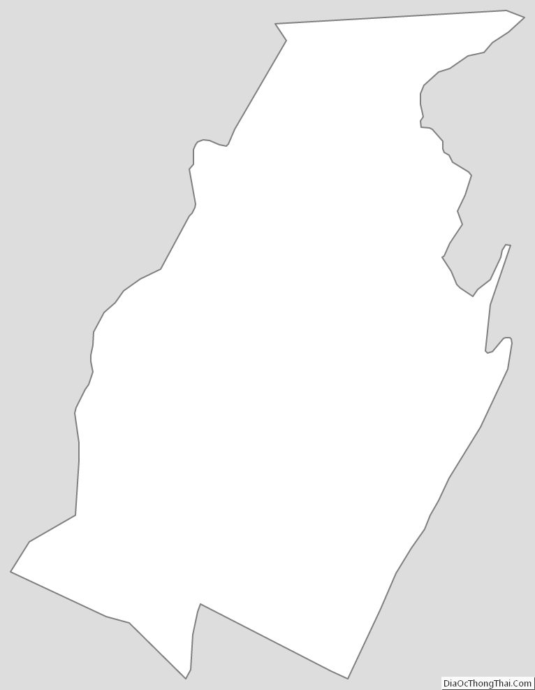
Blair County Outline Map
See also
Map of Pennsylvania State and its subdivision:- Adams
- Allegheny
- Armstrong
- Beaver
- Bedford
- Berks
- Blair
- Bradford
- Bucks
- Butler
- Cambria
- Cameron
- Carbon
- Centre
- Chester
- Clarion
- Clearfield
- Clinton
- Columbia
- Crawford
- Cumberland
- Dauphin
- Delaware
- Elk
- Erie
- Fayette
- Forest
- Franklin
- Fulton
- Greene
- Huntingdon
- Indiana
- Jefferson
- Juniata
- Lackawanna
- Lancaster
- Lawrence
- Lebanon
- Lehigh
- Luzerne
- Lycoming
- Mc Kean
- Mercer
- Mifflin
- Monroe
- Montgomery
- Montour
- Northampton
- Northumberland
- Perry
- Philadelphia
- Pike
- Potter
- Schuylkill
- Snyder
- Somerset
- Sullivan
- Susquehanna
- Tioga
- Union
- Venango
- Warren
- Washington
- Wayne
- Westmoreland
- Wyoming
- York
- Alabama
- Alaska
- Arizona
- Arkansas
- California
- Colorado
- Connecticut
- Delaware
- District of Columbia
- Florida
- Georgia
- Hawaii
- Idaho
- Illinois
- Indiana
- Iowa
- Kansas
- Kentucky
- Louisiana
- Maine
- Maryland
- Massachusetts
- Michigan
- Minnesota
- Mississippi
- Missouri
- Montana
- Nebraska
- Nevada
- New Hampshire
- New Jersey
- New Mexico
- New York
- North Carolina
- North Dakota
- Ohio
- Oklahoma
- Oregon
- Pennsylvania
- Rhode Island
- South Carolina
- South Dakota
- Tennessee
- Texas
- Utah
- Vermont
- Virginia
- Washington
- West Virginia
- Wisconsin
- Wyoming