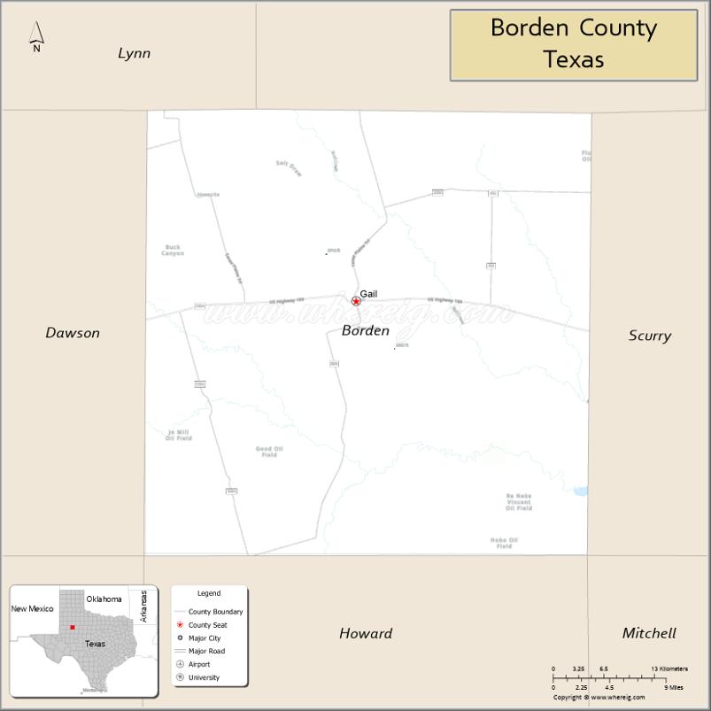
Borden County is a rural county located in the U.S. state of Texas. It is in West Texas and its county seat is Gail.
As of the 2020 census, its population was 631, making it the fifth-least populous county in Texas. Borden is one of five remaining prohibition or entirely dry counties in the state of Texas.
The county was created in 1876 and later organized in 1891. Gail and Borden County are named for Gail Borden Jr., businessman, publisher, surveyor, and inventor of condensed milk.
| Name: | Borden County |
|---|---|
| FIPS code: | 48-033 |
| State: | Texas |
| Founded: | 1876 |
| Named for: | Gail Borden Jr. |
| Seat: | Gail |
| Total Area: | 906 sq mi (2,350 km²) |
| Land Area: | 897 sq mi (2,320 km²) |
| Total Population: | 631 |
| Population Density: | 0.70/sq mi (0.27/km²) |
| Time zone: | UTC−6 (Central) |
| Summer Time Zone (DST): | UTC−5 (CDT) |
| Website: | www.co.borden.tx.us |
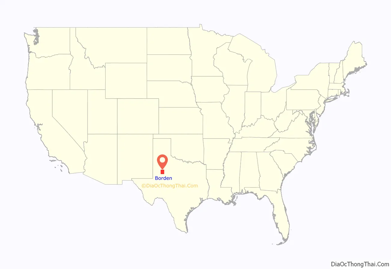
Borden County location map. Where is Borden County?
History
Native Americans
Shoshone and the Penateka band of Comanches were early tribes in the area.
County established
Borden County was created in 1876 from Bosque County and named for Gail Borden Jr., the inventor of condensed milk. Borden was publisher and editor of the Telegraph and Texas Register, as well as a political leader in the Republic of Texas. The county was organized in 1891, and Gail was made the county seat.
Farmers and ranchers settled the county, but the population remained relatively small. In 1902, Texas placed lands in the public domain and spurred a land rush in Borden County. Many of the newcomers grew cotton.
Borden County has had two courthouses, one built in 1890. The current courthouse is of brick and concrete construction and was erected in 1939. The architect was David S. Castle Co.
Oil was discovered in the county in 1949. By 1991, more than 340,000,000 barrels (54,000,000 m) of petroleum had been taken out of Borden County since its discovery.
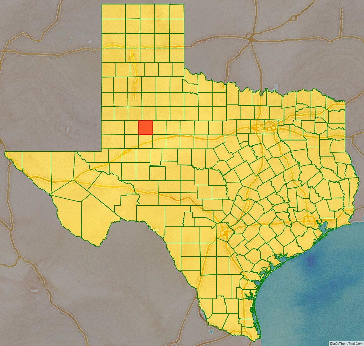
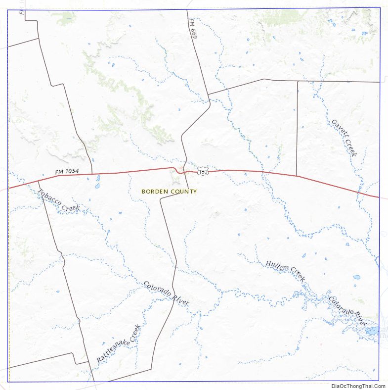
Borden County Road Map
Geography
According to the U.S. Census Bureau, the county has a total area of 906 square miles (2,350 km), of which 897 square miles (2,320 km) are land and 8.6 square miles (22 km) (1.0%) are covered by water.
Major highways
- U.S. Highway 180
- Farm to Market Road 669
Adjacent counties
- Garza County (north)
- Scurry County (east)
- Mitchell County (southeast)
- Howard County (south)
- Martin County (southwest)
- Dawson County (west)
- Lynn County (northwest)
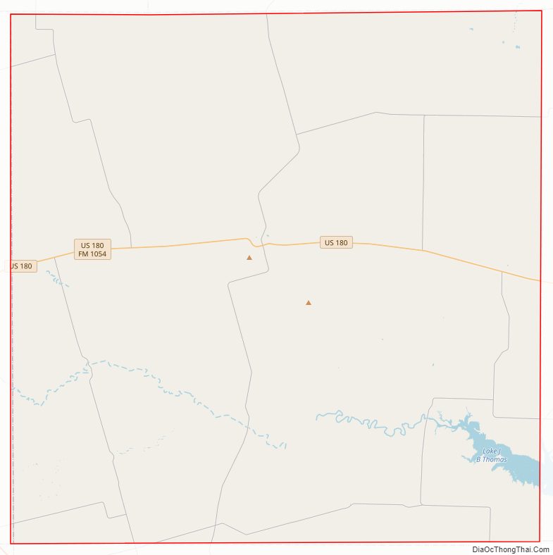
Borden County Topographic Map
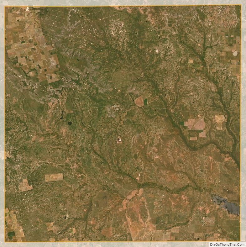
Borden County Satellite Map
Borden County Outline Map

See also
Map of Texas State and its subdivision:- Anderson
- Andrews
- Angelina
- Aransas
- Archer
- Armstrong
- Atascosa
- Austin
- Bailey
- Bandera
- Bastrop
- Baylor
- Bee
- Bell
- Bexar
- Blanco
- Borden
- Bosque
- Bowie
- Brazoria
- Brazos
- Brewster
- Briscoe
- Brooks
- Brown
- Burleson
- Burnet
- Caldwell
- Calhoun
- Callahan
- Cameron
- Camp
- Carson
- Cass
- Castro
- Chambers
- Cherokee
- Childress
- Clay
- Cochran
- Coke
- Coleman
- Collin
- Collingsworth
- Colorado
- Comal
- Comanche
- Concho
- Cooke
- Coryell
- Cottle
- Crane
- Crockett
- Crosby
- Culberson
- Dallam
- Dallas
- Dawson
- Deaf Smith
- Delta
- Denton
- Dewitt
- Dickens
- Dimmit
- Donley
- Duval
- Eastland
- Ector
- Edwards
- El Paso
- Ellis
- Erath
- Falls
- Fannin
- Fayette
- Fisher
- Floyd
- Foard
- Fort Bend
- Franklin
- Freestone
- Frio
- Gaines
- Galveston
- Garza
- Gillespie
- Glasscock
- Goliad
- Gonzales
- Gray
- Grayson
- Gregg
- Grimes
- Guadalupe
- Hale
- Hall
- Hamilton
- Hansford
- Hardeman
- Hardin
- Harris
- Harrison
- Hartley
- Haskell
- Hays
- Hemphill
- Henderson
- Hidalgo
- Hill
- Hockley
- Hood
- Hopkins
- Houston
- Howard
- Hudspeth
- Hunt
- Hutchinson
- Irion
- Jack
- Jackson
- Jasper
- Jeff Davis
- Jefferson
- Jim Hogg
- Jim Wells
- Johnson
- Jones
- Karnes
- Kaufman
- Kendall
- Kenedy
- Kent
- Kerr
- Kimble
- King
- Kinney
- Kleberg
- Knox
- La Salle
- Lamar
- Lamb
- Lampasas
- Lavaca
- Lee
- Leon
- Liberty
- Limestone
- Lipscomb
- Live Oak
- Llano
- Loving
- Lubbock
- Lynn
- Madison
- Marion
- Martin
- Mason
- Matagorda
- Maverick
- McCulloch
- McLennan
- McMullen
- Medina
- Menard
- Midland
- Milam
- Mills
- Mitchell
- Montague
- Montgomery
- Moore
- Morris
- Motley
- Nacogdoches
- Navarro
- Newton
- Nolan
- Nueces
- Ochiltree
- Oldham
- Orange
- Palo Pinto
- Panola
- Parker
- Parmer
- Pecos
- Polk
- Potter
- Presidio
- Rains
- Randall
- Reagan
- Real
- Red River
- Reeves
- Refugio
- Roberts
- Robertson
- Rockwall
- Runnels
- Rusk
- Sabine
- San Augustine
- San Jacinto
- San Patricio
- San Saba
- Schleicher
- Scurry
- Shackelford
- Shelby
- Sherman
- Smith
- Somervell
- Starr
- Stephens
- Sterling
- Stonewall
- Sutton
- Swisher
- Tarrant
- Taylor
- Terrell
- Terry
- Throckmorton
- Titus
- Tom Green
- Travis
- Trinity
- Tyler
- Upshur
- Upton
- Uvalde
- Val Verde
- Van Zandt
- Victoria
- Walker
- Waller
- Ward
- Washington
- Webb
- Wharton
- Wheeler
- Wichita
- Wilbarger
- Willacy
- Williamson
- Wilson
- Winkler
- Wise
- Wood
- Yoakum
- Young
- Zapata
- Zavala
- Alabama
- Alaska
- Arizona
- Arkansas
- California
- Colorado
- Connecticut
- Delaware
- District of Columbia
- Florida
- Georgia
- Hawaii
- Idaho
- Illinois
- Indiana
- Iowa
- Kansas
- Kentucky
- Louisiana
- Maine
- Maryland
- Massachusetts
- Michigan
- Minnesota
- Mississippi
- Missouri
- Montana
- Nebraska
- Nevada
- New Hampshire
- New Jersey
- New Mexico
- New York
- North Carolina
- North Dakota
- Ohio
- Oklahoma
- Oregon
- Pennsylvania
- Rhode Island
- South Carolina
- South Dakota
- Tennessee
- Texas
- Utah
- Vermont
- Virginia
- Washington
- West Virginia
- Wisconsin
- Wyoming