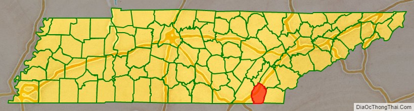
Bradley County is a county located in the southeastern portion of the U.S. state of Tennessee. As of the 2020 census, the population was 108,620, making it the thirteenth most populous county in Tennessee. Its county seat is Cleveland. It is named for Colonel Edward Bradley of Shelby County, Tennessee, who was colonel of Hale’s Regiment in the American Revolution and the 15th Regiment of the Tennessee Volunteers in the War of 1812. Bradley County is included in the Cleveland, Tennessee Metropolitan Statistical Area, which is also included in the Chattanooga-Cleveland-Dalton, TN-GA–AL Combined Statistical Area.
| Name: | Bradley County |
|---|---|
| FIPS code: | 47-011 |
| State: | Tennessee |
| Founded: | May 2, 1836 |
| Named for: | Edward Bradley, state legislator |
| Seat: | Cleveland |
| Largest city: | Cleveland |
| Total Area: | 331 sq mi (860 km²) |
| Land Area: | 329 sq mi (850 km²) |
| Total Population: | 108,620 |
| Population Density: | 330.15/sq mi (127.47/km²) |
| Time zone: | UTC−5 (Eastern) |
| Summer Time Zone (DST): | UTC−4 (EDT) |
| Website: | www.bradleycountytn.gov |
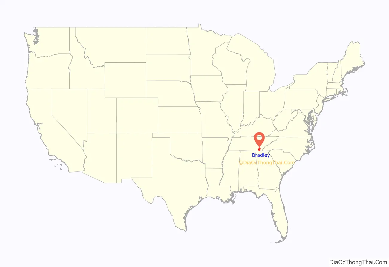
Bradley County location map. Where is Bradley County?
History
Indigenous peoples occupied this territory, especially along the waterways, for thousands of years before European contact. The first Europeans to see this area were likely Hernando De Soto and his expedition on June 2, 1540, while traveling through the Southeast interior of the North American continent. They encountered peoples of the South Appalachian Mississippian culture.
The historic Muscogee Creek and Yuchi occupied areas of what became Tennessee. The Yuchi town of Chestowee was located on the south bank of the lower Hiwassee River. They later moved from Tennessee into Georgia and South Carolina under pressure from the Cherokee, who were rising to power in the region. Cherokee warriors from the Middle Towns destroyed Chestowee in 1714, encouraged by English fur traders from South Carolina. Archeological surveys suggest that Chestowee was located at what is known as the Rymer archeological site, identified in later studies as within the European-American J.P. Rymer farm.
The Cherokee became predominant in this area and referred to a large region in present-day Bradley County as Chatata, meaning “clear water”. The Yuchi, while speaking a different language, allied with the Muscogee Creek when moving into their territory in Georgia and Alabama.
In anticipation of forced removal of the Cherokee by treaty cession in this area north of the Hiwassee River, white settlers began to move here. In 1821, the Cherokee Agency, the official liaison between the U.S. Government and the Cherokee Nation, was moved to present-day Charleston, Tennessee. Between 1832 and 1838, the Cherokee moved their capital to the Red Clay Council Grounds, on the southern border of Bradley County with Georgia; it served as the Cherokee capital and the last council grounds of the Cherokee Nation-East. This property is now a state park, Red Clay State Park.
The Cherokee Removal began after some of their leaders signed the Treaty of New Echota, signed on December 29, 1835. The government had earlier tried to persuade them to move to Indian Territory; these leaders signed the treaty while trying to gain the best conditions for their people, as they believed it was inevitable.
General Winfield Scott was directed to remove the Cherokee from the Southeast, and set up the headquarters at Fort Cass in Charleston. Several internment camps were established in Bradley County in the valleys between Charleston and Cleveland, Tennessee, where the Cherokee were held in preparation for the journey westward. This became known as the Trail of Tears. Two of the largest internment camps were located at Rattlesnake Springs.
European-American development of Bradley County
Bradley County was established by the legislature on February 10, 1836. It was named to honor Colonel Edward Bradley who served in the War of 1812. The first election in Bradley County took place on April 2, 1836. On May 2, 1836, the location for the county seat of Cleveland was chosen. On January 20, 1838, Cleveland, which had a population of 400, was formally recognized by the state legislature as the seat of Bradley County. Cleveland was incorporated on February 2, 1842.
Like most East Tennessee counties, the voters of Bradley County were largely opposed to secession on the eve of the Civil War. In Tennessee’s Ordinance of Secession referendum on June 8, 1861, the county’s residents voted against secession – 1,382 to 507. No major battles were fought in Bradley County, but several major skirmishes between Union and Confederate troops took place there. In 1864, Confederate soldiers failed in an attempt to destroy a Union train near the Tasso community, an effort that resulted in destroying a Confederate train instead.
The bridge over the Hiwassee River was burned on November 8, 1861, by members of the East Tennessee bridge-burning conspiracy led by Alfred Cate. On November 4, 1862, a train accident south of Cleveland near the Black Fox community killed 17 members of the 33rd Regiment Alabama Infantry, who were being transported to Chattanooga. Union soldiers under the command of William Tecumseh Sherman camped at Cleveland, Tasso, and Blue Springs on multiple occasions during the latter half of the war. The city of Cleveland was occupied by the Confederate Army from 1861 to 1863.
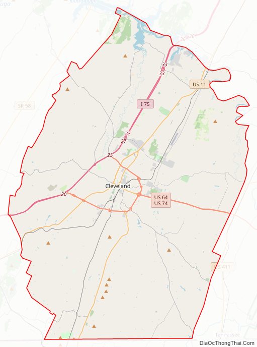
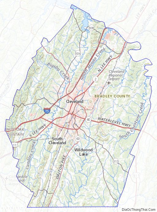
Bradley County Road Map
Geography
According to the U.S. Census Bureau, the county has a total area of 331 square miles (860 km), of which 329 square miles (850 km) is land and 2.7 square miles (7.0 km) (0.8%) is water. The county is situated on a series of paralleling ridges running north-northeasterly which are part of the Ridge and Valley Appalachians. The highest of these, Candies Creek Ridge, runs through the center of Cleveland. Located in between these ridges are creeks, and there are several springs in the county, which made the area favorable to early settlers. The highest point in the county is located on the Hamilton County line along White Oak Mountain. The county is bordered on the north by the Hiwassee River. The majority of the county is located in the Tennessee Valley drainage basin, except for approximately the southeastern third, which is located in the Mobile Bay Watershed and contains the Conasauga River. This river is the only river in Tennessee that is not part of the Mississippi River Watershed.
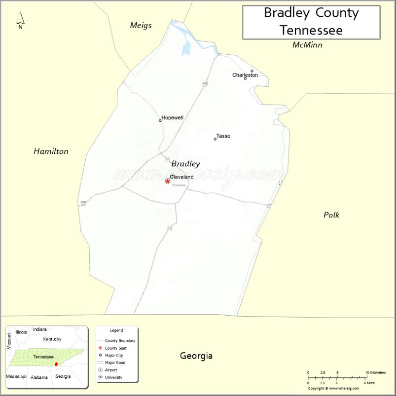
Adjacent counties
- Meigs County (northwest)
- McMinn County (north)
- Polk County (east)
- Murray County, Georgia (southeast)
- Whitfield County, Georgia (south)
- Hamilton County (west)
State protected areas
- Chickamauga Wildlife Management Area (part)
- Charlotte Anne Finnell Neal Wildlife Management Area
- Red Clay State Park
Bradley County Topographic Map
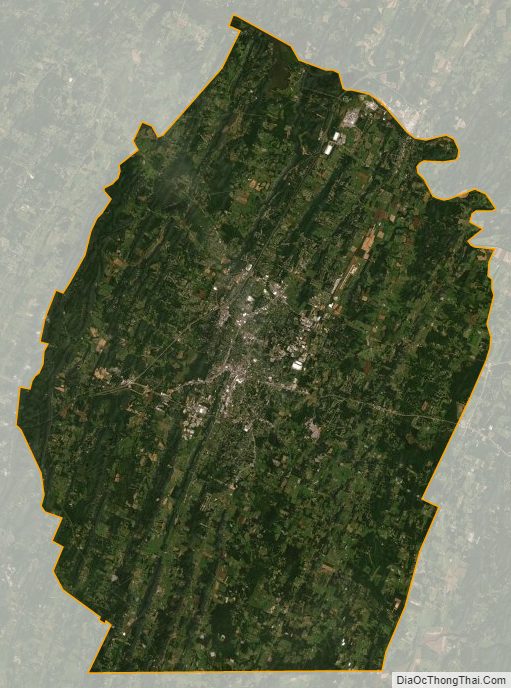
Bradley County Satellite Map
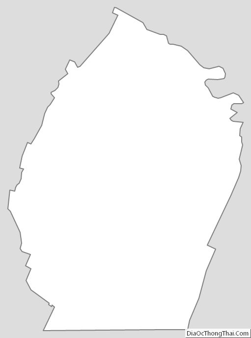
Bradley County Outline Map
See also
Map of Tennessee State and its subdivision:- Anderson
- Bedford
- Benton
- Bledsoe
- Blount
- Bradley
- Campbell
- Cannon
- Carroll
- Carter
- Cheatham
- Chester
- Claiborne
- Clay
- Cocke
- Coffee
- Crockett
- Cumberland
- Davidson
- Decatur
- DeKalb
- Dickson
- Dyer
- Fayette
- Fentress
- Franklin
- Gibson
- Giles
- Grainger
- Greene
- Grundy
- Hamblen
- Hamilton
- Hancock
- Hardeman
- Hardin
- Hawkins
- Haywood
- Henderson
- Henry
- Hickman
- Houston
- Humphreys
- Jackson
- Jefferson
- Johnson
- Knox
- Lake
- Lauderdale
- Lawrence
- Lewis
- Lincoln
- Loudon
- Macon
- Madison
- Marion
- Marshall
- Maury
- McMinn
- McNairy
- Meigs
- Monroe
- Montgomery
- Moore
- Morgan
- Obion
- Overton
- Perry
- Pickett
- Polk
- Putnam
- Rhea
- Roane
- Robertson
- Rutherford
- Scott
- Sequatchie
- Sevier
- Shelby
- Smith
- Stewart
- Sullivan
- Sumner
- Tipton
- Trousdale
- Unicoi
- Union
- Van Buren
- Warren
- Washington
- Wayne
- Weakley
- White
- Williamson
- Wilson
- Alabama
- Alaska
- Arizona
- Arkansas
- California
- Colorado
- Connecticut
- Delaware
- District of Columbia
- Florida
- Georgia
- Hawaii
- Idaho
- Illinois
- Indiana
- Iowa
- Kansas
- Kentucky
- Louisiana
- Maine
- Maryland
- Massachusetts
- Michigan
- Minnesota
- Mississippi
- Missouri
- Montana
- Nebraska
- Nevada
- New Hampshire
- New Jersey
- New Mexico
- New York
- North Carolina
- North Dakota
- Ohio
- Oklahoma
- Oregon
- Pennsylvania
- Rhode Island
- South Carolina
- South Dakota
- Tennessee
- Texas
- Utah
- Vermont
- Virginia
- Washington
- West Virginia
- Wisconsin
- Wyoming