Branch County is a county in the U.S. state of Michigan. As of the 2020 Census, the population was 44,862. The county seat is Coldwater. As one of the “cabinet counties” it was named for the U.S. Secretary of the Navy John Branch under President Andrew Jackson. The county was founded in 1829, and was organized in 1833.
Branch County comprises the Coldwater, MI Micropolitan Statistical Area.
| Name: | Branch County |
|---|---|
| FIPS code: | 26-023 |
| State: | Michigan |
| Founded: | 1829 |
| Named for: | John Branch |
| Seat: | Coldwater |
| Largest city: | Coldwater |
| Total Area: | 520 sq mi (1,300 km²) |
| Land Area: | 506 sq mi (1,310 km²) |
| Total Population: | 44,862 |
| Population Density: | 89/sq mi (34/km²) |
| Time zone: | UTC−5 (Eastern) |
| Summer Time Zone (DST): | UTC−4 (EDT) |
| Website: | www.countyofbranch.com |
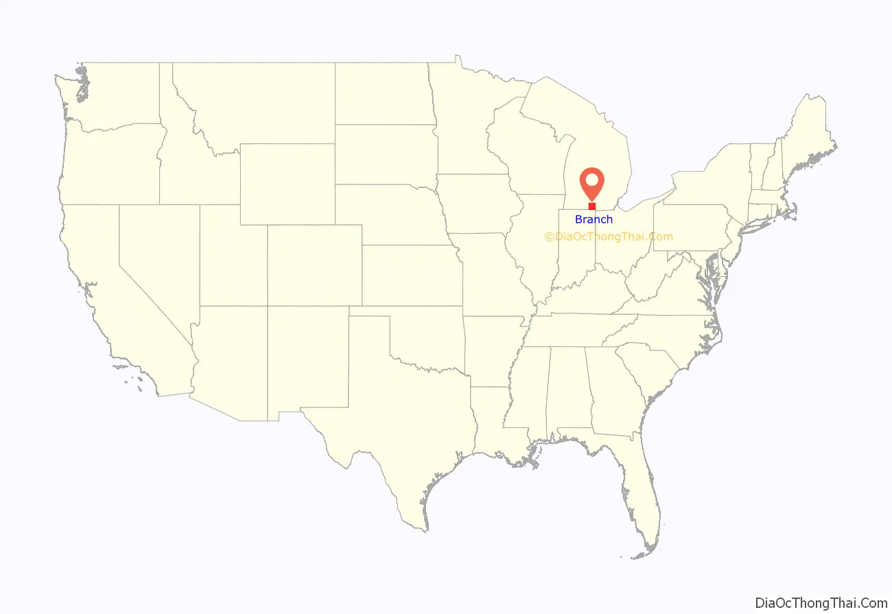
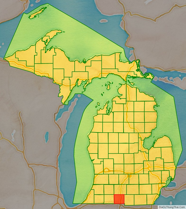
Branch County location map. Where is Branch County?
History
Branch County was a New England settlement. The original founders of Coldwater were settlers from the northern coastal colonies – “Yankees”, descended from the English Puritans who came from the Old World in the 1600s and who brought their culture. During the early 1800s, there was a wave of New England farmers who headed west into what was then the untamed Northwest Territory. Many traveled through New York State via the Erie Canal; the threat of Native Americans had been reduced by the end of the Black Hawk War.
These early settlers laid out farms, constructed roads, erected government buildings, and established post routes. They brought a passion for education, and established many schools. Many were supporters of abolitionism. They were mostly members of the Congregationalist Church though some were Episcopalian. Culturally Branch County, like much of Michigan, developed as part of the Northern Tier, continuous with New England culture, during its early history. The county still depends on agriculture as the basis of its economy.
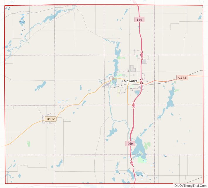
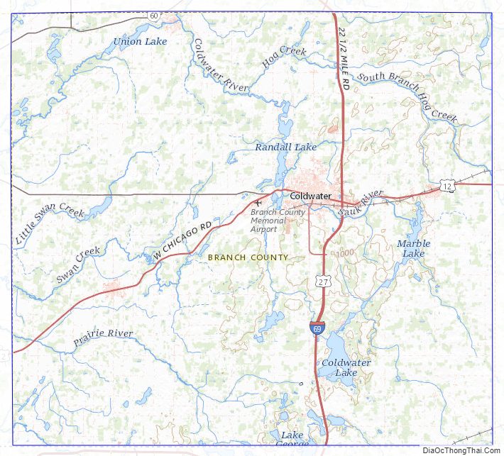
Branch County Road Map
Geography
According to the U.S. Census Bureau, the county has a total area of 520 square miles (1,300 km), of which 506 square miles (1,310 km) is land and 13 square miles (34 km) (2.6%) is water. It is the third-smallest county in Michigan by total area. The only island in the county is Iyopawa Island.
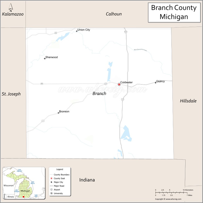
Adjacent counties
- Kalamazoo County – northwest
- Calhoun County – north
- Hillsdale County – east
- Steuben County, Indiana – south
- LaGrange County, Indiana – southwest
- St. Joseph County – west
Major highways
- I-69 – runs north–south through central Branch County. Runs east of Girard, Coldwater and Kinderhook.
- BL I-69 – runs through Coldwater.
- US 12 – runs ENE through central Branch County. Passes Bronson, Coldwater and Quincy.
- M-60 – runs through northern part of county. Enters near Union City; runs west 5 miles (8 km) to intersection with M60, south of Athens.
- M-66 – runs through NW tip of county. Enters west line from Leonidas, Michigan, runs east 2.4 miles ( 4 km), turns north to exit county toward Athens, Michigan.
- M-86 runs east–west through central Branch County. Enters from Colon, Michigan, runs east to intersection with US12, three miles (5 km) west of Coldwater.
Branch County Topographic Map
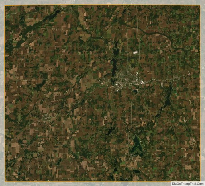
Branch County Satellite Map
Branch County Outline Map

See also
Map of Michigan State and its subdivision:- Alcona
- Alger
- Allegan
- Alpena
- Antrim
- Arenac
- Baraga
- Barry
- Bay
- Benzie
- Berrien
- Branch
- Calhoun
- Cass
- Charlevoix
- Cheboygan
- Chippewa
- Clare
- Clinton
- Crawford
- Delta
- Dickinson
- Eaton
- Emmet
- Genesee
- Gladwin
- Gogebic
- Grand Traverse
- Gratiot
- Hillsdale
- Houghton
- Huron
- Ingham
- Ionia
- Iosco
- Iron
- Isabella
- Jackson
- Kalamazoo
- Kalkaska
- Kent
- Keweenaw
- Lake
- Lake Hurron
- Lake Michigan
- Lake St. Clair
- Lake Superior
- Lapeer
- Leelanau
- Lenawee
- Livingston
- Luce
- Mackinac
- Macomb
- Manistee
- Marquette
- Mason
- Mecosta
- Menominee
- Midland
- Missaukee
- Monroe
- Montcalm
- Montmorency
- Muskegon
- Newaygo
- Oakland
- Oceana
- Ogemaw
- Ontonagon
- Osceola
- Oscoda
- Otsego
- Ottawa
- Presque Isle
- Roscommon
- Saginaw
- Saint Clair
- Saint Joseph
- Sanilac
- Schoolcraft
- Shiawassee
- Tuscola
- Van Buren
- Washtenaw
- Wayne
- Wexford
- Alabama
- Alaska
- Arizona
- Arkansas
- California
- Colorado
- Connecticut
- Delaware
- District of Columbia
- Florida
- Georgia
- Hawaii
- Idaho
- Illinois
- Indiana
- Iowa
- Kansas
- Kentucky
- Louisiana
- Maine
- Maryland
- Massachusetts
- Michigan
- Minnesota
- Mississippi
- Missouri
- Montana
- Nebraska
- Nevada
- New Hampshire
- New Jersey
- New Mexico
- New York
- North Carolina
- North Dakota
- Ohio
- Oklahoma
- Oregon
- Pennsylvania
- Rhode Island
- South Carolina
- South Dakota
- Tennessee
- Texas
- Utah
- Vermont
- Virginia
- Washington
- West Virginia
- Wisconsin
- Wyoming