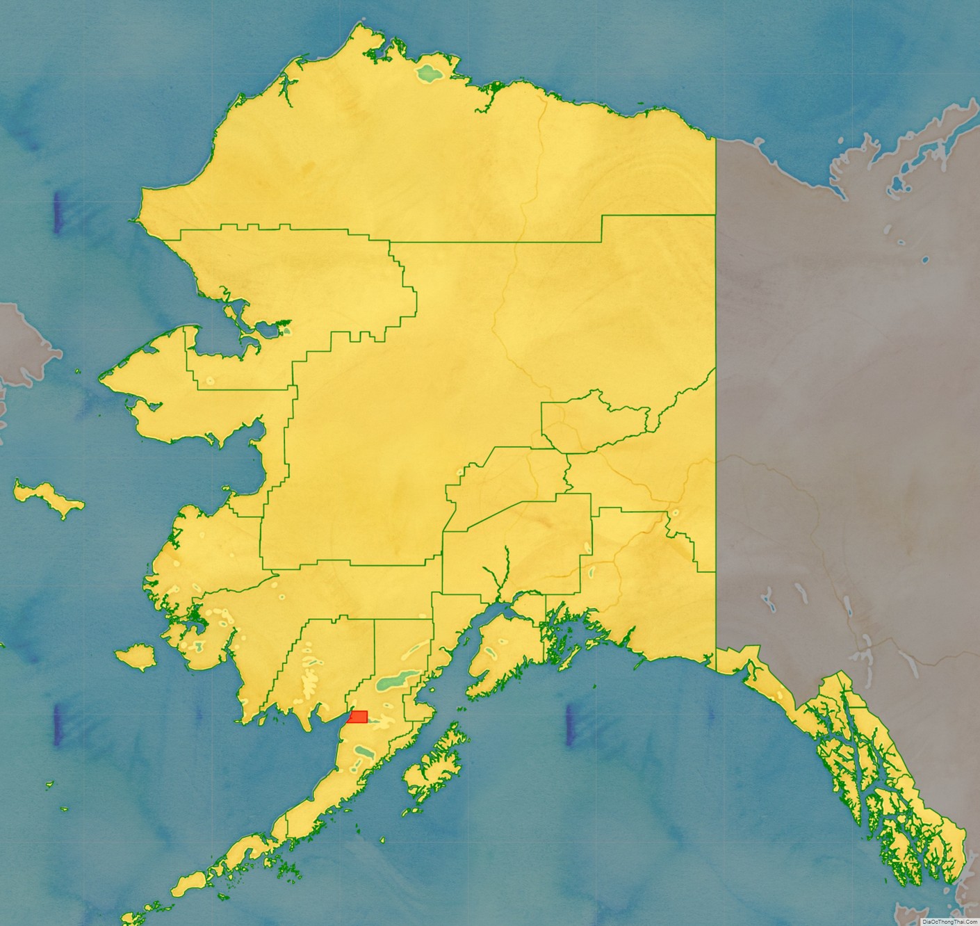
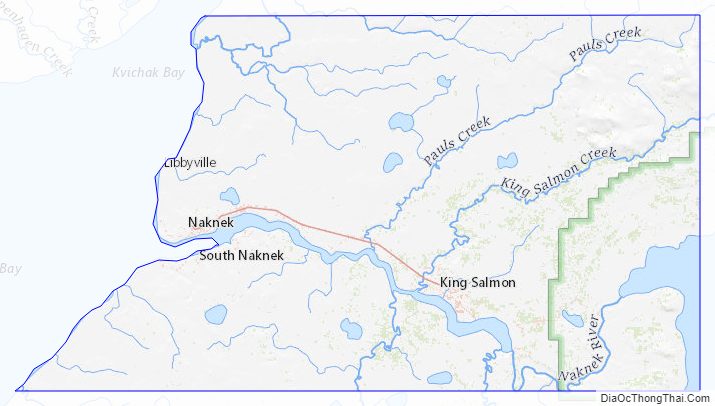
Bristol Bay Borough is a borough of the U.S. state of Alaska on Bristol Bay. As of the 2020 census the borough population was 844, down from 997 in 2010, the second-least populated borough in Alaska. The borough seat is Naknek. There are no incorporated settlements.
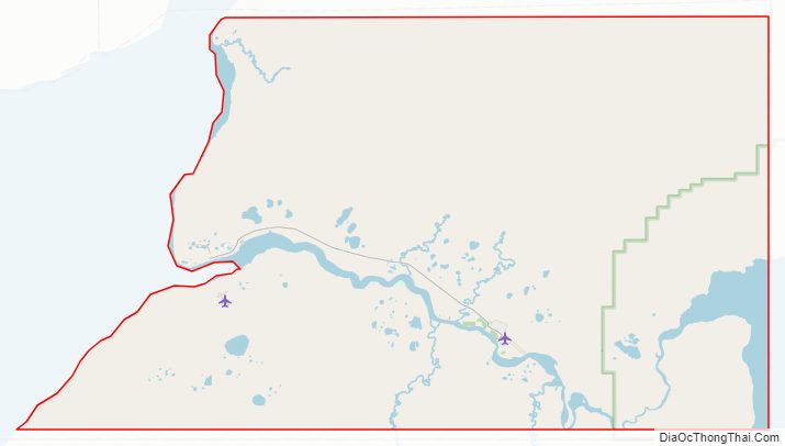
Incorporated in 1962, Bristol Bay was the first of Alaska’s boroughs. It is also among the smallest, consisting of little more than the rectangle of land around Naknek on the coast and King Salmon (which, uniquely, serves as the borough seat for the neighboring Lake and Peninsula Borough) inland.
| Name: | Bristol Bay Borough |
|---|---|
| FIPS code: | 02-060 |
| State: | Alaska |
| Named for: | Bristol Bay |
| Seat: | Naknek |
| Total Area: | 888 sq mi (2,300 km²) |
| Land Area: | 504 sq mi (1,310 km²) |
| Total Population: | 844 |
| Population Density: | 0.95/sq mi (0.37/km²) |
Bristol Bay Borough location map. Where is Bristol Bay Borough?
Bristol Bay Borough Road Map
Geography
The borough has a total area of 888 square miles (2,300 km), of which 504 square miles (1,310 km) is land and 384 square miles (990 km) (43.2%) is water.
Adjacent boroughs and census areas
- Lake and Peninsula Borough, Alaska (east, north and south)
- Dillingham Census Area, Alaska (west)
National protected area
- Katmai National Park and Preserve (part)
- Katmai Wilderness (part)
Bristol Bay Borough Topographic Map
Bristol Bay Borough Satellite Map

Bristol Bay Borough Outline Map

See also
Map of Alaska State and its subdivision:- Aleutians East
- Aleutians West
- Anchorage
- Bethel
- Bristol Bay
- Denali
- Dillingham
- Fairbanks North Star
- Haines
- Juneau
- Kenai Peninsula
- Ketchikan Gateway
- Kodiak Island
- Lake and Peninsula
- Matanuska-Susitna
- Nome
- North Slope
- Northwest Arctic
- Prince of Wales-Outer Ketchi
- Sitka
- Skagway-Yakutat-Angoon
- Southeast Fairbanks
- Valdez-Cordova
- Wade Hampton
- Wrangell-Petersburg
- Yukon-Koyukuk
- Alabama
- Alaska
- Arizona
- Arkansas
- California
- Colorado
- Connecticut
- Delaware
- District of Columbia
- Florida
- Georgia
- Hawaii
- Idaho
- Illinois
- Indiana
- Iowa
- Kansas
- Kentucky
- Louisiana
- Maine
- Maryland
- Massachusetts
- Michigan
- Minnesota
- Mississippi
- Missouri
- Montana
- Nebraska
- Nevada
- New Hampshire
- New Jersey
- New Mexico
- New York
- North Carolina
- North Dakota
- Ohio
- Oklahoma
- Oregon
- Pennsylvania
- Rhode Island
- South Carolina
- South Dakota
- Tennessee
- Texas
- Utah
- Vermont
- Virginia
- Washington
- West Virginia
- Wisconsin
- Wyoming