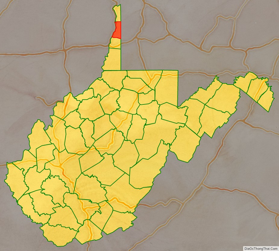
Brooke County is a county in the Northern Panhandle of the U.S. state of West Virginia. As of the 2020 census, the population was 22,559. Its county seat is Wellsburg. The county was created in 1797 from part of Ohio County and named in honor of Robert Brooke, Governor of Virginia from 1794 to 1796. Brooke County is part of the Weirton-Steubenville, WV-OH Metropolitan Statistical Area, which is also included in the Pittsburgh-New Castle-Weirton, PA-WV-OH Combined Statistical Area.
| Name: | Brooke County |
|---|---|
| FIPS code: | 54-009 |
| State: | West Virginia |
| Founded: | November 30, 1797 |
| Named for: | Robert Brooke |
| Seat: | Wellsburg |
| Largest city: | Follansbee |
| Total Area: | 92.57 sq mi (239.8 km²) |
| Land Area: | 89.20 sq mi (231.0 km²) |
| Total Population: | 22,559 |
| Population Density: | 252.90/sq mi (97.65/km²) |
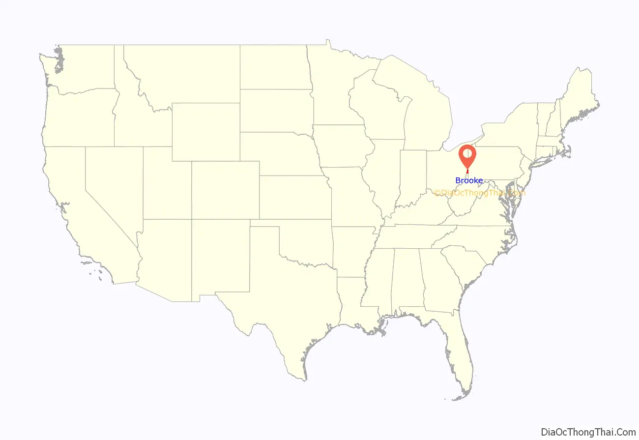
Brooke County location map. Where is Brooke County?
History
The Ohio Company of Virginia petitioned the British King for 500,000 acres of land in the Ohio River Valley in 1747, but the first settlers to this area, in what later became known as West Virginia’s Northern Panhandle, were brothers Jonathan, Israel and Friend Cox. They staked a “tomahawk claim” to 1200 acres (400 acres for each brother) at the mouth of Buffalo Creek and extending along the Ohio River. Their cousin George Cox staked an adjacent claim a few years later.
In 1788 Charles Prather purchased 481 acres from Friend Cox’s heir, John Cox; by that year’s end Alexander Wells, formerly of Baltimore, Maryland and later of Cross Creek Township, Pennsylvania, established a trading post (together with his Baltimore cousin Richard Owings). In 1791 the Ohio County Court incorporated the town around the post as “Charlestown” (after Prather’s first name). On November 30, 1796, the Virginia General Assembly formed Brooke County, from parts of Ohio County, and designated “Charlestown” as the county seat. Across the Appalachian Continental Divide to the east in Jefferson County, another Charlestown had previously been incorporated (it is now known as Charles Town). In addition, Charleston had been established at the confluence of the Elk and Kanawha rivers in 1788.
Addressing this confusion, the Virginia General Assembly on December 28, 1816, changed the Brooke county seat’s name from “Charlestown” to Wellsburg, supposedly to honor Charles Wells, Prather’s son-in-law. The first Masonic Lodge west of the Allegheny Mountains was established in Wellsburg on March 4, 1799. It was under the jurisdiction of the Grand Lodge of Pennsylvania for six years, but since December 17, 1817, it has been under the jurisdiction of the Grand Lodge of Virginia and later of West Virginia.
The first glass factory in Wellsburg was built in 1813, taking advantage of the relatively easy transportation on the Ohio River. When the National Road was built about five years later, its first crossing of the Ohio River was via a ferry further west. In 1818 Alexander Campbell founded the first Virginia school west of the Appalachians, which the Virginia General Assembly chartered in 1840 as Bethany College.
During the American Civil War, Brooke County’s elected officials helped found the new state of West Virginia, after their efforts to block secession failed at the Virginia Secession Convention of 1861. Wellsburg received a new charter in 1866 from the newly established West Virginia legislature, and Samuel Marks became Wellsburg’s first elected mayor.
In 1863, West Virginia’s counties were divided into civil townships, with the intention of encouraging local government. This proved impractical in the heavily rural state, and in 1872 the townships were converted into magisterial districts. Brooke County was divided into three districts: Buffalo, Cross Creek, and Wellsburg. Wellsburg District was co-extensive with the city of Wellsburg. The districts of Follansbee and Weirton were created between 1970 and 1980. Buffalo and Cross Creek Districts were discontinued in 2008.
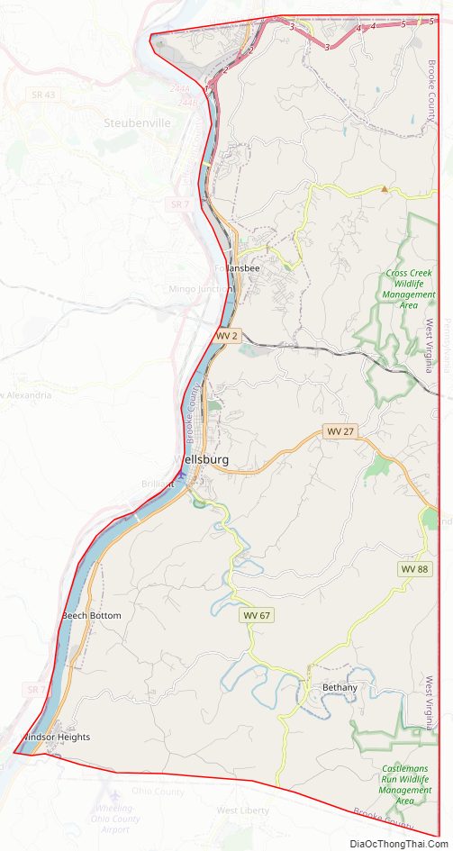
Brooke County Road Map
Geography
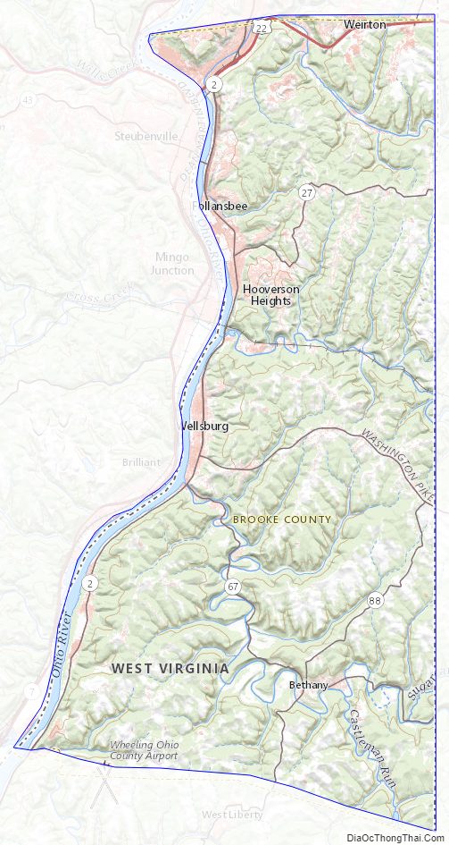
According to the United States Census Bureau, the county has a total area of 93 square miles (240 km), of which 89 square miles (230 km) is land and 3.4 square miles (8.8 km) (3.6%) is water. It is the second-smallest county in West Virginia by area. The highest point of elevation in Brooke County is approximately 1372 ft. and located about 1.5 miles south of Franklin.[1]
Major highways
- US 22
- WV 2
- WV 27
- WV 27 Alt.
- WV 67
- WV 88
- WV 105
Adjacent counties
- Hancock County (north)
- Washington County, Pennsylvania (east)
- Ohio County (south)
- Jefferson County, Ohio (west)
National protected area
- Ohio River Islands National Wildlife Refuge (part)
Brooke County Topographic Map
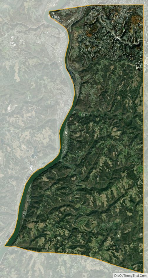
Brooke County Satellite Map
Brooke County Outline Map

See also
Map of West Virginia State and its subdivision:- Barbour
- Berkeley
- Boone
- Braxton
- Brooke
- Cabell
- Calhoun
- Clay
- Doddridge
- Fayette
- Gilmer
- Grant
- Greenbrier
- Hampshire
- Hancock
- Hardy
- Harrison
- Jackson
- Jefferson
- Kanawha
- Lewis
- Lincoln
- Logan
- Marion
- Marshall
- Mason
- McDowell
- Mercer
- Mineral
- Mingo
- Monongalia
- Monroe
- Morgan
- Nicholas
- Ohio
- Pendleton
- Pleasants
- Pocahontas
- Preston
- Putnam
- Raleigh
- Randolph
- Ritchie
- Roane
- Summers
- Taylor
- Tucker
- Tyler
- Upshur
- Wayne
- Webster
- Wetzel
- Wirt
- Wood
- Wyoming
- Alabama
- Alaska
- Arizona
- Arkansas
- California
- Colorado
- Connecticut
- Delaware
- District of Columbia
- Florida
- Georgia
- Hawaii
- Idaho
- Illinois
- Indiana
- Iowa
- Kansas
- Kentucky
- Louisiana
- Maine
- Maryland
- Massachusetts
- Michigan
- Minnesota
- Mississippi
- Missouri
- Montana
- Nebraska
- Nevada
- New Hampshire
- New Jersey
- New Mexico
- New York
- North Carolina
- North Dakota
- Ohio
- Oklahoma
- Oregon
- Pennsylvania
- Rhode Island
- South Carolina
- South Dakota
- Tennessee
- Texas
- Utah
- Vermont
- Virginia
- Washington
- West Virginia
- Wisconsin
- Wyoming