Bryan County is a county in the U.S. state of Oklahoma. As of the 2010 census, the population was 42,416. Its county seat is Durant. It is the only county in the United States named for Democratic politician William Jennings Bryan.
Bryan County comprises the Durant, OK Micropolitan Statistical Area, which is part of the Dallas-Fort Worth and the Texoma region, TX-OK Combined Statistical Area. The city of Durant has the headquarters of the Choctaw Nation of Oklahoma.
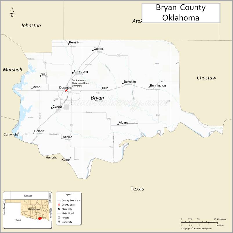
Bryan County consists of 10 Townships: Albany, Bennington, Bokchito, Brown, Caddo, Calera, Colbert, Kemp, Matoy, and Speairs.
| Name: | Bryan County |
|---|---|
| FIPS code: | 40-013 |
| State: | Oklahoma |
| Founded: | 1907 |
| Seat: | Durant |
| Largest city: | Durant |
| Total Area: | 944 sq mi (2,440 km²) |
| Land Area: | 904 sq mi (2,340 km²) |
| Total Population: | 42,416 |
| Population Density: | 49.7/sq mi (19.2/km²) |
| Time zone: | UTC−6 (Central) |
| Summer Time Zone (DST): | UTC−5 (CDT) |
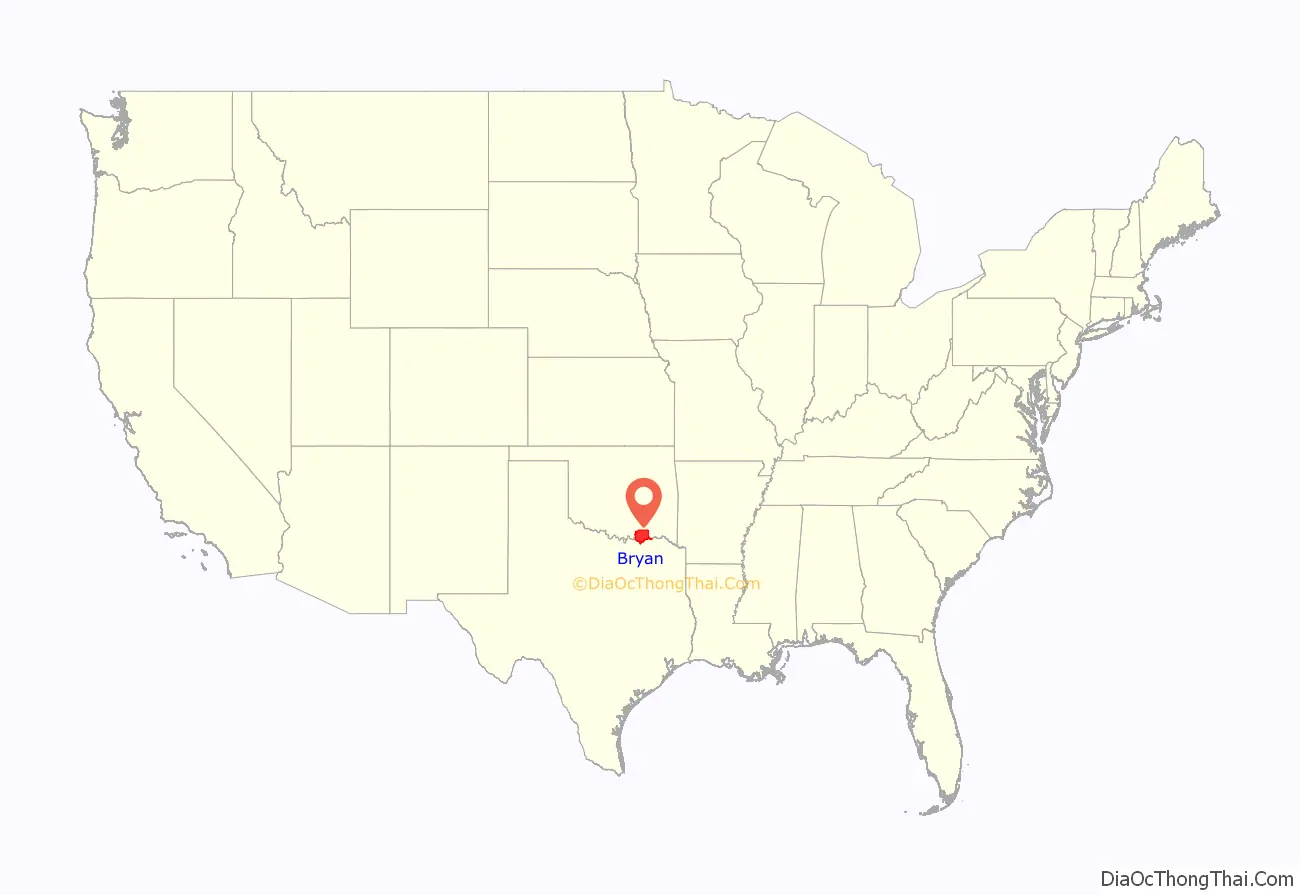
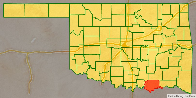
Bryan County location map. Where is Bryan County?
History
The area now known as Bryan County was occupied by the Choctaw tribe in 1831–2. After the tribe reestablished its government in the Indian Territory, it included much of the area within Blue County, a part of the Pushmataha District of the Choctaw Nation.
In 1845, the tribe opened Armstrong Academy for boys near the community of Bokchito. The academy served as Chahta Tamaha, the Choctaw capital, during the Civil War.
Bloomfield Academy, a school for Chickasaw girls, was opened in 1852, just south of the present town of Achille.
Prior to the Chickasaw removal to Indian Territory, the Chickasaw tribe bought part of the Choctaw allocation. The western quarter of today’s Bryan County was made part of the Chickasaw District in 1837. When the two tribes formally separated into two distinct nations in 1855, the Chickasaw District became the Chickasaw Nation.
During the late 1850s, the Butterfield Overland Mail and Stage route followed the older Texas Road across the present county. General Albert Pike established Fort McCulloch for the Confederate Army near the present town of Kenefic on the Blue River. Although no Civil War battles occurred in the vicinity, the fort was garrisoned by more than a thousand Indian troops whose leaders were allied with the Confederates.
After the Missouri, Kansas and Texas Railway (Katy) built a north–south line through this area in 1872, several new towns were created. One such town was Colbert, which became the seat of Blue County and the largest town in the Choctaw Nation. The St. Louis, San Francisco and New Orleans Railroad, later bought by the St. Louis and San Francisco Railway (Frisco), built an east–west line in 1903.
Just prior to statehood, when all tribal governments were dissolved, Blue County was extinguished. Bryan County was officially established on November 16, 1907, and Durant was designated as the county seat.
The Bridge War, also called the Red River Bridge War or the Toll Bridge War, was a 1931 bloodless boundary conflict between the U.S. states of Oklahoma and Texas over an existing toll bridge and a new free bridge crossing the Red River between Grayson County, Texas and Bryan County, Oklahoma.
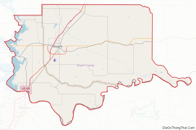
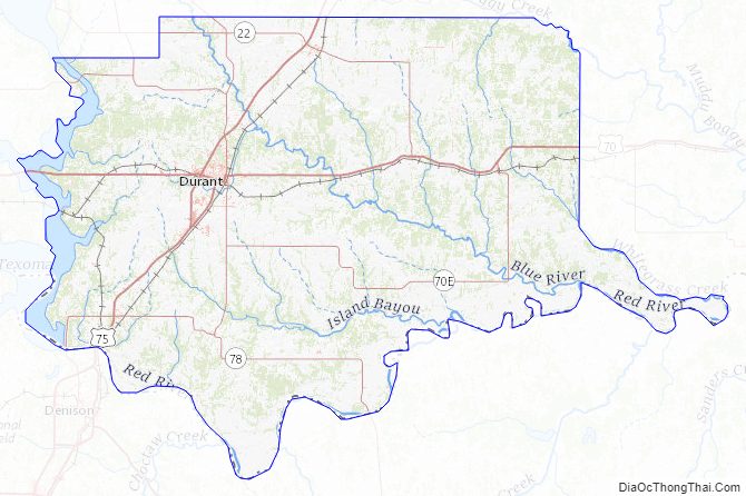
Bryan County Road Map
Geography
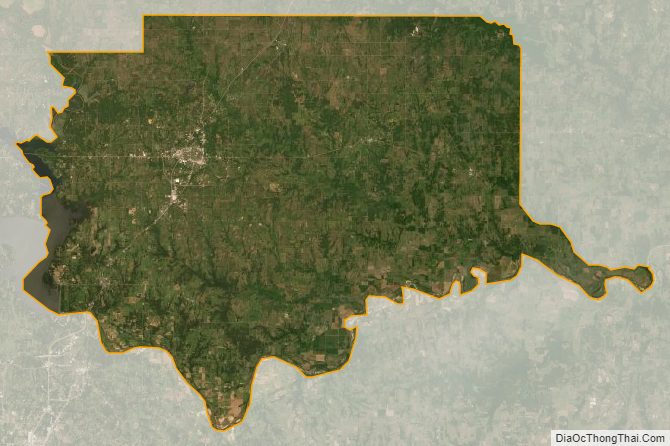
Bryan County is in southeastern Oklahoma, in a 10-county area designated as Choctaw Country for tourism purposes by the Oklahoma Department of Tourism and Recreation. According to the U.S. Census Bureau, the county has a total area of 944 square miles (2,440 km), of which 904 square miles (2,340 km) is land and 39 square miles (100 km) (4.2%) is water.
The county is in the Coastal Plains physiographic region, and is drained mostly by the Blue River. The Washita River originally drained much of the western part of the county, but now empties into Lake Texoma, which forms much of the southern boundary of the county. The county is a major part of the Texoma region.
Major highways
- US-69
- US-70
- US-75
- SH-91
- SH-70E
- SH-48
- SH-199
- SH-78
Adjacent counties
- Atoka County (north)
- Choctaw County (east)
- Lamar County, Texas (southeast)
- Fannin County, Texas (south)
- Grayson County, Texas (southwest)
- Marshall County (west)
- Johnston County (northwest)
Bryan County Topographic Map
Bryan County Satellite Map
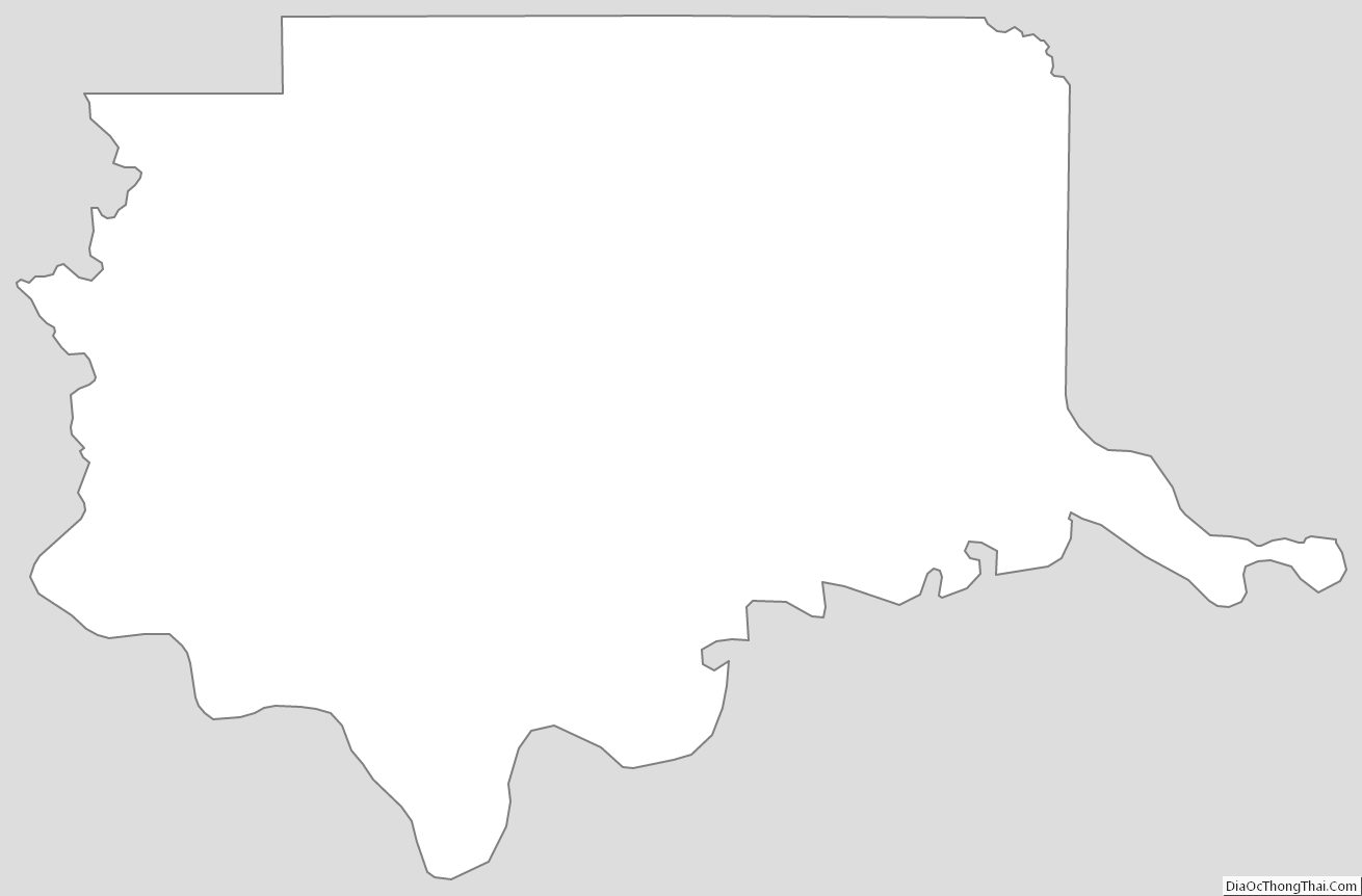
Bryan County Outline Map
See also
Map of Oklahoma State and its subdivision:- Adair
- Alfalfa
- Atoka
- Beaver
- Beckham
- Blaine
- Bryan
- Caddo
- Canadian
- Carter
- Cherokee
- Choctaw
- Cimarron
- Cleveland
- Coal
- Comanche
- Cotton
- Craig
- Creek
- Custer
- Delaware
- Dewey
- Ellis
- Garfield
- Garvin
- Grady
- Grant
- Greer
- Harmon
- Harper
- Haskell
- Hughes
- Jackson
- Jefferson
- Johnston
- Kay
- Kingfisher
- Kiowa
- Latimer
- Le Flore
- Lincoln
- Logan
- Love
- Major
- Marshall
- Mayes
- McClain
- McCurtain
- McIntosh
- Murray
- Muskogee
- Noble
- Nowata
- Okfuskee
- Oklahoma
- Okmulgee
- Osage
- Ottawa
- Pawnee
- Payne
- Pittsburg
- Pontotoc
- Pottawatomie
- Pushmataha
- Roger Mills
- Rogers
- Seminole
- Sequoyah
- Stephens
- Texas
- Tillman
- Tulsa
- Wagoner
- Washington
- Washita
- Woods
- Woodward
- Alabama
- Alaska
- Arizona
- Arkansas
- California
- Colorado
- Connecticut
- Delaware
- District of Columbia
- Florida
- Georgia
- Hawaii
- Idaho
- Illinois
- Indiana
- Iowa
- Kansas
- Kentucky
- Louisiana
- Maine
- Maryland
- Massachusetts
- Michigan
- Minnesota
- Mississippi
- Missouri
- Montana
- Nebraska
- Nevada
- New Hampshire
- New Jersey
- New Mexico
- New York
- North Carolina
- North Dakota
- Ohio
- Oklahoma
- Oregon
- Pennsylvania
- Rhode Island
- South Carolina
- South Dakota
- Tennessee
- Texas
- Utah
- Vermont
- Virginia
- Washington
- West Virginia
- Wisconsin
- Wyoming