Butler County is a county in the Commonwealth of Pennsylvania. It is part of Western Pennsylvania. As of the 2020 census, the population was 193,763. Its county seat is Butler. Butler County was created on March 12, 1800, from part of Allegheny County and named in honor of General Richard Butler, a hero of the American Revolution.
Butler County is part of the Pittsburgh, PA Metropolitan Statistical Area.
| Name: | Butler County |
|---|---|
| FIPS code: | 42-019 |
| State: | Pennsylvania |
| Founded: | March 12, 1800 |
| Named for: | Richard Butler |
| Seat: | Butler |
| Largest city: | Butler |
| Total Area: | 795 sq mi (2,060 km²) |
| Land Area: | 789 sq mi (2,040 km²) |
| Total Population: | 193,763 |
| Population Density: | 246/sq mi (95/km²) |
| Time zone: | UTC−5 (Eastern) |
| Summer Time Zone (DST): | UTC−4 (EDT) |
| Website: | www.co.butler.pa.us |
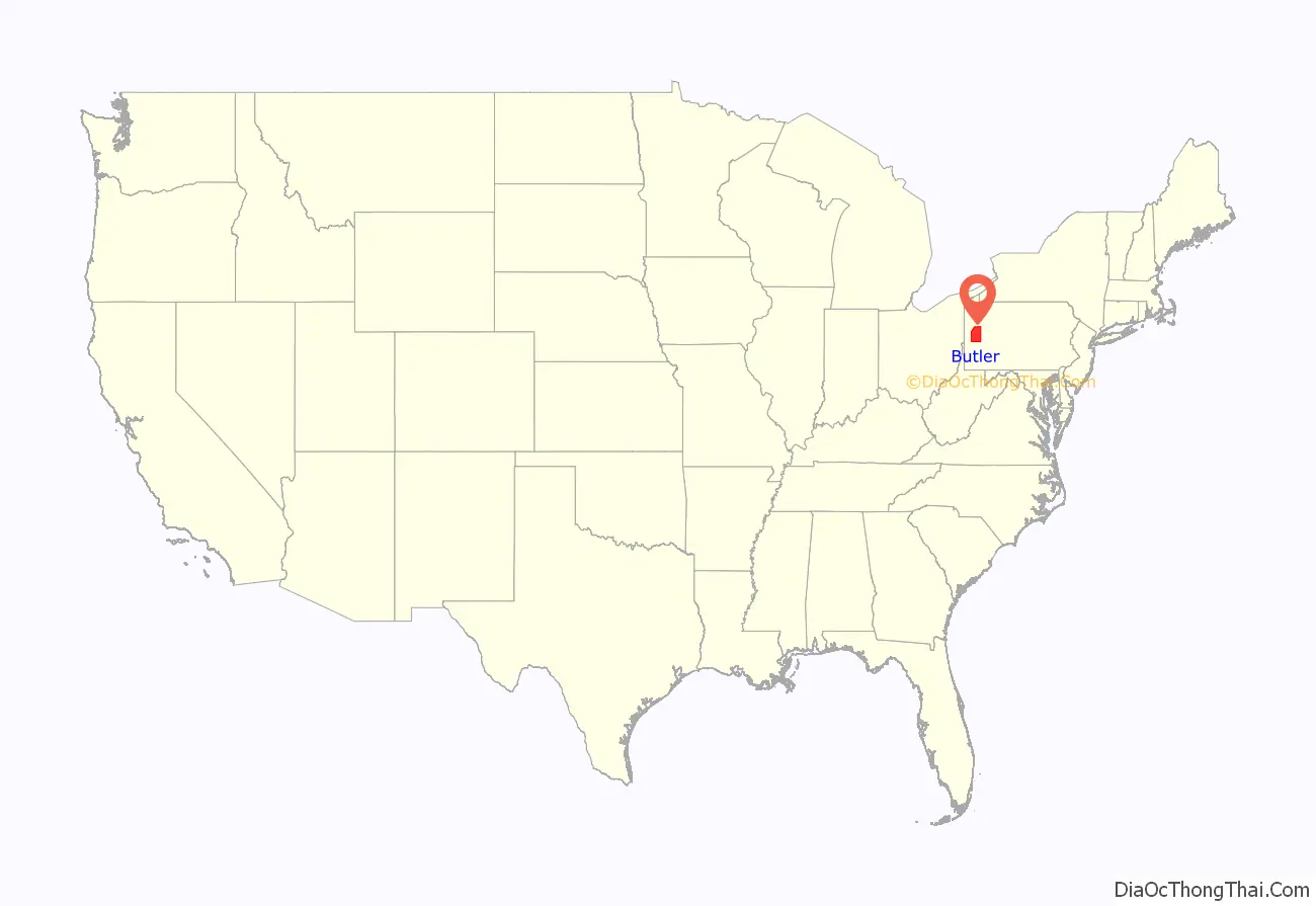
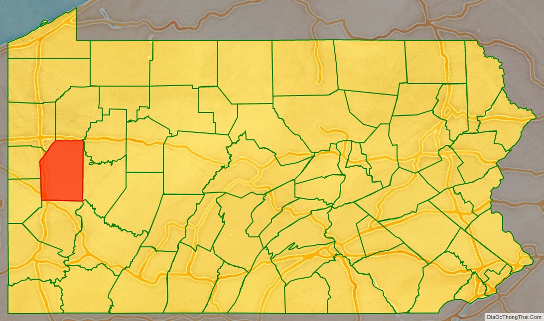
Butler County location map. Where is Butler County?
History
Some famous inventions and discoveries were made in Butler County. Saxonburg was founded as a Prussian colony by John A. Roebling, a civil engineer, and his brother Carl. After farming for a time, Roebling returned to engineering, and invented his revolutionary “wire rope.”, which he first produced at Saxonburg. He moved the operation to Trenton, New Jersey. He is best known for designing his most famous work, the Brooklyn Bridge, but designed and built numerous bridges in Pittsburgh and other cities as well.
At what is now known as Oil Creek, Butler County resident William Smith and Edwin Drake first proved oil could be tapped from underground for consistent supply. The Jeep was developed in Butler County by American Bantam in 1941.
Famous politicians have lived in and traveled through Butler County. U.S. Senator Walter Lowrie, the only senator from Butler, built a home in 1828 that still stands behind the Butler County Courthouse. The house has been adapted for use by the Butler County Historical Society. Butler’s highest-ranked federal official is William J. Perry, Secretary of Defense under President Bill Clinton from 1994 to 1997. He graduated from Butler High School in 1945.
George Washington passed through this area during the French and Indian War. In 1923, the funeral train of President Warren G. Harding passed through Butler County on its way to Washington D.C. John F. Kennedy spoke in front of the Butler County Courthouse during the 1960 United States presidential election. Hubert Humphrey also campaigned in Butler. In 2004, Vice President Dick Cheney spoke in Saxonburg to campaign for President George W. Bush in the 2004 United States presidential election. Donald Trump, while president, campaigned at the Butler County Airport in 2020.
Bret Michaels, lead singer of the rock band Poison, was born here in 1963.
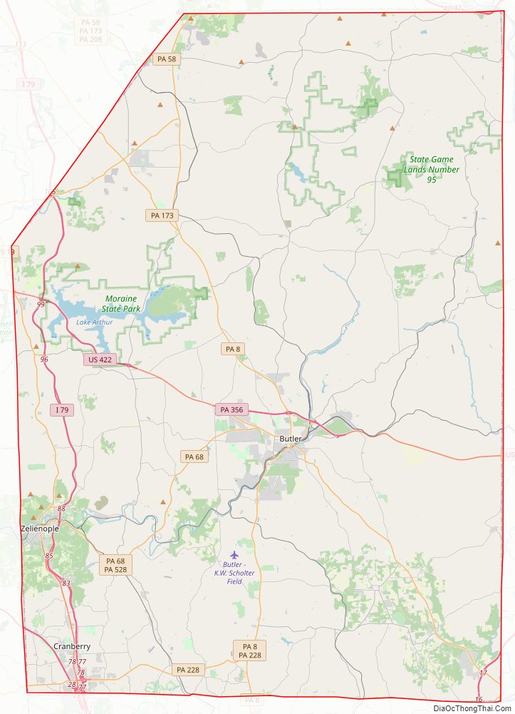
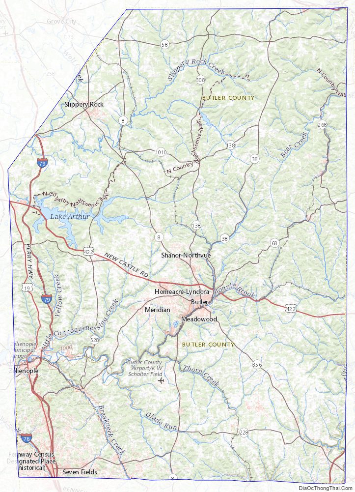
Butler County Road Map
Geography
According to the U.S. Census Bureau, the county has a total area of 795 square miles (2,060 km), of which 789 square miles (2,040 km) is land and 6.1 square miles (16 km) (0.8%) is water.
It is the location of Moraine State Park, with the 3,000-acre (12 km) glacial lake, Lake Arthur. Lake Arthur is used for fishing and sailing, and the surrounding park is used for hiking and hunting.
The county has a humid continental climate (Dfa/Dfb) and average monthly temperatures in Butler borough range from 27.7 °F in January to 72.1 °F in July. [1]
Waterways
- Allegheny River (The river touches Butler County at its northeast and southeast corners. It is both a recreational and industrial waterway.)
- Connoquenessing Creek (recreational canoeing and kayaking)
- Lake Arthur at Moraine State Park (recreational boating, canoeing and kayaking)
- Slippery Rock Creek (recreational canoeing and kayaking)
- Little Connoquenessing Creek
- Bull Creek
- Muddy Creek
- Sullivan Run
- Semiconon Run
- Mulligan Run
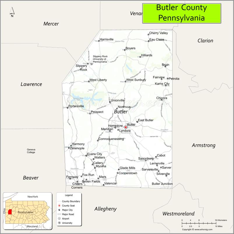
Adjacent counties
- Venango County (north)
- Clarion County (northeast)
- Armstrong County (east)
- Westmoreland County (southeast)
- Allegheny County (south)
- Beaver County (southwest)
- Lawrence County (west)
- Mercer County (northwest)
Butler County Topographic Map
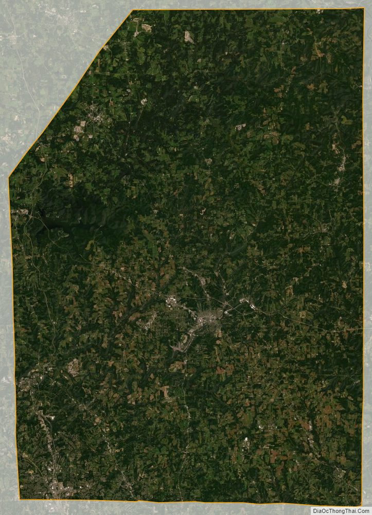
Butler County Satellite Map
Butler County Outline Map

See also
Map of Pennsylvania State and its subdivision:- Adams
- Allegheny
- Armstrong
- Beaver
- Bedford
- Berks
- Blair
- Bradford
- Bucks
- Butler
- Cambria
- Cameron
- Carbon
- Centre
- Chester
- Clarion
- Clearfield
- Clinton
- Columbia
- Crawford
- Cumberland
- Dauphin
- Delaware
- Elk
- Erie
- Fayette
- Forest
- Franklin
- Fulton
- Greene
- Huntingdon
- Indiana
- Jefferson
- Juniata
- Lackawanna
- Lancaster
- Lawrence
- Lebanon
- Lehigh
- Luzerne
- Lycoming
- Mc Kean
- Mercer
- Mifflin
- Monroe
- Montgomery
- Montour
- Northampton
- Northumberland
- Perry
- Philadelphia
- Pike
- Potter
- Schuylkill
- Snyder
- Somerset
- Sullivan
- Susquehanna
- Tioga
- Union
- Venango
- Warren
- Washington
- Wayne
- Westmoreland
- Wyoming
- York
- Alabama
- Alaska
- Arizona
- Arkansas
- California
- Colorado
- Connecticut
- Delaware
- District of Columbia
- Florida
- Georgia
- Hawaii
- Idaho
- Illinois
- Indiana
- Iowa
- Kansas
- Kentucky
- Louisiana
- Maine
- Maryland
- Massachusetts
- Michigan
- Minnesota
- Mississippi
- Missouri
- Montana
- Nebraska
- Nevada
- New Hampshire
- New Jersey
- New Mexico
- New York
- North Carolina
- North Dakota
- Ohio
- Oklahoma
- Oregon
- Pennsylvania
- Rhode Island
- South Carolina
- South Dakota
- Tennessee
- Texas
- Utah
- Vermont
- Virginia
- Washington
- West Virginia
- Wisconsin
- Wyoming