Callaway County is a county located in the U.S. state of Missouri. As of the 2020 United States Census, the county’s population was 44,283. Its county seat is Fulton. With a border formed by the Missouri River, the county was organized November 25, 1820, and named for Captain James Callaway, grandson of Daniel Boone. The county has been historically referred to as “The Kingdom of Callaway” after an incident in which some residents confronted Union troops during the U.S. Civil War.
Callaway County is part of the Jefferson City, Missouri, Metropolitan Statistical Area.
Vineyards and wineries were first established in the area by German immigrants in the mid-19th century. Among the first mentioned in county histories are those around the southeastern Callaway settlement of Heilburn, a community neighboring Portland, on the Missouri River. Since the 1960s, there has been a revival of winemaking there and throughout Missouri.
The Callaway Nuclear Generating Station is located in Callaway County, near Fulton.
| Name: | Callaway County |
|---|---|
| FIPS code: | 29-027 |
| State: | Missouri |
| Founded: | November 25, 1820 |
| Named for: | James Callaway |
| Seat: | Fulton |
| Largest city: | Fulton |
| Total Area: | 847 sq mi (2,190 km²) |
| Land Area: | 835 sq mi (2,160 km²) |
| Total Population: | 44,283 |
| Population Density: | 52/sq mi (20/km²) |
| Time zone: | UTC−6 (Central) |
| Summer Time Zone (DST): | UTC−5 (CDT) |
| Website: | callawaycounty.org |
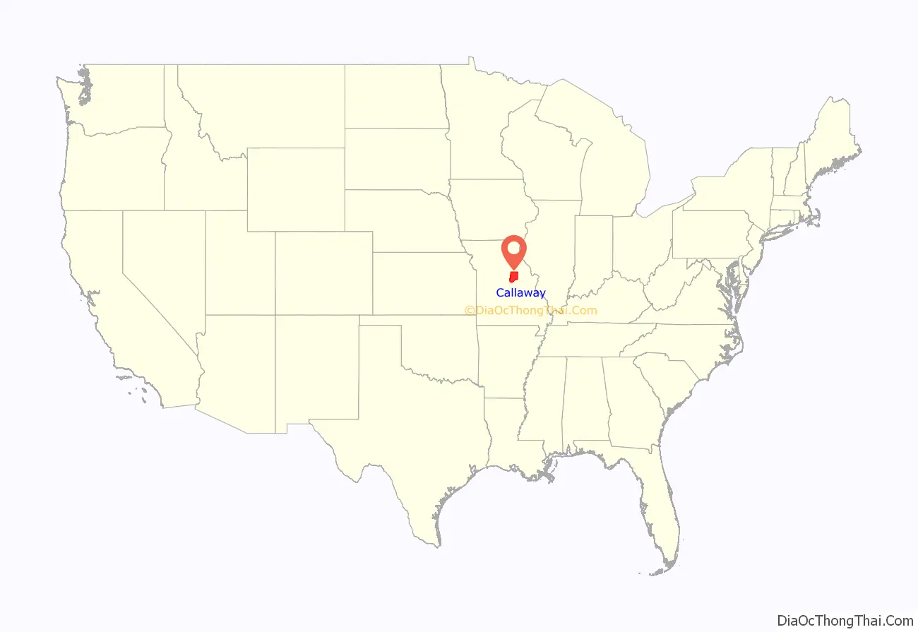
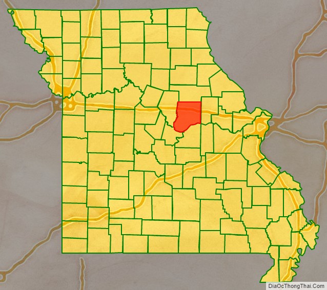
Callaway County location map. Where is Callaway County?
History
This area was historically occupied by the Osage and other Native American peoples, some of whom migrated from east of the Ohio River Valley. Others emerged as cultures in this area, following thousands of years of settlement by indigenous peoples.
The early European-American settlement of Callaway County was largely by migrants from the Upper South states of Virginia, Kentucky, and Tennessee, with an influx of German immigrants starting in the 1830s, as was the case with other counties along the Missouri River. Some of them brought black slaves and enslavement practices with them, and quickly started cultivating hemp and tobacco, the same crops as were grown in Middle Tennessee and Kentucky. Given their culture and traditions, this area became known as Little Dixie. By 1860, enslaved people made up at least 25 percent of the county’s population, higher than in most parts of the state.
On October 27, 1860, a woman known as “Slave Teney” was lynched by whites near Fulton after she confessed to killing the daughter of her owner.
Some pioneer families from Callaway and Lewis County, Missouri, moved to the West and became influential early settlers of the nascent state of California. Callaway families helped settle areas of California near the Oregon border, as they entered the state via the Oregon Trail, then southward toward San Francisco. Lewis County relatives helped build Sacramento and develop viticulture in the California Central Valley and areas north of San Francisco Bay. Some of these Missouri families, later key U.S./Unionist advocates and military personnel during the U.S. Civil War, held early local and statewide political offices in California.
The minutes of the U.S. Congressional hearing on the legitimacy of U.S. Civil-war-era elections in Callaway County include reports of substantial election meddling and voter harassment and intimidation, summarized in the 1867-68 Reports of Committees of the House of Representatives. It described the Confederate support in the county, citing prominent citizens, but the report also demonstrated that there was substantial county support for Union/U.S. government among citizens who were often intimidated into silence. Historians therefore cannot ascertain exact percentages of Union or Confederate sympathies in the county.
The Battle of Moore’s Mill was the only significant Civil War battle that took place in Callaway County. One historian said it was known as “Kingdom of Callaway”. A truce with U.S./Union forces during the war effectively allowed Confederate advocates to continue to operate under surveillance, in proximity to the Missouri government offices in Jefferson City. There may have been more than twice as many Confederate as U.S./Union troops in Callaway. A so-called “Confederate government of Missouri” set up offices in southwest Missouri near the Arkansas border, while a line almost straight south along the Arkansas-Oklahoma border connected it to a known Texas-affiliate (and possibly controlling) office set up across from the southwest corner of Arkansas in Marshall, Texas.
According to “A Short History of Callaway County” by Ovid Bell, the publisher of the (county seat) Fulton Daily Sun Gazette, “Fulton was occupied during the greater part of the war by Union soldiers and militia, and Southern (i.e. Confederate) sympathizers were in constant fear of imprisonment and death.” U.S. forces loyal to the Union were raised by Captains William T Snell, Henry Thomas, and JJP Johnson. They were reinforced by troops under General John B. Henderson from the town of Louisiana in Pike County, Missouri.
After the late-1860s Reconstruction era, an element of white residents in the state and county worked to restore white supremacy. Violence against Black people reached a peak around the turn of the 20th century, when whites lynched a total of four African Americans in the county. The victims included Ham Peterson in May 1884, killed because his brother spoke disrespectfully to whites; an unnamed African-American man killed by a mob in October 1884, after being accused of raping a young girl; and Emmett Divens, lynched August 15, 1895.
Other settlers in the Missouri River valley included German immigrants from the mid-19th century following the Revolutions of 1848 in the German states; they established a strong wine industry in the area and built towns with German-influenced architecture, concentrated substantially in counties south of Callaway and across the Missouri River, celebrated annually in the Maifest events in the Gasconade county seat, Hermann. Missouri was the second-largest wine-producing state nationally until Prohibition. Since the 1960s, numerous vineyards and wineries have been established again in the river valley, including Summit Lake Winery in Holts Summit. One definition of the Missouri Rhineland can be found in a Chicago Tribune article of September 2018.
Callaway has remained largely agricultural, economically, with its rich farmlands, yet borders Missouri’s capital city and Lincoln University (Missouri) in Cole County, to the south, and the main University of Missouri campus in Columbia, 40 miles or less from the most populous areas of the county. Callaway County has for years hosted William Woods University and Westminster College in the county seat, Fulton, while Osage county, to the south, hosts the State Technical College of Missouri in Linn.
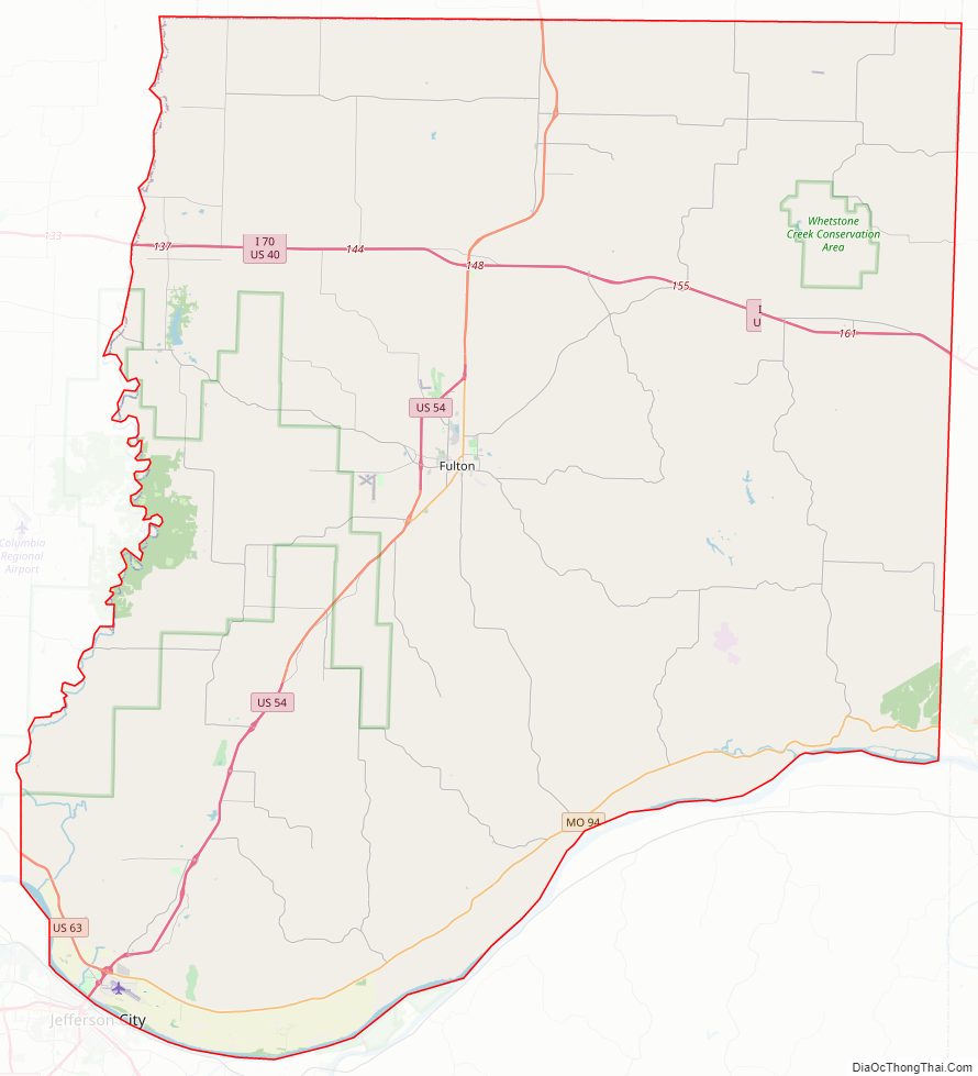
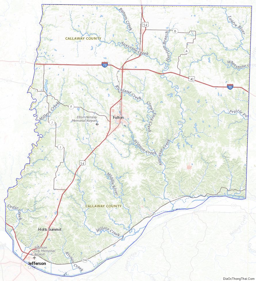
Callaway County Road Map
Geography
According to the U.S. Census Bureau, the county has a total area of 847 square miles (2,190 km), of which 835 square miles (2,160 km) is land and 13 square miles (34 km) (1.5%) is water.
The northern part of the county is relatively flat and devoid of large tracts of forests. The southern border of the county is the Missouri River, and the area is heavily forested over large hills and valleys. Cedar Creek makes up the bulk of the county’s western border. Jefferson City lies across the Missouri River from the southwestern corner of the county.
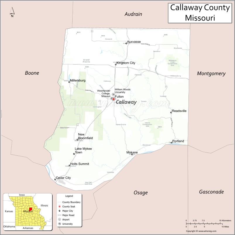
Adjacent counties
- Audrain County (north)
- Montgomery County (east)
- Osage County (south)
- Cole County (southwest)
- Boone County (west)
- Gasconade County (southeast)
Major highways
- Interstate 70
- U.S. Route 40
- U.S. Route 54
- U.S. Route 63
- Route 94
National protected areas
- Big Muddy National Fish and Wildlife Refuge (part)
- Mark Twain National Forest (part)
Callaway County Topographic Map
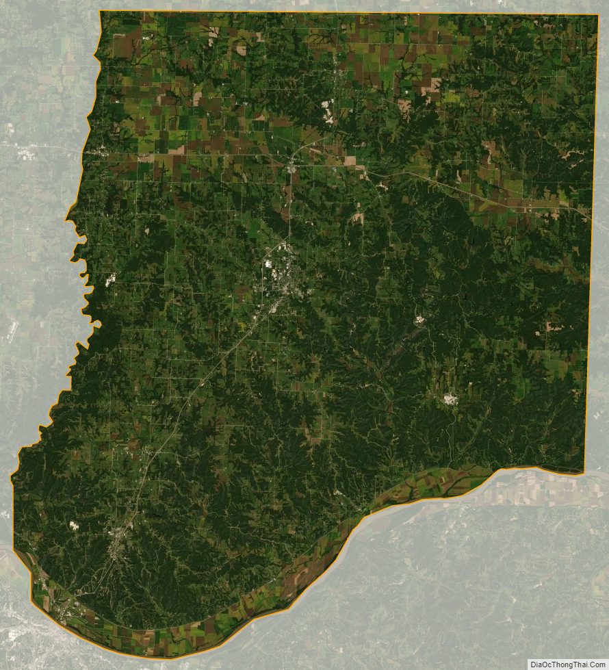
Callaway County Satellite Map
Callaway County Outline Map
See also
Map of Missouri State and its subdivision:- Adair
- Andrew
- Atchison
- Audrain
- Barry
- Barton
- Bates
- Benton
- Bollinger
- Boone
- Buchanan
- Butler
- Caldwell
- Callaway
- Camden
- Cape Girardeau
- Carroll
- Carter
- Cass
- Cedar
- Chariton
- Christian
- Clark
- Clay
- Clinton
- Cole
- Cooper
- Crawford
- Dade
- Dallas
- Daviess
- De Kalb
- Dent
- Douglas
- Dunklin
- Franklin
- Gasconade
- Gentry
- Greene
- Grundy
- Harrison
- Henry
- Hickory
- Holt
- Howard
- Howell
- Iron
- Jackson
- Jasper
- Jefferson
- Johnson
- Knox
- Laclede
- Lafayette
- Lawrence
- Lewis
- Lincoln
- Linn
- Livingston
- Macon
- Madison
- Maries
- Marion
- McDonald
- Mercer
- Miller
- Mississippi
- Moniteau
- Monroe
- Montgomery
- Morgan
- New Madrid
- Newton
- Nodaway
- Oregon
- Osage
- Ozark
- Pemiscot
- Perry
- Pettis
- Phelps
- Pike
- Platte
- Polk
- Pulaski
- Putnam
- Ralls
- Randolph
- Ray
- Reynolds
- Ripley
- Saint Charles
- Saint Clair
- Saint Francois
- Saint Louis
- Sainte Genevieve
- Saline
- Schuyler
- Scotland
- Scott
- Shannon
- Shelby
- Stoddard
- Stone
- Sullivan
- Taney
- Texas
- Vernon
- Warren
- Washington
- Wayne
- Webster
- Worth
- Wright
- Alabama
- Alaska
- Arizona
- Arkansas
- California
- Colorado
- Connecticut
- Delaware
- District of Columbia
- Florida
- Georgia
- Hawaii
- Idaho
- Illinois
- Indiana
- Iowa
- Kansas
- Kentucky
- Louisiana
- Maine
- Maryland
- Massachusetts
- Michigan
- Minnesota
- Mississippi
- Missouri
- Montana
- Nebraska
- Nevada
- New Hampshire
- New Jersey
- New Mexico
- New York
- North Carolina
- North Dakota
- Ohio
- Oklahoma
- Oregon
- Pennsylvania
- Rhode Island
- South Carolina
- South Dakota
- Tennessee
- Texas
- Utah
- Vermont
- Virginia
- Washington
- West Virginia
- Wisconsin
- Wyoming