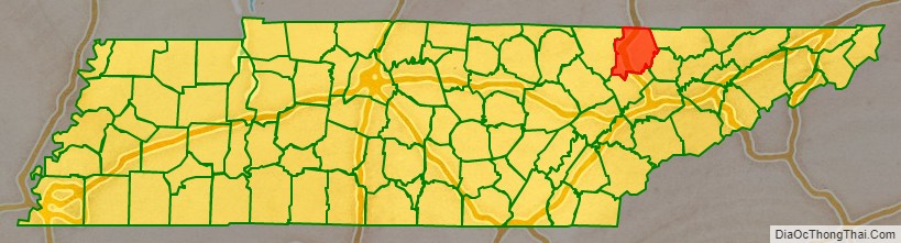
Campbell County is a county in the U.S. state of Tennessee. It is located on the state’s northern border in East Tennessee. As of the 2020 census, its population was 39,272. Its county seat is Jacksboro. Campbell County is included in the Knoxville metropolitan statistical area.
| Name: | Campbell County |
|---|---|
| FIPS code: | 47-013 |
| State: | Tennessee |
| Founded: | September 11, 1806 |
| Named for: | Arthur Campbell |
| Seat: | Jacksboro |
| Largest city: | LaFollette |
| Total Area: | 498 sq mi (1,290 km²) |
| Land Area: | 480 sq mi (1,200 km²) |
| Total Population: | 39,272 |
| Population Density: | 81.82/sq mi (31.59/km²) |
| Time zone: | UTC−5 (Eastern) |
| Summer Time Zone (DST): | UTC−4 (EDT) |
| Website: | www.campbellcountytn.gov |
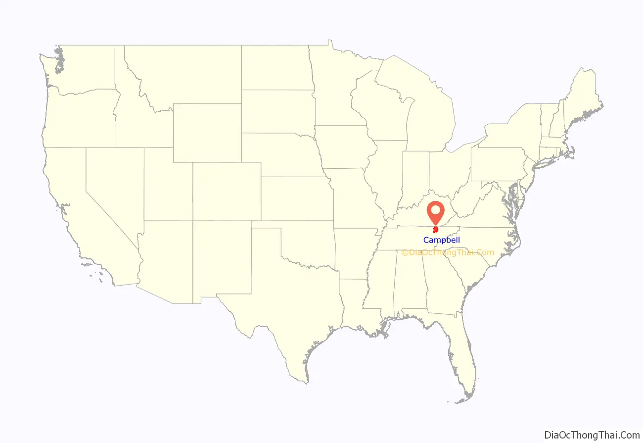
Campbell County location map. Where is Campbell County?
History
Campbell County was formed in 1806 from parts of Anderson and Claiborne Counties. It was named in honor of Colonel Arthur Campbell (1743–1811), a member of the Virginia House of Burgesses and an officer during the American Revolutionary War.
New Mammoth Cave, located in Elk Valley, just west of Jellico, was mined for saltpeter (the main ingredient of gunpowder) during the War of 1812. This cave possibly was also mined during the Civil War. In 1921, the cave was developed as a tourist attraction and was open to the public until at least 1928. Today, New Mammoth Cave is securely gated by the U.S. Fish and Wildlife Service. It is protected as a sanctuary for bats, including the federally endangered Indiana bat.
During the Civil War, the county’s sympathies were predominantly with the Union. On June 8, 1861, voters in Campbell County rejected Tennessee’s Ordinance of Secession by a vote of 1,094 to 60. On August 1, 1861, Campbell County became the first Tennessee county to form a Union Army unit for the Civil War, organizing Company B of the 1st Tennessee Infantry at Jacksboro.
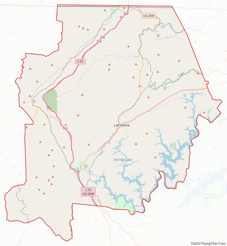
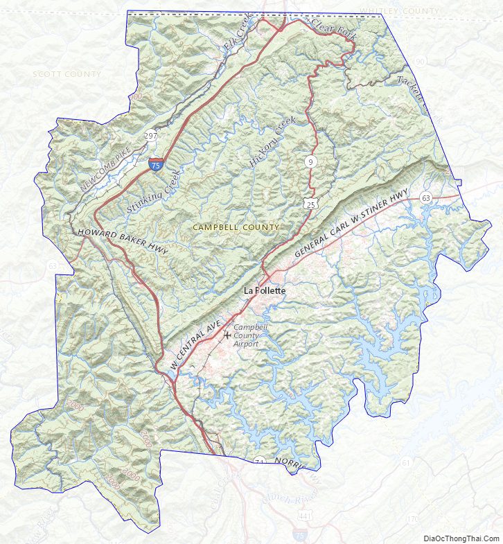
Campbell County Road Map
Geography
According to the U.S. Census Bureau, the county has a total area of 498 sq mi (1,290 km), of which 480 sq mi (1,200 km) are land and 18 sq mi (47 km) (3.6%) are covered by water.
Campbell County is situated in a geological border region between the Cumberland Mountains in the northwest and the Appalachian Ridge-and-Valley Range in the southeast. This border area is characterized by several large, elongated ridges, namely Cross Mountain in the west and Cumberland Mountain, Walnut Mountain, and Pine Mountain to the north. Ivydale, situated in the Cumberland Mountains region, is the exact geographical center of Campbell County. Elevations vary widely across the county, ranging from 3,534 ft (1,077 m) at Cross Mountain to slightly less than 1,000 ft (300 m) a few miles away at Norris Lake. Norris Lake— an artificial reservoir created by the Tennessee Valley Authority in the 1930s— is the main body of water in the region. It is fed by the Clinch and Powell Rivers, as well as several large creeks, most notably Davis Creek, Big Creek, and Cove Creek. Cove Creek also feeds the much smaller Cove Lake— a recreational lake built by TVA in the 1930s as part of the Norris project— which is located near Caryville.
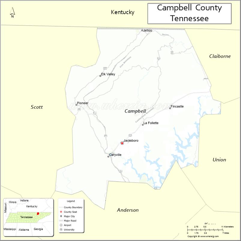
Most of the county’s residents live in the southern half of the county, where La Follette, Jacksboro, and Caryville are located. Jellico, located along the Tennessee-Kentucky border, is the most notable populated area in the county’s plateau section.
Portions of the county north of Walnut Mountain are part of the Cumberland River watershed. Portions of the county south of Walnut Mountain are part of the Tennessee River watershed. In the northwestern part of the county, a large valley, known as Elk Valley, runs from southwest to northeast, from Pioneer to Jellico.
Adjacent counties
- Whitley County, Kentucky (north)
- Claiborne County (east)
- Union County (southeast)
- Anderson County (south)
- Scott County (west)
- McCreary County, Kentucky (northwest)
State-protected areas
- Chuck Swan State Forest (part)
- Cove Creek Wildlife Management Area
- Cove Lake State Park
- Cumberland Trail (part)
- Indian Mountain State Park
- Norris Dam State Park (part)
- North Cumberland Wildlife Management Area (part)
Campbell County Topographic Map
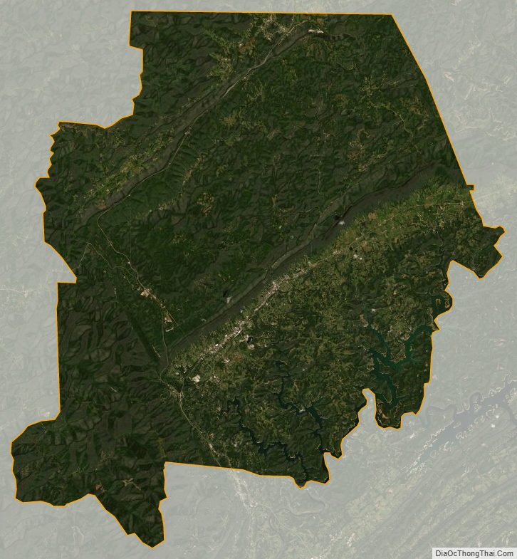
Campbell County Satellite Map
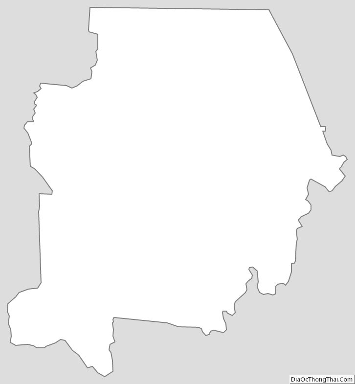
Campbell County Outline Map
See also
Map of Tennessee State and its subdivision:- Anderson
- Bedford
- Benton
- Bledsoe
- Blount
- Bradley
- Campbell
- Cannon
- Carroll
- Carter
- Cheatham
- Chester
- Claiborne
- Clay
- Cocke
- Coffee
- Crockett
- Cumberland
- Davidson
- Decatur
- DeKalb
- Dickson
- Dyer
- Fayette
- Fentress
- Franklin
- Gibson
- Giles
- Grainger
- Greene
- Grundy
- Hamblen
- Hamilton
- Hancock
- Hardeman
- Hardin
- Hawkins
- Haywood
- Henderson
- Henry
- Hickman
- Houston
- Humphreys
- Jackson
- Jefferson
- Johnson
- Knox
- Lake
- Lauderdale
- Lawrence
- Lewis
- Lincoln
- Loudon
- Macon
- Madison
- Marion
- Marshall
- Maury
- McMinn
- McNairy
- Meigs
- Monroe
- Montgomery
- Moore
- Morgan
- Obion
- Overton
- Perry
- Pickett
- Polk
- Putnam
- Rhea
- Roane
- Robertson
- Rutherford
- Scott
- Sequatchie
- Sevier
- Shelby
- Smith
- Stewart
- Sullivan
- Sumner
- Tipton
- Trousdale
- Unicoi
- Union
- Van Buren
- Warren
- Washington
- Wayne
- Weakley
- White
- Williamson
- Wilson
- Alabama
- Alaska
- Arizona
- Arkansas
- California
- Colorado
- Connecticut
- Delaware
- District of Columbia
- Florida
- Georgia
- Hawaii
- Idaho
- Illinois
- Indiana
- Iowa
- Kansas
- Kentucky
- Louisiana
- Maine
- Maryland
- Massachusetts
- Michigan
- Minnesota
- Mississippi
- Missouri
- Montana
- Nebraska
- Nevada
- New Hampshire
- New Jersey
- New Mexico
- New York
- North Carolina
- North Dakota
- Ohio
- Oklahoma
- Oregon
- Pennsylvania
- Rhode Island
- South Carolina
- South Dakota
- Tennessee
- Texas
- Utah
- Vermont
- Virginia
- Washington
- West Virginia
- Wisconsin
- Wyoming