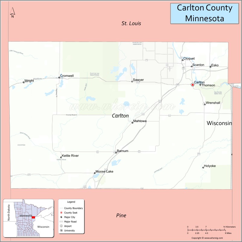
Carlton County is a county in the State of Minnesota, formed in 1857. As of the 2020 census, the population was 36,207. Its county seat is Carlton. Part of the Fond du Lac Indian Reservation lies in northeastern Carlton County.
Carlton County is part of the Duluth, MN-WI Metropolitan Statistical Area.
| Name: | Carlton County |
|---|---|
| FIPS code: | 27-017 |
| State: | Minnesota |
| Founded: | May 23, 1857 (created) 1870 (organized) |
| Named for: | Reuben B. Carlton |
| Seat: | Carlton |
| Largest city: | Cloquet |
| Total Area: | 875 sq mi (2,270 km²) |
| Land Area: | 861 sq mi (2,230 km²) |
| Total Population: | 36,207 |
| Population Density: | 42.1/sq mi (16.3/km²) |
| Time zone: | UTC−6 (Central) |
| Summer Time Zone (DST): | UTC−5 (CDT) |
| Website: | www.co.carlton.mn.us |
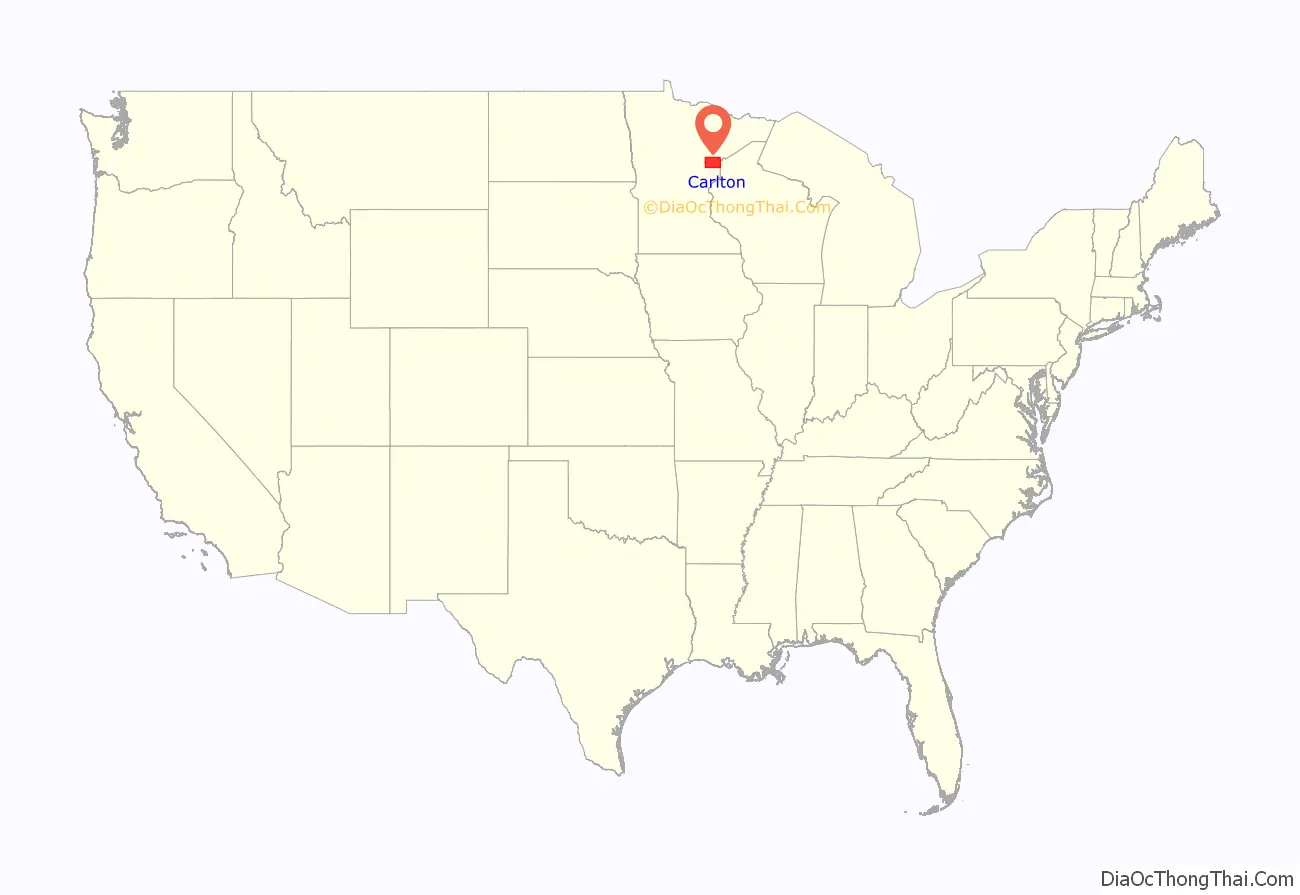
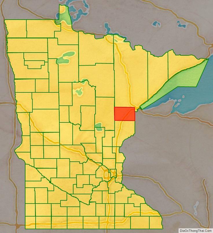
Carlton County location map. Where is Carlton County?
History
Under a 1854 Treaty of La Pointe the Fond du Lac Indian Reservation and other reservations were established in exchange for all the Lake Superior Ojibwe land in the Arrowhead Region. Carlton County was formed and organized in 1870. It was named for Reuben B. Carlton, a member of the Minnesota Senate (1857–58).
In October 1918, an immense forest fire occurred, known as the Cloquet Fire. The Carlton County Historical Society hosts a permanent exhibit about the fire of 1918, along with ones about the Ojibwe of Carlton County and the Logging Era.
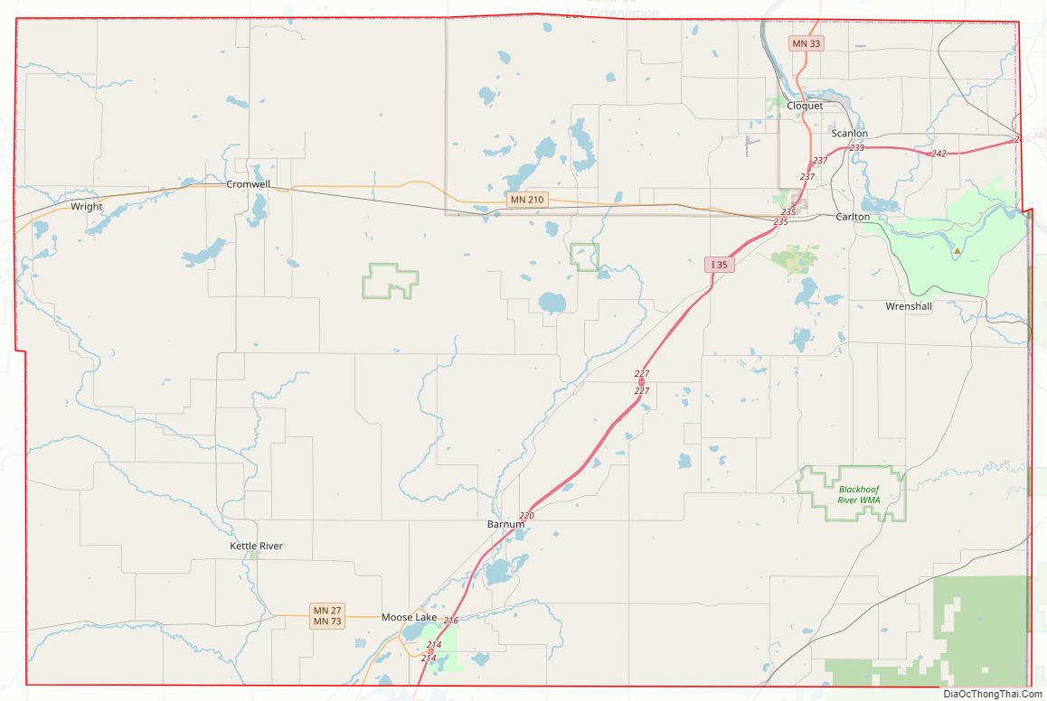
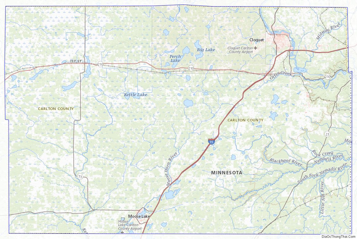
Carlton County Road Map
Geography
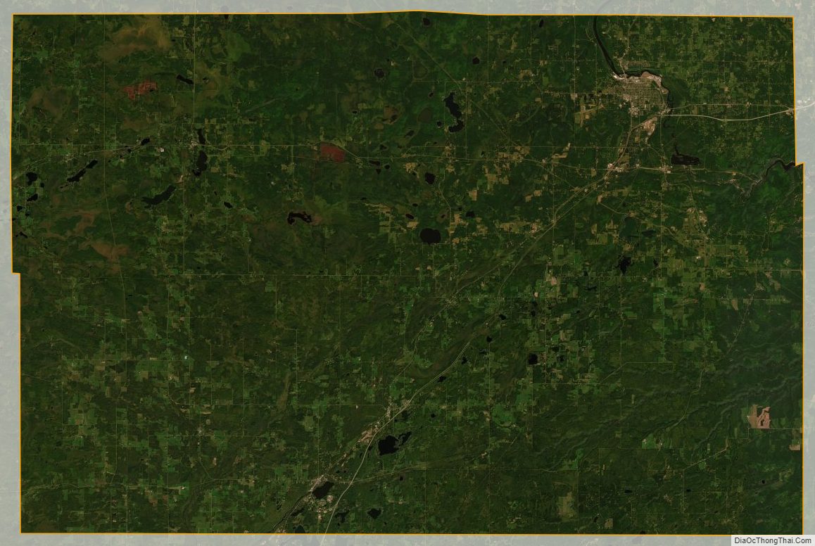
Carlton County lies on Minnesota’s eastern edge. Its eastern boundary abuts Wisconsin. The Saint Louis River flows east-southeast through the county, discharging into Lake Superior. The Moose Horn River flows southwest through the county, discharging into the Kettle River. The Nemadji River and the South Fork Nemadji River flow east through the county, meeting a few miles east of its eastern boundary before reaching Lake Superior. The county terrain consists of low rolling hills, heavily wooded, and slopes to the several river valleys. The county’s northwest corner lies at 1,329′ (405m) ASL, and a small hill 0.2 miles (0.35 km) west of Rogers Lake rises to 1,450′ (442m) ASL.
The county has an area of 875 square miles (2,270 km), of which 861 square miles (2,230 km) is land and 14 square miles (36 km) (1.6%) is water.
Major highways
- Interstate 35
- Minnesota State Highway 23
- Minnesota State Highway 27
- Minnesota State Highway 33
- Minnesota State Highway 45
- Minnesota State Highway 73
- Minnesota State Highway 210
- Minnesota State Highway 289
Adjacent counties
- Saint Louis County – north
- Douglas County, Wisconsin – east
- Pine County – south
- Aitkin County – west
Protected areas
- Black Hoof Wildlife Management Area
- Dye State Wildlife Management Area
- Fond du Lac State Forest (part)
- Jay Cooke State Park
- Kettle Lake State Wildlife Management Area
- Nemadji State Forest (part)
- Sawyer State Wildlife Management Area
Carlton County Topographic Map
Carlton County Satellite Map
Carlton County Outline Map

See also
Map of Minnesota State and its subdivision:- Aitkin
- Anoka
- Becker
- Beltrami
- Benton
- Big Stone
- Blue Earth
- Brown
- Carlton
- Carver
- Cass
- Chippewa
- Chisago
- Clay
- Clearwater
- Cook
- Cottonwood
- Crow Wing
- Dakota
- Dodge
- Douglas
- Faribault
- Fillmore
- Freeborn
- Goodhue
- Grant
- Hennepin
- Houston
- Hubbard
- Isanti
- Itasca
- Jackson
- Kanabec
- Kandiyohi
- Kittson
- Koochiching
- Lac qui Parle
- Lake
- Lake of the Woods
- Lake Superior
- Le Sueur
- Lincoln
- Lyon
- Mahnomen
- Marshall
- Martin
- McLeod
- Meeker
- Mille Lacs
- Morrison
- Mower
- Murray
- Nicollet
- Nobles
- Norman
- Olmsted
- Otter Tail
- Pennington
- Pine
- Pipestone
- Polk
- Pope
- Ramsey
- Red Lake
- Redwood
- Renville
- Rice
- Rock
- Roseau
- Saint Louis
- Scott
- Sherburne
- Sibley
- Stearns
- Steele
- Stevens
- Swift
- Todd
- Traverse
- Wabasha
- Wadena
- Waseca
- Washington
- Watonwan
- Wilkin
- Winona
- Wright
- Yellow Medicine
- Alabama
- Alaska
- Arizona
- Arkansas
- California
- Colorado
- Connecticut
- Delaware
- District of Columbia
- Florida
- Georgia
- Hawaii
- Idaho
- Illinois
- Indiana
- Iowa
- Kansas
- Kentucky
- Louisiana
- Maine
- Maryland
- Massachusetts
- Michigan
- Minnesota
- Mississippi
- Missouri
- Montana
- Nebraska
- Nevada
- New Hampshire
- New Jersey
- New Mexico
- New York
- North Carolina
- North Dakota
- Ohio
- Oklahoma
- Oregon
- Pennsylvania
- Rhode Island
- South Carolina
- South Dakota
- Tennessee
- Texas
- Utah
- Vermont
- Virginia
- Washington
- West Virginia
- Wisconsin
- Wyoming