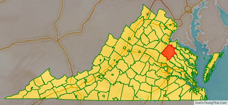
Caroline County is a United States county located in the eastern part of the Commonwealth of Virginia. The northern boundary of the county borders on the Rappahannock River, notably at the historic town of Port Royal. The Caroline county seat is Bowling Green.
Caroline County was established in 1728 and was named in honor of the British queen Caroline of Ansbach. Developed in the colonial and antebellum years for tobacco and later mixed crops, worked by generations of enslaved African Americans, such agriculture gradually became less important. In the 20th century it was known for thoroughbred horse farms. It is the birthplace of the renowned racehorse Secretariat, winner of the 1973 Triple Crown: the Kentucky Derby, Preakness Stakes and Belmont Stakes.
As of the 2020 census, the county population was 30,887. It has doubled in the last fifty years. Caroline is now considered part of the Greater Richmond Region and benefited by suburban and related development.
| Name: | Caroline County |
|---|---|
| FIPS code: | 51-033 |
| State: | Virginia |
| Founded: | 1727 |
| Named for: | Caroline of Ansbach |
| Seat: | Bowling Green |
| Largest town: | Bowling Green |
| Total Area: | 537 sq mi (1,390 km²) |
| Land Area: | 528 sq mi (1,370 km²) |
| Total Population: | 30,887 |
| Population Density: | 58/sq mi (22/km²) |
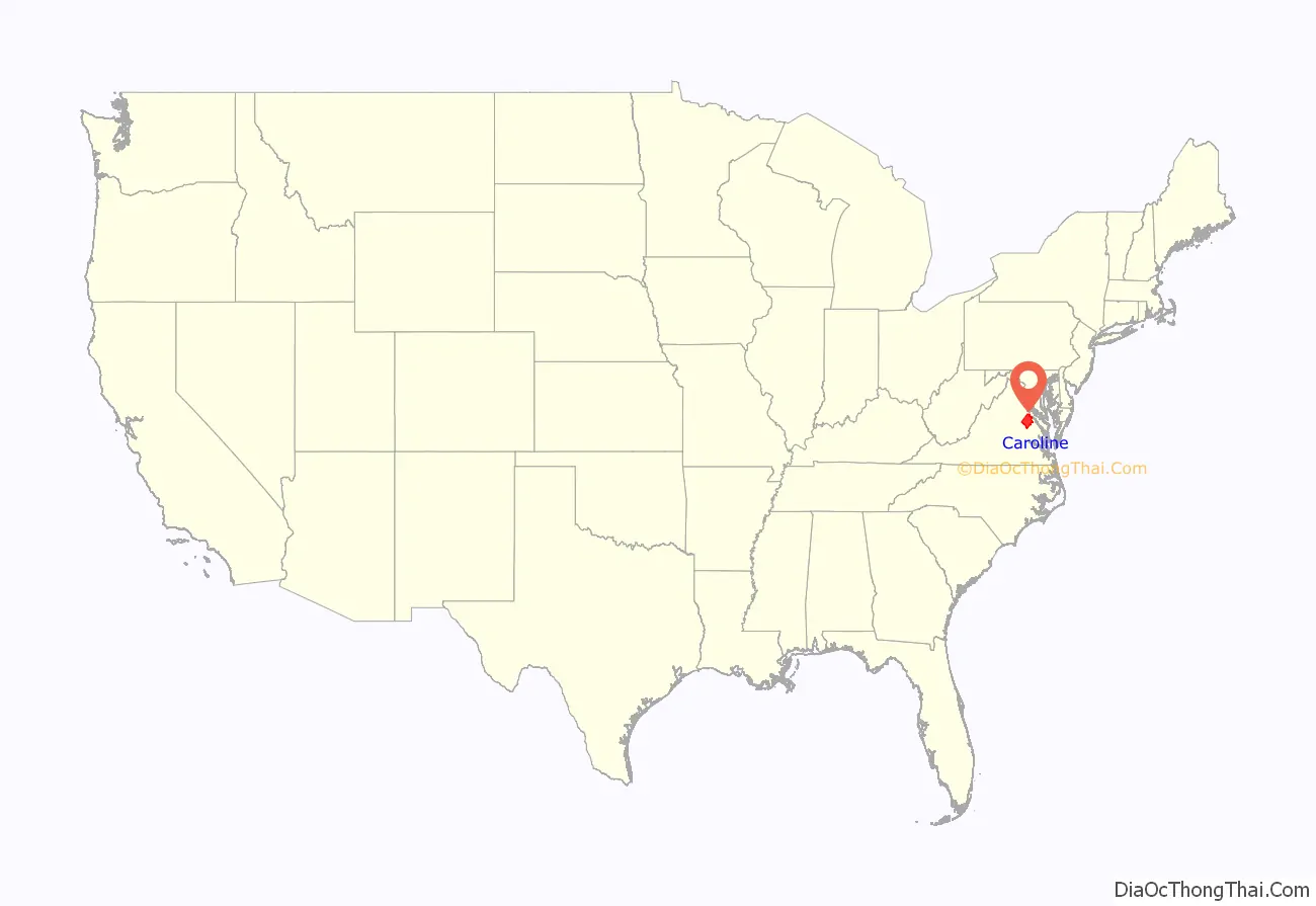
Caroline County location map. Where is Caroline County?
History
Founding, and colonial era
Caroline County was established in the British Colony of Virginia in 1727 from parts of Essex, King and Queen, and King William counties. It was named for the new queen of Great Britain, Caroline of Ansbach.
During the Colonial Period, Caroline County was the birthplace of thoroughbred horse racing in North America. Arabian horses were imported from England to provide the basis for American breeding stock. The economy was based on tobacco cultivation as a commodity crop, and later mixed crops, much of which was worked by enslaved Africans and African Americans into the antebellum period.
The planter elite of Virginia became active in seeking independence from Great Britain. Patriot Edmund Pendleton played a large role in the Virginia Resolution for Independence (1775). Caroline native John Penn, who later lived in and represented North Carolina as a delegate, was a signer of the Declaration of Independence, albeit as a delegate from North Carolina.
19th century
Explorers William Clark and his slave York were members of the Lewis and Clark Expedition (1803–1805), commissioned by President Thomas Jefferson to explore the newly acquired Louisiana Purchase area west of the Mississippi River. William’s older brother, General George Rogers Clark, was considered a conqueror of the old Northwest Territory and a Revolutionary War hero. Both were born near what is now Ladysmith.
In 1847, after being a member of the first graduating class of Virginia Military Institute (VMI), William “Little Billy” Mahone (1826–1895) of Southampton County began teaching at Rappahannock Academy in Caroline County. He was to become prominent as a railroad builder and developer, Confederate general, leader of Virginia’s short-lived Readjuster Party, and a United States Senator.
On May 10, 1863, Confederate Lieutenant General Thomas “Stonewall” Jackson died of complications from pneumonia at the Chandler plantation in Guinea Station (also known as Guiney’s Station), in the unincorporated Caroline County community of Woodford. The Chandler residence has been preserved and is now known as the “Jackson Shrine.”
During the American Civil War, Union General Ulysses S. Grant’s Overland Campaign, Confederate troops under General George E. Pickett fought Union troops near Milford. Just as the Civil War was concluding in April 1865, President Lincoln was assassinated in Washington, D.C., as part of a conspiracy to kill the leaders of the United States. As the conspirators fled, a manhunt was launched. After 10 days, in the wee hours of April 26, federal troops tracked down John Wilkes Booth, Lincoln’s assassin, and fellow conspirator David E. Herold at Garrett’s farm about 3 miles west of Port Royal. Booth was fatally shot during their capture by federal troops. Herold was returned to Washington, where he was executed by hanging with 3 co-conspirators on July 7, 1865.
20th century
While racial segregation was the law under Jim Crow, in many small communities, residents made friendships across racial lines. In 1958, Richard Loving and Mildred Jeter decided to marry. They went to Washington, D.C., but returned to their home in Central Point in this county. Living as a married interracial couple, they challenged state miscegenation laws. They were soon arrested and charged under the state’s anti-miscegenation statute, the Racial Integrity Act of 1924. Forced to leave the state to avoid jail, they lived in Washington, D.C., for years but wanted to return home; they filed suit against the state’s law. Their case reached the Supreme Court of the United States on appeal, which in 1967 found anti-miscegenation statutes to be unconstitutional in Loving v. Virginia, based on violating due process and equal rights under the law.
At the southern edge of the county, The Meadow, a plantation originally established in 1810, became a premier facility in the 20th century for breeding, raising and training Thoroughbred race horses. In 1972, Riva Ridge, raised and trained at The Meadow, won the Kentucky Derby and the Belmont Stakes, two of the three events of the Triple Crown. In 1973 Secretariat, born at The Meadow, won the Triple Crown for the Chenery family’s Meadow Stable.
21st century
In 2003, The State Fair of Virginia purchased Meadow Farm for development as a new site for the annual Virginia State Fair. Long held at locations in the capital of Richmond and Henrico County, the fair was increasingly squeezed out by expanding development around it and the growth of the event. Before development of Meadow Farm, it was held at Strawberry Hill in central Henrico County, at the facility which later became the Richmond International Raceway.
Beginning in September 2009, the annual Virginia State Fair has been held at the new Meadow Event Park in Caroline County. The annual Meadow Celtic Games and Festival (formerly Richmond Celtic Games and Festival) will also be held at the new facility.
In 2009 the National Civic League presented Caroline County with one of ten annual All-America City Awards.
Caroline County Road Map
Geography
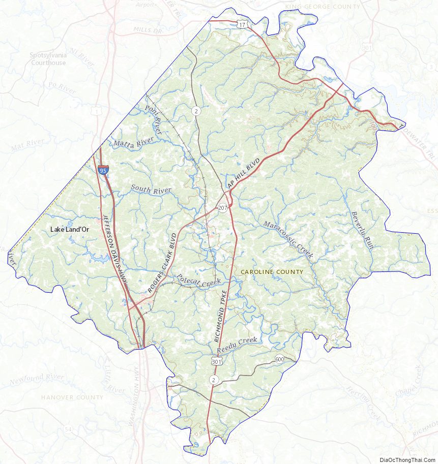
According to the U.S. Census Bureau, the county has a total area of 537 square miles (1,390 km), of which 528 square miles (1,370 km) is land and 9 square miles (23 km) (1.7%) is water. Caroline County is 30 miles (48 km) north of the capital in Richmond and 32 miles (51 km) south of Fredericksburg.
Caroline County is bounded on the north by Spotsylvania and King George counties; on the south by Hanover County; on the east by King William, King and Queen, and Essex counties; and on the west by Spotsylvania County.
The county is home to a quarry that has proved a rich source of pre-historic whale and shark skeletons. The whole county is located in what was in ancient times land under an ocean. It is known to paleontologists as the middle Miocene Calvert Formation of Virginia. A whale skeleton discovered there in 1990 was proved to be a new whale species (see Eobalaenoptera harrisoni).
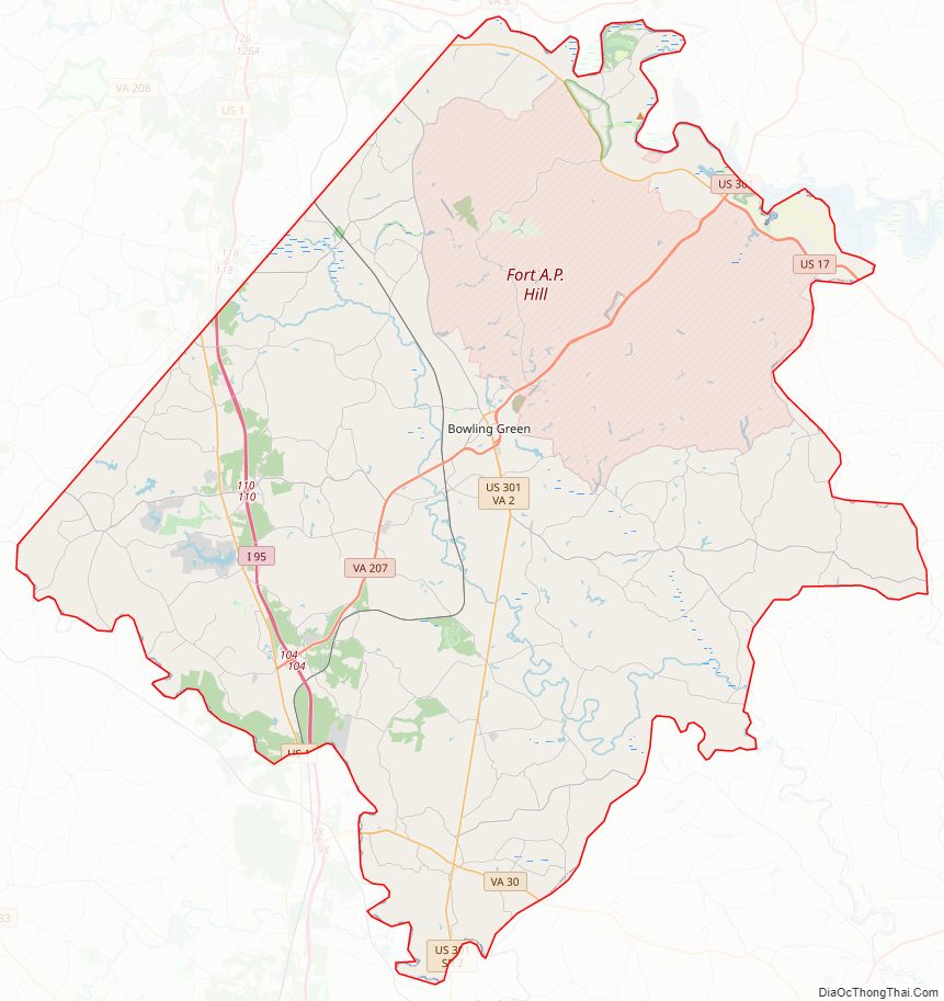
Caroline County is served by Interstate 95, US 1 and US 301. These three routes are important for inter-regional travel.
Adjacent counties
- King George County – north
- Hanover County – south
- King William County – east
- King and Queen County – east
- Essex County – east
- Spotsylvania County – northwest
Major highways
- I-95, the major north–south highway on the Eastern Seaboard runs through Caroline County. Exits 104 and 110 are located in the county and provide numerous motorist services. A pair of rest areas are located between the two interchanges at Milepost 108.
- US 1, a principal route connecting Richmond, Petersburg, and beyond enters Caroline County after the North Anna River Bridge. The road is known locally as Jefferson Davis Highway, and George Washington Boulevard, depending on which communities it runs through. The road is a four-lane, undivided highway with occasional left turn lanes and dividers at many intersections. It runs through Chandler Crossing, Ruther Glen, Golansville, Ladysmith, Ryland Corner, Cedon, and Ann Wrights Corner, before crossing into the Spotsylvania County Line.
- US 17, a principal route connecting the Hampton Road area with Fredericksburg as it runs through Caroline County along close proximity to the Rappahannock River. The road is known locally as Tidewater Trail. U.S. 17 is a four-lane, divided highway until it reaches Port Royal Crossroads, and becomes a four-lane undivided highway. Dividers briefly return at the intersection with US 301, and then the road becomes a two-lane highway throughout the rest of the county before crossing into Spotsylvania County.
- US 301, a principal route connecting Richmond, Petersburg, and beyond enters Caroline County shortly after crossing a bridge over the Pamunkey River. The road is known locally as Richmond Turnpike for points south of the Bowling Green Bypass and as A.P. Hill Boulevard north of the bypass, and Main Street north of US 17 until it crosses the bridge over the Rappahannock River. The road is a two-lane undivided highway until reaching Antioch Forks, where it becomes a four-lane divided highway almost entirely throughout the county. U.S. 301 runs winds through Fort A.P. Hill until approaching Port Royal Crossroads at US 17, where the divider ends as it becomes Main Street until the bridge over the Rappahannock.
- SR 2, a south-to-north state route that runs concurrent with US 301 until Bowling Green. North of the Bowling Green Bypass it becomes Main Street, and north of the town limits, it becomes Fredericksburg Turnpike, until it crosses the Spotsylvania County Line.
- SR 30, a west to east state route that winds through southern Caroline County as Dawn Boulevard. It enters the county from Doswell in Hanover County and crosses the King William county line before entering Calno.
- SR 207, a major state route that runs from Ruther Glen to Bowling Green 11.93 miles (19.20 km) and connects US 1 and I-95 to US 301. The road is known for most of its length as Rogers Clark Boulevard, until it moves onto the Bowling Green Bypass.
National protected area
- Rappahannock River Valley National Wildlife Refuge (part) Port Royal unit
Caroline County Topographic Map
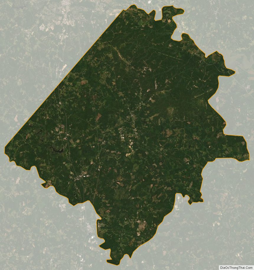
Caroline County Satellite Map
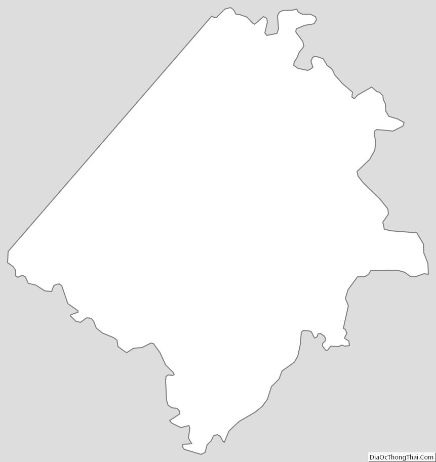
Caroline County Outline Map
See also
Map of Virginia State and its subdivision:- Accomack
- Albemarle
- Alexandria
- Alleghany
- Amelia
- Amherst
- Appomattox
- Arlington
- Augusta
- Bath
- Bedford
- Bedford City
- Bland
- Botetourt
- Bristol
- Brunswick
- Buchanan
- Buckingham
- Buena Vista
- Campbell
- Caroline
- Carroll
- Charles City
- Charlotte
- Charlottesville
- Chesapeake
- Chesterfield
- Clarke
- Clifton Forge City
- Colonial Heights
- Covington
- Craig
- Culpeper
- Cumberland
- Danville
- Dickenson
- Dinwiddie
- Emporia
- Essex
- Fairfax
- Fairfax City
- Falls Church
- Fauquier
- Floyd
- Fluvanna
- Franklin
- Frederick
- Fredericksburg
- Galax
- Giles
- Gloucester
- Goochland
- Grayson
- Greene
- Greensville
- Halifax
- Hampton
- Hanover
- Harrisonburg
- Henrico
- Henry
- Highland
- Hopewell
- Isle of Wight
- James City
- King and Queen
- King George
- King William
- Lancaster
- Lee
- Lexington
- Loudoun
- Louisa
- Lunenburg
- Lynchburg
- Madison
- Manassas
- Manassas Park
- Martinsville
- Mathews
- Mecklenburg
- Middlesex
- Montgomery
- Nelson
- New Kent
- Newport News
- Norfolk
- Northampton
- Northumberland
- Norton
- Nottoway
- Orange
- Page
- Patrick
- Petersburg
- Pittsylvania
- Poquoson
- Portsmouth
- Powhatan
- Prince Edward
- Prince George
- Prince William
- Pulaski
- Radford
- Rappahannock
- Richmond
- Roanoke
- Roanoke City
- Rockbridge
- Rockingham
- Russell
- Salem
- Scott
- Shenandoah
- Smyth
- Southampton
- Spotsylvania
- Stafford
- Staunton
- Suffolk
- Surry
- Sussex
- Tazewell
- Virginia Beach
- Warren
- Washington
- Waynesboro
- Westmoreland
- Williamsburg
- Winchester
- Wise
- Wythe
- York
- Alabama
- Alaska
- Arizona
- Arkansas
- California
- Colorado
- Connecticut
- Delaware
- District of Columbia
- Florida
- Georgia
- Hawaii
- Idaho
- Illinois
- Indiana
- Iowa
- Kansas
- Kentucky
- Louisiana
- Maine
- Maryland
- Massachusetts
- Michigan
- Minnesota
- Mississippi
- Missouri
- Montana
- Nebraska
- Nevada
- New Hampshire
- New Jersey
- New Mexico
- New York
- North Carolina
- North Dakota
- Ohio
- Oklahoma
- Oregon
- Pennsylvania
- Rhode Island
- South Carolina
- South Dakota
- Tennessee
- Texas
- Utah
- Vermont
- Virginia
- Washington
- West Virginia
- Wisconsin
- Wyoming