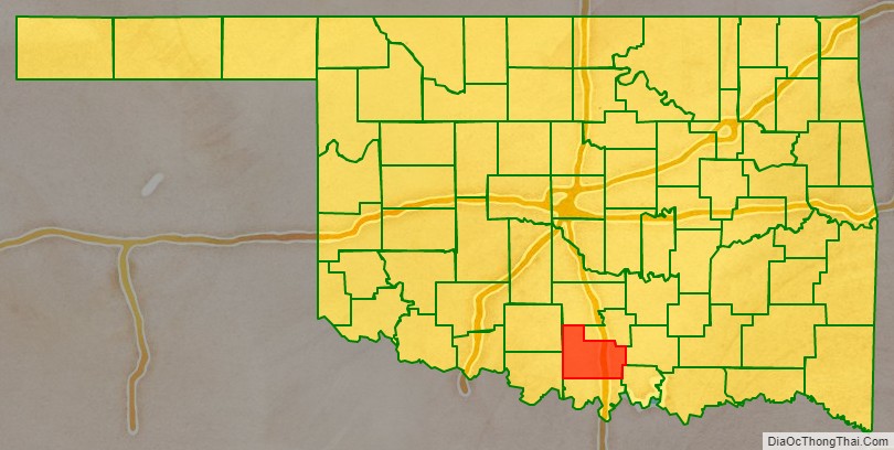
Carter County is a county in the U.S. state of Oklahoma. As of the 2010 census, the population was 47,557. Its county seat is Ardmore. The county was named for Captain Ben W. Carter, a Cherokee who lived among the Chickasaw.
Carter County is part of the Ardmore Micropolitan Statistical Area. It is also a part of the Texoma region.
| Name: | Carter County |
|---|---|
| FIPS code: | 40-019 |
| State: | Oklahoma |
| Founded: | 1907 |
| Seat: | Ardmore |
| Largest city: | Ardmore |
| Total Area: | 834 sq mi (2,160 km²) |
| Land Area: | 822 sq mi (2,130 km²) |
| Total Population: | 47,557 |
| Population Density: | 58/sq mi (22/km²) |
| Time zone: | UTC−6 (Central) |
| Summer Time Zone (DST): | UTC−5 (CDT) |
| Website: | cartercountyok.us |
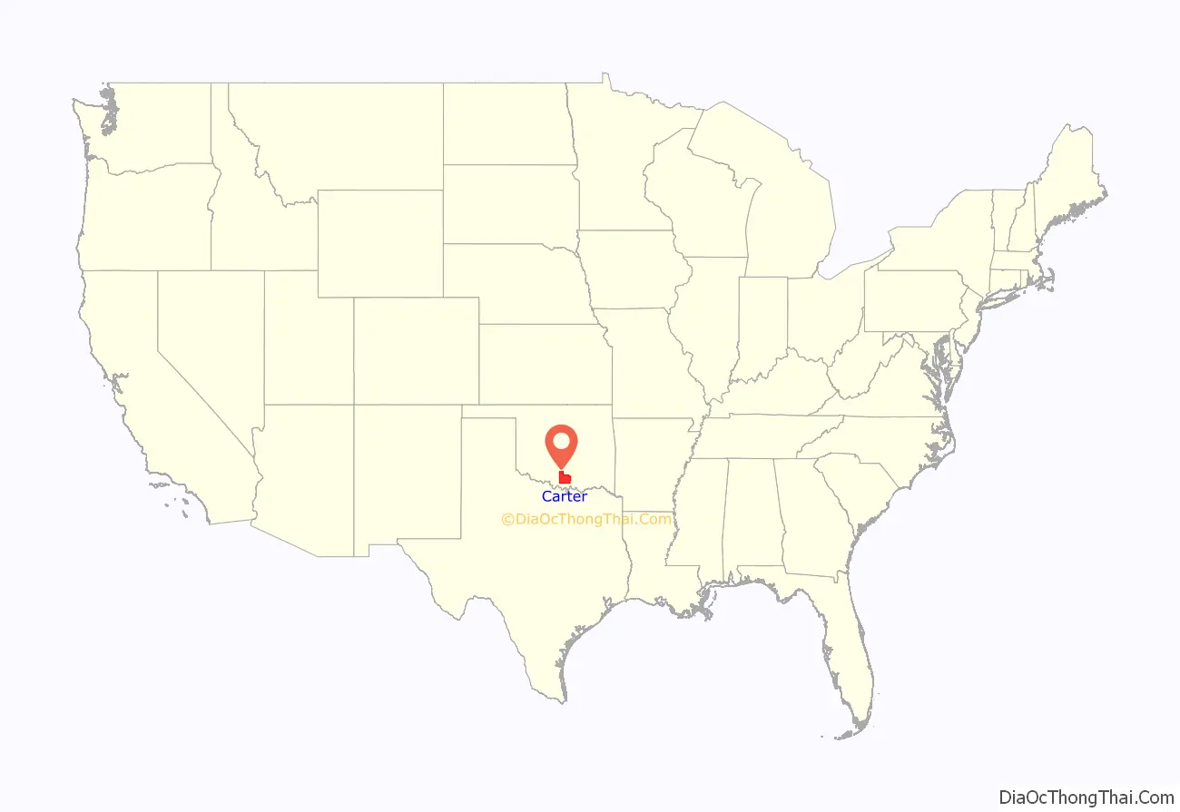
Carter County location map. Where is Carter County?
History
Prior to statehood, the present Carter County, Oklahoma, was part of Pickens County in the Chickasaw Nation of the Indian Territory.
After the Civil War, the government of the United States forced the Chickasaw government to allow railroads built across its territory. The Gulf, Colorado and Santa Fe Railway (controlled by the Atchison, Topeka and Santa Fe Railway, AT&SF) built a line north from Texas to Purcell.
In 1901-1903 the Arkansas and Choctaw Railway (acquired by the St. Louis and San Francisco Railway in 1907) built a line from Arkansas to Ardmore. Oil production spurred further railroad development. In 1913–14, the Oklahoma, New Mexico and Pacific Railway constructed a line from Ardmore west to Ringling. In 1916, the Ringling and Oil Fields Railway laid tracks north from Ringling Junction to Healdton. These last two rail lines were abandoned in 1976.
Oil and gas production began very early in the 20th century. The Healdton field opened in 1913, and led to the development of Ardmore as a major oil production center. However, a disastrous fire occurred in Ardmore in 1915, when a railroad car exploded, killing 43 people and destroying much of the downtown. Ardmore and the local oil industry recovered, and the city also became a manufacturing center. Akron Tire and Rubber Company built and operated a plant in Ardmore as early as 1915. In 1970, Uniroyal built a tire plant there. It was acquired by Michelin North America in 1990. By the start of the 21st century, manufacturing was the largest component of the county economy.
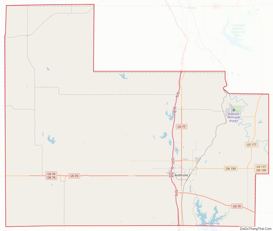
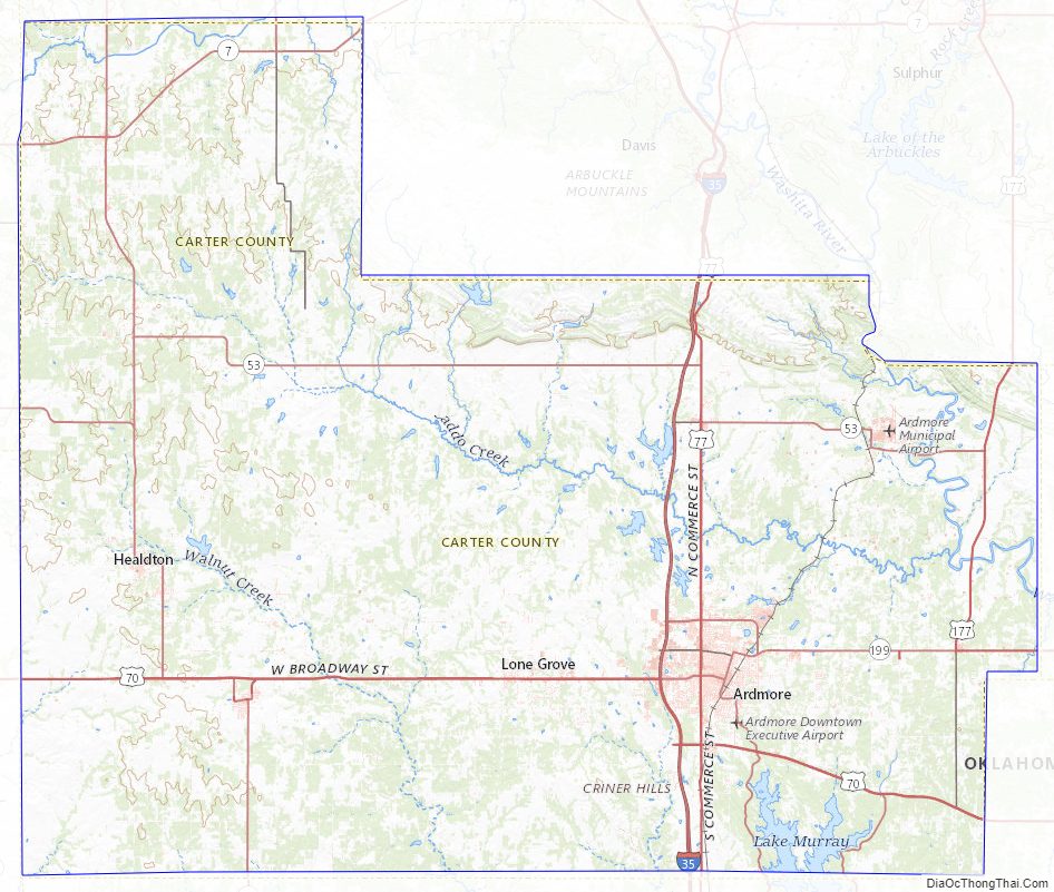
Carter County Road Map
Geography
According to the U.S. Census Bureau, the county has a total area of 834 square miles (2,160 km), of which 822 square miles (2,130 km) is land and 12 square miles (31 km) (1.4%) is water.
The county contains parts of several physiographic regions, including the Arbuckle Mountains, the Coastal Plains, the Red Bed plains and the Cross Timbers. The northern part of the county drains to the Washita River, while several creeks drain the southern part directly to the Red River.
Geology
The Healdton Field, encompassing Healdton and located in the western portion of Carter County, produces from the Pennsylvanian Healdton sands of the Hoxbar Group and the Ordovician massive carbonate Arbuckle Group. The field is located on the “Healdton uplift”, a northwest–southeast trending anticline, which formed with the Wichita Orogeny, and is 8 miles long and up to 3 miles wide. This was followed by deposition of the Healdton sandstones and shales on pre-Pennsylvanian eroded rocks and subsequent folding during the Arbuckle Orogeny. A prospector named Palmer drilled a shallow well, 425 feet, near an oil seep in the 1890s but Federal Law prohibited oil development on “Indian lands” until the early 1900s. Therefore, the discovery of the field is credited to the drilling of No. 1 Wirt Franklin in 1913.
Major highways
- Interstate 35
- U.S. Highway 70
- U.S. Highway 70A
- U.S. Highway 77
- U.S. Highway 177
- State Highway 7
- State Highway 53
- State Highway 74
- State Highway 76
- State Highway 77S
- State Highway 142
- State Highway 199
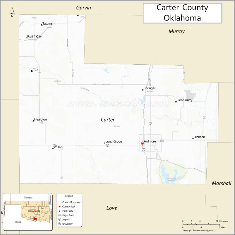
Adjacent counties
- Garvin County (north)
- Murray County (northeast)
- Johnston County (east)
- Marshall County (southeast)
- Love County (south)
- Jefferson County (southwest)
- Stephens County (northwest)
Carter County Topographic Map
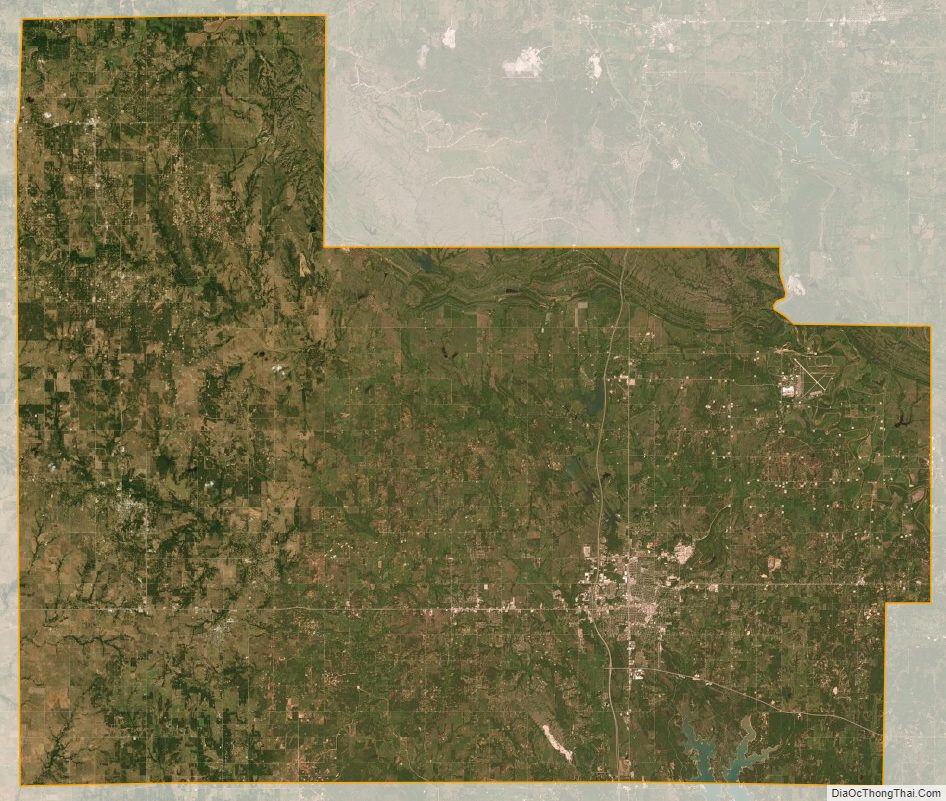
Carter County Satellite Map
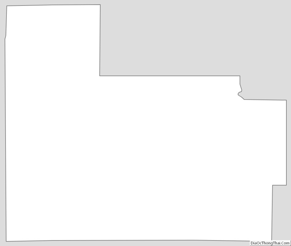
Carter County Outline Map
See also
Map of Oklahoma State and its subdivision:- Adair
- Alfalfa
- Atoka
- Beaver
- Beckham
- Blaine
- Bryan
- Caddo
- Canadian
- Carter
- Cherokee
- Choctaw
- Cimarron
- Cleveland
- Coal
- Comanche
- Cotton
- Craig
- Creek
- Custer
- Delaware
- Dewey
- Ellis
- Garfield
- Garvin
- Grady
- Grant
- Greer
- Harmon
- Harper
- Haskell
- Hughes
- Jackson
- Jefferson
- Johnston
- Kay
- Kingfisher
- Kiowa
- Latimer
- Le Flore
- Lincoln
- Logan
- Love
- Major
- Marshall
- Mayes
- McClain
- McCurtain
- McIntosh
- Murray
- Muskogee
- Noble
- Nowata
- Okfuskee
- Oklahoma
- Okmulgee
- Osage
- Ottawa
- Pawnee
- Payne
- Pittsburg
- Pontotoc
- Pottawatomie
- Pushmataha
- Roger Mills
- Rogers
- Seminole
- Sequoyah
- Stephens
- Texas
- Tillman
- Tulsa
- Wagoner
- Washington
- Washita
- Woods
- Woodward
- Alabama
- Alaska
- Arizona
- Arkansas
- California
- Colorado
- Connecticut
- Delaware
- District of Columbia
- Florida
- Georgia
- Hawaii
- Idaho
- Illinois
- Indiana
- Iowa
- Kansas
- Kentucky
- Louisiana
- Maine
- Maryland
- Massachusetts
- Michigan
- Minnesota
- Mississippi
- Missouri
- Montana
- Nebraska
- Nevada
- New Hampshire
- New Jersey
- New Mexico
- New York
- North Carolina
- North Dakota
- Ohio
- Oklahoma
- Oregon
- Pennsylvania
- Rhode Island
- South Carolina
- South Dakota
- Tennessee
- Texas
- Utah
- Vermont
- Virginia
- Washington
- West Virginia
- Wisconsin
- Wyoming