Catron County is a county in the U.S. state of New Mexico. As of the 2010 census, the population was 3,725, making it New Mexico’s third-least populous county. Its county seat is Reserve. Catron County is New Mexico’s largest county by area.
| Name: | Catron County |
|---|---|
| FIPS code: | 35-003 |
| State: | New Mexico |
| Founded: | February 25, 1921 |
| Named for: | Thomas B. Catron |
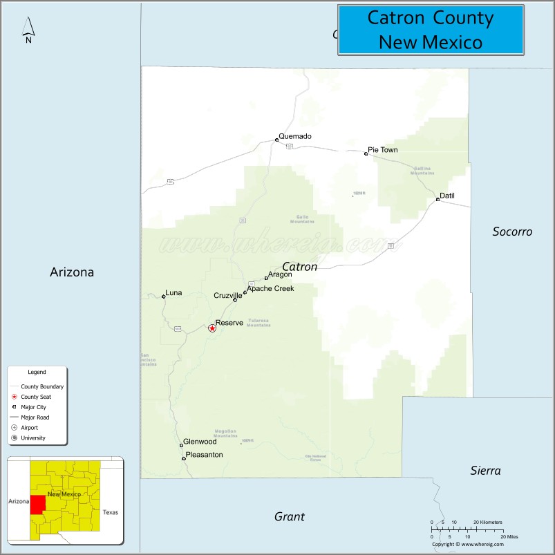
| Seat: | Reserve |
| Total Area: | 6,929 sq mi (17,950 km²) |
| Land Area: | 6,924 sq mi (17,930 km²) |
| Total Population: | 3,731 |
| Population Density: | 0.5/sq mi (0.2/km²) |
| Time zone: | UTC−7 (Mountain) |
| Summer Time Zone (DST): | UTC−6 (MDT) |
| Website: | www.catroncounty.us |
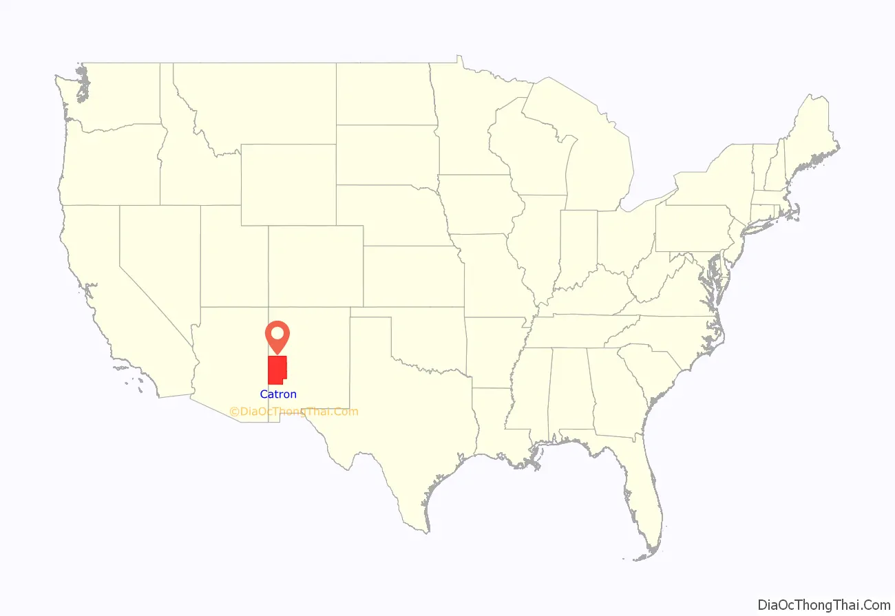
Catron County location map. Where is Catron County?
History
Human settlement in the Catron County region dates to some of the earliest in the Americas. During the Clovis period, between 10999 BC and 8000 BC, and Folsom period, between 7999 BC and 5999 BC, the Ake Site was occupied near Datil. Bat Cave, near Horse Springs, was occupied around 3,500 BC.
The Mimbres culture was expressed by the Mogollon people. They lived throughout the Catron County area from AD 1000 to 1130. Their art is renowned for its beauty.
In the 16th century, Spanish explorers and colonists came to the region, declaring it in 1598 to be part of Santa Fé de Nuevo México, a province of New Spain in the Americas. The province remained in Spanish control until Mexico gained independence in 1821. Under the 1824 Constitution of Mexico, this became the federally administered Territory of New Mexico.
Mexico ceded the region to the U.S. in the Treaty of Guadalupe Hidalgo in 1848 after being defeated in the Mexican–American War. In 1849, President Zachary Taylor proposed that New Mexico, including this region, immediately be admitted as a state in order to sidestep political conflict over the expansion of slavery in the territories. That did not happen. European-American settlers from the southern and eastern states began to arrive here, including some with enslaved African Americans. The territory did not become a state until 1912, long after the Civil War and abolition of slavery.
In 1880, Sergeant James C. Cooney was the first person to find silver and gold ore in the mountains of Catron County. He was reportedly killed by Chiricahua Apache led by Victorio that year, in what the European Americans called the “Alma Massacre”. His remains are buried at Cooney’s Tomb.
The foothills and canyons provided many hiding places for Apache warriors as they continued to resist American encroachment. During this time Cochise was another well-known Chiricahua leader. Noted war chief Goyaałé (Geronimo) had several hideouts in the county. Later in 1880, Buffalo Soldiers led by Sergeant George Jordan defeated Chiricahua Apache warriors led by Victorio in the Battle of Fort Tularosa. Four years later, self-appointed sheriff Elfego Baca was the hero of the so-called Frisco shootout in San Francisco Plaza.
The country also attracted European-American outlaws. In the mid-1880s Butch Cassidy and his Wild Bunch gang holed up at a ranch near Alma. Notorious outlaw Tom Ketchum also lived in Catron County around this time.
Socorro County included all of Catron County’s territory from the creation of Santa Fé de Nuevo México until 1921. At that time, Catron County was organized and named for Thomas B. Catron, a leading figure in New Mexico statehood and its first US senator. In 1927, the State Legislature attempted to abolish both Socorro and Catron in order to create a new Rio Grande County. A court suit voided this act, and the two counties retained their independence.
The Lightning Field, an art installation on the open earth, brought national attention to Quemado in this county in the late 1970s.
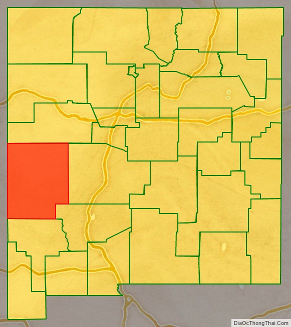
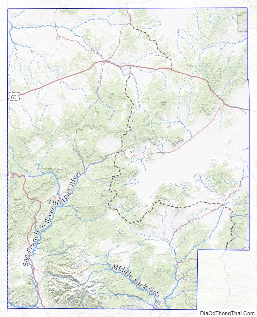
Catron County Road Map
Geography
According to the U.S. Census Bureau, the county has a total area of 6,929 square miles (17,950 km), of which 6,924 square miles (17,930 km) is land and 5.5 square miles (14 km) (0.08%) is water.
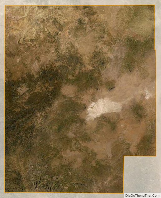
Catron County is the largest county, by area, in New Mexico. At almost 7,000 square miles (18,000 km), Catron County is larger than four states. With a population of only 3,400 people, the county is as sparsely populated as many an old West frontier area. The elk population at some 12,000 head, is much larger than the sparse human population.
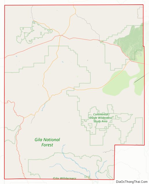
Within the boundaries of Catron County lie parts of the Gila National Forest, the Apache National Forest and the Cibola National Forest. The establishment of these national forests, in the past called “forest reserves,” led to the name Reserve being given to a village on the San Francisco River, which also serves as the County Seat. There are no stop lights in the whole county, so when license tests are given in Reserve, an artificial portable stop light is set up in a parking lot.
Bordering Arizona, Catron County affords the shortest route between Albuquerque and Phoenix or Tucson. Reserve can also be reached by following U.S. Route 180 north from Silver City and New Mexico State Road 12 east for a total of 99 miles (159 km).
In Catron County there is a volcanic area that until recently contained sufficient heat to cause steam to rise after a slight rain. It is called Burning Mountain and appears to have been used by the Apache for healing purposes. The county is home to the Red Hill Volcanic Field as well as the Plains of San Agustin.
Mountains
- Black Mountain
- Black Range
- Datil Mountains
- Diablo Range
- Gallo Mountains
- Mangas Mountains
- Mogollon Mountains
- Saliz Mountains
- San Francisco Mountains
- Tularosa Mountains
- Whitewater Baldy
Bodies of water
- San Francisco River
- Tularosa River
- Rio Salado
- Middle Fork Hot Springs
- Jordan Hot Springs (New Mexico)
- Turkey Creek Hot Springs
- Zuni Salt Lake
Forests
- Apache-Sitgreaves National Forest
- Blue Range Wilderness
- Cibola National Forest
- Gila Wilderness
- Gila National Forest
- Whitewater Canyon National Forest Recreation Area
Adjacent counties
- Cibola County – north
- Socorro County – east
- Sierra County – southeast
- Grant County – south
- Greenlee County, Arizona – west
- Apache County, Arizona – west
National protected areas
- Apache National Forest (part)
- Cibola National Forest (part)
- Gila Cliff Dwellings National Monument
- Gila National Forest (part)
Catron County Topographic Map
Catron County Satellite Map
Catron County Outline Map

See also
Map of New Mexico State and its subdivision: Map of other states:- Alabama
- Alaska
- Arizona
- Arkansas
- California
- Colorado
- Connecticut
- Delaware
- District of Columbia
- Florida
- Georgia
- Hawaii
- Idaho
- Illinois
- Indiana
- Iowa
- Kansas
- Kentucky
- Louisiana
- Maine
- Maryland
- Massachusetts
- Michigan
- Minnesota
- Mississippi
- Missouri
- Montana
- Nebraska
- Nevada
- New Hampshire
- New Jersey
- New Mexico
- New York
- North Carolina
- North Dakota
- Ohio
- Oklahoma
- Oregon
- Pennsylvania
- Rhode Island
- South Carolina
- South Dakota
- Tennessee
- Texas
- Utah
- Vermont
- Virginia
- Washington
- West Virginia
- Wisconsin
- Wyoming