Cedar County is a county in the U.S. state of Nebraska. As of the 2010 United States Census, the population was 8,852. The county seat is Hartington. The county was formed in 1857, and was named for the Cedar tree groves in the area.
In the Nebraska license plate system, Cedar County is represented by the prefix 13 (it had the 13th-largest number of vehicles registered in the county when the license plate system was established in 1922).
| Name: | Cedar County |
|---|---|
| FIPS code: | 31-027 |
| State: | Nebraska |
| Founded: | 1857 |
| Seat: | Hartington |
| Largest city: | Hartington |
| Total Area: | 746 sq mi (1,930 km²) |
| Land Area: | 740 sq mi (1,900 km²) |
| Total Population: | 8,330 |
| Population Density: | 11.5/sq mi (4.4/km²) |
| Time zone: | UTC−6 (Central) |
| Summer Time Zone (DST): | UTC−5 (CDT) |
| Website: | www.co.cedar.ne.us |
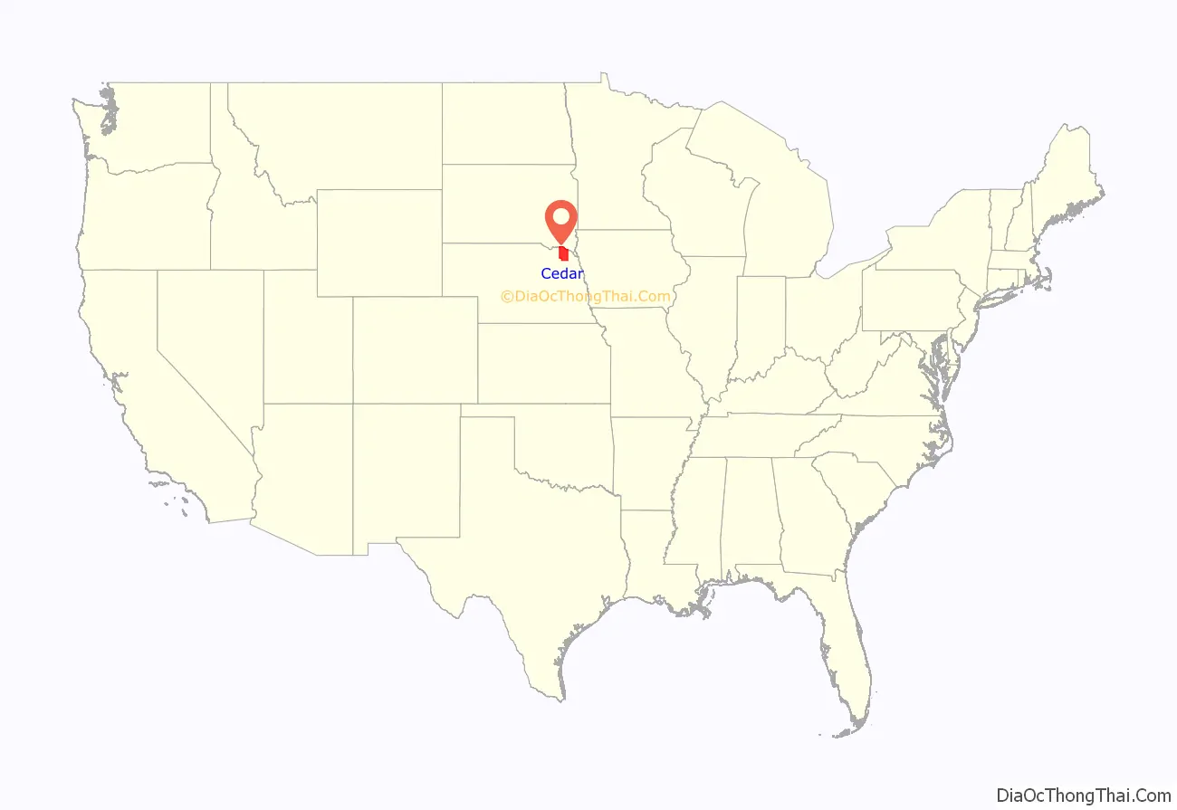
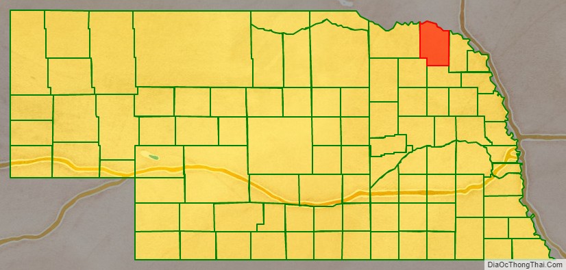
Cedar County location map. Where is Cedar County?
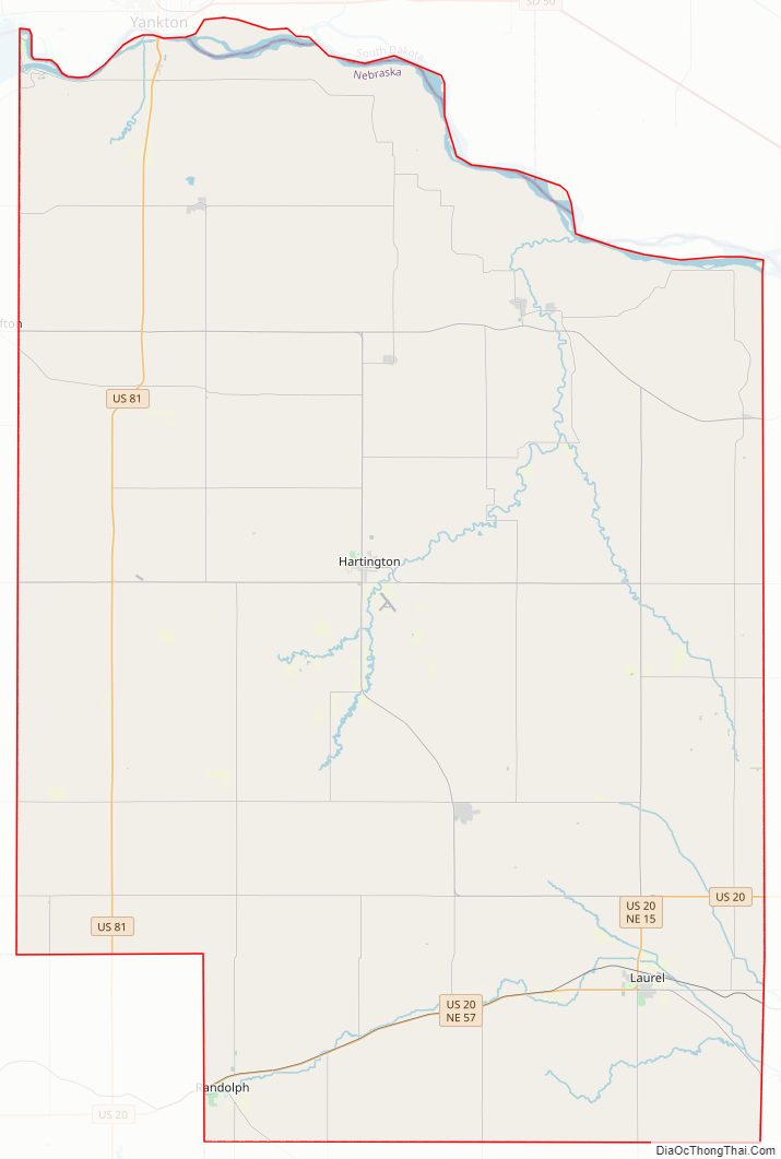
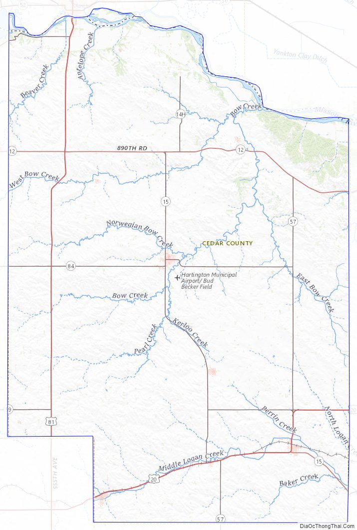
Cedar County Road Map
Geography
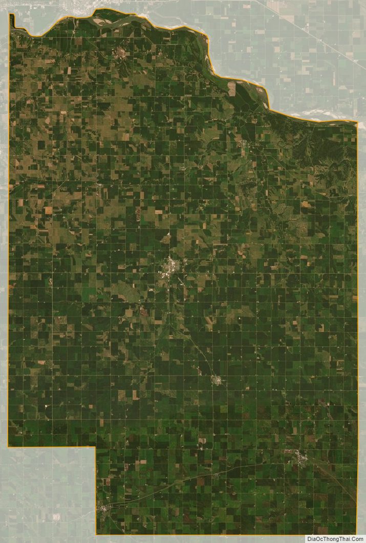
Cedar County is on the northern edge of Nebraska. Its north boundary abuts the south boundary line of the state of South Dakota, across the Missouri River. According to the US Census Bureau, the county has an area of 746 square miles (1,930 km), of which 740 square miles (1,900 km) is land and 5.5 square miles (14 km) (0.7%) is water.
Major highways
- U.S. Highway 20
- U.S. Highway 81
- Nebraska Highway 12
- Nebraska Highway 15
- Nebraska Highway 57
- Nebraska Highway 59
- Nebraska Highway 84
- Nebraska Highway 121
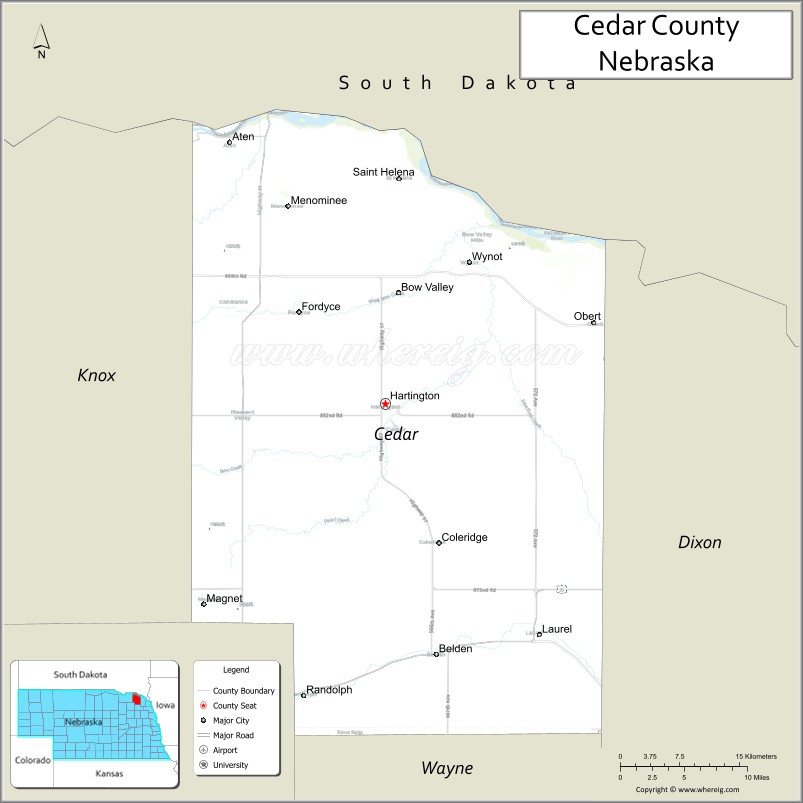
Adjacent counties
- Clay County, South Dakota – northeast
- Dixon County – east
- Wayne County – southeast
- Pierce County – southwest
- Knox County – west
- Yankton County, South Dakota – northwest
Protected areas
- Audubon Bend Wildlife Area
- Calumet Bluff
- Chalkrock State Wildlife Management Area
- Cottonwood Recreation Area
- Missouri National Recreational River (part)
- Bow Creek Recreation Area
- Meridian Bridge
- Nebraska Tailwaters Recreation Area
- Tatanka State Wildlife Management Area (part)
- Training Dike Recreation Area
- Wiseman State Wildlife Management Area
Lakes
- Chalkrock Lake
- Lewis and Clark Lake (part)
Cedar County Topographic Map
Cedar County Satellite Map
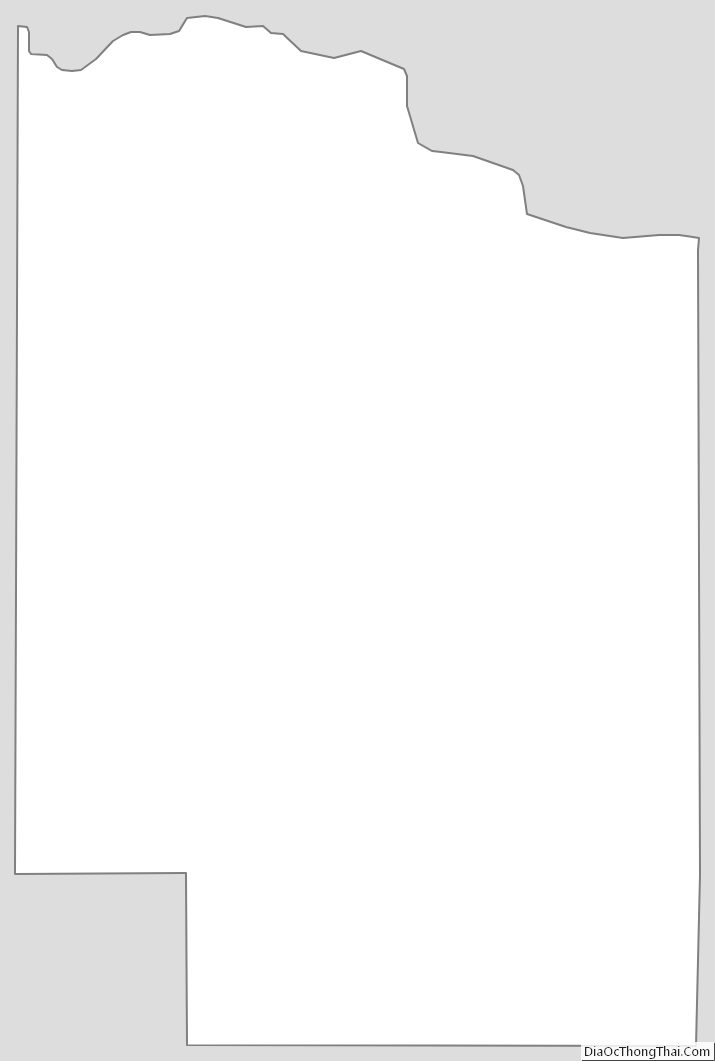
Cedar County Outline Map
See also
Map of Nebraska State and its subdivision:- Adams
- Antelope
- Arthur
- Banner
- Blaine
- Boone
- Box Butte
- Boyd
- Brown
- Buffalo
- Burt
- Butler
- Cass
- Cedar
- Chase
- Cherry
- Cheyenne
- Clay
- Colfax
- Cuming
- Custer
- Dakota
- Dawes
- Dawson
- Deuel
- Dixon
- Dodge
- Douglas
- Dundy
- Fillmore
- Franklin
- Frontier
- Furnas
- Gage
- Garden
- Garfield
- Gosper
- Grant
- Greeley
- Hall
- Hamilton
- Harlan
- Hayes
- Hitchcock
- Holt
- Hooker
- Howard
- Jefferson
- Johnson
- Kearney
- Keith
- Keya Paha
- Kimball
- Knox
- Lancaster
- Lincoln
- Logan
- Loup
- Madison
- McPherson
- Merrick
- Morrill
- Nance
- Nemaha
- Nuckolls
- Otoe
- Pawnee
- Perkins
- Phelps
- Pierce
- Platte
- Polk
- Red Willow
- Richardson
- Rock
- Saline
- Sarpy
- Saunders
- Scotts Bluff
- Seward
- Sheridan
- Sherman
- Sioux
- Stanton
- Thayer
- Thomas
- Thurston
- Valley
- Washington
- Wayne
- Webster
- Wheeler
- York
- Alabama
- Alaska
- Arizona
- Arkansas
- California
- Colorado
- Connecticut
- Delaware
- District of Columbia
- Florida
- Georgia
- Hawaii
- Idaho
- Illinois
- Indiana
- Iowa
- Kansas
- Kentucky
- Louisiana
- Maine
- Maryland
- Massachusetts
- Michigan
- Minnesota
- Mississippi
- Missouri
- Montana
- Nebraska
- Nevada
- New Hampshire
- New Jersey
- New Mexico
- New York
- North Carolina
- North Dakota
- Ohio
- Oklahoma
- Oregon
- Pennsylvania
- Rhode Island
- South Carolina
- South Dakota
- Tennessee
- Texas
- Utah
- Vermont
- Virginia
- Washington
- West Virginia
- Wisconsin
- Wyoming