| Name: | Chaffee County |
|---|---|
| FIPS code: | 08-015 |
| State: | Colorado |
| Named for: | Jerome B. Chaffee |
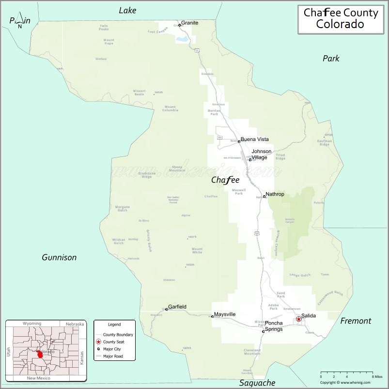
| Seat: | Salida |
| Largest city: | Salida |
| Total Area: | 1,015 sq mi (2,630 km²) |
| Land Area: | 1,013 sq mi (2,620 km²) |
| Total Population: | 20,074 |
| Population Density: | 19/sq mi (7/km²) |
| Time zone: | UTC−7 (Mountain) |
| Summer Time Zone (DST): | UTC−6 (MDT) |
| Website: | www.chaffeecounty.org |
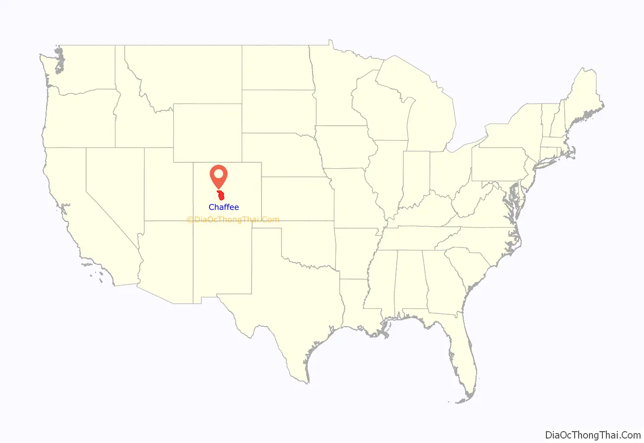
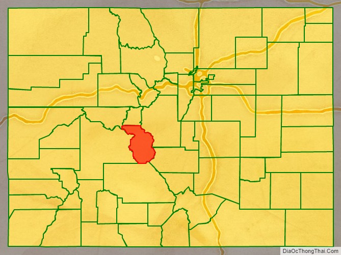
Chaffee County location map. Where is Chaffee County?
History
Chaffee County has a confusing origin. Between February 8 and February 10, 1879, Carbonate County was created by the Colorado legislature out of northern Lake County. On February 10 the two counties were renamed, with the southern part of Lake County becoming Chaffee County, and Carbonate County becoming Lake County. Chaffee County is known as the “Heart of the Rockies”. It was named for Jerome B. Chaffee, Colorado’s first United States Senator.
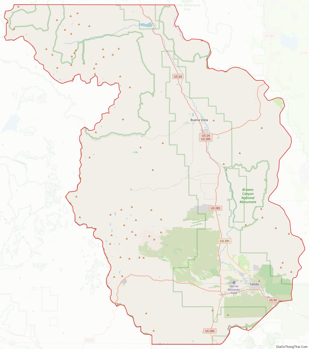
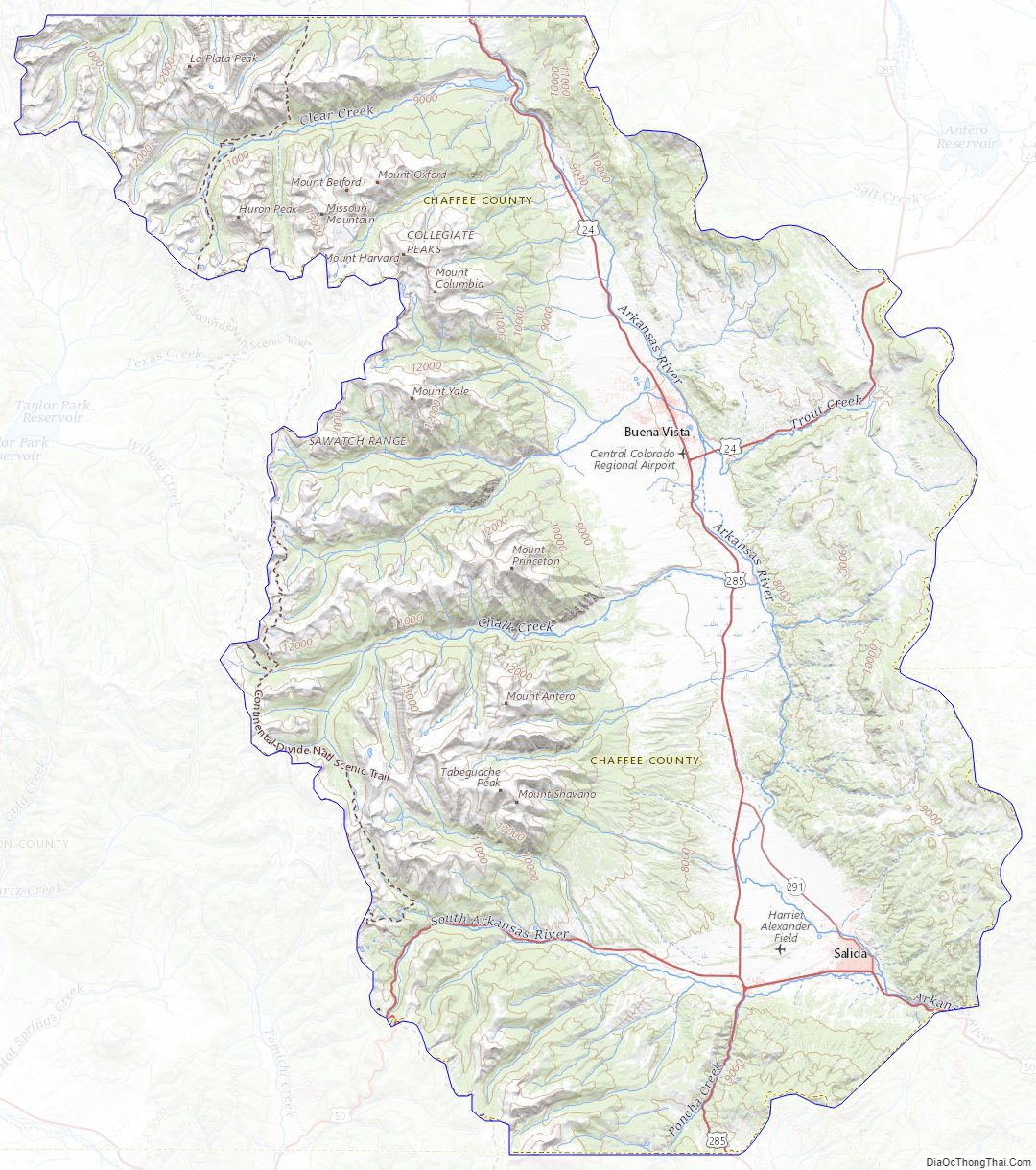
Chaffee County Road Map
Geography
According to the U.S. Census Bureau, the county has a total area of 1,015 square miles (2,630 km), of which 1,013 square miles (2,620 km) is land and 1.6 square miles (4.1 km) (0.2%) is water.
Adjacent counties
- Lake County – north
- Park County – northeast
- Fremont County – southeast
- Saguache County – south
- Gunnison County – west
- Pitkin County – northwest
Major Highways
- U.S. Highway 24
- U.S. Highway 50
- U.S. Highway 285
- State Highway 291
- State Highway 306
National protected areas
- Browns Canyon National Monument
- Buffalo Peaks Wilderness
- Collegiate Peaks Wilderness
- San Isabel National Forest
Recreation area
- Arkansas Headwaters Recreation Area
Trails
- American Discovery Trail
- Colorado Trail
- Continental Divide National Scenic Trail
Bicycle routes
- Great Parks Bicycle Route
- Western Express Bicycle Route
Chaffee County Topographic Map
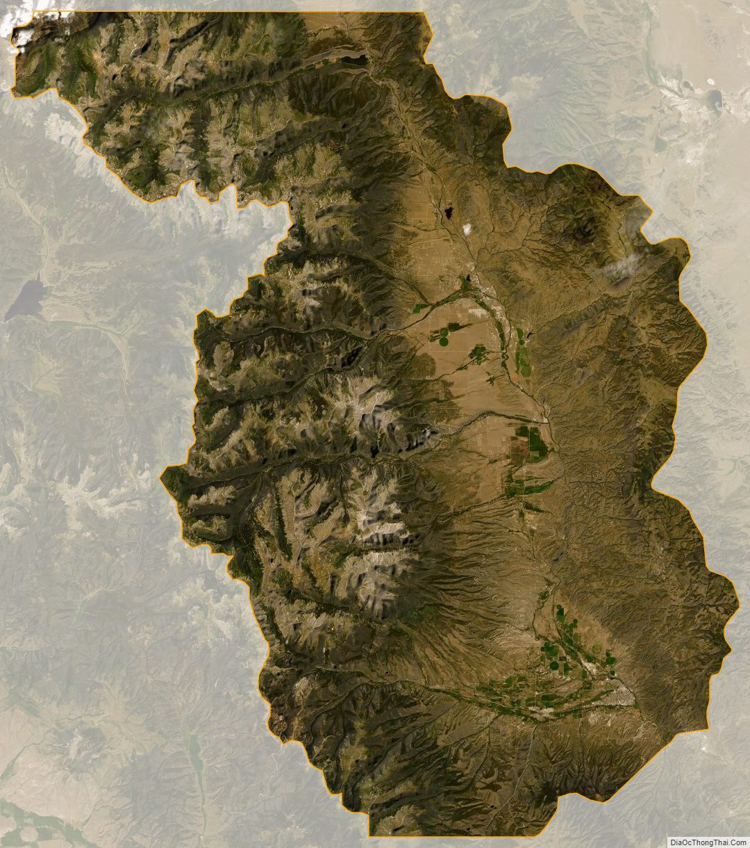
Chaffee County Satellite Map
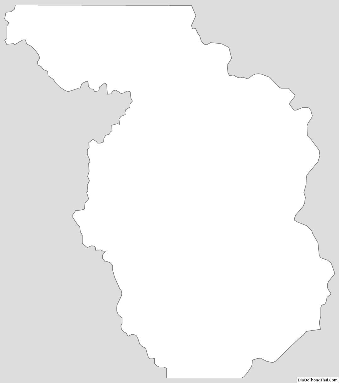
Chaffee County Outline Map
See also
Map of Colorado State and its subdivision:- Adams
- Alamosa
- Arapahoe
- Archuleta
- Baca
- Bent
- Boulder
- Broomfield
- Chaffee
- Cheyenne
- Clear Creek
- Conejos
- Costilla
- Crowley
- Custer
- Delta
- Denver
- Dolores
- Douglas
- Eagle
- El Paso
- Elbert
- Fremont
- Garfield
- Gilpin
- Grand
- Gunnison
- Hinsdale
- Huerfano
- Jackson
- Jefferson
- Kiowa
- Kit Carson
- La Plata
- Lake
- Larimer
- Las Animas
- Lincoln
- Logan
- Mesa
- Mineral
- Moffat
- Montezuma
- Montrose
- Morgan
- Otero
- Ouray
- Park
- Phillips
- Pitkin
- Prowers
- Pueblo
- Rio Blanco
- Rio Grande
- Routt
- Saguache
- San Juan
- San Miguel
- Sedgwick
- Summit
- Teller
- Washington
- Weld
- Yuma
- Alabama
- Alaska
- Arizona
- Arkansas
- California
- Colorado
- Connecticut
- Delaware
- District of Columbia
- Florida
- Georgia
- Hawaii
- Idaho
- Illinois
- Indiana
- Iowa
- Kansas
- Kentucky
- Louisiana
- Maine
- Maryland
- Massachusetts
- Michigan
- Minnesota
- Mississippi
- Missouri
- Montana
- Nebraska
- Nevada
- New Hampshire
- New Jersey
- New Mexico
- New York
- North Carolina
- North Dakota
- Ohio
- Oklahoma
- Oregon
- Pennsylvania
- Rhode Island
- South Carolina
- South Dakota
- Tennessee
- Texas
- Utah
- Vermont
- Virginia
- Washington
- West Virginia
- Wisconsin
- Wyoming