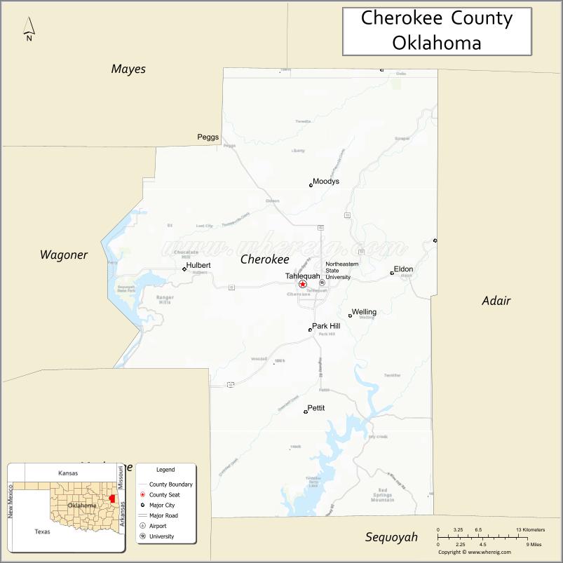
Cherokee County is a county located in the U.S. state of Oklahoma. As of the 2010 census, the population was 46,987. Its county seat is Tahlequah, which is also the capital of the Cherokee Nation.
Cherokee County comprises the Tahlequah, OK Micropolitan Statistical Area, which is included in the Tulsa–Muskogee–Bartlesville, OK Combined Statistical Area.
| Name: | Cherokee County |
|---|---|
| FIPS code: | 40-021 |
| State: | Oklahoma |
| Founded: | 1907 |
| Named for: | Cherokee Nation |
| Seat: | Tahlequah |
| Largest city: | Tahlequah |
| Total Area: | 776 sq mi (2,010 km²) |
| Land Area: | 749 sq mi (1,940 km²) |
| Total Population: | 46,987 |
| Population Density: | 63/sq mi (24/km²) |
| Time zone: | UTC−6 (Central) |
| Summer Time Zone (DST): | UTC−5 (CDT) |
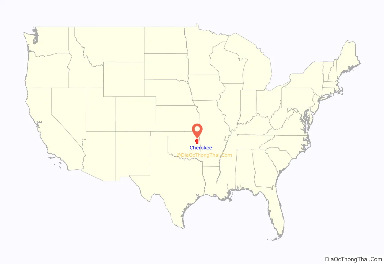
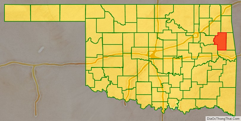
Cherokee County location map. Where is Cherokee County?
History
According to a historian, Cherokee County was established in 1907. However, the Encyclopedia of Oklahoma History and Culture, states that it was created from the Tahlequah District of the Cherokee Nation in 1906.
The Cherokee moved to this area as a result of the forced relocation brought about by the Indian Removal Act of 1830, also known as Trail Of Tears. The first significant settlements were at the site of Park Hill, where there was already a mission community, and Tahlequah, which became the seat of Cherokee government. However the Civil War divided the tribe and caused many of the early structures to be destroyed. Non-Indians began moving into the area illegally starting in the mid-1870s, and became the majority by the 1890s.
In 1851, the Cherokee Male Seminary opened in Tahlequah and the Cherokee Female Seminary opened in Park Hill. The latter burned down in 1887 and was rebuilt in Tahlequah. A 1910 fire destroyed the Male Seminary. The Female Seminary became Northeastern State Normal School after statehood in 1907 and is now part of Northeastern State University.
During 1901 – 1903, The Ozark and Cherokee Central Railway, which later became part of the St. Louis and San Francisco Railway was the first to build a track in the county. It boosted the shipment of farm products through the 1920s, but declined during the Great Depression. All rail service ceased in 1942.
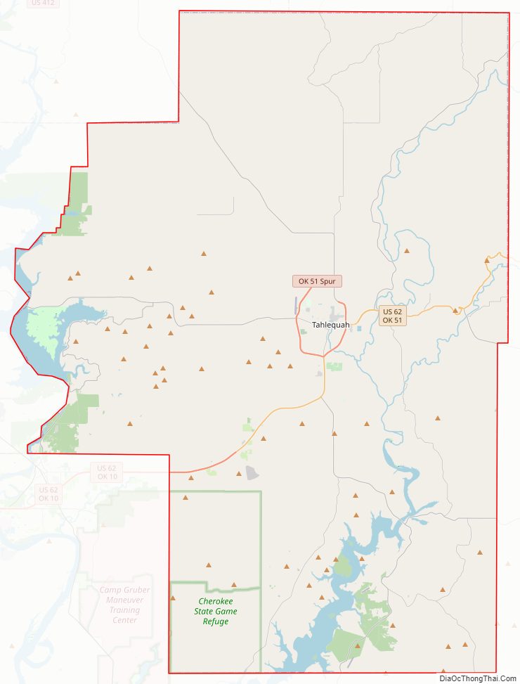
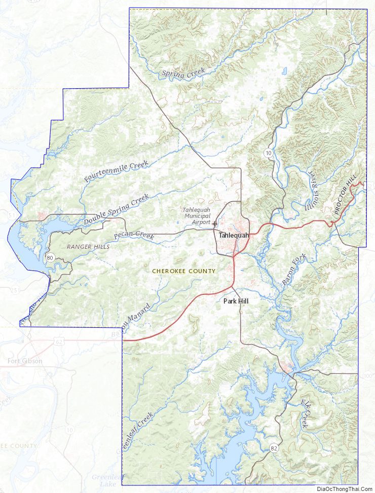
Cherokee County Road Map
Geography
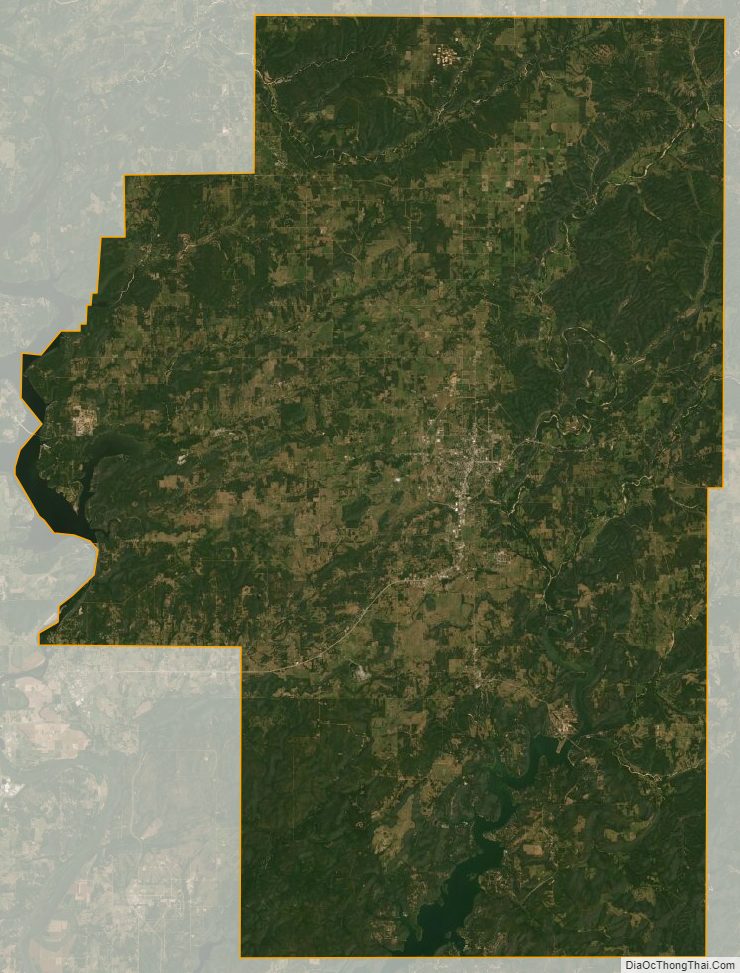
According to the U.S. Census Bureau, the county has a total area of 776 square miles (2,010 km), of which 749 square miles (1,940 km) is land and 2.7 square miles (7.0 km) (3.5%) is water.
The county lies in the foothills of the Ozark Mountains. It includes most of Tenkiller Lake and part of Fort Gibson Lake. The principal river running through it is the Illinois River. Grand River (Oklahoma) forms part of its western boundary.
Major highways
- U.S. Highway 62
- State Highway 10
- State Highway 51
- State Highway 82
Adjacent counties
- Delaware County (north)
- Adair County (east)
- Sequoyah County (south)
- Muskogee County (southwest)
- Wagoner County (west)
- Mayes County (northwest)
Cherokee County Topographic Map
Cherokee County Satellite Map
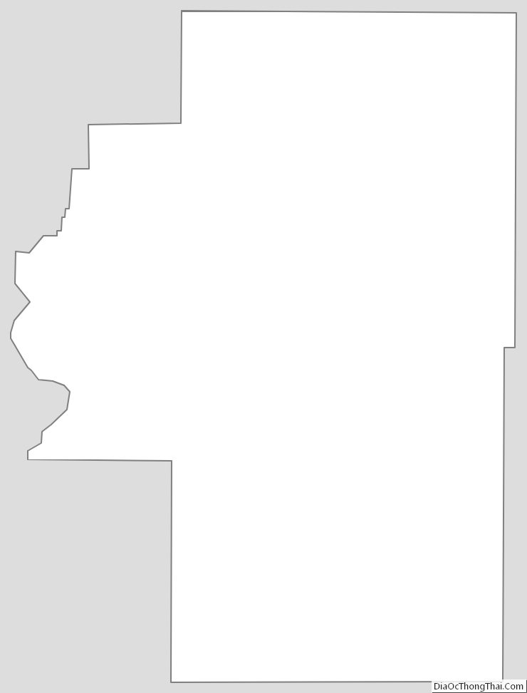
Cherokee County Outline Map
See also
Map of Oklahoma State and its subdivision:- Adair
- Alfalfa
- Atoka
- Beaver
- Beckham
- Blaine
- Bryan
- Caddo
- Canadian
- Carter
- Cherokee
- Choctaw
- Cimarron
- Cleveland
- Coal
- Comanche
- Cotton
- Craig
- Creek
- Custer
- Delaware
- Dewey
- Ellis
- Garfield
- Garvin
- Grady
- Grant
- Greer
- Harmon
- Harper
- Haskell
- Hughes
- Jackson
- Jefferson
- Johnston
- Kay
- Kingfisher
- Kiowa
- Latimer
- Le Flore
- Lincoln
- Logan
- Love
- Major
- Marshall
- Mayes
- McClain
- McCurtain
- McIntosh
- Murray
- Muskogee
- Noble
- Nowata
- Okfuskee
- Oklahoma
- Okmulgee
- Osage
- Ottawa
- Pawnee
- Payne
- Pittsburg
- Pontotoc
- Pottawatomie
- Pushmataha
- Roger Mills
- Rogers
- Seminole
- Sequoyah
- Stephens
- Texas
- Tillman
- Tulsa
- Wagoner
- Washington
- Washita
- Woods
- Woodward
- Alabama
- Alaska
- Arizona
- Arkansas
- California
- Colorado
- Connecticut
- Delaware
- District of Columbia
- Florida
- Georgia
- Hawaii
- Idaho
- Illinois
- Indiana
- Iowa
- Kansas
- Kentucky
- Louisiana
- Maine
- Maryland
- Massachusetts
- Michigan
- Minnesota
- Mississippi
- Missouri
- Montana
- Nebraska
- Nevada
- New Hampshire
- New Jersey
- New Mexico
- New York
- North Carolina
- North Dakota
- Ohio
- Oklahoma
- Oregon
- Pennsylvania
- Rhode Island
- South Carolina
- South Dakota
- Tennessee
- Texas
- Utah
- Vermont
- Virginia
- Washington
- West Virginia
- Wisconsin
- Wyoming