Cherokee County is a county located in the U.S. state of Texas. As of the 2020 census, its population was 50,412. The county seat is Rusk, which lies 130 miles southeast of Dallas and 160 miles north of Houston. The county was named for the Cherokee, who lived in the area before being expelled in 1839. Cherokee County comprises the Jacksonville micropolitan statistical area, which is also included in the Tyler–Jacksonville combined statistical area.
| Name: | Cherokee County |
|---|---|
| FIPS code: | 48-073 |
| State: | Texas |
| Founded: | July 13, 1846 |
| Named for: | Cherokee people |
| Seat: | Rusk |
| Largest city: | Jacksonville |
| Total Area: | 1,062 sq mi (2,750 km²) |
| Land Area: | 1,053 sq mi (2,730 km²) |
| Total Population: | 50,412 |
| Population Density: | 47/sq mi (18/km²) |
| Time zone: | UTC−6 (Central) |
| Summer Time Zone (DST): | UTC−5 (CDT) |
| Website: | www.co.cherokee.tx.us |
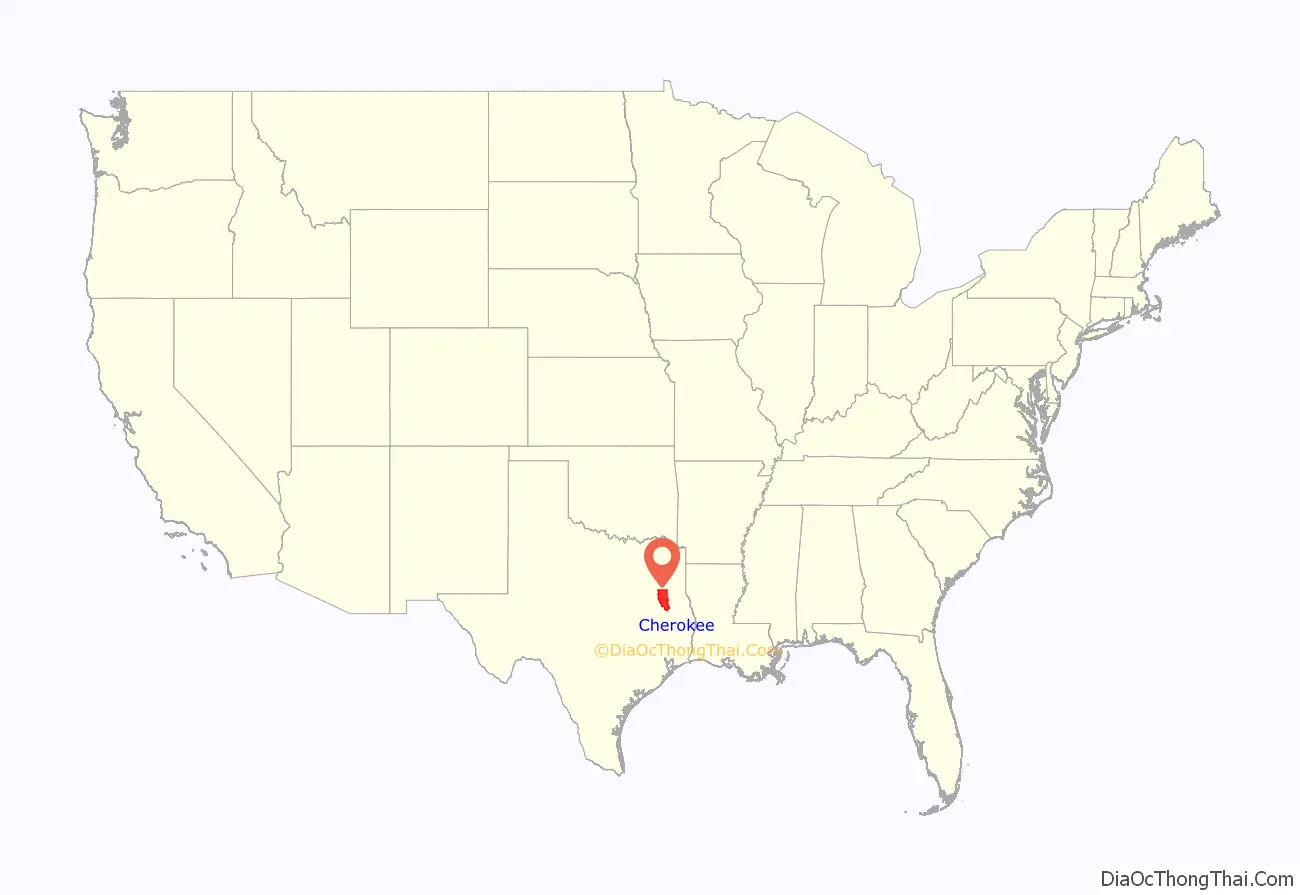
Cherokee County location map. Where is Cherokee County?
History
Native Americans
The Hasinai group of the Caddo tribe built a village in the area in around AD 800 and continued to live in the area until the 1830s, when they migrated to the Brazos River. The federal government moved them to the Brazos Indian Reservation in 1855 and later to Oklahoma.
The Cherokee, Delaware, Shawnee, and Kickapoo Native American peoples began settling in the area around 1820. The Texas Cherokee tried unsuccessfully to gain a grant to their own land from the Mexican government.
Sam Houston, adopted son of Chief Oolooteka (John Jolly) of the Cherokee, negotiated the January 14, 1836, treaty between Chief Bowl of the Cherokee and the Republic of Texas. On December 16, 1837, the Texas Senate declared the treaty null and void, and encroachment upon Cherokee lands continued. On October 5, 1838, Indians massacred members of the Isaac Killough family at their farm northwest of the site of present Jacksonville, leading to the Cherokee War of 1839 and the expulsion of some to Oklahoma. Some went to Monclova in Mexico, and some to Rusk and Gregg counties (many had relatives among the Choctaw/Chickasaw/Creek community there). Later, in 1844, President Polk issued an executive order known as “The Right to return”, allowing many Cherokee to return to Texas. Some came to what is now Cherokee County.
Early exploration and settlers
Domingo Terán de los Ríos and Father Damián Massanet explored the area on behalf of Spain in 1691. Louis Juchereau de St. Denis began trading with the Hasinais in 1705. Nuestro Padre San Francisco de los Tejas was originally established in 1690, but was re-established in 1716 by Captain Domingo Ramon. It was abandoned again because of French incursions and re-established in 1721 by the Marques de San Miguel de Aguyao.
In 1826, empresario David G. Burnet received a grant from the Coahuila y Tejas legislature to settle 300 families. The settlers were mostly from the Southern states, and brought the lifestyle of that region with them. By contracting how many families each grantee could settle, the government sought to have some control over colonization.
County established and growth
Cherokee County was formed from land given by Nacogdoches County in 1846. It was organized in the same year. The town of Rusk became the county seat. Cherokee County voted in favor of secession from the Union, during the build-up to the American Civil War.
In 1872, the International – Great Northern Railroad caused Jacksonville to relocate two miles east, to be near the tracks. The Kansas and Gulf Short Line Railway was built north-to-south through the county between 1882 and 1885. The Texas and New Orleans Railroad in 1905, and the Texas State Railroad in 1910, each gave rise to new county towns along their tracks.
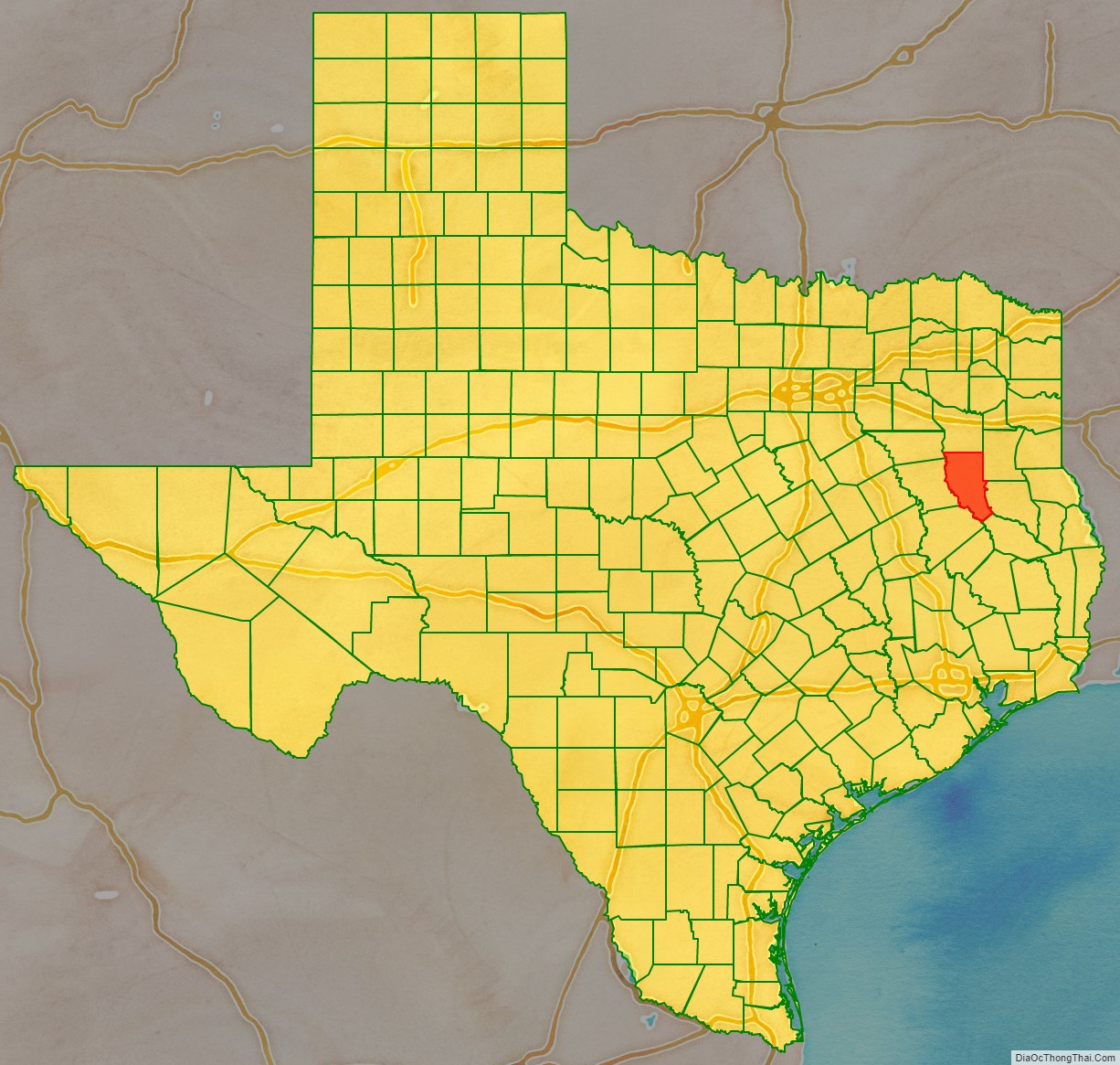
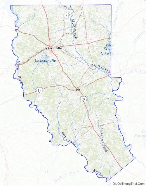
Cherokee County Road Map
Geography
According to the U.S. Census Bureau, the county has a total area of 1,062 square miles (2,750 km), of which 1,053 square miles (2,730 km) is land and 9.3 square miles (24 km) (0.9%) is covered by water.
Major highways
- U.S. Highway 69
- U.S. Highway 79
- U.S. Highway 84
- U.S. Highway 175
- State Highway 21
- State Highway 110
- State Highway 135
- State Highway 204
- State Highway 294
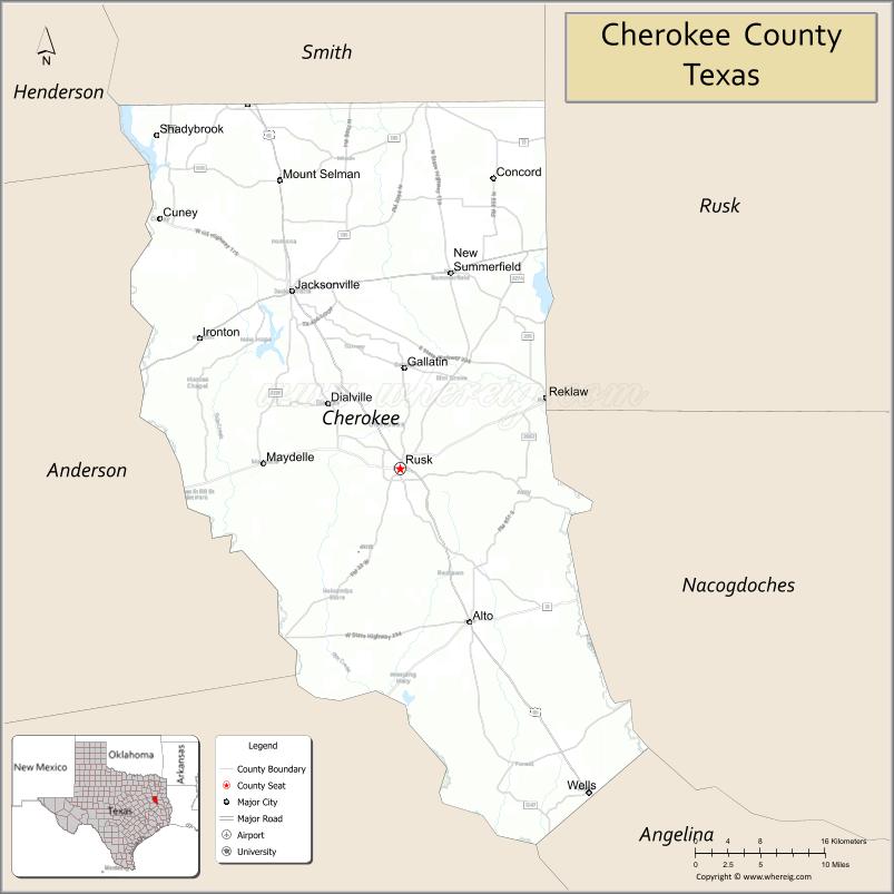
Adjacent counties
- Smith County (north)
- Rusk County (northeast, east)
- Nacogdoches County (east, southeast)
- Angelina County (southeast)
- Houston County (southwest)
- Anderson County (west)
- Henderson County (northwest)
National protected area
- Neches River National Wildlife Refuge (part)
Cherokee County Topographic Map
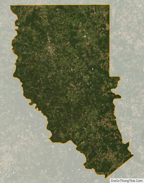
Cherokee County Satellite Map
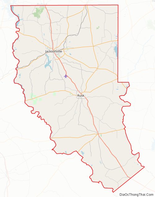
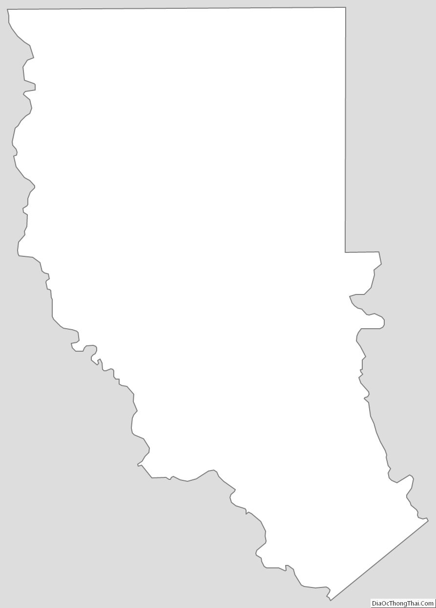
Cherokee County Outline Map
See also
Map of Texas State and its subdivision:- Anderson
- Andrews
- Angelina
- Aransas
- Archer
- Armstrong
- Atascosa
- Austin
- Bailey
- Bandera
- Bastrop
- Baylor
- Bee
- Bell
- Bexar
- Blanco
- Borden
- Bosque
- Bowie
- Brazoria
- Brazos
- Brewster
- Briscoe
- Brooks
- Brown
- Burleson
- Burnet
- Caldwell
- Calhoun
- Callahan
- Cameron
- Camp
- Carson
- Cass
- Castro
- Chambers
- Cherokee
- Childress
- Clay
- Cochran
- Coke
- Coleman
- Collin
- Collingsworth
- Colorado
- Comal
- Comanche
- Concho
- Cooke
- Coryell
- Cottle
- Crane
- Crockett
- Crosby
- Culberson
- Dallam
- Dallas
- Dawson
- Deaf Smith
- Delta
- Denton
- Dewitt
- Dickens
- Dimmit
- Donley
- Duval
- Eastland
- Ector
- Edwards
- El Paso
- Ellis
- Erath
- Falls
- Fannin
- Fayette
- Fisher
- Floyd
- Foard
- Fort Bend
- Franklin
- Freestone
- Frio
- Gaines
- Galveston
- Garza
- Gillespie
- Glasscock
- Goliad
- Gonzales
- Gray
- Grayson
- Gregg
- Grimes
- Guadalupe
- Hale
- Hall
- Hamilton
- Hansford
- Hardeman
- Hardin
- Harris
- Harrison
- Hartley
- Haskell
- Hays
- Hemphill
- Henderson
- Hidalgo
- Hill
- Hockley
- Hood
- Hopkins
- Houston
- Howard
- Hudspeth
- Hunt
- Hutchinson
- Irion
- Jack
- Jackson
- Jasper
- Jeff Davis
- Jefferson
- Jim Hogg
- Jim Wells
- Johnson
- Jones
- Karnes
- Kaufman
- Kendall
- Kenedy
- Kent
- Kerr
- Kimble
- King
- Kinney
- Kleberg
- Knox
- La Salle
- Lamar
- Lamb
- Lampasas
- Lavaca
- Lee
- Leon
- Liberty
- Limestone
- Lipscomb
- Live Oak
- Llano
- Loving
- Lubbock
- Lynn
- Madison
- Marion
- Martin
- Mason
- Matagorda
- Maverick
- McCulloch
- McLennan
- McMullen
- Medina
- Menard
- Midland
- Milam
- Mills
- Mitchell
- Montague
- Montgomery
- Moore
- Morris
- Motley
- Nacogdoches
- Navarro
- Newton
- Nolan
- Nueces
- Ochiltree
- Oldham
- Orange
- Palo Pinto
- Panola
- Parker
- Parmer
- Pecos
- Polk
- Potter
- Presidio
- Rains
- Randall
- Reagan
- Real
- Red River
- Reeves
- Refugio
- Roberts
- Robertson
- Rockwall
- Runnels
- Rusk
- Sabine
- San Augustine
- San Jacinto
- San Patricio
- San Saba
- Schleicher
- Scurry
- Shackelford
- Shelby
- Sherman
- Smith
- Somervell
- Starr
- Stephens
- Sterling
- Stonewall
- Sutton
- Swisher
- Tarrant
- Taylor
- Terrell
- Terry
- Throckmorton
- Titus
- Tom Green
- Travis
- Trinity
- Tyler
- Upshur
- Upton
- Uvalde
- Val Verde
- Van Zandt
- Victoria
- Walker
- Waller
- Ward
- Washington
- Webb
- Wharton
- Wheeler
- Wichita
- Wilbarger
- Willacy
- Williamson
- Wilson
- Winkler
- Wise
- Wood
- Yoakum
- Young
- Zapata
- Zavala
- Alabama
- Alaska
- Arizona
- Arkansas
- California
- Colorado
- Connecticut
- Delaware
- District of Columbia
- Florida
- Georgia
- Hawaii
- Idaho
- Illinois
- Indiana
- Iowa
- Kansas
- Kentucky
- Louisiana
- Maine
- Maryland
- Massachusetts
- Michigan
- Minnesota
- Mississippi
- Missouri
- Montana
- Nebraska
- Nevada
- New Hampshire
- New Jersey
- New Mexico
- New York
- North Carolina
- North Dakota
- Ohio
- Oklahoma
- Oregon
- Pennsylvania
- Rhode Island
- South Carolina
- South Dakota
- Tennessee
- Texas
- Utah
- Vermont
- Virginia
- Washington
- West Virginia
- Wisconsin
- Wyoming