Chippewa County is a county in the U.S. state of Minnesota. As of the 2020 census, the population was 12,598. Its county seat is Montevideo. The county was formed in 1862, and was organized in 1868.
| Name: | Chippewa County |
|---|---|
| FIPS code: | 27-023 |
| State: | Minnesota |
| Founded: | 1870 |
| Named for: | Chippewa River |
| Seat: | Montevideo |
| Largest city: | Montevideo |
| Total Area: | 588 sq mi (1,520 km²) |
| Land Area: | 581 sq mi (1,500 km²) |
| Total Population: | 12,598 |
| Population Density: | 21.7/sq mi (8.4/km²) |
| Time zone: | UTC−6 (Central) |
| Summer Time Zone (DST): | UTC−5 (CDT) |
| Website: | www.co.chippewa.mn.us |
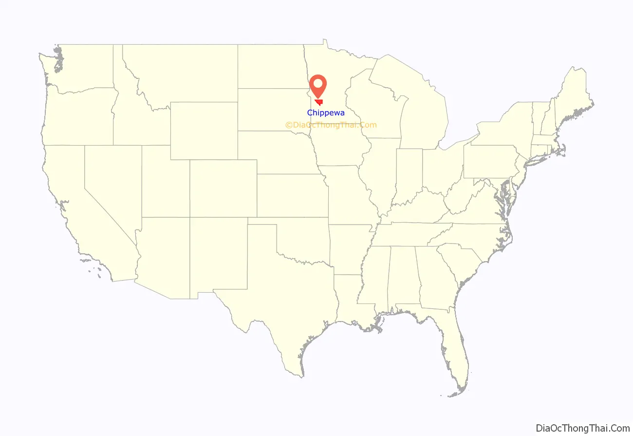
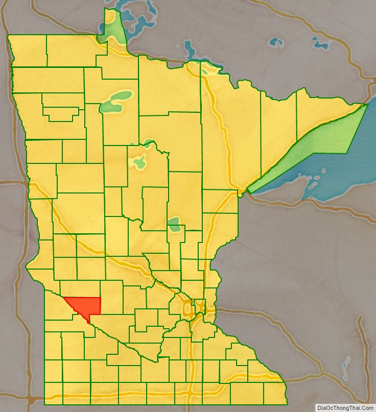
Chippewa County location map. Where is Chippewa County?
History
Chippewa County was organized on March 5, 1868, after having been part of Renville County. The northern boundary change separating it from Swift County led to reorganization on February 18, 1870. The first three county commissioners, appointed by the governor, were Daniel S. Wilkins, Ole Thorson and M. Davidson. The county commissioners first met at Wilkins’s cabin on January 9, 1869. Wilkins was appointed chairman of the board. The first officers appointed were J.D Baker as auditor; J.C. Eldred as register of deeds; Samuel J. Sargant as treasurer; George W. Daniels as judge of probate; Edward Alcorn as sheriff; J.D. Baker as superintendent of schools; Horace W. Griggs as coroner; George W. Frink as justice of the peace; and F.W. Palmer and M. Morris as constables.
County seat
Chippewa City was the first village to be laid out in Chippewa County. It was on the west side of the Chippewa River, just north of the confluence with the Minnesota River. Daniel S. Wilkins was the first settler to arrive in 1865, and he laid out Chippewa City in autumn 1868. Wilkins’s cabin there was the location of the first county commissioners’ meeting.
George W. Frink arrived in Chippewa County in 1867 and made claim to land on the east side of the Chippewa River, where he built a log house in Montevideo. With towns on both sides of the river, there was debate over which should be the county seat. L. R. Moyer reported that some men from Montevideo went to Chippewa City and took the county records, “lock, stock and barrel”. They also stole the post office, and G. W. Fink was named postmaster. The state of Minnesota legalized the move and Montevideo remains the county seat.
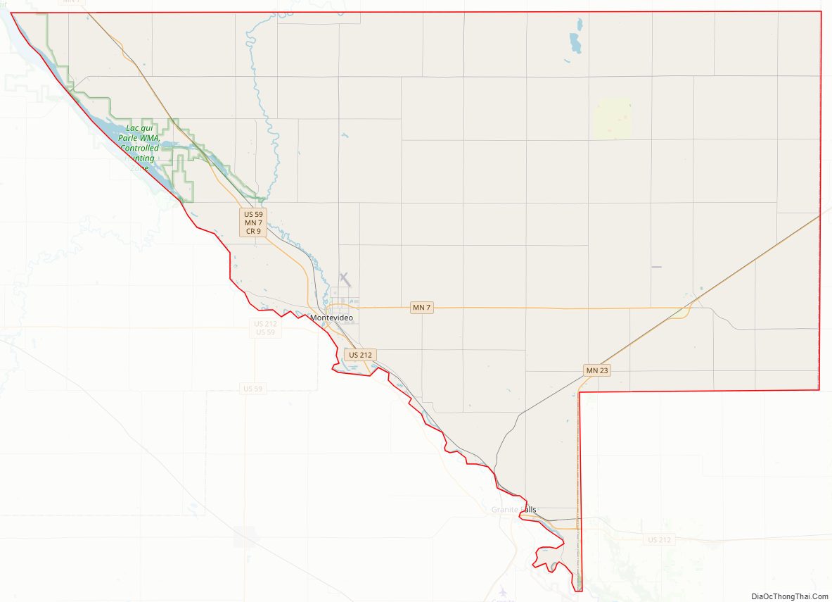
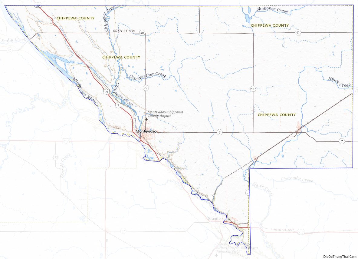
Chippewa County Road Map
Geography
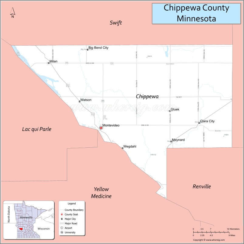
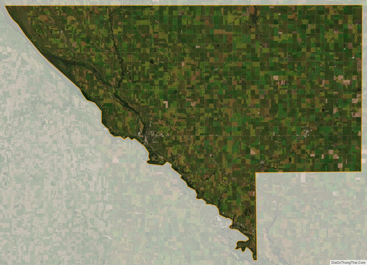
The upper part of the county’s western boundary is formed by the outline of Lac qui Parle reservoir, which was formed when the Minnesota River was dammed in 1939. The Minnesota River flows southeast from the lake, along the county’s southwestern border, while the Chippewa River flows south through the western part of the county to discharge into the Minnesota at the county’s southern border. The Dry Weather Creek drains the west-central part of the county into the Chippewa, while the Palmer Creek drains the lower central part of the county into the Minnesota near the county’s southernmost point. The county terrain consists of low rolling hills, devoted to agriculture. The terrain generally slopes to the south, and locally to the river valleys. The county’s highest point is near its southeastern corner, section 23 of Rheiderland Township, at 1,142′ (348m) The county has a total area of 588 square miles (1,520 km), of which 581 square miles (1,500 km) is land and 6.7 square miles (17 km) (1.1%) is water.
Lakes
- Carlton Lake
- Long Lake
- Norboro Lake
- Round Lake
- Shakopee Lake
- Watson Sag
Major highways
- U.S. Highway 59
- U.S. Highway 212
- Minnesota State Highway 7
- Minnesota State Highway 23
- Minnesota State Highway 29
- Minnesota State Highway 40
Adjacent counties
- Swift County – north
- Kandiyohi County – northeast
- Renville County – southeast
- Yellow Medicine County – southwest
- Lac qui Parle County – west
Protected areas
- Boike State Wildlife Management Area
- Franko State Wildlife Management Area
- Gneiss Outcrops Scientific and Natural Area
- Minnesota River Valley Overlook
- Spartan State Wildlife Management Area
Chippewa County Topographic Map
Chippewa County Satellite Map
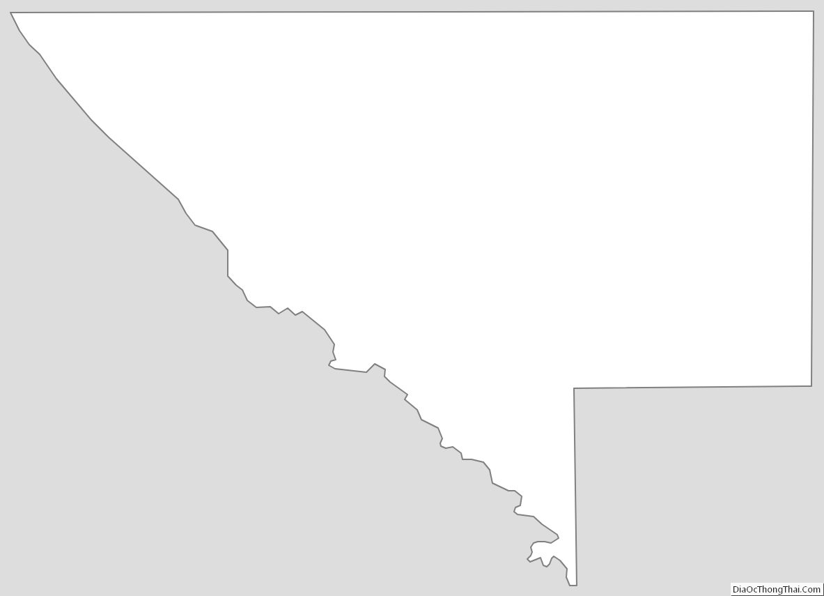
Chippewa County Outline Map
See also
Map of Minnesota State and its subdivision:- Aitkin
- Anoka
- Becker
- Beltrami
- Benton
- Big Stone
- Blue Earth
- Brown
- Carlton
- Carver
- Cass
- Chippewa
- Chisago
- Clay
- Clearwater
- Cook
- Cottonwood
- Crow Wing
- Dakota
- Dodge
- Douglas
- Faribault
- Fillmore
- Freeborn
- Goodhue
- Grant
- Hennepin
- Houston
- Hubbard
- Isanti
- Itasca
- Jackson
- Kanabec
- Kandiyohi
- Kittson
- Koochiching
- Lac qui Parle
- Lake
- Lake of the Woods
- Lake Superior
- Le Sueur
- Lincoln
- Lyon
- Mahnomen
- Marshall
- Martin
- McLeod
- Meeker
- Mille Lacs
- Morrison
- Mower
- Murray
- Nicollet
- Nobles
- Norman
- Olmsted
- Otter Tail
- Pennington
- Pine
- Pipestone
- Polk
- Pope
- Ramsey
- Red Lake
- Redwood
- Renville
- Rice
- Rock
- Roseau
- Saint Louis
- Scott
- Sherburne
- Sibley
- Stearns
- Steele
- Stevens
- Swift
- Todd
- Traverse
- Wabasha
- Wadena
- Waseca
- Washington
- Watonwan
- Wilkin
- Winona
- Wright
- Yellow Medicine
- Alabama
- Alaska
- Arizona
- Arkansas
- California
- Colorado
- Connecticut
- Delaware
- District of Columbia
- Florida
- Georgia
- Hawaii
- Idaho
- Illinois
- Indiana
- Iowa
- Kansas
- Kentucky
- Louisiana
- Maine
- Maryland
- Massachusetts
- Michigan
- Minnesota
- Mississippi
- Missouri
- Montana
- Nebraska
- Nevada
- New Hampshire
- New Jersey
- New Mexico
- New York
- North Carolina
- North Dakota
- Ohio
- Oklahoma
- Oregon
- Pennsylvania
- Rhode Island
- South Carolina
- South Dakota
- Tennessee
- Texas
- Utah
- Vermont
- Virginia
- Washington
- West Virginia
- Wisconsin
- Wyoming