Choctaw County is a county located in the U.S. state of Oklahoma. As of the 2010 census, the population was 15,205. Its county seat is Hugo.
Formerly part of the Choctaw Nation in Indian Territory, this county was reorganized and redefined in 1907, at the time of Oklahoma statehood. According to the Encyclopedia of Oklahoma History and Culture, the name is derived from Chahta, the mythical founder of the Choctaw people. It is part of the area of jurisdiction of the Choctaw Nation of Oklahoma.
| Name: | Choctaw County |
|---|---|
| FIPS code: | 40-023 |
| State: | Oklahoma |
| Founded: | 1907 |
| Seat: | Hugo |
| Largest city: | Hugo |
| Total Area: | 800 sq mi (2,000 km²) |
| Land Area: | 770 sq mi (2,000 km²) |
| Total Population: | 15,205 |
| Population Density: | 20/sq mi (8/km²) |
| Time zone: | UTC−6 (Central) |
| Summer Time Zone (DST): | UTC−5 (CDT) |
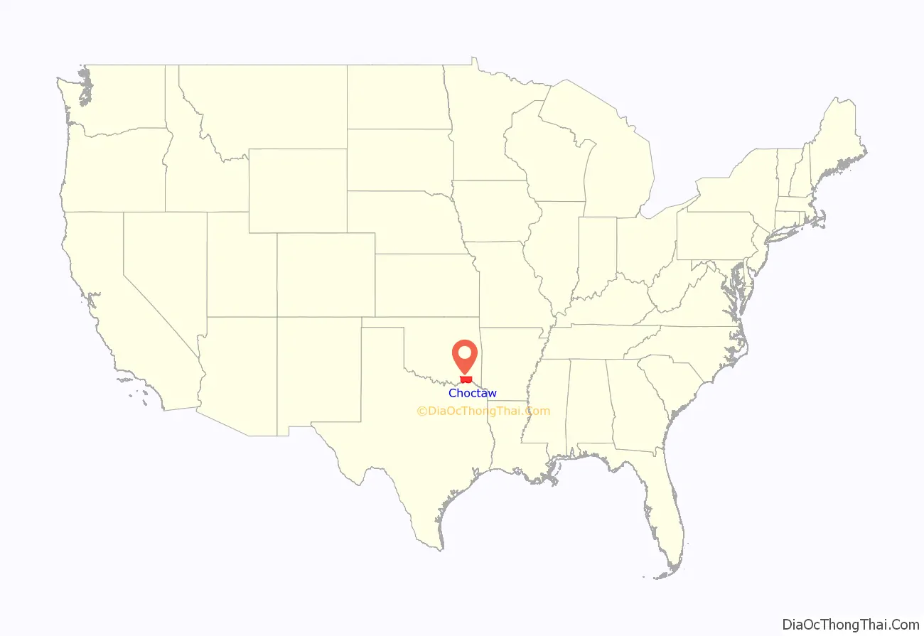
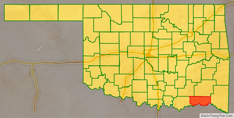
Choctaw County location map. Where is Choctaw County?
History
The Choctaw Nation moved into the area now occupied by Choctaw County in 1831–1832, as a result of their forcible removal from their homeland in the Southeastern United States, under the Indian Removal Act. The US wanted to extinguish Native American land claims in the Southeast to enable development by European Americans. It offered land in exchange in Indian Territory.
The U.S. Army had already established Fort Towson in the western area in 1824, and took on the mission of protecting the newcomers from other tribes. In 1837, the Chickasaw were also removed, and settled the area around Doaksville, which was adjacent to the fort. Both the town of Fort Towson and Doaksville served as the capital of the Choctaw Nation. Doaksville became a ghost town after the Civil War. In 1848, the Presbyterian church established a mission, which still exists and is now known as Goodland Academy.
The St. Louis and San Francisco Railway built a line through the town of Hugo in 1902, stimulating commercial development of the town as a regional center. Before statehood, the area of Choctaw County was part of Jackson, Kiamichi, Cedar, and Towson counties, Choctaw Nation. It included two of the three administrative super-regions comprising the Choctaw Nation: the Apukshunnubbee District and the Pushmataha District.
As the end of the Indian Territory drew near, tribal citizens and other inhabitants organized an effort for the territory to be admitted to the Union as a state. The State of Sequoyah, which they proposed, divided the territories of the five tribes into counties. Hugo was designated as the county seat of Hitchcock County. Although neither Congress nor the president were interested in admitting Sequoyah as a state, the county boundaries proposed for Sequoyah were in some cases adopted for counties in the future state of Oklahoma.
In southeastern Oklahoma, the future Choctaw County’s boundaries were generally those of Hitchcock County, Sequoyah. Similarly, boundaries proposed for Pushmataha County, Sequoyah served, in general, as the boundaries for Pushmataha County, Oklahoma. And McCurtain County, Oklahoma generally follows the boundaries proposed for McCurtain County, Sequoyah. Both counties are adjacent to and share boundaries with Choctaw County.
When Oklahoma became a state in 1907, Choctaw County was created and Hugo was named as the county seat.
Recent events
In October 2011 the U.S. Navy announced plans to honor Choctaw County with the naming of a ship. The Joint High Speed Vessel (JHSV) will simultaneously honor the three American counties named Choctaw County, in the states of Alabama, Mississippi, and Oklahoma. “I grew up in Choctaw County, Miss., where people work hard to raise their families and provide for their children,” Secretary of the Navy Ray Mabus said in announcing the plan. “I chose to name JHSV after Choctaw County to honor those men and women who represent rural America.” USNS Choctaw County will bear hull number JHSV-2.
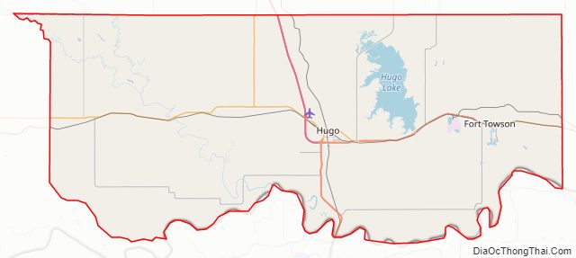
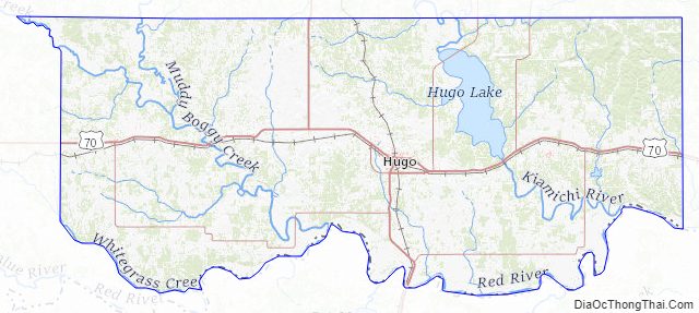
Choctaw County Road Map
Geography
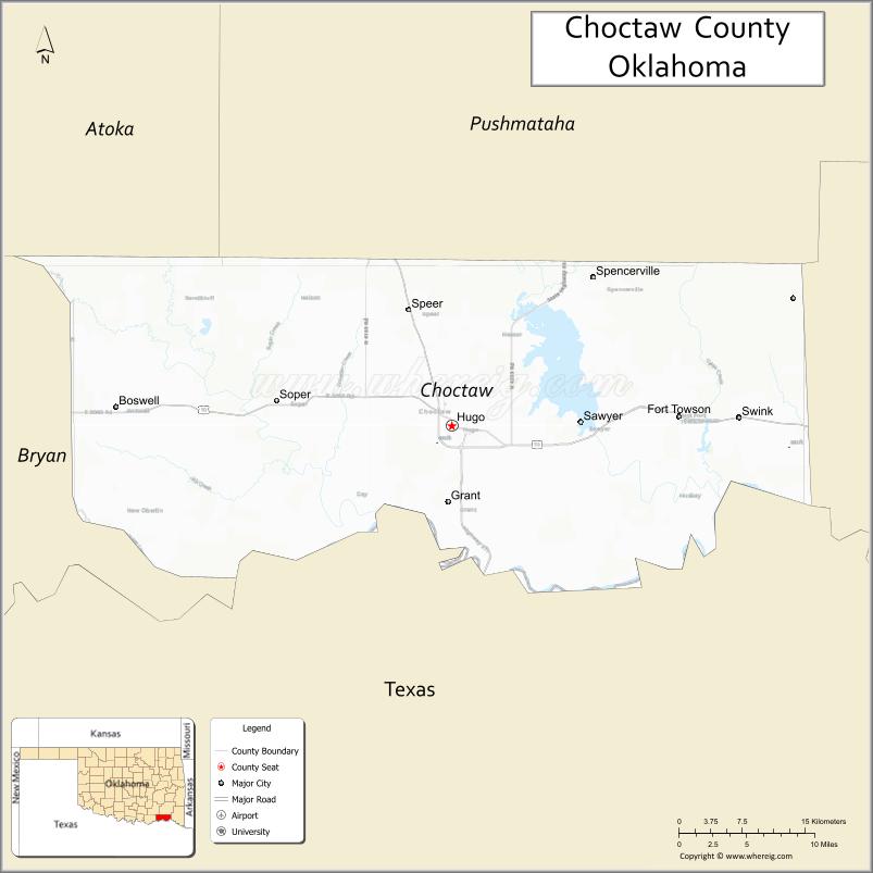
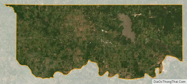
Choctaw County is in southeastern Oklahoma, in a 10-county area designated for tourism purposes by the Oklahoma Department of Tourism and Recreation as Choctaw Country. According to the U.S. Census Bureau, the county has a total area of 800 square miles (2,100 km), of which 770 square miles (2,000 km) is land and 29 square miles (75 km) (3.7%) is water. The major streams in the county are the Kiamichi River, the Muddy Boggy River and the Clear Boggy River, which all drain into the Red River. Lakes include Hugo Lake, on the Kiamichi River, and Raymond Gary Lake. Choctaw County is the only documented part of Oklahoma, together with McCurtain County, located within the natural range of the American alligator.
Major highways
- U.S. Highway 70
- U.S. Highway 271
- State Highway 93
- Indian Nation Turnpike
Adjacent counties
- Pushmataha County (north)
- McCurtain County (east)
- Red River County, Texas (southeast)
- Lamar County, Texas (south)
- Bryan County (west)
- Atoka County (northwest)
Choctaw County Topographic Map
Choctaw County Satellite Map
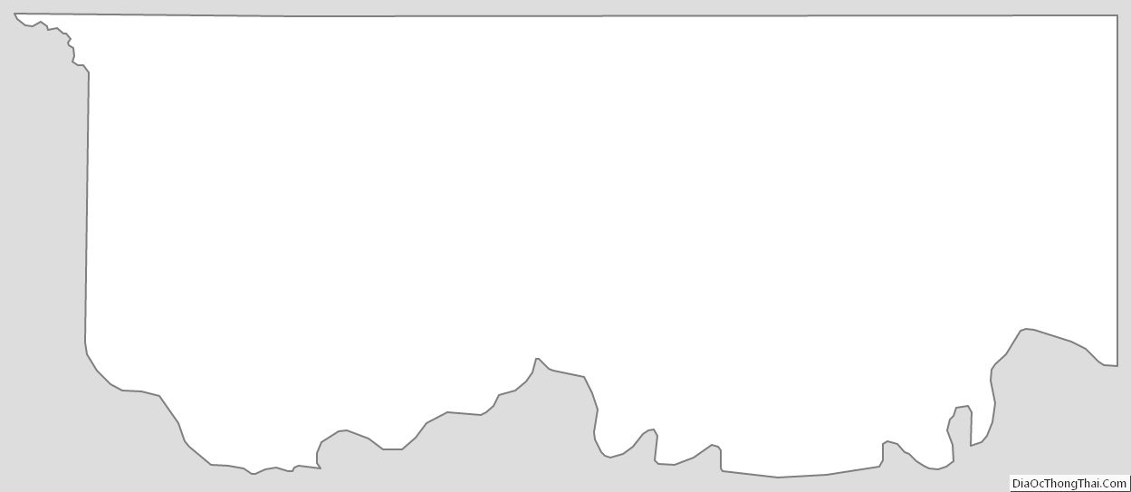
Choctaw County Outline Map
See also
Map of Oklahoma State and its subdivision:- Adair
- Alfalfa
- Atoka
- Beaver
- Beckham
- Blaine
- Bryan
- Caddo
- Canadian
- Carter
- Cherokee
- Choctaw
- Cimarron
- Cleveland
- Coal
- Comanche
- Cotton
- Craig
- Creek
- Custer
- Delaware
- Dewey
- Ellis
- Garfield
- Garvin
- Grady
- Grant
- Greer
- Harmon
- Harper
- Haskell
- Hughes
- Jackson
- Jefferson
- Johnston
- Kay
- Kingfisher
- Kiowa
- Latimer
- Le Flore
- Lincoln
- Logan
- Love
- Major
- Marshall
- Mayes
- McClain
- McCurtain
- McIntosh
- Murray
- Muskogee
- Noble
- Nowata
- Okfuskee
- Oklahoma
- Okmulgee
- Osage
- Ottawa
- Pawnee
- Payne
- Pittsburg
- Pontotoc
- Pottawatomie
- Pushmataha
- Roger Mills
- Rogers
- Seminole
- Sequoyah
- Stephens
- Texas
- Tillman
- Tulsa
- Wagoner
- Washington
- Washita
- Woods
- Woodward
- Alabama
- Alaska
- Arizona
- Arkansas
- California
- Colorado
- Connecticut
- Delaware
- District of Columbia
- Florida
- Georgia
- Hawaii
- Idaho
- Illinois
- Indiana
- Iowa
- Kansas
- Kentucky
- Louisiana
- Maine
- Maryland
- Massachusetts
- Michigan
- Minnesota
- Mississippi
- Missouri
- Montana
- Nebraska
- Nevada
- New Hampshire
- New Jersey
- New Mexico
- New York
- North Carolina
- North Dakota
- Ohio
- Oklahoma
- Oregon
- Pennsylvania
- Rhode Island
- South Carolina
- South Dakota
- Tennessee
- Texas
- Utah
- Vermont
- Virginia
- Washington
- West Virginia
- Wisconsin
- Wyoming