Clare County is a county in the U.S. state of Michigan. As of the 2020 Census, the population was 30,856. The county seat is Harrison.
| Name: | Clare County |
|---|---|
| FIPS code: | 26-035 |
| State: | Michigan |
| Founded: | 1840 |
| Named for: | County Clare, Ireland |
| Seat: | Harrison |
| Largest city: | Clare |
| Total Area: | 575 sq mi (1,490 km²) |
| Land Area: | 564 sq mi (1,460 km²) |
| Total Population: | 30,856 |
| Population Density: | 55/sq mi (21/km²) |
| Time zone: | UTC−5 (Eastern) |
| Summer Time Zone (DST): | UTC−4 (EDT) |
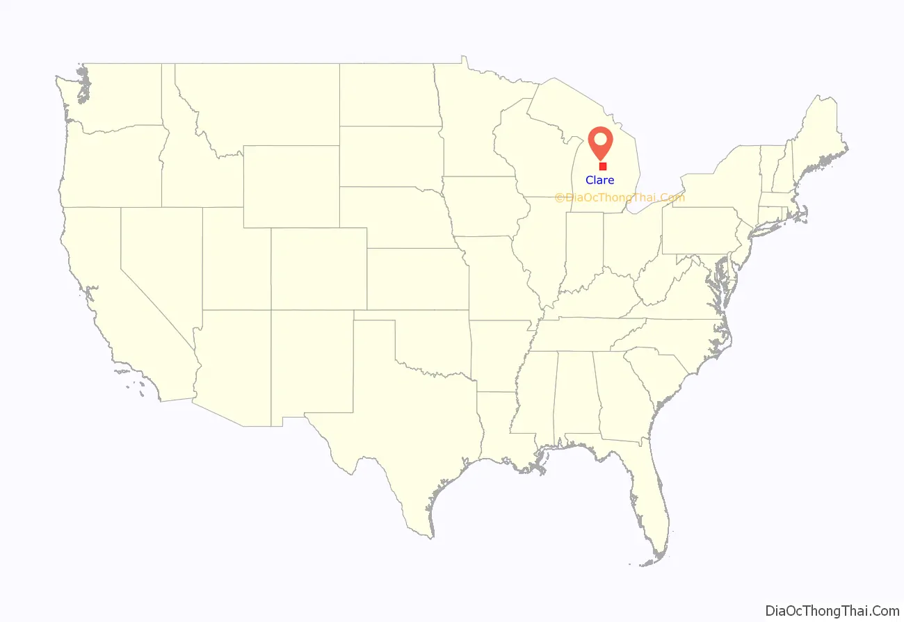
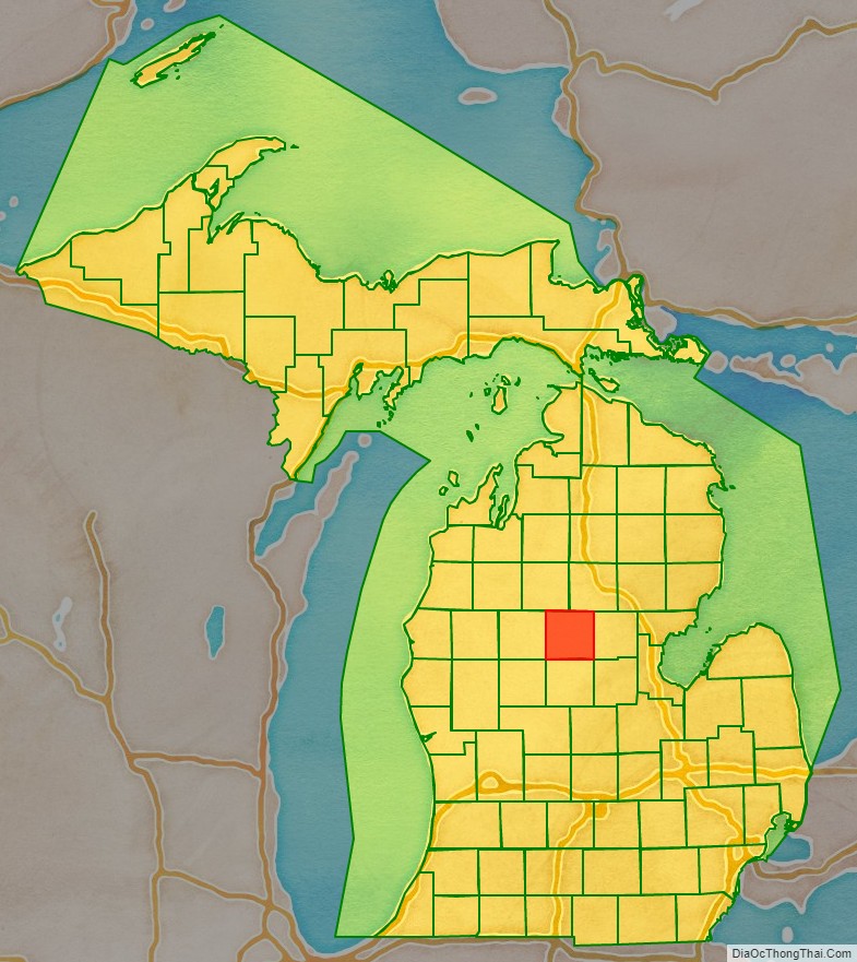
Clare County location map. Where is Clare County?
History
The county was created by the Michigan Legislature from part of Michilimackinac County in 1840, named Kaykakee County after a Sauk Indian Chief. It was renamed Clare County in 1843 after County Clare in Ireland. The county was administered by a succession of other Michigan counties prior to the organization of county government in 1871. Farwell was the first county seat; in 1877 the county seat was moved to Harrison.
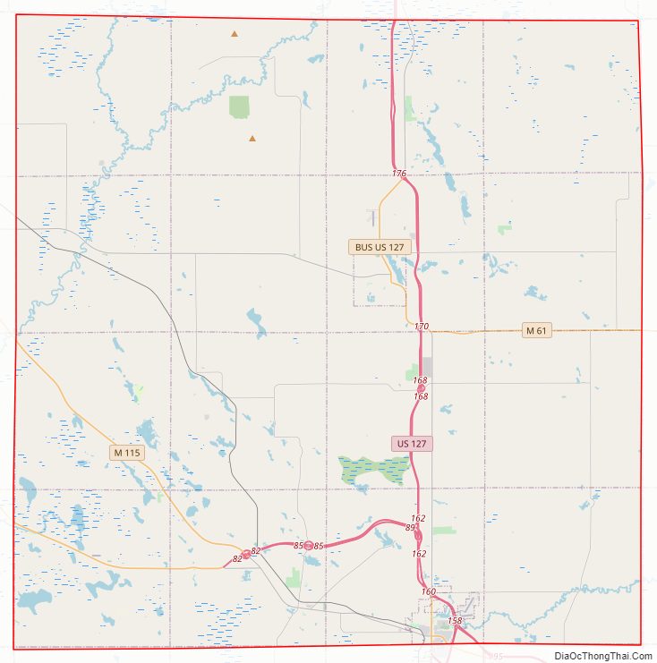
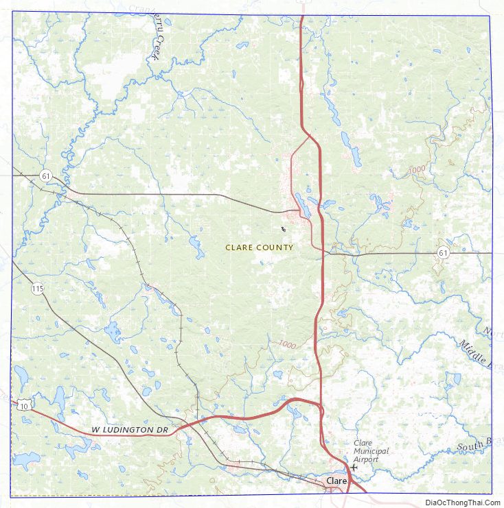
Clare County Road Map
Geography
According to the US Census Bureau, the county has a total area of 575 square miles (1,490 km), of which 564 square miles (1,460 km) is land and 11 square miles (28 km) (1.9%) is water. It is considered to be part of both Northern Michigan and Central Michigan.
Features
- Au Sable State Forest
Major highways
- US 10 runs east–west through bottom of county. Enters west county line at 3.7 miles (6 km) north of SW corner of county. Runs easterly to intersection with US127 at 2.8 miles (4.5 km) north of Clare.
- Bus. US 10 runs through Clare with Bus. US 127 until they meet M-115, where Bus. US 10 runs eastward to US 10.
- US 127 runs north–south through eastern middle of county, Passing Harrison and Clare.
- Bus. US 127 runs through Clare with Bus. US 10 until the two meet M-115, where Bus. US 10 turns eastward while Bus. US 127 continues southward to US 127.
- Bus. US 127 runs from US 127 to go through Harrison. Bus. US 127 intersects M-61, and the two have a concurrency with each other until they both intersect US 127, where Bus. US 127 ends with M-61 continues eastward to Gladwin.
- M-18 runs along east line of county, from the northeast corner for 3.5 miles (5.6 km), then turns east into Gladwin County.
- M-61 runs east–west through middle of county, entering the west line from Osceola County and running east to intersection with US 127 at Harrison.
- M-115 runs southeast and east across bottom of county. It enters the west line from Osceola County at nine miles (14 km) above the southwest corner of county and runs to an intersection with Bus. US 127/Bus. US 10 at Clare.
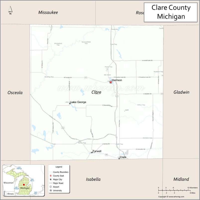
Adjacent counties
- Missaukee County – northwest
- Roscommon County – northeast
- Gladwin County – east
- Midland County – southeast
- Isabella County – south
- Mecosta County – southwest
- Osceola County – west
Clare County Topographic Map
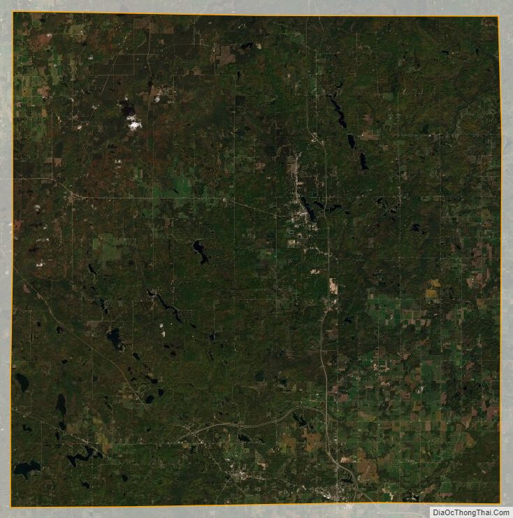
Clare County Satellite Map
Clare County Outline Map

See also
Map of Michigan State and its subdivision:- Alcona
- Alger
- Allegan
- Alpena
- Antrim
- Arenac
- Baraga
- Barry
- Bay
- Benzie
- Berrien
- Branch
- Calhoun
- Cass
- Charlevoix
- Cheboygan
- Chippewa
- Clare
- Clinton
- Crawford
- Delta
- Dickinson
- Eaton
- Emmet
- Genesee
- Gladwin
- Gogebic
- Grand Traverse
- Gratiot
- Hillsdale
- Houghton
- Huron
- Ingham
- Ionia
- Iosco
- Iron
- Isabella
- Jackson
- Kalamazoo
- Kalkaska
- Kent
- Keweenaw
- Lake
- Lake Hurron
- Lake Michigan
- Lake St. Clair
- Lake Superior
- Lapeer
- Leelanau
- Lenawee
- Livingston
- Luce
- Mackinac
- Macomb
- Manistee
- Marquette
- Mason
- Mecosta
- Menominee
- Midland
- Missaukee
- Monroe
- Montcalm
- Montmorency
- Muskegon
- Newaygo
- Oakland
- Oceana
- Ogemaw
- Ontonagon
- Osceola
- Oscoda
- Otsego
- Ottawa
- Presque Isle
- Roscommon
- Saginaw
- Saint Clair
- Saint Joseph
- Sanilac
- Schoolcraft
- Shiawassee
- Tuscola
- Van Buren
- Washtenaw
- Wayne
- Wexford
- Alabama
- Alaska
- Arizona
- Arkansas
- California
- Colorado
- Connecticut
- Delaware
- District of Columbia
- Florida
- Georgia
- Hawaii
- Idaho
- Illinois
- Indiana
- Iowa
- Kansas
- Kentucky
- Louisiana
- Maine
- Maryland
- Massachusetts
- Michigan
- Minnesota
- Mississippi
- Missouri
- Montana
- Nebraska
- Nevada
- New Hampshire
- New Jersey
- New Mexico
- New York
- North Carolina
- North Dakota
- Ohio
- Oklahoma
- Oregon
- Pennsylvania
- Rhode Island
- South Carolina
- South Dakota
- Tennessee
- Texas
- Utah
- Vermont
- Virginia
- Washington
- West Virginia
- Wisconsin
- Wyoming