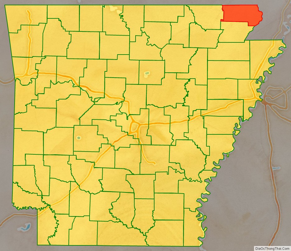
Clay County is a county located in the U.S. state of Arkansas. Originally incorporated as Clayton County, as of the 2020 census, its population was 14,552. The county has two county seats, Corning and Piggott. It is a dry county, in which the sale of alcoholic beverages is restricted or prohibited.
| Name: | Clay County |
|---|---|
| FIPS code: | 05-021 |
| State: | Arkansas |
| Founded: | March 24, 1873 |
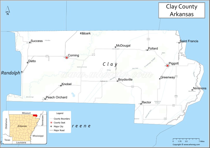
| Seat: | Corning (western district); Piggott (eastern district) |
| Largest city: | Piggott |
| Total Area: | 641 sq mi (1,660 km²) |
| Land Area: | 639 sq mi (1,660 km²) |
| Total Population: | 14,552 |
| Population Density: | 23/sq mi (8.8/km²) |
| Time zone: | UTC−6 (Central) |
| Summer Time Zone (DST): | UTC−5 (CDT) |
| Website: | claycounty.arkansas.gov |
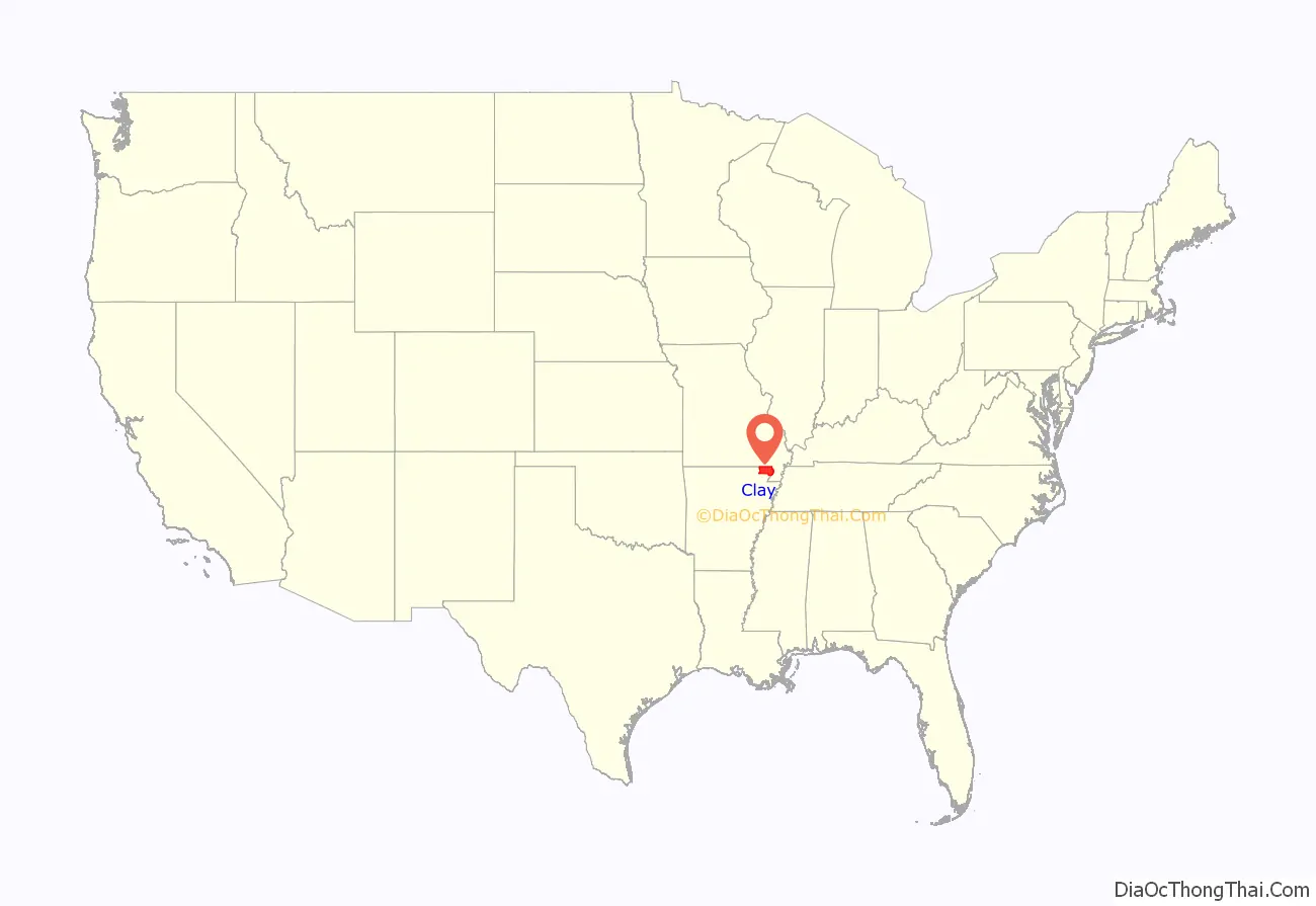
Clay County location map. Where is Clay County?
History
When Clay County was created as Arkansas’s 67th county on March 24, 1873 (along with Baxter County), it was named Clayton County, after John M. Clayton, then a member of the Arkansas Senate and a brother of then-U.S. Senator Powell Clayton, though some sources suggest it may have been named for Powell Clayton instead.
Two years later on December 6, 1875, the county’s name was shortened to “Clay” by the Arkansas General Assembly. Some claim it was renamed for the statesman Henry Clay, while others say John M. Clayton remained its official namesake. The name change apparently was inspired by lingering distrust of Powell Clayton, as he had declared martial law and suspended elections in the county in 1868 when he was Governor of Arkansas and it was still part of Greene County.
The first county seat was Corning, established in 1873, with the arrival of the St. Louis, Iron Mountain and Southern Railway, as the first incorporated town in the county. The county seat was moved to Boydsville in 1877, in what was known as “Old Bradshaw Field”, because people living east of the Black and Cache Rivers had difficulty getting to Corning during the flood season. However, this caused problems for those living west of the rivers, and in 1881 Corning was re-established as the seat of the Western District, with Boydsville remaining the seat for the Eastern District. With the arrival of the St. Louis, Arkansas and Texas Railroad in 1882, other towns such as Greenway, Rector and Piggott experienced growth. In 1887, the Eastern District seat was moved to Piggott, and the dual county seat system remains in place today. Important county functions (such as the Quorum Court) alternate between Piggott and Corning as their venues.
In the early 20th century, Clay, Greene, and Craighead counties had sundown town policies forbidding African Americans from living in the area.
On April 6, 1972, Sheriff Douglas Batey and deputies Glen Ray Archer and Troy Key were shot and killed while trying to serve a warrant on Bert Grissom. Grissom opened fire as soon as the men stepped out of their car. He later surrendered without resistance to another deputy, and was tried, convicted, and sentenced to life in prison. William Thomas Pond became sheriff, but he died in an automobile accident on June 8, 1973. Four of the five police officers who have lost their lives serving the Clay County Sheriff’s Office died in these two incidents.
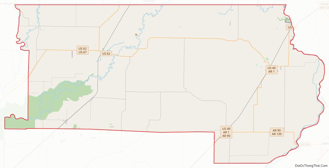
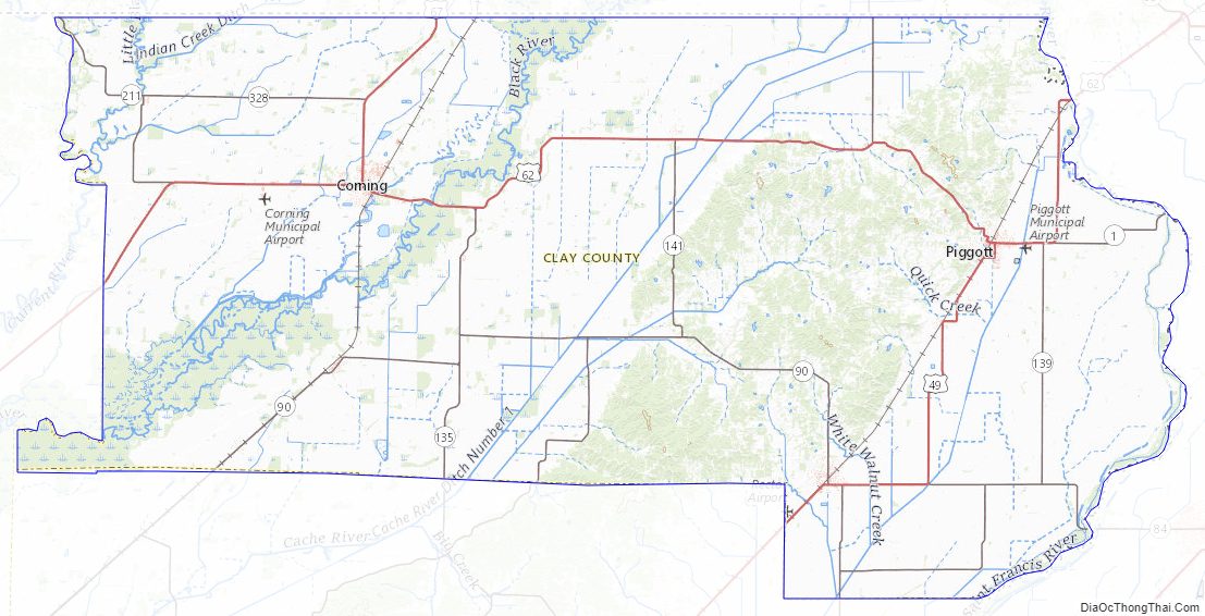
Clay County Road Map
Geography
According to the U.S. Census Bureau, the county has a total area of 641 square miles (1,660 km), of which 639 square miles (1,660 km) is land and 2.0 square miles (5.2 km) (0.3%) is water.
Major highways
- Future Interstate 57
- U.S. Highway 49
- U.S. Highway 62
- U.S. Highway 67
- Highway 90
- Highway 119
- Highway 139
Adjacent counties
- Butler County, Missouri (north)
- Dunklin County, Missouri (east)
- Greene County (south)
- Randolph County (west)
- Ripley County, Missouri (northwest)
Clay County Topographic Map
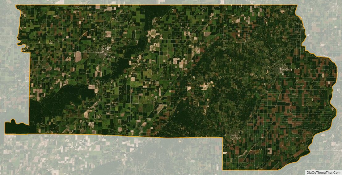
Clay County Satellite Map
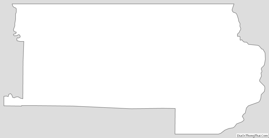
Clay County Outline Map
See also
Map of Arkansas State and its subdivision:- Arkansas
- Ashley
- Baxter
- Benton
- Boone
- Bradley
- Calhoun
- Carroll
- Chicot
- Clark
- Clay
- Cleburne
- Cleveland
- Columbia
- Conway
- Craighead
- Crawford
- Crittenden
- Cross
- Dallas
- Desha
- Drew
- Faulkner
- Franklin
- Fulton
- Garland
- Grant
- Greene
- Hempstead
- Hot Spring
- Howard
- Independence
- Izard
- Jackson
- Jefferson
- Johnson
- Lafayette
- Lawrence
- Lee
- Lincoln
- Little River
- Logan
- Lonoke
- Madison
- Marion
- Miller
- Mississippi
- Monroe
- Montgomery
- Nevada
- Newton
- Ouachita
- Perry
- Phillips
- Pike
- Poinsett
- Polk
- Pope
- Prairie
- Pulaski
- Randolph
- Saint Francis
- Saline
- Scott
- Searcy
- Sebastian
- Sevier
- Sharp
- Stone
- Union
- Van Buren
- Washington
- White
- Woodruff
- Yell
- Alabama
- Alaska
- Arizona
- Arkansas
- California
- Colorado
- Connecticut
- Delaware
- District of Columbia
- Florida
- Georgia
- Hawaii
- Idaho
- Illinois
- Indiana
- Iowa
- Kansas
- Kentucky
- Louisiana
- Maine
- Maryland
- Massachusetts
- Michigan
- Minnesota
- Mississippi
- Missouri
- Montana
- Nebraska
- Nevada
- New Hampshire
- New Jersey
- New Mexico
- New York
- North Carolina
- North Dakota
- Ohio
- Oklahoma
- Oregon
- Pennsylvania
- Rhode Island
- South Carolina
- South Dakota
- Tennessee
- Texas
- Utah
- Vermont
- Virginia
- Washington
- West Virginia
- Wisconsin
- Wyoming