Clearfield County is a county in the Commonwealth of Pennsylvania. As of the 2020 census, the population was 80,562. The county seat is Clearfield, and the largest city is DuBois. The county was created in 1804 and later organized in 1822.
Clearfield County comprises the DuBois, PA Micropolitan Statistical Area, which is also included in the State College–DuBois, PA Combined Statistical Area.
| Name: | Clearfield County |
|---|---|
| FIPS code: | 42-033 |
| State: | Pennsylvania |
| Founded: | January 29, 1822 |
| Seat: | Clearfield |
| Largest city: | DuBois |
| Total Area: | 1,154 sq mi (2,990 km²) |
| Land Area: | 1,145 sq mi (2,970 km²) |
| Total Population: | 80,562 |
| Population Density: | 70/sq mi (27/km²) |
| Time zone: | UTC−5 (Eastern) |
| Summer Time Zone (DST): | UTC−4 (EDT) |
| Website: | www.clearfieldco.org |
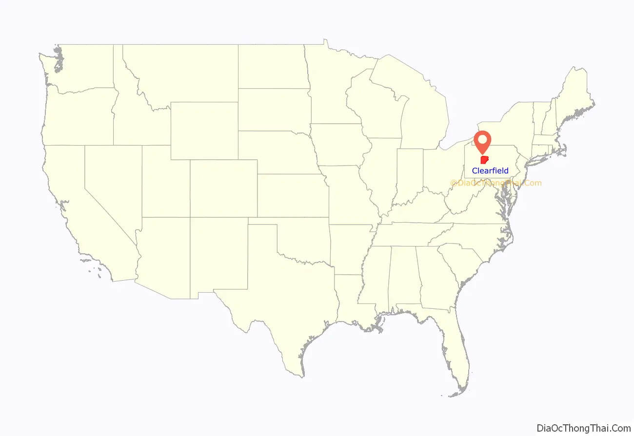
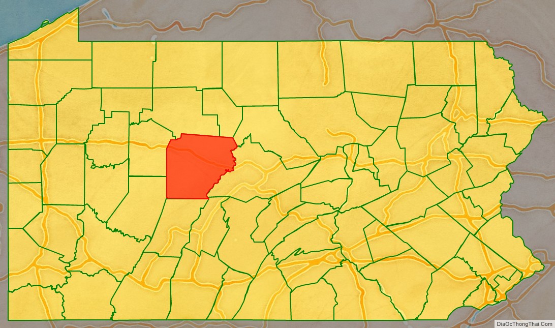
Clearfield County location map. Where is Clearfield County?
History
Clearfield County was formed by the Act of Assembly by the second Governor of Pennsylvania at the time, Thomas McKean on March 26, 1804. The county was created from parts of the already created counties of Huntingdon and Lycoming. The name for the county was most likely derived from the many cleared fields of the valleys surrounding Clearfield Creek and West Branch of the Susquehanna River, formed by the bison herds and also by old corn fields of prior Native Americans tribes.
Location of county government
The first board of county commissioners to the county were Roland Curtin, James Fleming and James Smith, all appointed by Governor McKean in 1805. The first act the commissioners did was to create a local government or seat of the newly created county. They came upon land owned at the time by Abraham Witmer at a village known as Chincleclamousche, named after the Native American chief of the Cornplanter’s tribe of Senecas. Clearfield became the new name of the old village.
Early industry
The two major industries of the county in the mid-1800s until the early 1900s was lumber and coal. Lumber was still being floated down the West Branch of the Susquehanna up until 1917. Coal remains the main industry of the county to this day.
Clearfield County Conspiracy Trials
No case tried in the county has caused as much comment as the union conspiracy trials. In all there were fifty-six persons, primarily miners in the Houtzdale region, who were charged with conspiracy as organized strikers.
The first case, against John Maloney and fifty-three others, was tried in 1875, before a jury with Judge Orvis presiding. All were found guilty, although they seem to have been solely peacefully picketing. Four were sentenced to one year’s imprisonment and eight, to six months; the others’ sentences were suspended. As every organized labor society in the United States was interested in the result, the events of the trial and verdict were telegraphed throughout the country
This proceeding was followed by the trial of the remaining two offenders, who were union representatives, John Siney and Xingo Parks. Siney was then the President of the Miners’ National Association (MNA); he had come to Houtzdale and delivered an address of support for the union strike, for which he was arrested. Parks was an able organizer for the MNA. Federal Senator Matthew H. Carpenter of Wisconsin defended both men. At trial, Siney was acquitted; Parks was found guilty of inciting unlawful assembly and sentenced to one year’s imprisonment, but pardoned within a month from the time sentence was pronounced.
These cases led in the next year to a liberalization of the Pennsylvania conspiracy law, through amendment providing that only “force, threat, or menace of harm to person or property” would be illegal.
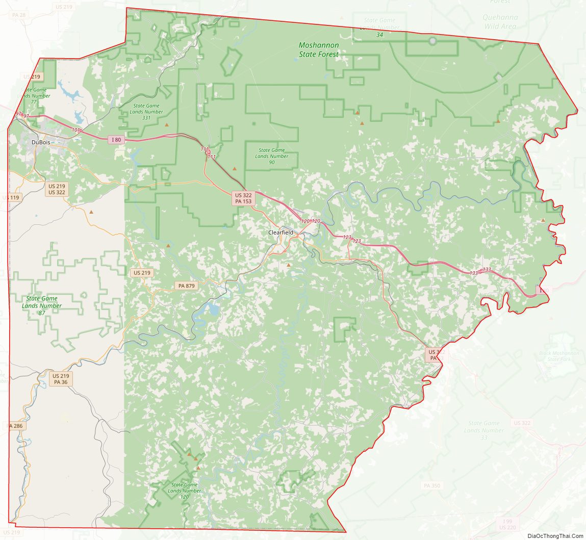
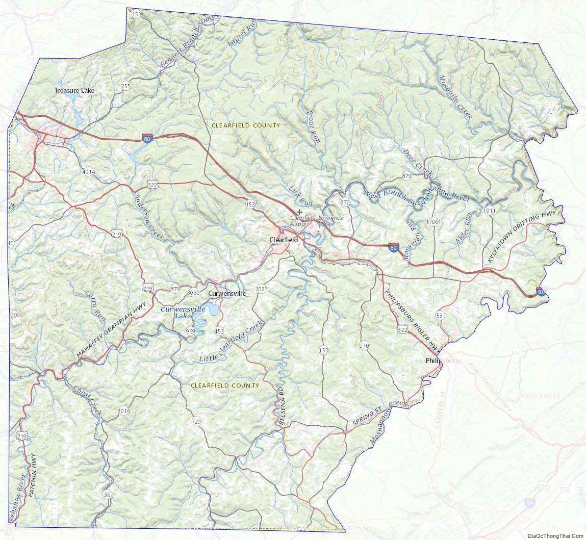
Clearfield County Road Map
Geography
According to the U.S. Census Bureau, the county has a total area of 1,154 square miles (2,990 km), of which 1,145 square miles (2,970 km) is land and 9.2 square miles (24 km) (0.8%) is water. It is the third-largest county in Pennsylvania by land area and fourth-largest by total area. The West Branch Susquehanna River flows through the county, bisecting the county seat along the way.
The mountainous terrain of the county made traffic difficult for early settlers. Various Native American paths and trails crossing the area were used intermittently by settlers, invading armies, and escaped slaves travelling north along the Underground Railroad. A major feature located in Bloom Township, within the county, is known as Bilger’s rocks and exhibits fine examples of exposed sandstone bedrock that was created during the formation of the Appalachian Mountains.
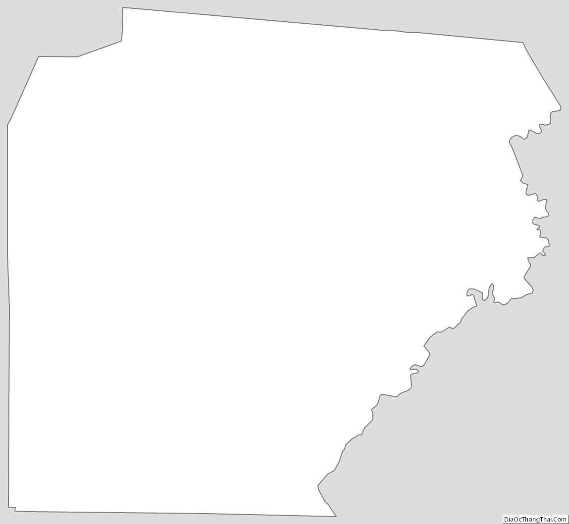
The shape of Clearfield County bears an amazing resemblance to that of the state of Arkansas.
Major highways
- I-80, exits 97, 101, 111, 120, 123 & 133
- US 119
- US 219
- US 322
- PA 36
- PA 53
- PA 153
- PA 253
- PA 255
- PA 286
- PA 410
- PA 453
- PA 729
- PA 830
- PA 865
- PA 879
- PA 969
- PA 970
Adjacent counties
- Elk County (north)
- Cameron County (north)
- Clinton County (northeast)
- Centre County (east)
- Blair County (southeast)
- Cambria County (south)
- Indiana County (southwest)
- Jefferson County (west)
Climate
The county has a warm-summer humid continental climate (Dfb). Average monthly temperatures in DuBois range from 24.6 °F in January to 68.6 °F in July, while in Clearfield borough they range from 23.8 °F in January to 69.3 °F in July and in Osceola Mills they range from 24.4 °F in January to 69.1 °F in July. [1]
Clearfield County Topographic Map
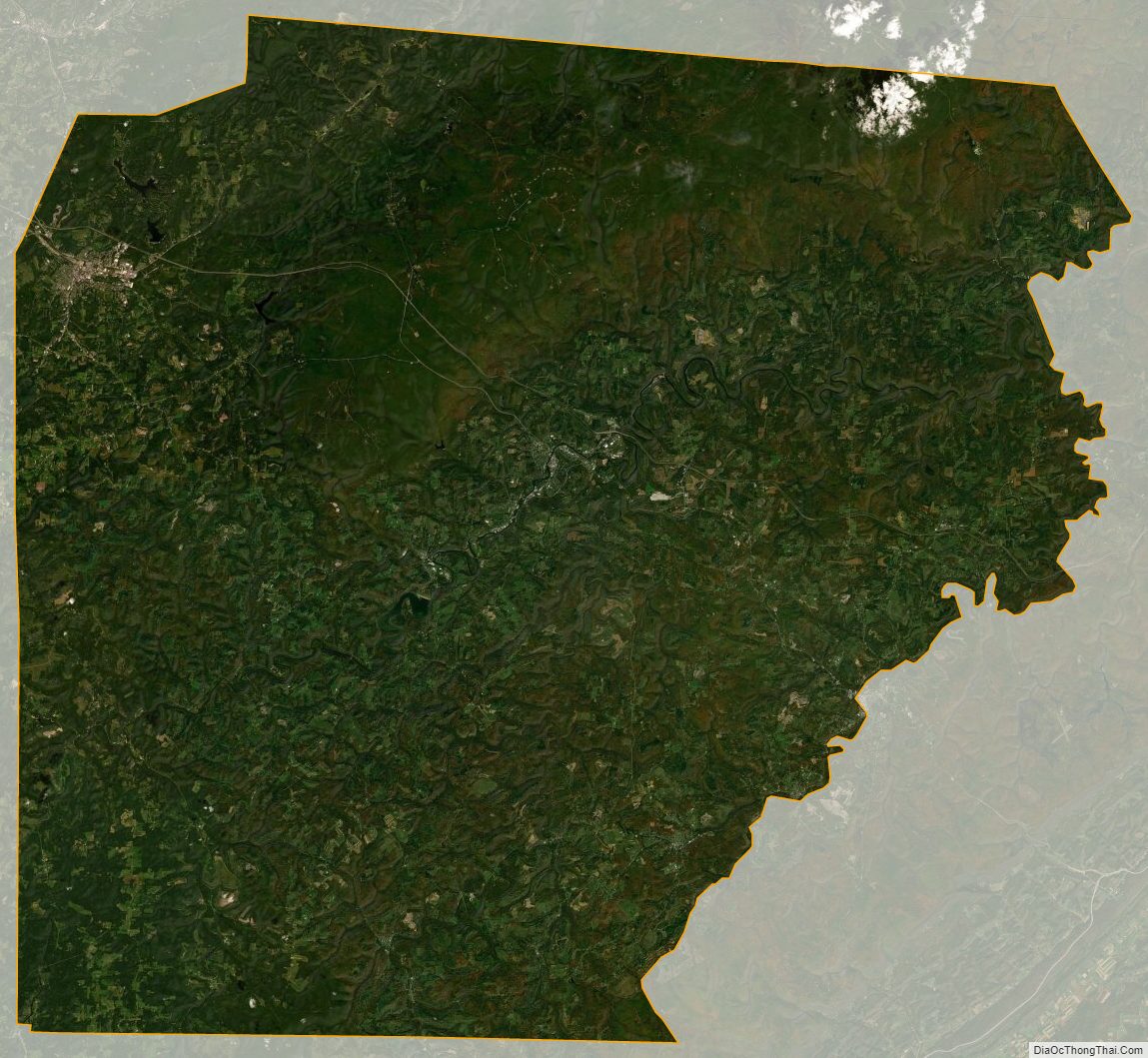
Clearfield County Satellite Map
Clearfield County Outline Map
See also
Map of Pennsylvania State and its subdivision:- Adams
- Allegheny
- Armstrong
- Beaver
- Bedford
- Berks
- Blair
- Bradford
- Bucks
- Butler
- Cambria
- Cameron
- Carbon
- Centre
- Chester
- Clarion
- Clearfield
- Clinton
- Columbia
- Crawford
- Cumberland
- Dauphin
- Delaware
- Elk
- Erie
- Fayette
- Forest
- Franklin
- Fulton
- Greene
- Huntingdon
- Indiana
- Jefferson
- Juniata
- Lackawanna
- Lancaster
- Lawrence
- Lebanon
- Lehigh
- Luzerne
- Lycoming
- Mc Kean
- Mercer
- Mifflin
- Monroe
- Montgomery
- Montour
- Northampton
- Northumberland
- Perry
- Philadelphia
- Pike
- Potter
- Schuylkill
- Snyder
- Somerset
- Sullivan
- Susquehanna
- Tioga
- Union
- Venango
- Warren
- Washington
- Wayne
- Westmoreland
- Wyoming
- York
- Alabama
- Alaska
- Arizona
- Arkansas
- California
- Colorado
- Connecticut
- Delaware
- District of Columbia
- Florida
- Georgia
- Hawaii
- Idaho
- Illinois
- Indiana
- Iowa
- Kansas
- Kentucky
- Louisiana
- Maine
- Maryland
- Massachusetts
- Michigan
- Minnesota
- Mississippi
- Missouri
- Montana
- Nebraska
- Nevada
- New Hampshire
- New Jersey
- New Mexico
- New York
- North Carolina
- North Dakota
- Ohio
- Oklahoma
- Oregon
- Pennsylvania
- Rhode Island
- South Carolina
- South Dakota
- Tennessee
- Texas
- Utah
- Vermont
- Virginia
- Washington
- West Virginia
- Wisconsin
- Wyoming