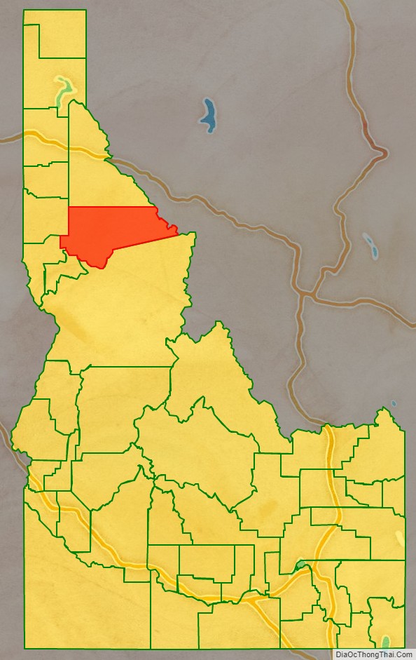
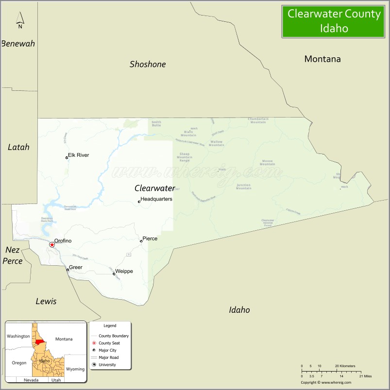
Clearwater County is a county located in the U.S. state of Idaho. As of the 2020 census, the population was 8,734. The county seat is Orofino. Established in 1911, the county was named after the Clearwater River.
The county is home to North Fork of the Clearwater River, and a small portion of the South Fork and the main Clearwater. Also in the county are the Dworshak Reservoir, Dworshak State Park, Dworshak National Fish Hatchery, and the Dworshak Dam, third highest in the U.S. The modest Bald Mountain ski area is located between Orofino and Pierce.
| Name: | Clearwater County |
|---|---|
| FIPS code: | 16-035 |
| State: | Idaho |
| Founded: | February 27, 1911 |
| Named for: | Clearwater River |
| Seat: | Orofino |
| Largest city: | Orofino |
| Total Area: | 2,488 sq mi (6,440 km²) |
| Land Area: | 2,457 sq mi (6,360 km²) |
| Total Population: | 8,734 |
| Population Density: | 3.5/sq mi (1.4/km²) |
| Time zone: | UTC−8 (Pacific) |
| Summer Time Zone (DST): | UTC−7 (PDT) |
| Website: | www.clearwatercounty.org |
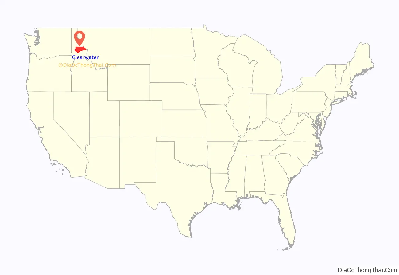
Clearwater County location map. Where is Clearwater County?
History
The Clearwater River and Lolo Pass, in the southeast corner of the county, were made famous by the exploration of Lewis and Clark in the early 19th century. Following an arduous trek through the Bitterroot Mountains, suffering through a mid-September snowstorm and near starvation, the Corps of Discovery expedition camped with the Nez Perce tribe on the Weippe Prairie outside of present-day Weippe in 1805. With the assistance of the Nez Perce, the expedition recuperated and constructed burned-out canoes at Canoe Camp in October 1805 and then paddled down the Clearwater, Snake, and Columbia rivers and met the Pacific Ocean a month later at present-day Astoria, Oregon.
Elias D. Pierce and Wilbur F. Bassett made the first discovery of gold in Idaho, on Orofino Creek (Canal Gulch) in 1860, 1 mile (2 km) north of present-day Pierce.
Until 1904, Clearwater County was part of Shoshone County to the north. It was annexed by Nez Perce County for several years and then was established as a new county in 1911. The original county seat of Shoshone County was Pierce, in today’s Clearwater County. It was the first gold rush area of present-day Idaho (then Washington Territory) in 1860 and was made the county seat of a vast Shoshone County in 1861, two years prior to the establishment of the Idaho Territory. When the Silver Valley population rose dramatically in the 1880s, the seat was moved to Murray in 1884 (and to Wallace in 1898) to better serve the majority of the county’s population. The population of the southern area increased with homesteading in the Weippe area in the late 1890s. The vast distance and time required for travel to Wallace from the Clearwater River area prompted the move of the southern portion to Nez Perce County.
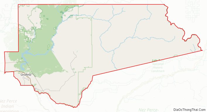
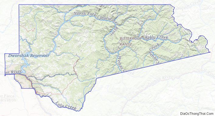
Clearwater County Road Map
Geography
According to the U.S. Census Bureau, the county has a total area of 2,488 square miles (6,440 km), of which 2,457 square miles (6,360 km) is land and 31 square miles (80 km) (1.2%) is water. It is part of the Palouse, a wide and rolling prairie-like region of the middle Columbia basin.
Adjacent counties
- Shoshone County – north
- Mineral County, Montana – northeast/Mountain Time Border
- Missoula County, Montana– east/Mountain Time Border
- Idaho County – south
- Lewis County – southwest
- Nez Perce County – southwest
- Latah County – west
Major highways
- US-12
- SH-7
- SH-8
- SH-11
National protected areas
- Clearwater National Forest (part)
- Mallard-Larkins Pioneer Area
- Lolo Trail National Historic Landmark (part)
- Nez Perce National Historical Park (part)
- Canoe Camp
- Musselshell Meadows
- Pierce Courthouse
- Weippe Prairie
- St. Joe National Forest (part)
Ski area
- Bald Mountain Ski Area
Clearwater County Topographic Map
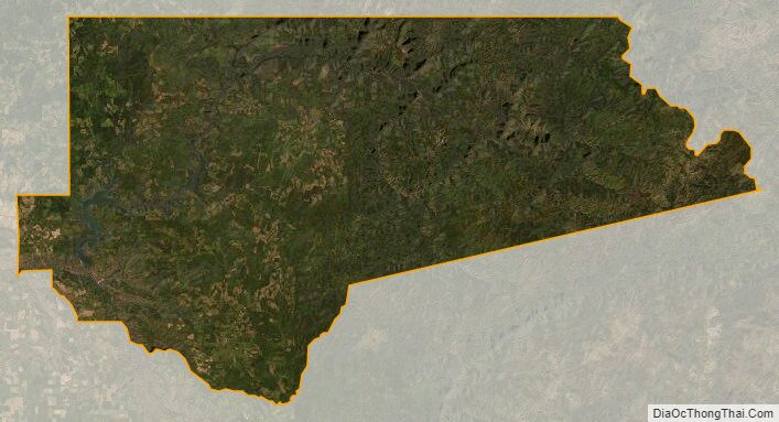
Clearwater County Satellite Map
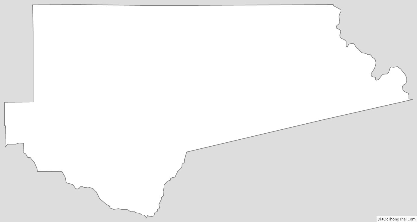
Clearwater County Outline Map
See also
Map of Idaho State and its subdivision:- Ada
- Adams
- Bannock
- Bear Lake
- Benewah
- Bingham
- Blaine
- Boise
- Bonner
- Bonneville
- Boundary
- Butte
- Camas
- Canyon
- Caribou
- Cassia
- Clark
- Clearwater
- Custer
- Elmore
- Franklin
- Fremont
- Gem
- Gooding
- Idaho
- Jefferson
- Jerome
- Kootenai
- Latah
- Lemhi
- Lewis
- Lincoln
- Madison
- Minidoka
- Nez Perce
- Oneida
- Owyhee
- Payette
- Power
- Shoshone
- Teton
- Twin Falls
- Valley
- Washington
- Alabama
- Alaska
- Arizona
- Arkansas
- California
- Colorado
- Connecticut
- Delaware
- District of Columbia
- Florida
- Georgia
- Hawaii
- Idaho
- Illinois
- Indiana
- Iowa
- Kansas
- Kentucky
- Louisiana
- Maine
- Maryland
- Massachusetts
- Michigan
- Minnesota
- Mississippi
- Missouri
- Montana
- Nebraska
- Nevada
- New Hampshire
- New Jersey
- New Mexico
- New York
- North Carolina
- North Dakota
- Ohio
- Oklahoma
- Oregon
- Pennsylvania
- Rhode Island
- South Carolina
- South Dakota
- Tennessee
- Texas
- Utah
- Vermont
- Virginia
- Washington
- West Virginia
- Wisconsin
- Wyoming