Clearwater County is a county in the northwestern part of the U.S. state of Minnesota. As of the 2020 census, the population was 8,524. Its county seat is Bagley.
Clearwater County is home to Lake Itasca, the source of the Mississippi River. Parts of the Red Lake and White Earth Indian reservations extend into the county.
| Name: | Clearwater County |
|---|---|
| FIPS code: | 27-029 |
| State: | Minnesota |
| Founded: | December 20, 1902 |
| Named for: | Clearwater Lake Clearwater River |
| Seat: | Bagley |
| Largest city: | Bagley |
| Total Area: | 1,030 sq mi (2,700 km²) |
| Land Area: | 999 sq mi (2,590 km²) |
| Total Population: | 8,524 |
| Population Density: | 8.5/sq mi (3.3/km²) |
| Time zone: | UTC−6 (Central) |
| Summer Time Zone (DST): | UTC−5 (CDT) |
| Website: | www.co.clearwater.mn.us |
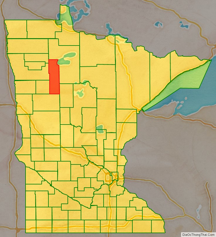
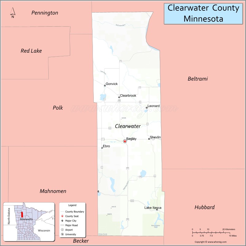
Clearwater County location map. Where is Clearwater County?

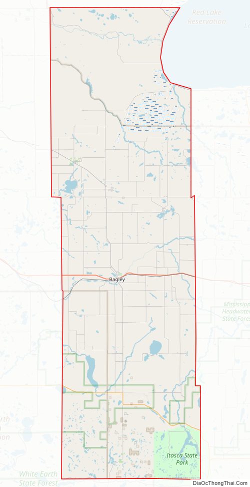
Clearwater County Road Map
Geography
The Red Lake River flows west out of Red Lake across the top of Clearwater County on its way to discharge into the Red River at Grand Forks, North Dakota. The Clearwater River flows west-southwest across the central part of the county on its way to discharge into the Red Lake River. The county terrain consists of wooded rolling hills, dotted with lakes and ponds. The terrain slopes to the north, with the highest point on the lower west boundary, at 1,781′ (543m) ASL. The county has an area of 1,030 square miles (2,700 km), of which 999 square miles (2,590 km) is land and 31 square miles (80 km) (3.0%) is water.
The county’s high point, just south of Scoop Lake, is one of a few places to exceed 2000 feet in Minnesota, rising to 2005 feet at 47.2318°N, -95.5034°W.
Major highways
- U.S. Highway 2
- Minnesota State Highway 1
- Minnesota State Highway 92
- Minnesota State Highway 113
- Minnesota State Highway 200
- Minnesota State Highway 223
Adjacent counties
- Beltrami County – northeast
- Hubbard County – southeast
- Becker County – south
- Mahnomen County – southwest
- Polk County – west
- Pennington County – northwest
Protected areas
- Bagley Lake State Wildlife Management Area
- Clearwater State Wildlife Management Area
- Iron Springs Bog SNA
- Itasca State Park (part)
- Jackson Lake State Wildlife Management Area
- Little Pine State Wildlife Management Area
- Lower Rice Lake State Wildlife Management Area
- Old Red Lake Trail State Wildlife Management Area
- Upper Rice Lake State Wildlife Management Area
Clearwater County Topographic Map
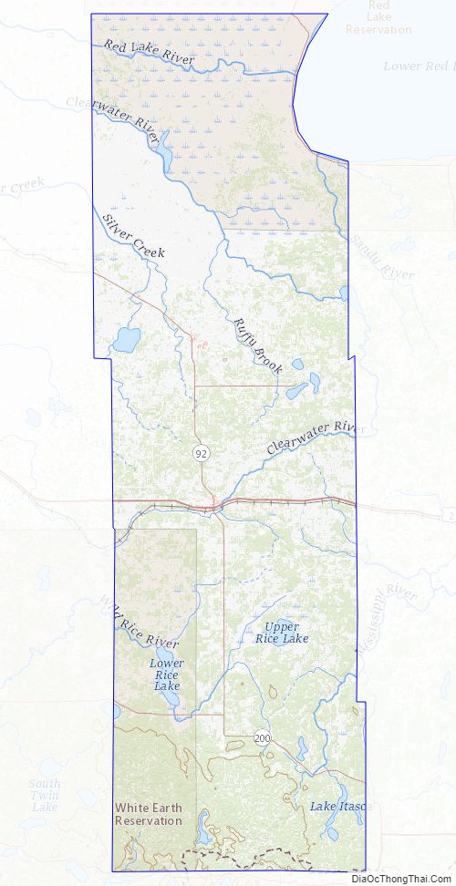
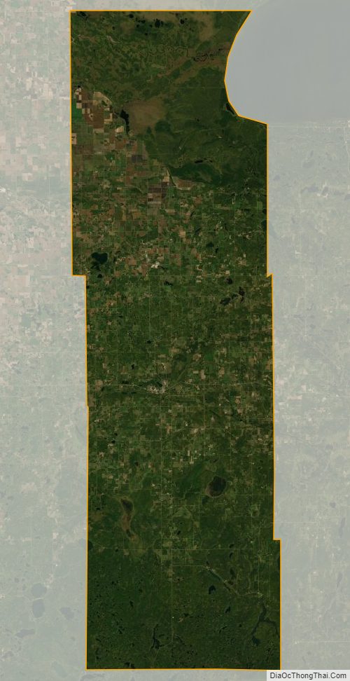
Clearwater County Satellite Map
Clearwater County Outline Map
See also
Map of Minnesota State and its subdivision:- Aitkin
- Anoka
- Becker
- Beltrami
- Benton
- Big Stone
- Blue Earth
- Brown
- Carlton
- Carver
- Cass
- Chippewa
- Chisago
- Clay
- Clearwater
- Cook
- Cottonwood
- Crow Wing
- Dakota
- Dodge
- Douglas
- Faribault
- Fillmore
- Freeborn
- Goodhue
- Grant
- Hennepin
- Houston
- Hubbard
- Isanti
- Itasca
- Jackson
- Kanabec
- Kandiyohi
- Kittson
- Koochiching
- Lac qui Parle
- Lake
- Lake of the Woods
- Lake Superior
- Le Sueur
- Lincoln
- Lyon
- Mahnomen
- Marshall
- Martin
- McLeod
- Meeker
- Mille Lacs
- Morrison
- Mower
- Murray
- Nicollet
- Nobles
- Norman
- Olmsted
- Otter Tail
- Pennington
- Pine
- Pipestone
- Polk
- Pope
- Ramsey
- Red Lake
- Redwood
- Renville
- Rice
- Rock
- Roseau
- Saint Louis
- Scott
- Sherburne
- Sibley
- Stearns
- Steele
- Stevens
- Swift
- Todd
- Traverse
- Wabasha
- Wadena
- Waseca
- Washington
- Watonwan
- Wilkin
- Winona
- Wright
- Yellow Medicine
- Alabama
- Alaska
- Arizona
- Arkansas
- California
- Colorado
- Connecticut
- Delaware
- District of Columbia
- Florida
- Georgia
- Hawaii
- Idaho
- Illinois
- Indiana
- Iowa
- Kansas
- Kentucky
- Louisiana
- Maine
- Maryland
- Massachusetts
- Michigan
- Minnesota
- Mississippi
- Missouri
- Montana
- Nebraska
- Nevada
- New Hampshire
- New Jersey
- New Mexico
- New York
- North Carolina
- North Dakota
- Ohio
- Oklahoma
- Oregon
- Pennsylvania
- Rhode Island
- South Carolina
- South Dakota
- Tennessee
- Texas
- Utah
- Vermont
- Virginia
- Washington
- West Virginia
- Wisconsin
- Wyoming