Cocke County is a county on the eastern border of the U.S. state of Tennessee. As of the 2020 census, the population was 35,999. Its county seat is Newport. Cocke County comprises the Newport, TN Micropolitan Statistical Area, which is part of the Knoxville–Morristown–Sevierville, Tennessee Combined Statistical Area.
| Name: | Cocke County |
|---|---|
| FIPS code: | 47-029 |
| State: | Tennessee |
| Founded: | October 9, 1797 |
| Named for: | William Cocke |
| Seat: | Newport |
| Largest city: | Newport |
| Total Area: | 443 sq mi (1,150 km²) |
| Land Area: | 435 sq mi (1,130 km²) |
| Total Population: | 35,999 |
| Population Density: | 82/sq mi (32/km²) |
| Time zone: | UTC−5 (Eastern) |
| Summer Time Zone (DST): | UTC−4 (EDT) |
| Website: | www.cockecountytn.gov |
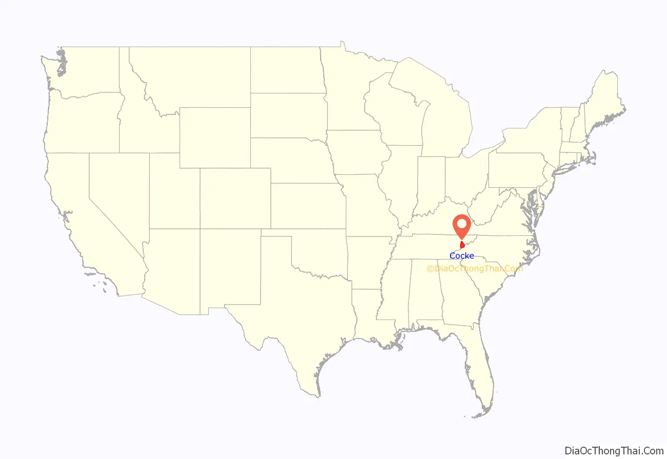
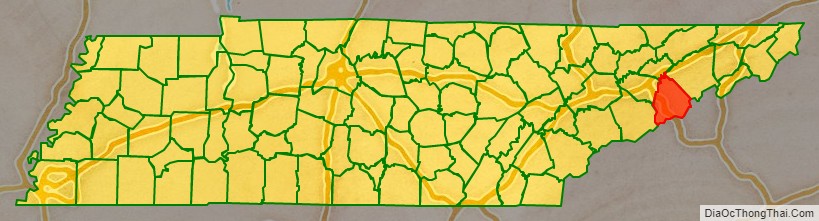
Cocke County location map. Where is Cocke County?
History
Before the arrival of European settlers, the area that is now Cocke County probably was inhabited by the Cherokee. They were the most recent of a series of indigenous cultures who had occupied this country for thousands of years.
The first recorded European settlement in the county was in 1783 when land near the fork of the French Broad and the Pigeon Rivers was cleared and cultivated. The earliest European settlers were primarily Scots-Irish, Dutch, and Germans who came to the area over the mountains from the Carolinas or through Virginia from Pennsylvania and other northern states.
The county was established by an Act of the Tennessee General Assembly on October 9, 1797, from a part of Greene County, Tennessee. It was named after William Cocke, one of the state’s first Senators. Located within the Appalachian and Great Smoky Mountains, it had difficult conditions for early settlers.
Like many East Tennessee counties, settled by yeomen farmers, Cocke County was largely pro-Union on the eve of the Civil War. In Tennessee’s Ordinance of Secession referendum on June 8, 1861, the county’s residents voted 1,185 to 518 against secession.
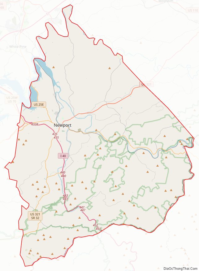
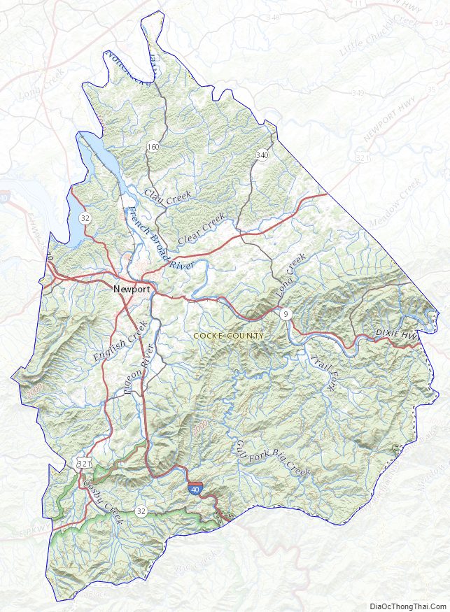
Cocke County Road Map
Geography
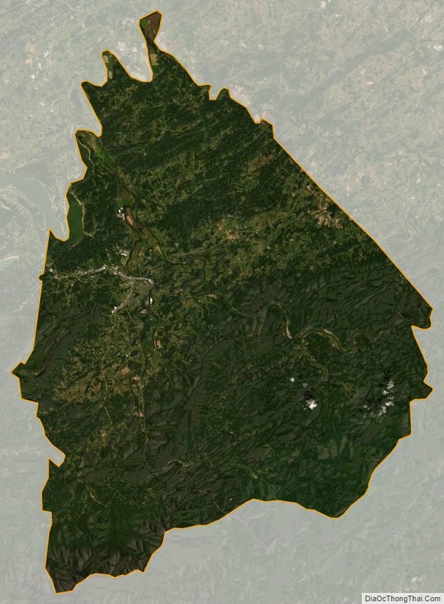
According to the U.S. Census Bureau, the county has a total area of 443 square miles (1,150 km), of which 435 square miles (1,130 km) are land and 8.6 square miles (22 km) (1.9%) are covered by water. The southern part of the county is located within the Great Smoky Mountains, and the lands are protected by the Great Smoky Mountains National Park. The northern part of the county is situated within the Ridge-and-Valley Appalachians. The county’s highest point is Old Black, which rises to 6,370 feet (1,940 m) in the Smokies along the county’s border with North Carolina. English Mountain, a large ridge that peaks at 3,629 feet (1,106 m), dominates the western part of the county.
Cocke County is drained by the French Broad River, which traverses the northern part of the county and forms much of its boundary with Jefferson County. A portion of this river is part of Douglas Lake, an artificial reservoir created by Douglas Dam further downstream. The Pigeon River flows northward across the county and empties into the French Broad north of Newport at Irish Bottoms.
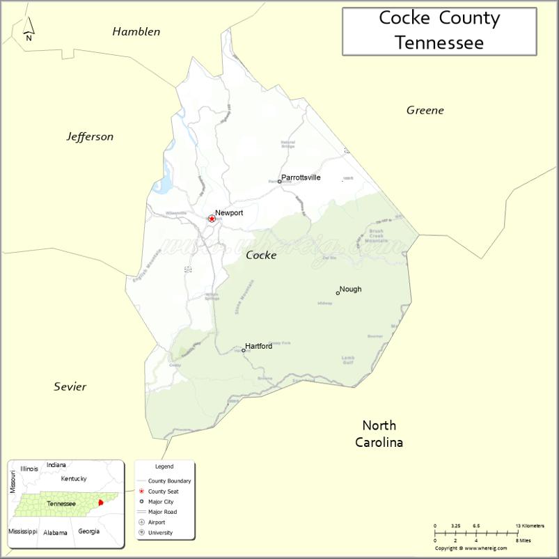
Adjacent counties
- Hamblen County (north)
- Greene County (northeast)
- Madison County, North Carolina (east)
- Haywood County, North Carolina (south)
- Sevier County (southwest)
- Jefferson County (northwest)
National protected areas
- Appalachian Trail (part)
- Cherokee National Forest (part)
- Foothills Parkway (part)
- Great Smoky Mountains National Park (part)
State protected areas
- Rankin Wildlife Management Area (part)
- Martha Sundquist State Forest
Major highways
- I-40
- US 70
- US 25
- US 25E
- US 25W
- US 321
- US 411
- SR 32
- SR 73
Cocke County Topographic Map
Cocke County Satellite Map
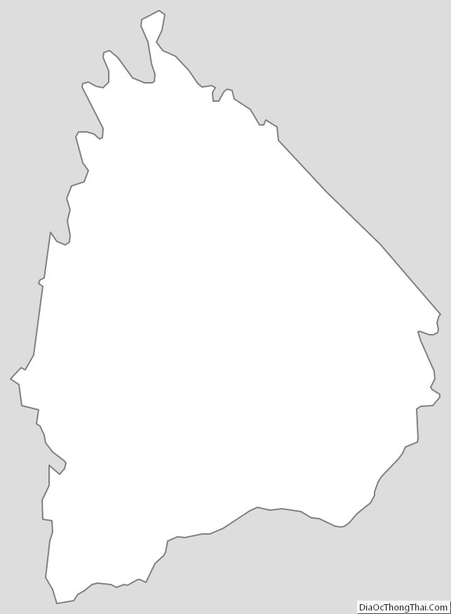
Cocke County Outline Map
See also
Map of Tennessee State and its subdivision:- Anderson
- Bedford
- Benton
- Bledsoe
- Blount
- Bradley
- Campbell
- Cannon
- Carroll
- Carter
- Cheatham
- Chester
- Claiborne
- Clay
- Cocke
- Coffee
- Crockett
- Cumberland
- Davidson
- Decatur
- DeKalb
- Dickson
- Dyer
- Fayette
- Fentress
- Franklin
- Gibson
- Giles
- Grainger
- Greene
- Grundy
- Hamblen
- Hamilton
- Hancock
- Hardeman
- Hardin
- Hawkins
- Haywood
- Henderson
- Henry
- Hickman
- Houston
- Humphreys
- Jackson
- Jefferson
- Johnson
- Knox
- Lake
- Lauderdale
- Lawrence
- Lewis
- Lincoln
- Loudon
- Macon
- Madison
- Marion
- Marshall
- Maury
- McMinn
- McNairy
- Meigs
- Monroe
- Montgomery
- Moore
- Morgan
- Obion
- Overton
- Perry
- Pickett
- Polk
- Putnam
- Rhea
- Roane
- Robertson
- Rutherford
- Scott
- Sequatchie
- Sevier
- Shelby
- Smith
- Stewart
- Sullivan
- Sumner
- Tipton
- Trousdale
- Unicoi
- Union
- Van Buren
- Warren
- Washington
- Wayne
- Weakley
- White
- Williamson
- Wilson
- Alabama
- Alaska
- Arizona
- Arkansas
- California
- Colorado
- Connecticut
- Delaware
- District of Columbia
- Florida
- Georgia
- Hawaii
- Idaho
- Illinois
- Indiana
- Iowa
- Kansas
- Kentucky
- Louisiana
- Maine
- Maryland
- Massachusetts
- Michigan
- Minnesota
- Mississippi
- Missouri
- Montana
- Nebraska
- Nevada
- New Hampshire
- New Jersey
- New Mexico
- New York
- North Carolina
- North Dakota
- Ohio
- Oklahoma
- Oregon
- Pennsylvania
- Rhode Island
- South Carolina
- South Dakota
- Tennessee
- Texas
- Utah
- Vermont
- Virginia
- Washington
- West Virginia
- Wisconsin
- Wyoming